Storm Agnes latest: Met Office issues new weather warning for torrential rain
The warning is set to kick in at 8pm on Thursday and remain in place until 2am on Friday morning.
Your support helps us to tell the story
From reproductive rights to climate change to Big Tech, The Independent is on the ground when the story is developing. Whether it's investigating the financials of Elon Musk's pro-Trump PAC or producing our latest documentary, 'The A Word', which shines a light on the American women fighting for reproductive rights, we know how important it is to parse out the facts from the messaging.
At such a critical moment in US history, we need reporters on the ground. Your donation allows us to keep sending journalists to speak to both sides of the story.
The Independent is trusted by Americans across the entire political spectrum. And unlike many other quality news outlets, we choose not to lock Americans out of our reporting and analysis with paywalls. We believe quality journalism should be available to everyone, paid for by those who can afford it.
Your support makes all the difference.The Met Office have issued a new weather warning for torrential rain this evening.
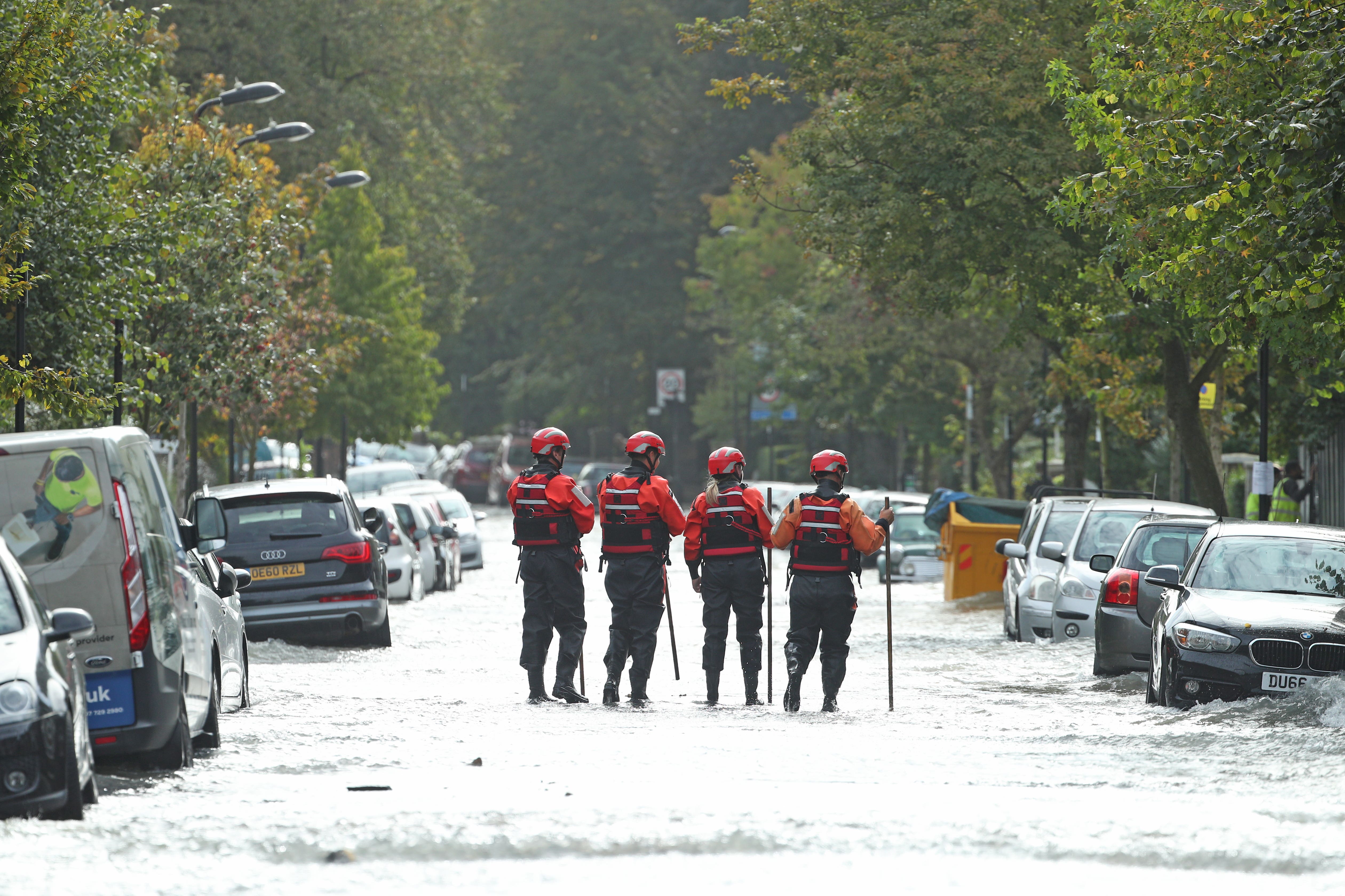
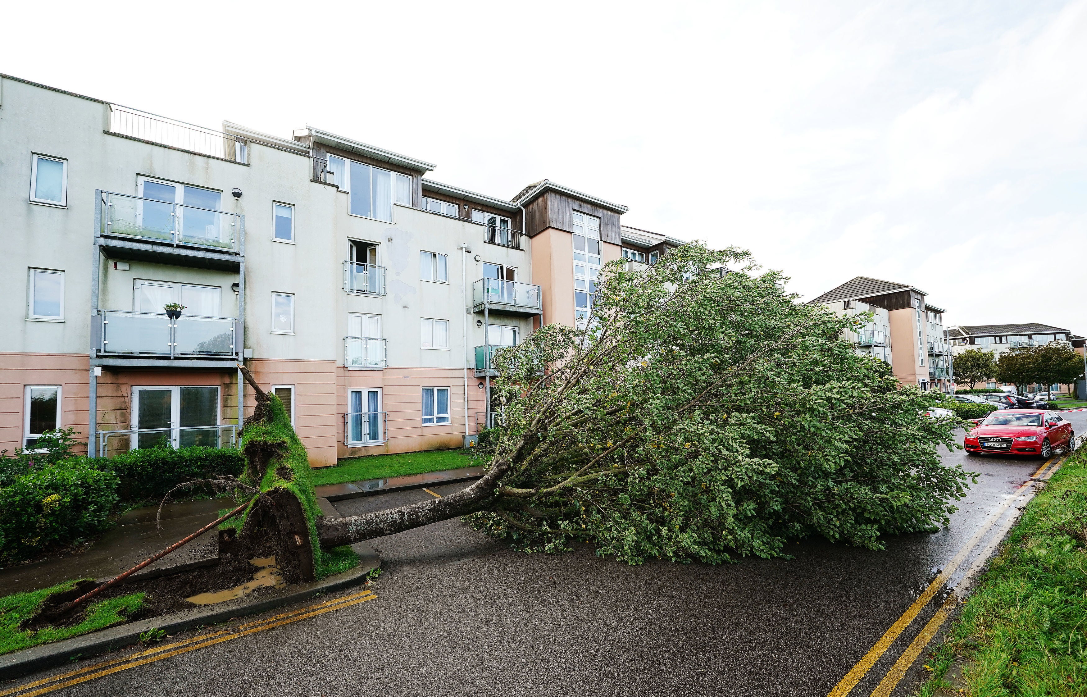
It comes as Storm Agnes arrived overnight with powerful 80mph gusts, leading to power outages, widespread flooding and the toppling of trees.
A yellow weather warning was issued by the forecaster on Thursday morning, just hours after the last weather warning for wind was removed at 7am. The new warning will affect areas in southern Wales including Cardiff, Newport and Swansea.
The warning is set to kick in at 8pm on Thursday and remain in place until 2am on Friday morning.
The Met Office say people should expect “difficult driving conditons and perhaps a few road closures”, as well as delays or cancellations to train and bus services.
Gusts of up to 70mph had already been recorded in south-west Ireland, with the storm hitting areas of northern England and Scotland on Wednesday.
In addition to the weather warning, there are currently 11 flood warnings and 20 flood alerts still in place across England, Scotland and Wales.
Impacted by Storm Agnes? Send your pictures and videos to alexander.ross@independent.co.uk.


String of flood warnings in place across Britain
A string of flood warnings and alerts are still in place despite Storm Agnes moving away from the UK.
Across England and Scotland there are currently 11 flood warnings still in place, with one being in the Lake District and ten others spanning Scotland’s Western Isles, Dundee, Tayside and Whitesands in Dumfries.
In addition to the flood warnings, there are also 20 less severe flood alerts currently in place across England, Scotland and Wales.
Seven of these alerts are placed across England including the Lake District in Cumbria, Wye Estuary in Gloucestershire, the North Devon coast, Poole Harbour in Dorset and Mersey Estuary in Warrington.
There are ten alerts active in Scotland, spanning the entirety of the south in addition to the Western Isles. In Wales, three alerts are active for the West Anglesey, Carmarthenshire and Lleyn Peninsula and Cardigan Bay coastlines.
What’s the difference between a flood warning and a flood alert?
With a string of flood warnings and alerts active across the UK, here’s a guide to help you understand what the Environment Agency’s codes mean.
Flood Warning
Flood warnings mean flooding is expected in the area and immediate action is required. They are used 30 minutes to an hour in advance of the flooding and are triggered by high tides coupled with strong winds, heavy rainfall causing flash flooding of rivers and forecast flooding from rivers.
Impact expected in these areas include flooding of homes and businesses, rail infrastructure and roads. They could also mean large waves on the coast and flooding of recreational attractions.
Flood Alerts
Flood warnings mean flooding is possible in the area and that people should be prepared. They are used two hours to two days in advance of flooding and are triggered by forecasts indicating river flooding is possible, forecasts of intense rainfall or high tides, surges and strong winds.
Impact expected in these areas include the flooding of fields, recreation land and car parks, minor roads and flooding of farmland.
Agnes brings highs of 84mph winds to the UK
Wind speeds reached 84mph in some areas of the UK yesterday as Storm Agnes knocked trees over and blew roofs off buildings.
The Met Office has shared the official extremes that Storm Agnes brought to Britain on Wednesday.
The area most affected by winds was Capel Curig in northern Wales, which was battered by 84mph gusts. Other spots hit by the worst winds included Aberdaron in northern Wales and Shap in Cumbria, which saw 68mph amd 66mph winds respectively.

Over 50mm of rain fallen in some areas
The Met Office has shared the areas that saw the most rainfall as Storm Agnes travelled across the UK.
The area most affected by rainfall was Honister Pass in Cumbria, which had 52.2mm of rain lash down.
Mickledon and Seathwaite, also both in Cumbria also saw extreme downpours, with 52mm and 47.6mm falling respectively.
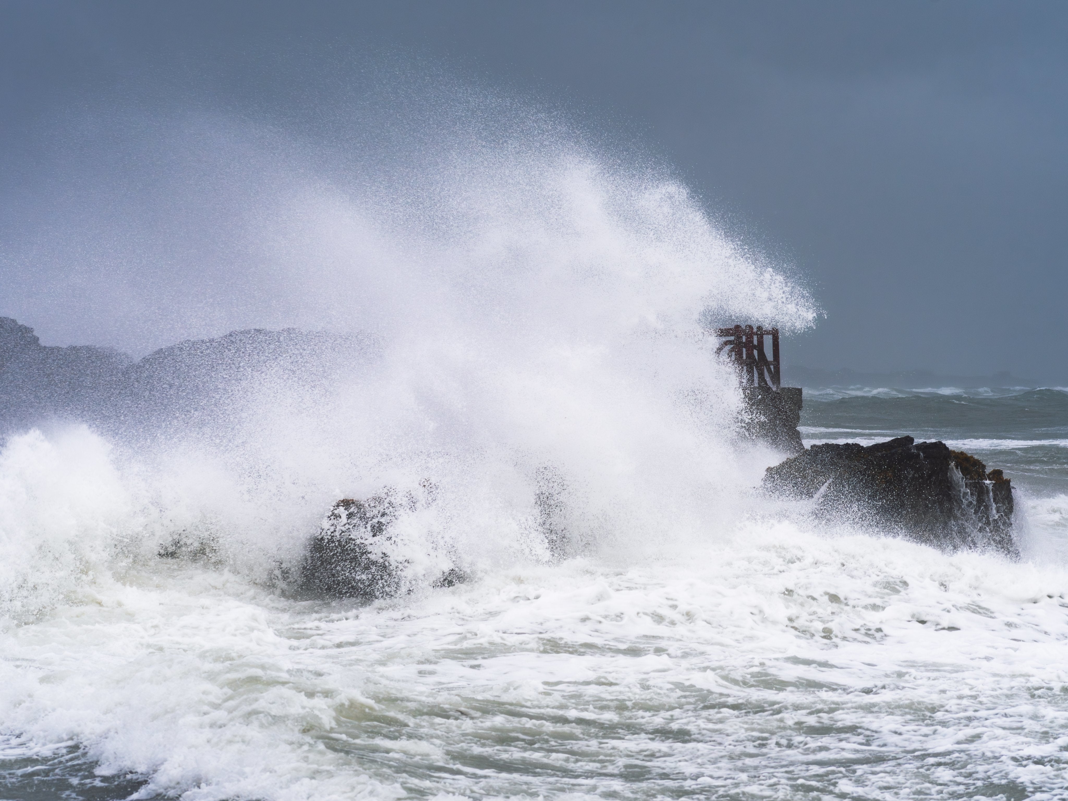
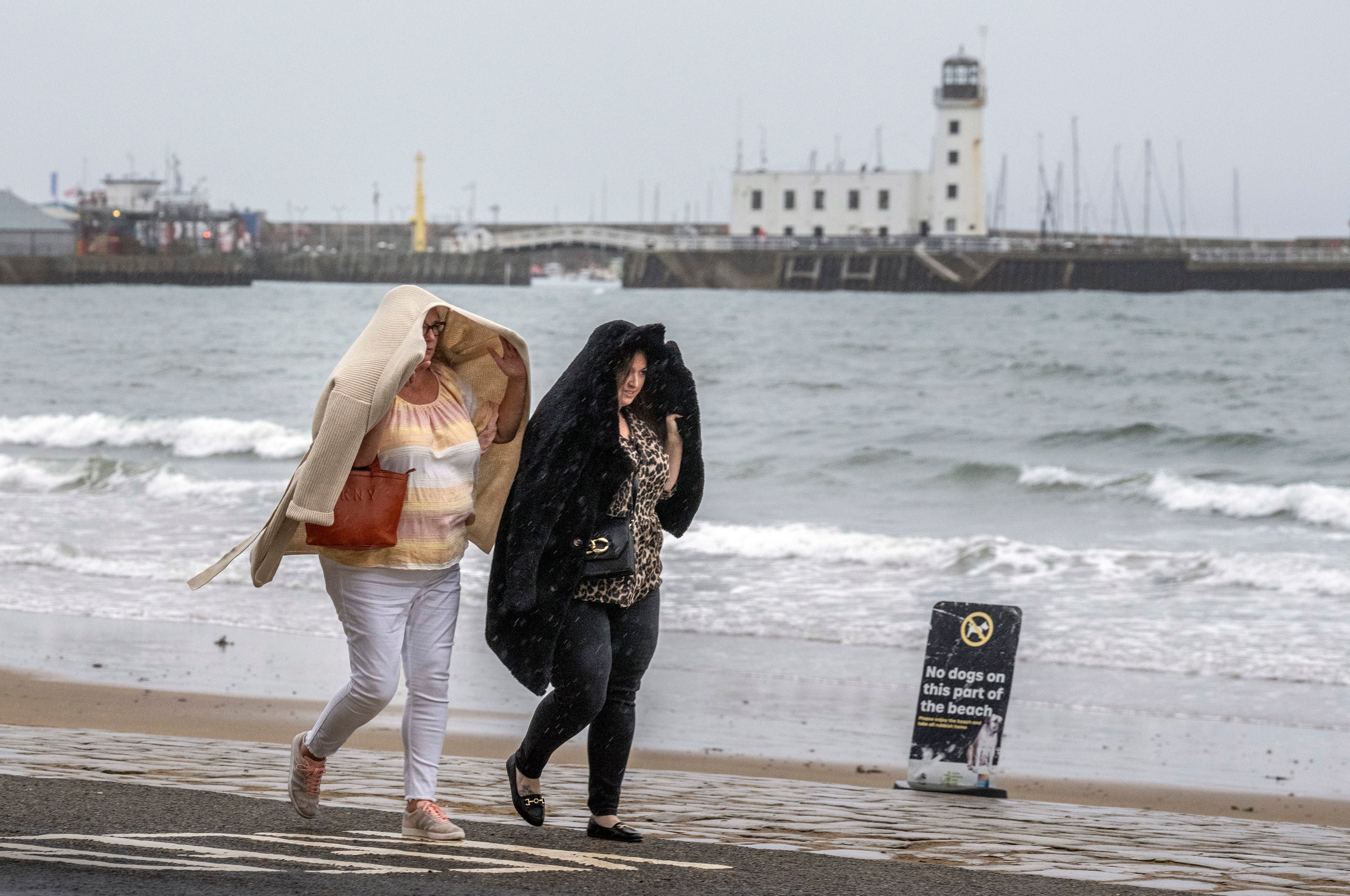
Storm Agnes: In pictures
As Storm Agnes clears the north-west of Britain, here are the best pictures of the extreme weather:

Join our commenting forum
Join thought-provoking conversations, follow other Independent readers and see their replies
Comments