Storm Agnes tracker: When and where 80mph winds will hit over next 24 hours
Only southern England is due to be spared from torrential rain and strong winds

Your support helps us to tell the story
From reproductive rights to climate change to Big Tech, The Independent is on the ground when the story is developing. Whether it's investigating the financials of Elon Musk's pro-Trump PAC or producing our latest documentary, 'The A Word', which shines a light on the American women fighting for reproductive rights, we know how important it is to parse out the facts from the messaging.
At such a critical moment in US history, we need reporters on the ground. Your donation allows us to keep sending journalists to speak to both sides of the story.
The Independent is trusted by Americans across the entire political spectrum. And unlike many other quality news outlets, we choose not to lock Americans out of our reporting and analysis with paywalls. We believe quality journalism should be available to everyone, paid for by those who can afford it.
Your support makes all the difference.As Storm Agnes hits the UK, weather warnings have been announced across the country with winds of 75mph expected this afternoon.
The Met Office has said that the first named storm of the season will “rapidly intensify”, with a danger to life warning issued by the forecaster from Wednesday until Thursday.
While initially a bright and dry morning, Storm Agnes is set to arrive from the west by the afternoon, bringing heavy rain and strong winds that could cause flooding and and distruption to travel services.
Britons are now bracing themselves for 80mph winds and 60mm of rain, with the possibility of power cuts, transport delays and damage to buildings. A number of P&O Ferries have been cancelled between Northern Ireland and Scotland, as well as 11 domestic flights.
Oli Claydon, a spokesperson for Met Office, said: “In terms of most impacted areas, we’re looking at the Irish Sea coasts, so south-eastern parts of Northern Ireland, west and north-western coasts of Wales, and the north-western coast of England.”
Follow our live coverage of Storm Agnes here
Only southern England is due to spared from the storm, with temperatures likely to be dry at around 23C.
When is Storm Agnes going to hit?

The storm is currently approaching Ireland from the Atlantic, with the first weather warnings issued from 12pm onwards until 7am on Thursday.
It is expected to affect anywhere around the Irish Sea, with exposed areas on the coastline possibly facing 60-75mph winds and warnings that the ferry network could be disrupted.
By 1pm, two weather warnings for rain and another for wind will have come into place in north-western England, stressing that injuries and danger to life from flying debris is possible, while power cuts are likely to occur.

There is also a small chance of injuries that could occur from large waves and beach material being thrown onto beach fronts, as strong winds are set to batter the west coastline.
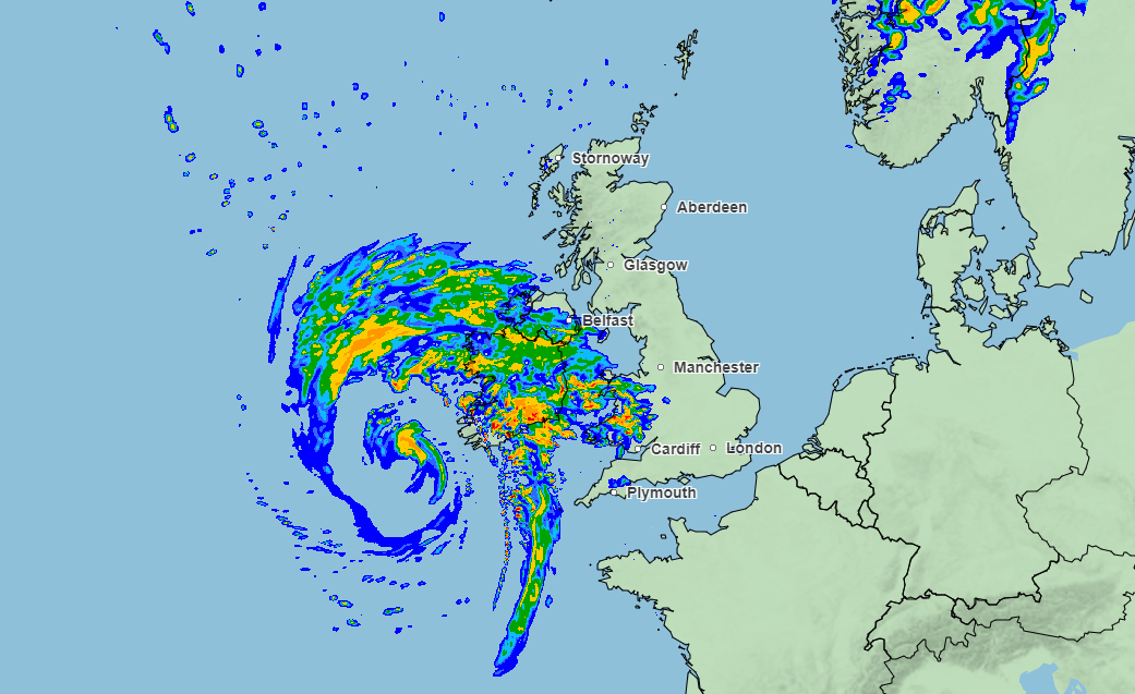
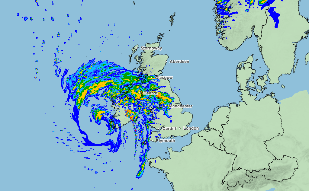
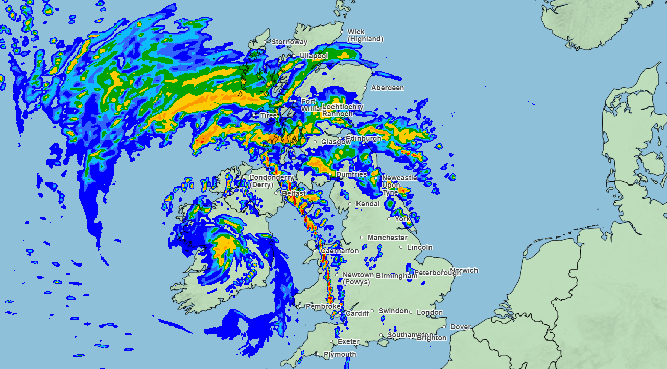
Graphics from the Met Office’s weather tracker at 3pm shows heavy rain moving throughout northern England, with Newcastle, Dumfries and Darlington facing disruptions and flooding.
By 4pm, the rain is predicted to have moved to south-eastern Scotland, with 4-8mm of rain expected to fall near Glasgow with showers reaching Aberdeen.

ScotRail also issued a warning about possible train timetable changes if track speed restrictions are brought in.
The rail operator posted on X: “Storm Agnes will bring strong winds and heavy rainfall to Scotland (today) and into Thursday with the potential to cause disruption. There may be changes to some of our services if Network Rail introduce train speed limits for safety reasons. Check before you travel.”
By 8pm, heavy rain will remain concentrated in Scotland, with Fort William and parts of the Scottish Highlands expected to receive between 8-16mm of rainfall.
While the turbulent weather continues throughout the evening, the three yellow weather warnings will come to an end at 7am on Thursday, with tomorrow poised for a “much calmer” forecase.
Further spells of wet weather should peter out by the end of the week, with a drier weekend predicted across the UK.


Join our commenting forum
Join thought-provoking conversations, follow other Independent readers and see their replies
0Comments