Storm Agnes latest: Met Office issues new weather warning for torrential rain
The warning is set to kick in at 8pm on Thursday and remain in place until 2am on Friday morning.
Your support helps us to tell the story
From reproductive rights to climate change to Big Tech, The Independent is on the ground when the story is developing. Whether it's investigating the financials of Elon Musk's pro-Trump PAC or producing our latest documentary, 'The A Word', which shines a light on the American women fighting for reproductive rights, we know how important it is to parse out the facts from the messaging.
At such a critical moment in US history, we need reporters on the ground. Your donation allows us to keep sending journalists to speak to both sides of the story.
The Independent is trusted by Americans across the entire political spectrum. And unlike many other quality news outlets, we choose not to lock Americans out of our reporting and analysis with paywalls. We believe quality journalism should be available to everyone, paid for by those who can afford it.
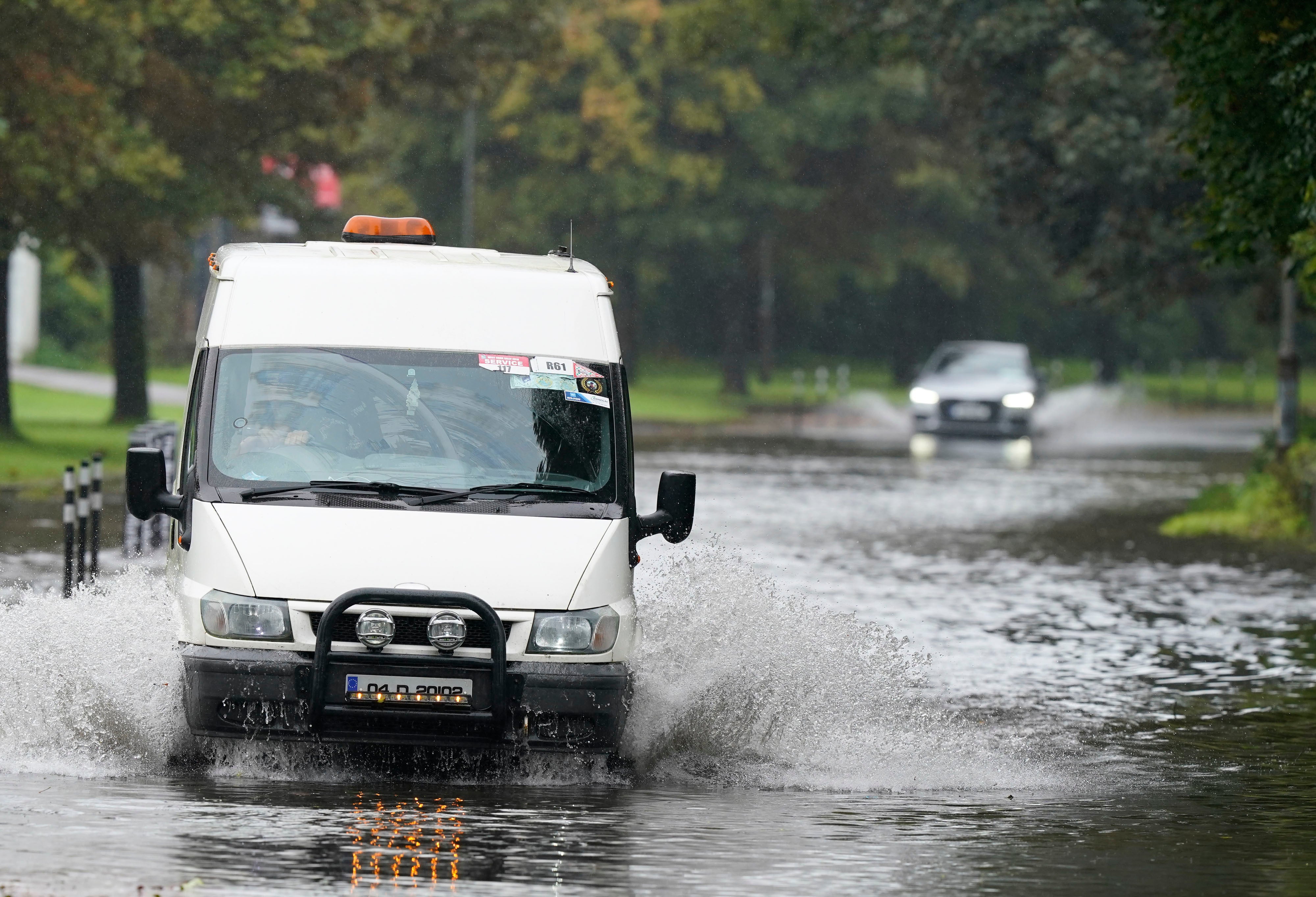
Your support makes all the difference.The Met Office have issued a new weather warning for torrential rain this evening.
It comes as Storm Agnes arrived overnight with powerful 80mph gusts, leading to power outages, widespread flooding and the toppling of trees.
A yellow weather warning was issued by the forecaster on Thursday morning, just hours after the last weather warning for wind was removed at 7am. The new warning will affect areas in southern Wales including Cardiff, Newport and Swansea.
The warning is set to kick in at 8pm on Thursday and remain in place until 2am on Friday morning.
The Met Office say people should expect “difficult driving conditons and perhaps a few road closures”, as well as delays or cancellations to train and bus services.
Gusts of up to 70mph had already been recorded in south-west Ireland, with the storm hitting areas of northern England and Scotland on Wednesday.
In addition to the weather warning, there are currently 11 flood warnings and 20 flood alerts still in place across England, Scotland and Wales.
Impacted by Storm Agnes? Send your pictures and videos to alexander.ross@independent.co.uk.


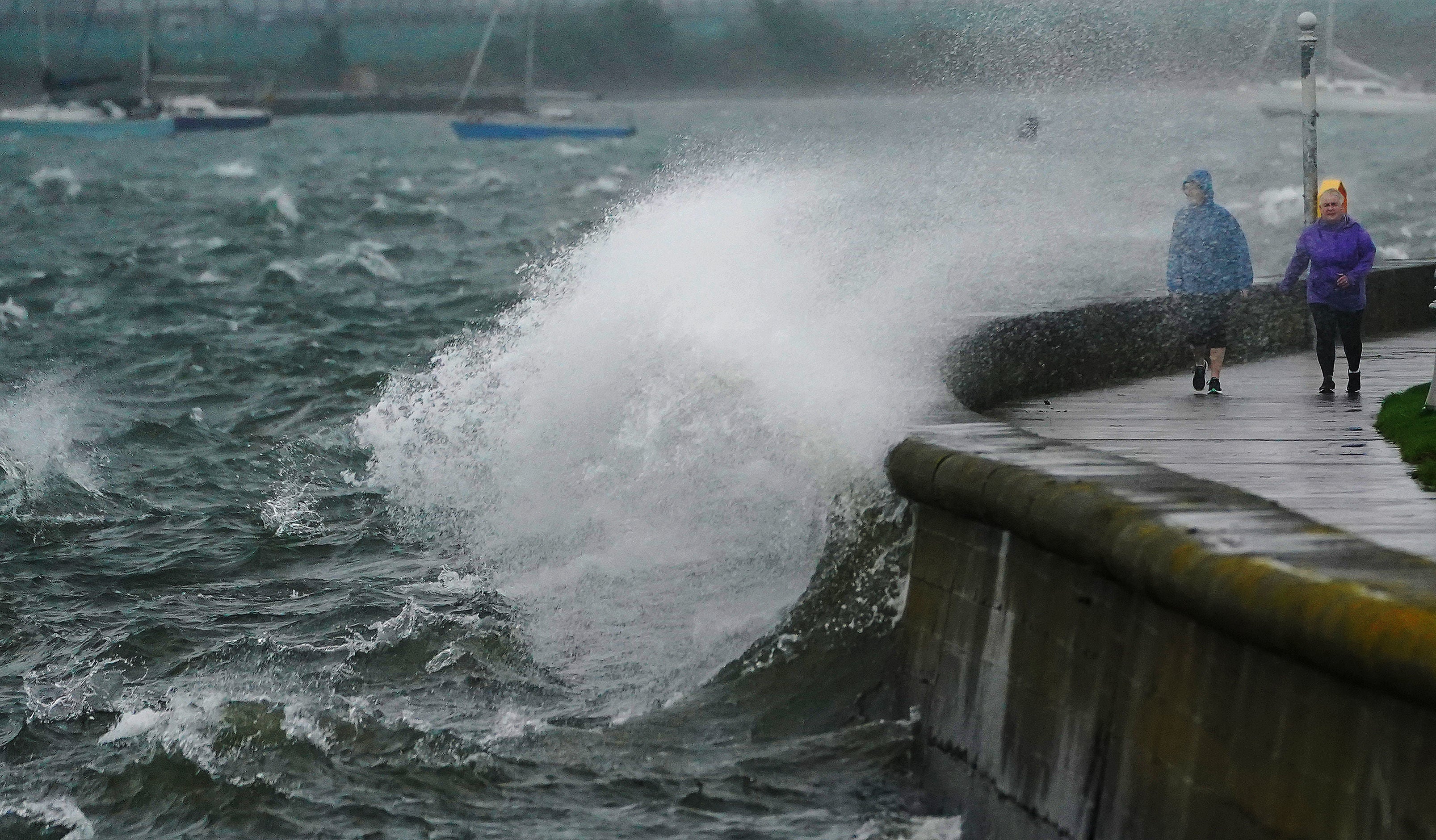
County Cork Ferry battles on through Storm Agnes
Amidst adverse weather conditions, the Cobh Ferry in County Cork, Ireland has been pictured continuing to transport passengers.
Strong winds were reported in County Cork at 9am, and both Met Eireann and the Met Office have warned of the possibility of disruption to travel.
In the Republic of Ireland a status orange wind warning is in place in several counties.
A status yellow warning for rain is also in place across large areas.
Manx passenger ferries cancelled across Wednesday
All ferry sailings to and from the Isle of Man have been cancelled following unexpected gales across the Irish Sea.
The Maxman sailings between Douglas and Heysham Port in Lancashire have been pulled, as have the Manannan’s return trip to Liverpool and crossings by the Ben-my-Chree.
Waves crash across Poolbeg
Waves have been pictured crashing across Poolbeg, an artificial peninsula extending from Ringsend, Dublin, into Dublin Bay.
Storm Agnes, which is the first named storm of the season, is forecast to bring strong and disruptive winds until Thursday morning.
Both Met Eireann and the Met Office have warned of the possibility of disruption to travel, with a status orange wind warning in place in several counties across the Republic of Ireland.
Ofgem issues warning over power cuts and gas leaks
Ofgem has issued a warning to customers over potential disruptions to electricity supply.
“Bad weather is on the way with yellow warnings in place for most of the UK especially the North”, the energy regulator warned on X.
“Save these emergency numbers on your phone in case of a disruption to your energy supply
“Powercut? Call 105
“Smell gas? Call 0800 111 999.”
Storm Agnes tracker: When and where 80mph winds will hit over next 24 hours
As Storm Agnes hits the UK, weather warnings have been announced across the country with winds of 75mph expected this afternoon.
The Met Office has said that the first named storm of the season will “rapidly intensify”, with a danger to life warning issued by the forecaster from Wednesday until Thursday.
While initially a bright and dry morning, Storm Agnes is set to arrive from the west by the afternoon, bringing heavy rain and strong winds that could cause flooding and distruption to travel services.
Holly Evans reports:

Storm Agnes tracker: When and where 80mph winds will hit over next 24 hours
Only southern England is due to be spared from torrential rain and strong winds
In pictures: Storm Agnes lands in Ireland
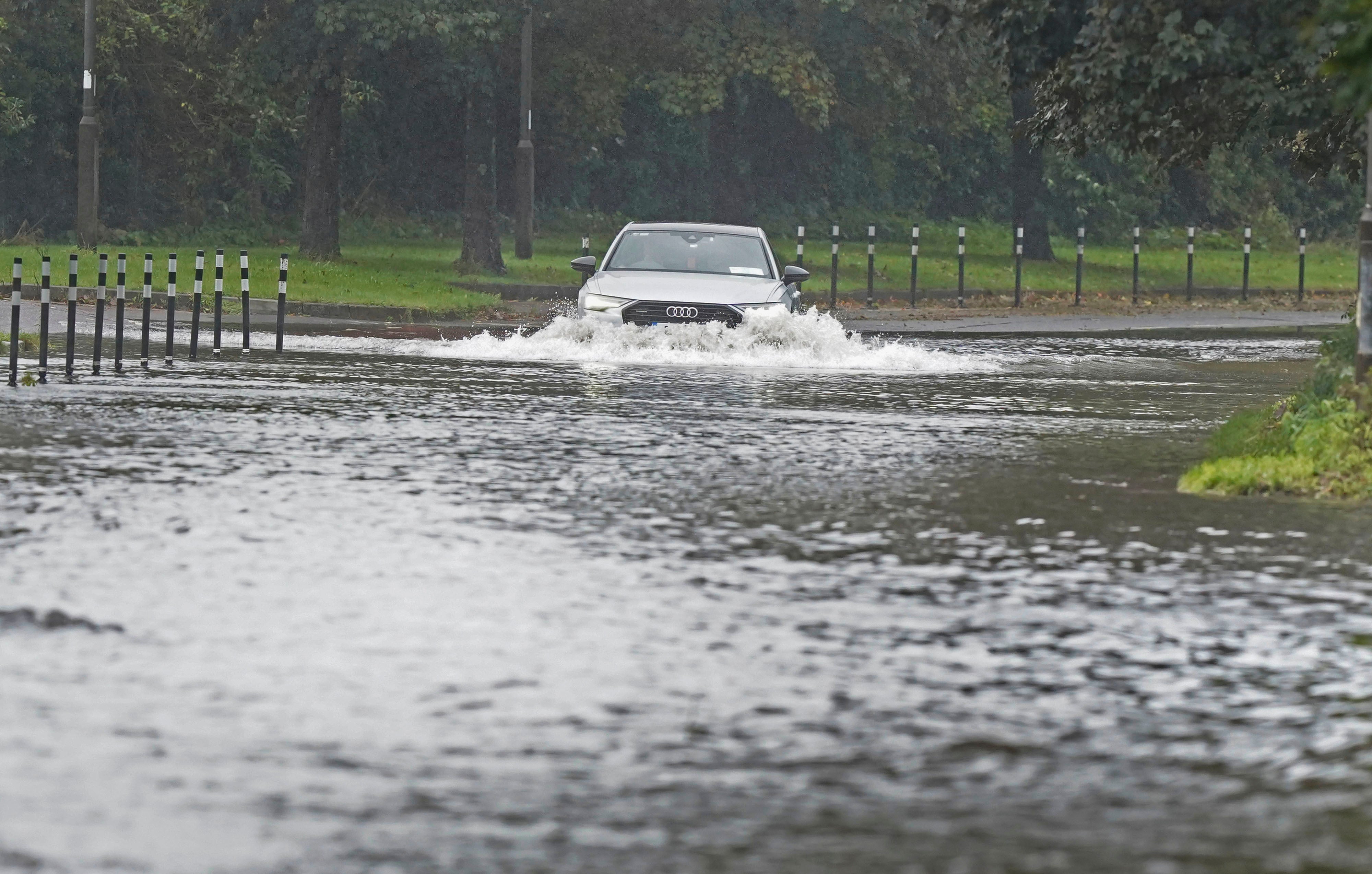
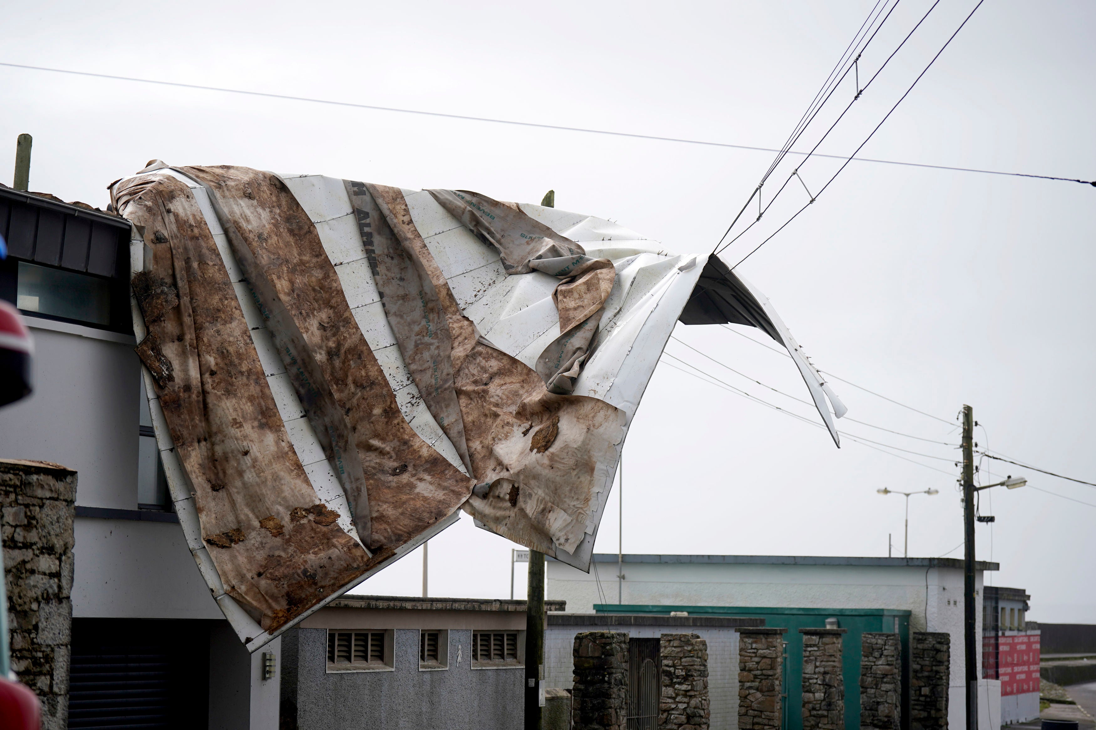
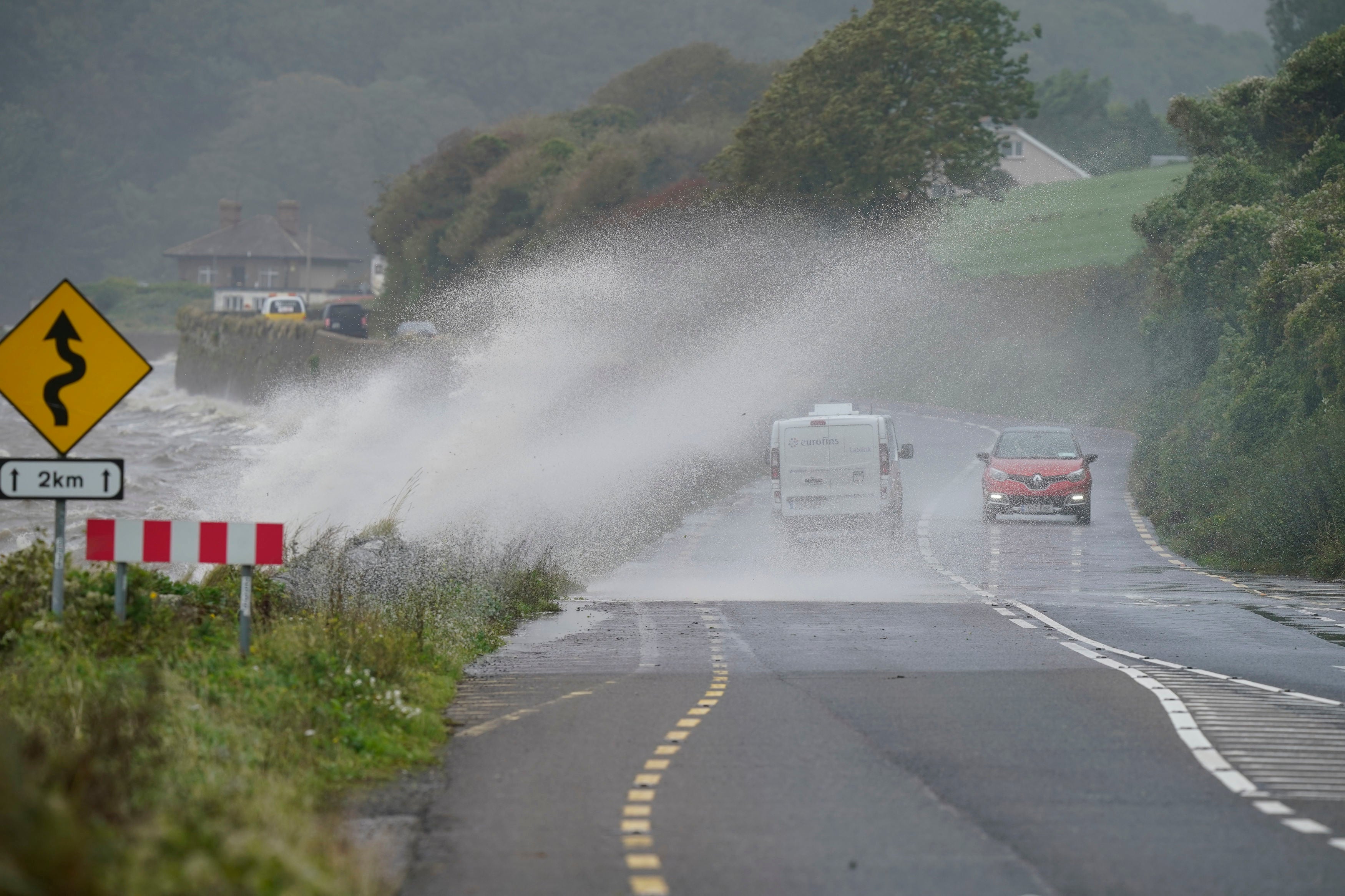
Cars have been pictured driving through floodwaters, waves crashing onto promenades and roofs blown off buildings as Storm Agnes sweeps Ireland.
Both Met Eireann and the Met Office have warned of the possibility of disruption to travel, with a status orange wind warning in place in several counties.
A status yellow warning for rain is also in place across large areas.
‘Worst conditions still to come’ as Storm Agnes hits UK
Forecasters have warned the “worst conditions are still to come”, with Storm Agnes set to make landfall in the UK after battering the south of Ireland with gale force winds.
Agnes, the first named storm of the season, has triggered a series of Met Office yellow weather warnings for wind and rain, with forecasts of damaging winds and big stormy seas.
Gusts of up to 70mph had already been recorded in south-west Ireland, with the storm set to hit areas of northern England and Scotland later on Wednesday.
Met Office meteorologist Marco Petagna said: “This evening’s rush hour could be quite tricky” in some north and north-western areas of the UK, as it is expected to coincide with expected periods of strong wind and rain.
He added: “Some of the worst conditions are still to come. The rain warnings are out to cover through the evening and the wind warnings are into the overnight period.
“We are looking at high gusts developing.”
RNLI advises staying a ‘safe distance’ away from water and cliff edges
The storm is likely to cause “dangerous conditions” on the coasts around the UK and Ireland, according to The Royal National Lifeboat Institution (RNLI).
They advised staying a “safe distance” away from the water and cliff edges.
Humber Maritime Rescue Coordination Centre Commander Bev Allen said: “The first few storms of the autumn and winter are always a little frightening for us, as people are still in summer mode, the power of the waves can take them by surprise.
“We would encourage people to stay away from the water’s edge in stormy weather - it’s not worth risking your life for that selfie. Keep off groynes, piers, jetties and harbour walls. If you can feel the spray, you’re too close.”
On the weather from Thursday, Mr Petagna said: “The weather will stay unsettled for the next few days but we are not expecting it to be as impactful.”
Cork Airport experiences delays and cancellations as Storm Agnes wreaks havoc on transport
Cork Airport has experienced some delays and cancellations amidst Storm Agnes, and a spokesperson from Belfast City Airport said disruption to schedules across the UK due to the weather is “likely.”
Meanwhile, Dublin Airport said it is operating normally, but had received a number of flights that had been diverted from Kerry Airport.
In a statement, Irish Ferries said disruption to schedules may be experienced due to adverse weather conditions over the coming days, with passengers advised to check schedules.
Fallen trees are being reported across the island, with the roof being blown off a building in Youghal, Co Cork.
Kerry County Council said it has crews dealing with fallen trees and branches at a number of locations.
Met Office releases latest satellite images of Storm Agnes’ movements
As Storm Agnes sweeps the UK, the Met Office has released the latest satellite images of its movements.
“#StormAgnes continues to track northeast through this afternoon, bringing strong winds and heavy rain to northern and western parts of the UK”, it stated via X.
Join our commenting forum
Join thought-provoking conversations, follow other Independent readers and see their replies
Comments