Met Office warns Hurricane Ernesto remnants could bring heavy rain and wind to UK
After a weekend of sunshine, unsettled weather is expected from next week onwards as Hurrican Ernesto is set to influence conditions in the UK
Your support helps us to tell the story
From reproductive rights to climate change to Big Tech, The Independent is on the ground when the story is developing. Whether it's investigating the financials of Elon Musk's pro-Trump PAC or producing our latest documentary, 'The A Word', which shines a light on the American women fighting for reproductive rights, we know how important it is to parse out the facts from the messaging.
At such a critical moment in US history, we need reporters on the ground. Your donation allows us to keep sending journalists to speak to both sides of the story.
The Independent is trusted by Americans across the entire political spectrum. And unlike many other quality news outlets, we choose not to lock Americans out of our reporting and analysis with paywalls. We believe quality journalism should be available to everyone, paid for by those who can afford it.
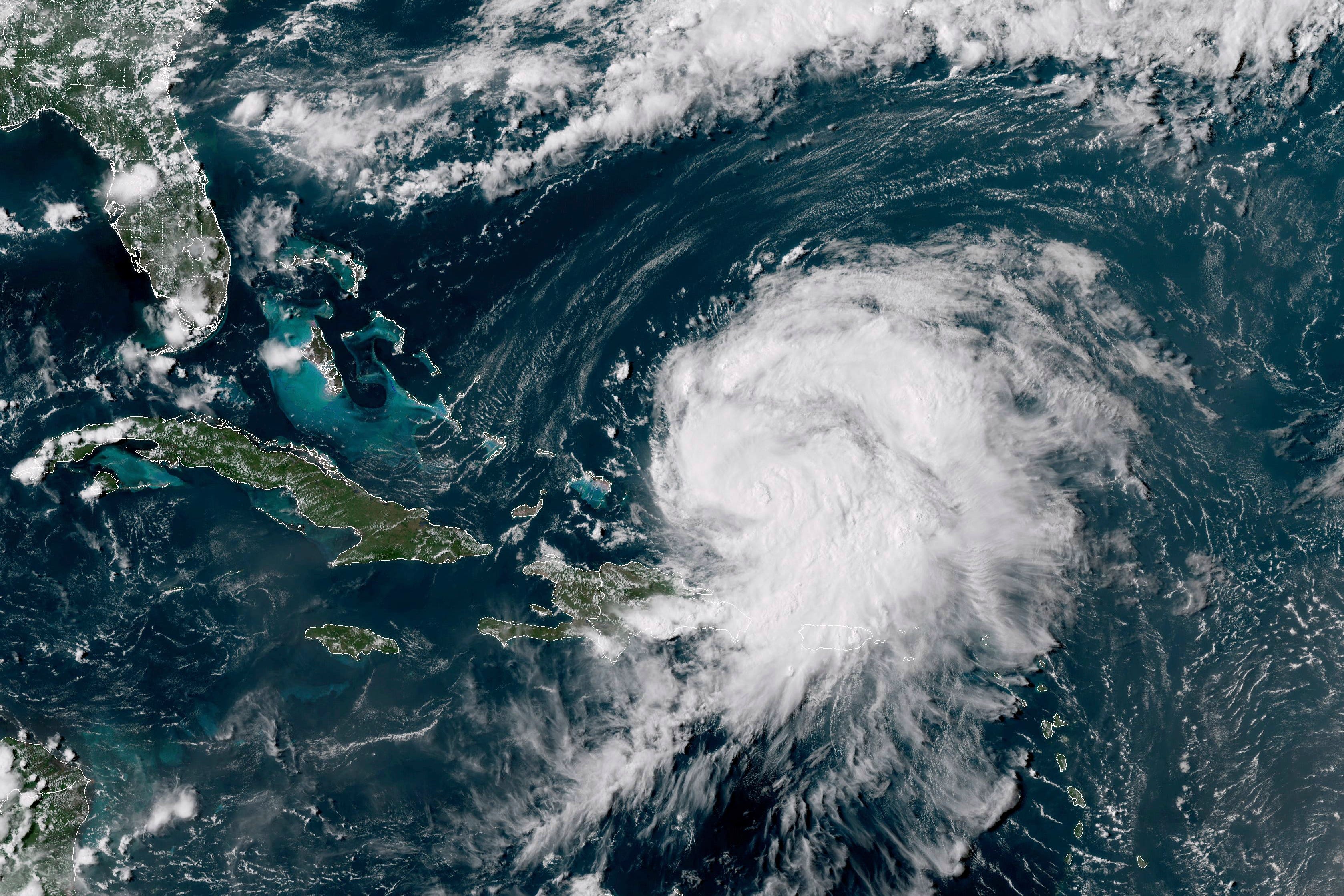
Your support makes all the difference.Hurricane Ernesto may have an impact on the UK’s weather as the weekend’s sunshine is set to turn to rain and wind in the coming days.
The category 2 storm is set to hit Bermuda, a British island territory, on Saturday morning, bringing a dangerous storm surge and potentially deadly flooding.
As it is expected to move in the North Atlantic next week, the Met Office has warned that it may possibly influence the weather from Thursday onwards, with outbreaks of heavy wind and rain possible.
“However, the most likely scenario is for a period of unsettled weather from Wednesday, especially in the north and west with heavy rain and strong winds possible, whilst it may be warmer and less wet towards the southeast. As always, keep an eye on the most up-to-date forecast for the latest,” David Oliver, the Deputy Chief Meteorologist at the Met Office said.
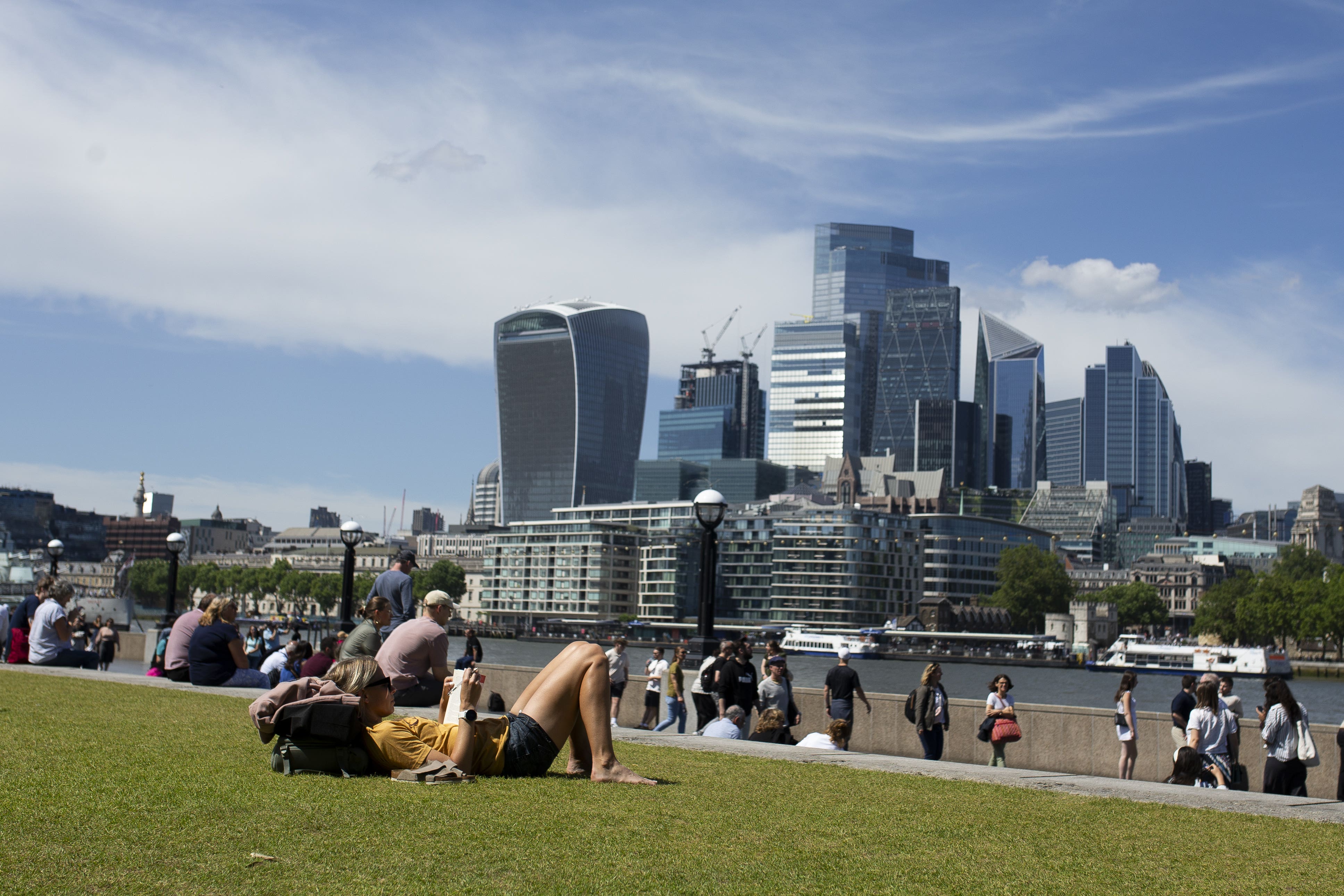
Britons across the country are currently enjoying a mild and pleasant weekend, with highs of 25 degrees in London and peaks of 19 degrees across Scotland.
While a few showers are possible in the far north, a weak ridge of high pressure has ensured that the weekend stays dry and sunny for most of the UK.
The jet stream, meaning strong winds above the Earth’s surface, currently lies in the far north of the country and across France meaning dry weather will persist for the coming two days.
Mr Oliver continued: “Monday sees changes in the jet stream, these bringing an Atlantic frontal system toward the UK. This will bring some cloudy, wet and windy conditions to many areas during the course of Monday and Tuesday, with strong winds possible in the north.”
Today:
Fine day for many with variable cloud and sunny spells. The sunshine most prolonged in the southeast, helping it to feel warm. A few showers in the west, and breezy for northwest Scotland, making it feel a little cooler here.
Tonight:
Staying dry overnight for most with clear spells but isolated showers continuing in the northwest, where it remains breezy. Some mist and fog patches forming under the clearest skies.
Sunday:
Another pleasant day for most with a good number of warm sunny spells. Cloudier and breezier in the north with isolated showers, locally heavy for a time.
Outlook for Monday to Wednesday:
Dry start to Monday but rain spreading in from the west and pushing east on Tuesday. Drier in the southeast from mid-week, but still wet and windy in the northwest.
Join our commenting forum
Join thought-provoking conversations, follow other Independent readers and see their replies
Comments