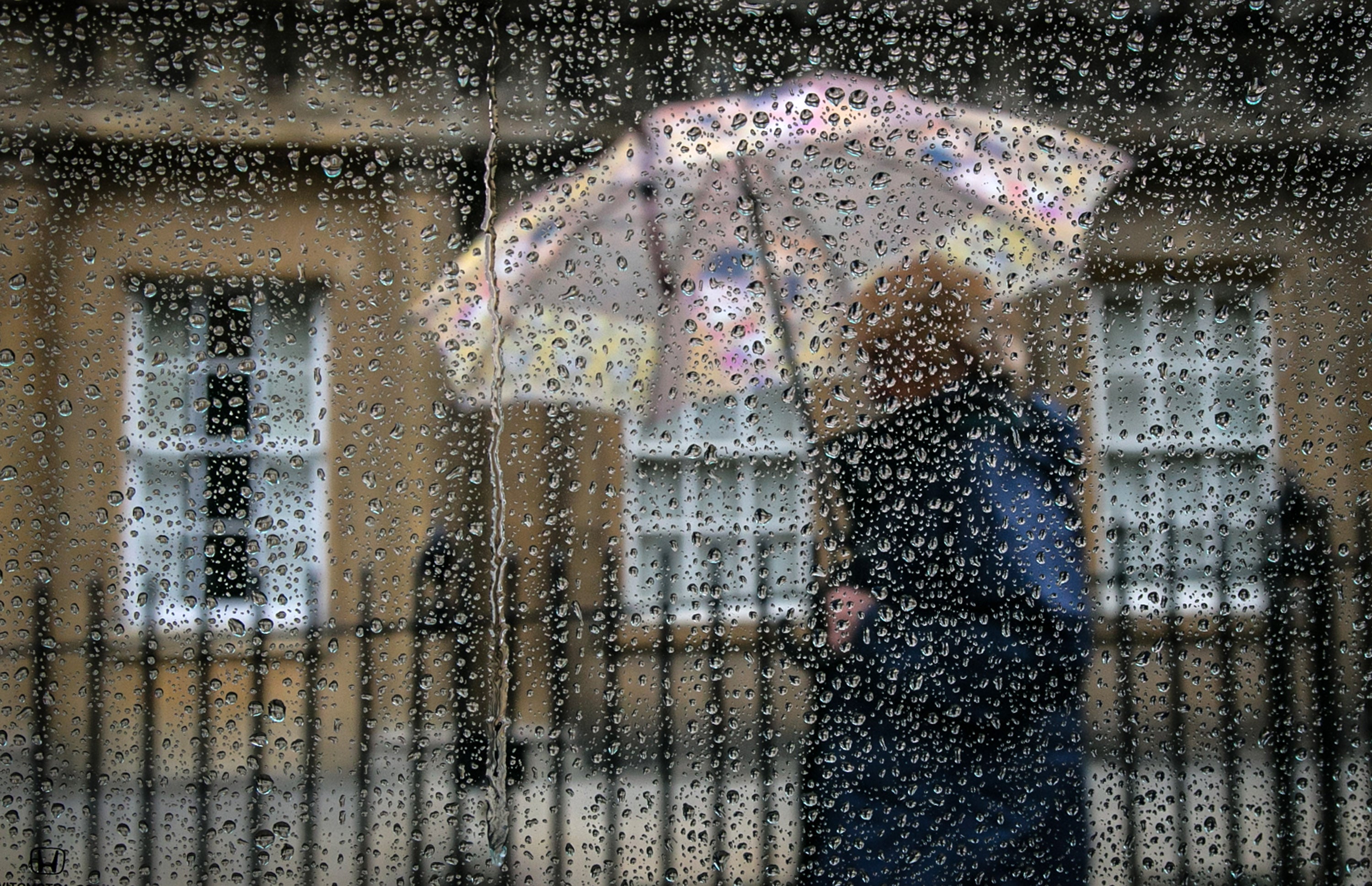
UK set to be hit with heavy rainfall after Britons basked in mini-heatwave
The hot period in the south and east of England is being replaced by a ‘westerly airflow’ for the UK which will bring showers
Your support helps us to tell the story
From reproductive rights to climate change to Big Tech, The Independent is on the ground when the story is developing. Whether it's investigating the financials of Elon Musk's pro-Trump PAC or producing our latest documentary, 'The A Word', which shines a light on the American women fighting for reproductive rights, we know how important it is to parse out the facts from the messaging.
At such a critical moment in US history, we need reporters on the ground. Your donation allows us to keep sending journalists to speak to both sides of the story.
The Independent is trusted by Americans across the entire political spectrum. And unlike many other quality news outlets, we choose not to lock Americans out of our reporting and analysis with paywalls. We believe quality journalism should be available to everyone, paid for by those who can afford it.
Your support makes all the difference.After a good spell of sunshine and hot weather, Britons should prepare for rainfall and strong winds across parts of the UK.
The high temperatures and sunny conditions enjoyed over the last few days are expected to dissipate on Wednesday as the southeast will see some rain and sunny spells, with temperatures beginning to cool, the Met Office said.
The hot temperatures in the south and east of the country are being replaced by a “westerly airflow” which will bring showers, longer spells of rain and a return to more average temperatures for the time of year.
The Met Office’s forecast for Wednesday said there will be patchy rain and drizzle across central and eastern England. There could be heavier rain in the north west of the UK by evening, becoming more widespread on Thursday.
A “plume of rain” moving towards the north west of Scotland could bring some heavy rain, especially on high ground, according to the forecaster. Rain and strong winds will spread across much of Scotland, Northern Ireland and parts of northern England overnight.
Southern and eastern parts of England will remain largely dry and warm, but it could be particularly windy across the country.
A mostly dry and clear weekend is expected, but temperatures are not likely to be as high as they were earlier in the week.
Rain across the north will slowly spread southwards on Thursday throughout the day, but many southern and central parts remain fine and dry throughout, the Met Office said.
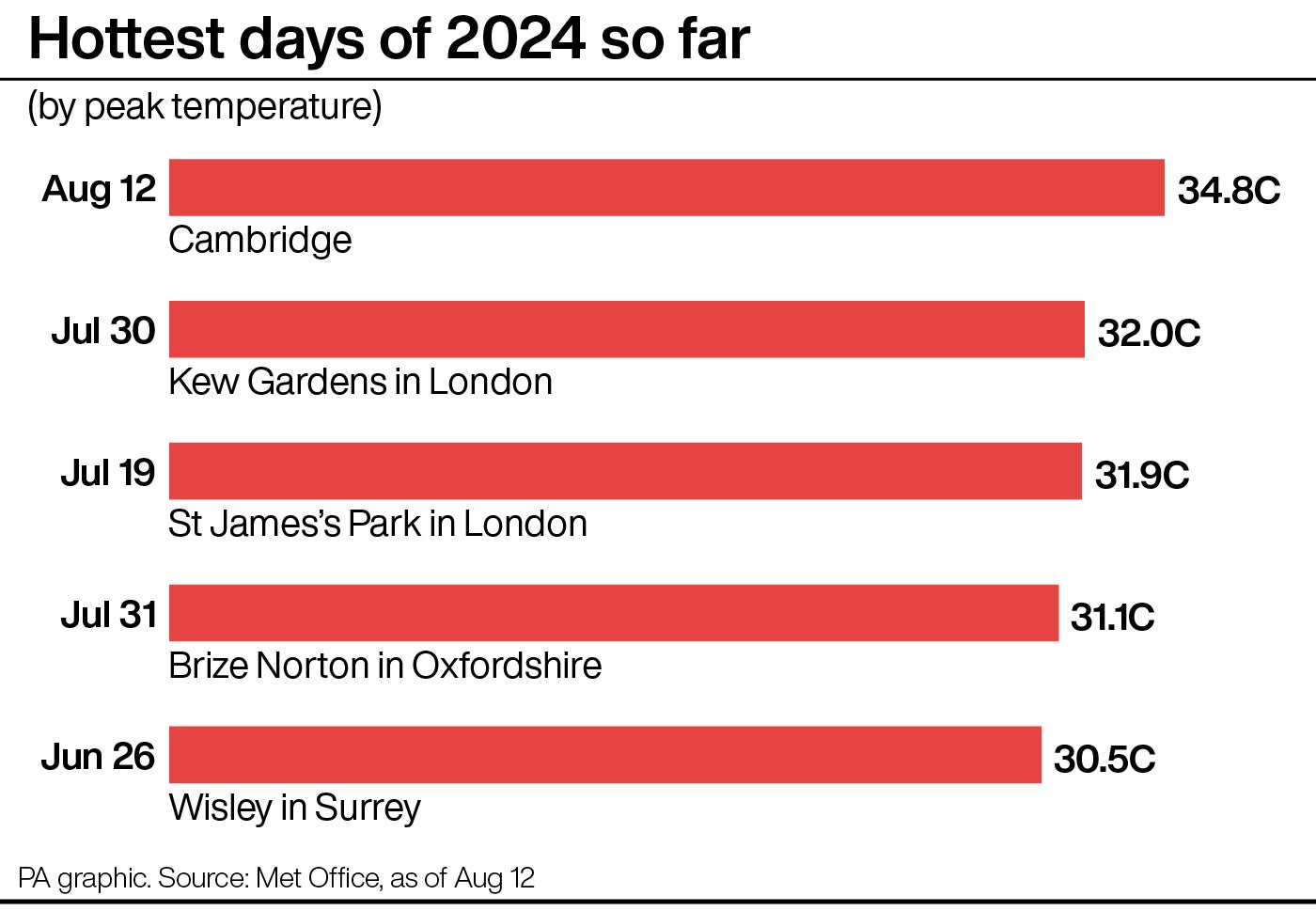
This comes as the temperature reached 34.8C in Cambridge on Monday, marking 2024’s hottest day yet, after the previous record of 31.9C in central London on 19 July.
Liam Eslick, a meteorologist at the Met Office, said: “There will be sunshine towards the western half of the UK on Wednesday, so it will still feel rather pleasant, getting up towards those low 20s.
“Into Thursday we do have a second plume of rain moving in towards the north west of Scotland which can bring some pretty strong winds and pretty heavy rain.
“It’s not anything to be concerned about for now, it’s just a watchpoint.
“The South East will probably be the driest part of the country but those temperatures will slowly start to come down towards what we would expect for mid-August, around 22C or 23C.”
Mr Eslick said there was good news for those with weekend plans, as sunny weather is likely to return.
“It will be a mostly dry picture for many people as we go in towards the weekend, most places will see a pretty dry picture and will start to see some sunnier spells,” he said.
Join our commenting forum
Join thought-provoking conversations, follow other Independent readers and see their replies
Comments