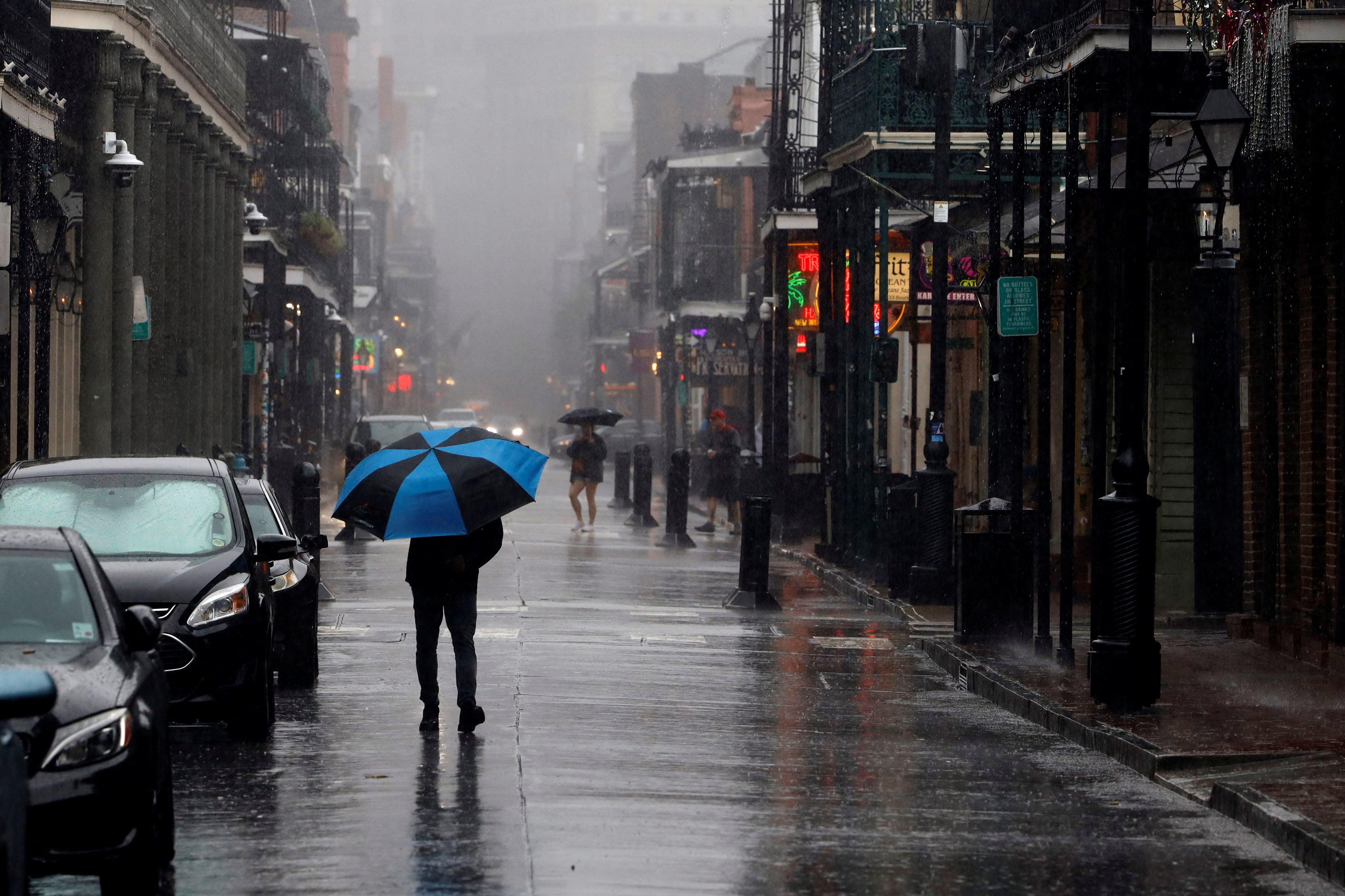
Hurricane Francine updates: System now a tropical storm as it move though Gulf region
State of emergency declared in Louisiana as New Orleans under tornado watch
Your support helps us to tell the story
From reproductive rights to climate change to Big Tech, The Independent is on the ground when the story is developing. Whether it's investigating the financials of Elon Musk's pro-Trump PAC or producing our latest documentary, 'The A Word', which shines a light on the American women fighting for reproductive rights, we know how important it is to parse out the facts from the messaging.
At such a critical moment in US history, we need reporters on the ground. Your donation allows us to keep sending journalists to speak to both sides of the story.
The Independent is trusted by Americans across the entire political spectrum. And unlike many other quality news outlets, we choose not to lock Americans out of our reporting and analysis with paywalls. We believe quality journalism should be available to everyone, paid for by those who can afford it.
Your support makes all the difference.Francine strengthened into a hurricane on Tuesday night and made landfall near New Orleans on Wednesday.
The hurricane sent New Orleans residents scrambling to prepare with evacuations underway in multiple areas, impacting certain services and shutting down City Hall. Mayor LaToya Cantrell urged residents to prepare to hunker down.
“Hold the line, stay focused, stay prepared,” she said at a Wednesday briefing.
In Baton Rouge, Louisiana, Governor Jeff Landry – who had declared a state of emergency to help free up resources to prepare for the storm – instructed residents to take advantage of the electricity they still receive.
By Wednesday night, the system was downgraded into a tropical storm as it moved its way through Mississippi, heading north.
“There is a danger of life-threatening storm surge during the next several hours for portions of the Louisiana and Mississippi coastlines, where a Storm Surge Warning remains in effect,” National Weather Service forecasters warned.
Even as Tropical Storm Francine continues to weaken, forecasters ask people to remain vigilant about the rainfall and the potential for flash flooding.
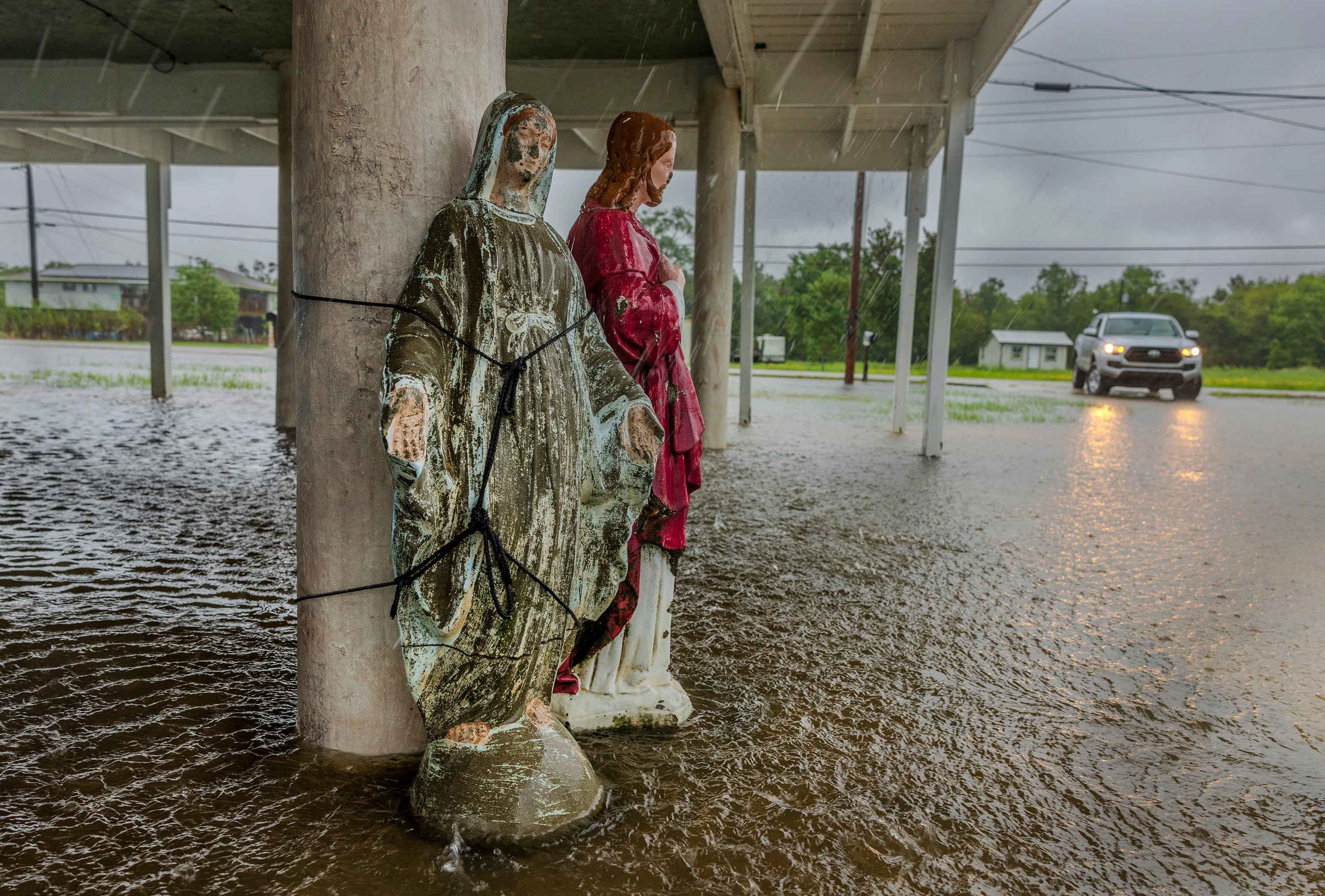
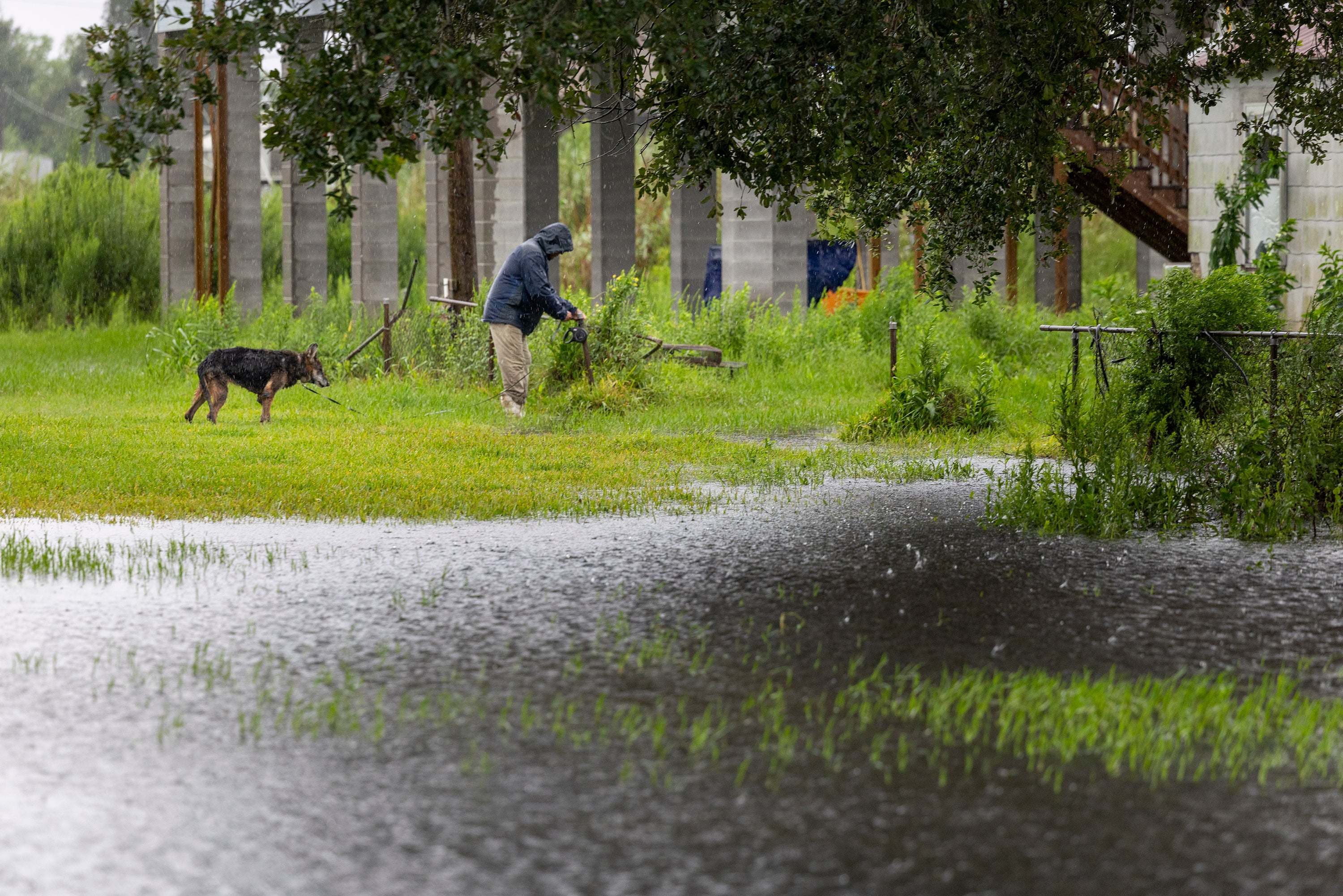
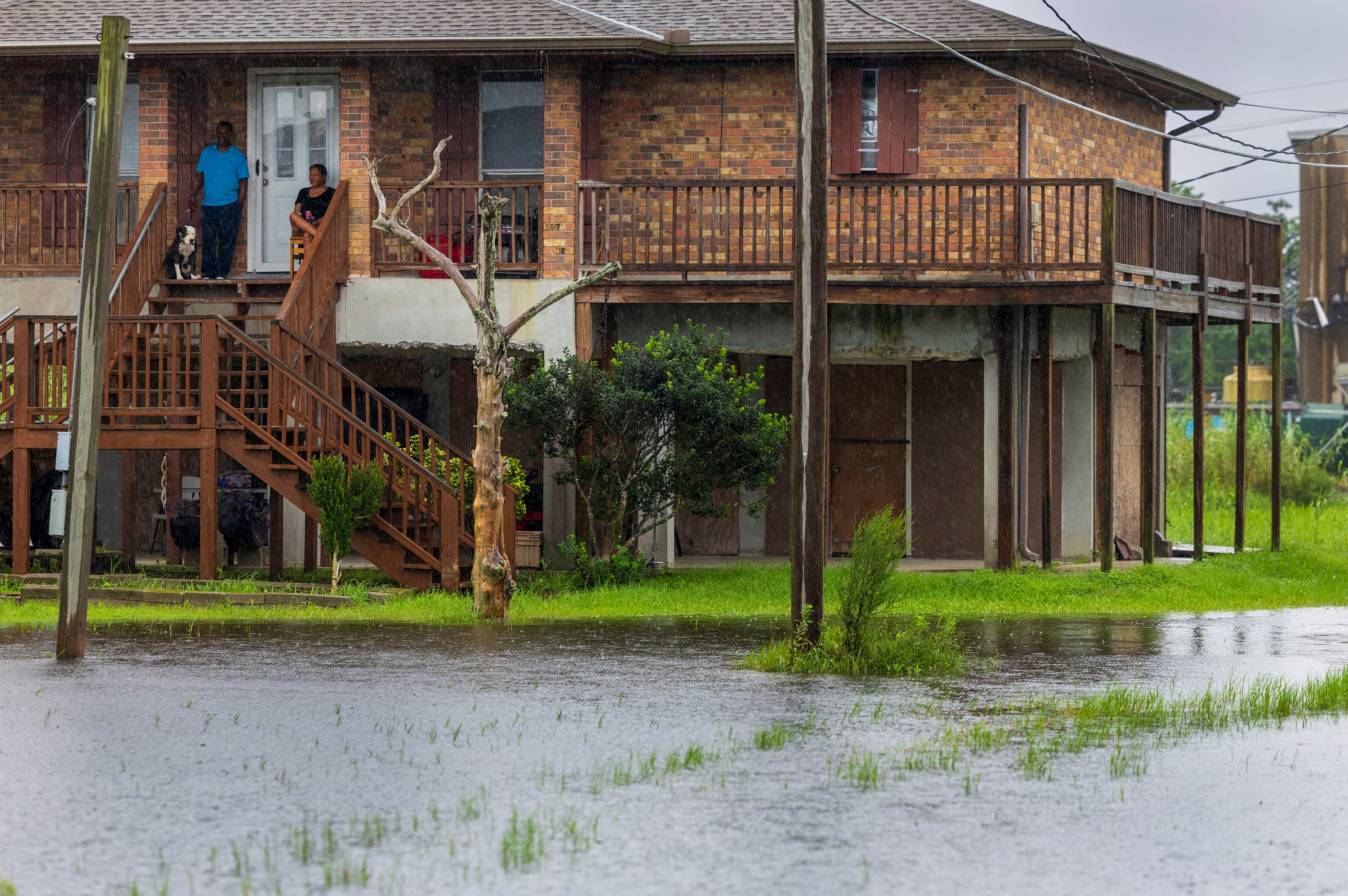
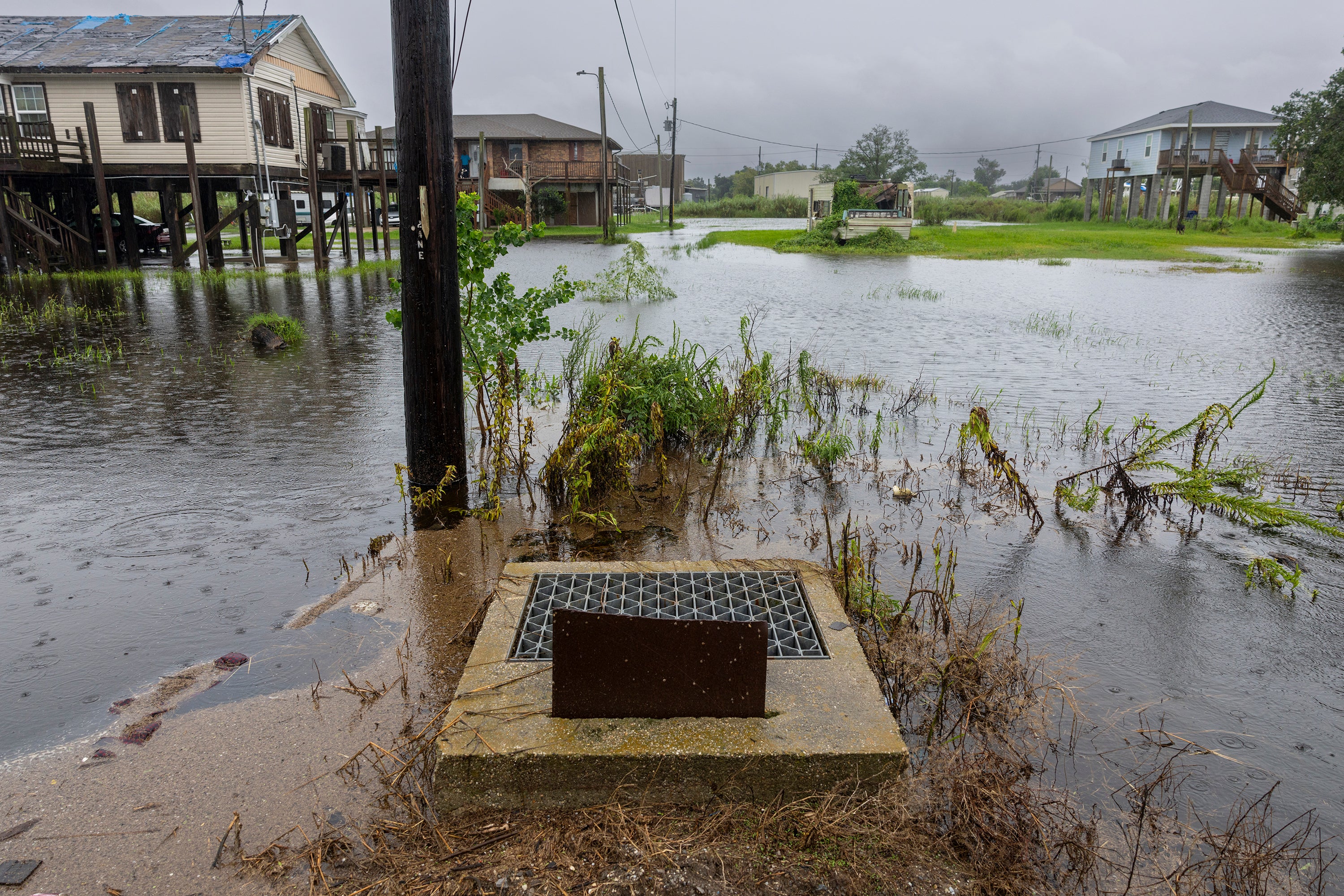
In Pictures: First flooding from Francine seen in new images
The water is rising in Terrebonne Parish as Hurricane Francine begins to impact the southern Louisiana coast.
Hurricane Francine strengthens into a Category 2 storm as it approaches landfall
Hurricane Francine strengthened into a Category 2 storm on Wednesday afternoon. The storm’s eyewall was bringing coastal flooding to Dulac and other coastal Louisiana communities. It is expected to make landfall within the next few hours.
As its eye approaches the state, the National Hurricane Center said that life-threatening storm surge and hurricane conditions were spreading.
Francine was positioned about 40 miles south-southwest of Morgan City and approximately 100 miles west-southwest of New Orleans.
The hurricane has maximum sustained winds of 100 miles per hour, with higher gusts.
What to know before Hurricane Francine makes landfall

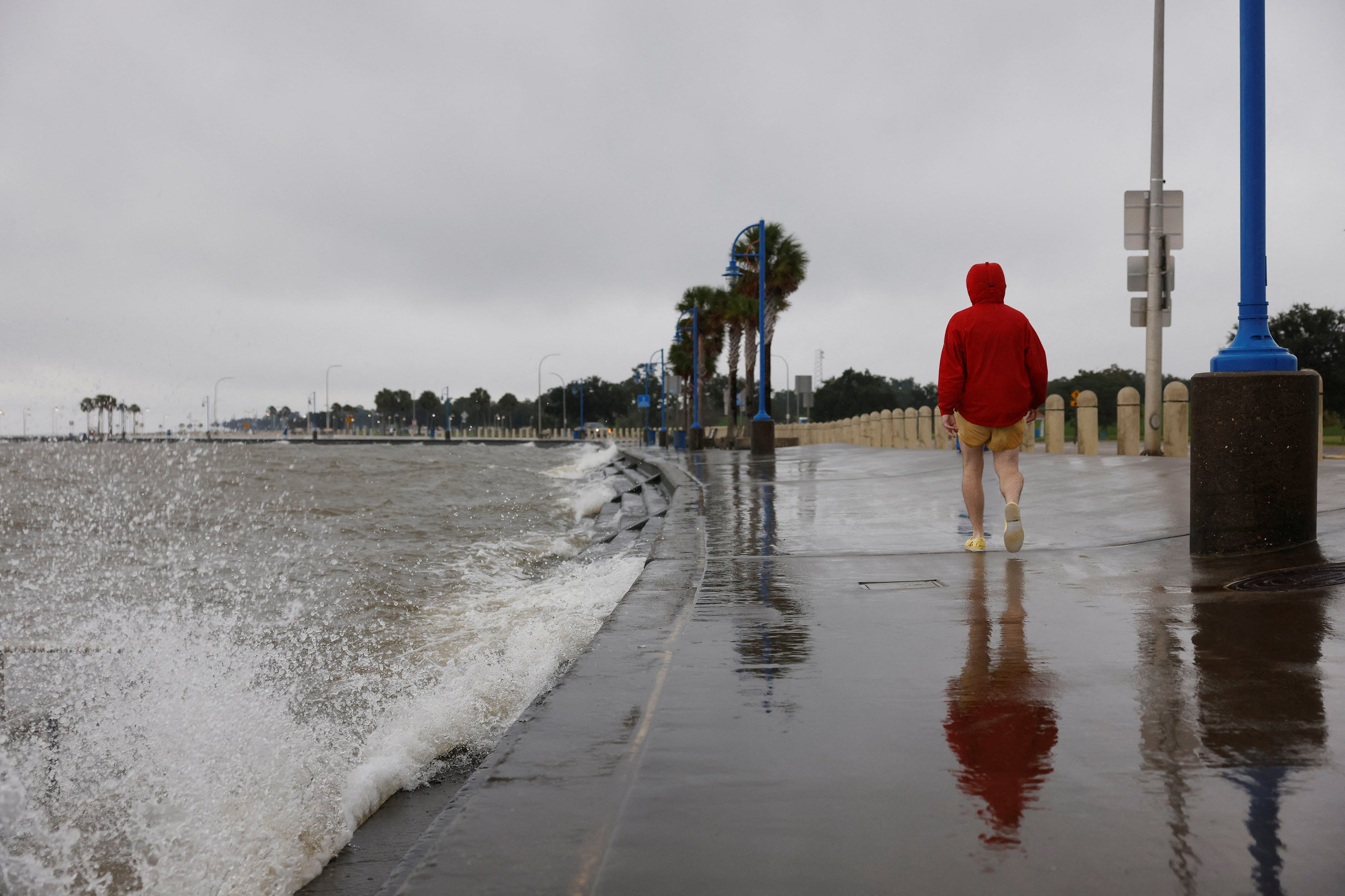
Life-threatening storm surge is forecast tonight for the Louisiana and Mississippi coasts.
Damaging and life-threatening hurricane-force winds are also expected this evening where there is a hurricane warning.
Francine is also expected to bring heavy rainfall and flash and urban flooding, as well as river flooding, across southeastern Louisiana, Mississippi, far southern Alabama, and the Florida Panhandle through Thursday night.
Flash and urban flooding is also probably across the Lower Tennessee Valley and Lower Mississippi Valley from tonight and into Friday morning.
Tammany Parish urges its residents to stay safe as Hurricane Francine’s eyewall breaches the Louisiana coast
Tammany Parish President Mike Cooper urged residents to stay safe on Wednesday afternoon as Hurricane Fracine’s eyewall breached the southern Louisiana coast.
“The eye of Francine is projected to be just to the west of us. Now is the time to stay where you are or get to a safe location,” he said.
“Of course, time is ticking and the timeframe is increasingly reduced.”
Locals should be prepared to hunker down until tomorrow morning and stay off the roads. Power outages are expected in the parish, and Cooper warned about the danger of falling trees.
“Strong winds can turn our beautiful, tall pine trees into hazards,” he cautioned.
The area will see wind gusts of up to 60 miles per hour and possibly 4-6 feet of storm surge.
Hurricane Francine expected to make landfall in the next hour
Hurricane Francine is expected to make landfall in the next hour.
The National Weather Service’s New Orleans office said the Category 2 storm has winds near 100 miles per hour.
“Life-threatening conditions are expected across portions of the area,” it said.
Hurricane Francine makes landfall
Hurricane Francine has made landfall inTerrebonne Parish, about 30 miles south-southwest of Morgan City.
It hit Louisiana as a Category 2 hurricane with sustained winds of 100 miles per hour.
Hurricane Francine expected to bring several life-threatening hazards: NWS
The National Weather Service is warning residents of multiple hazards related to Hurricane Francine, which will likely make landfall in the next hour.
Sustained hurricane force winds could affect areas west and southwest of the tidal lake, bringing the threat of power outages and damage to homes, trees and power lines.
Coastal areas will see life-threatening water levels, with flooding that may be slow to drain due to wind direction on Thursday.
High rainfall will impact saturated soils and flash flooding could quickly occur in urban and poor drainage areas.
Rises on river areas are expected as the rain drains, including minor flooding along rivers from the north shore through the Mississippi coast.
Several tornadoes are possible in Francine’s bands.
Social media users post dramatic videos of Hurricane Francine as it makes landfall
Hurricane Francine made landfall on Wednesday afternoon. It’s bringing life-threatening hazards to the southern region of the state.
Social media users have taken to X to post dramatic video as the storm comes in.
NWS issues flash flood warning through this evening
The National Weather Service issued a flash flood warning until 8 p.m. in Thibodaux, Bayou Blue, and Raceland.
Dramatic satellite video shows Hurricane Francine as it makes landfall
Satellite video from CSU/CIRA and NOAA shows Hurricane Francine as it swirls over Louisiana on Wednesday afternoon.
The Category 2 storm is bringing life-threatening flooding, winds, and storm surge.
Join our commenting forum
Join thought-provoking conversations, follow other Independent readers and see their replies
Comments