Meteorologists have downgraded an Atlantic storm system. But Florida’s coast still faces more floods
Florida’s eastern coast could see additional flooding impacts a week after Hurricane Milton tore through the state
Your support helps us to tell the story
From reproductive rights to climate change to Big Tech, The Independent is on the ground when the story is developing. Whether it's investigating the financials of Elon Musk's pro-Trump PAC or producing our latest documentary, 'The A Word', which shines a light on the American women fighting for reproductive rights, we know how important it is to parse out the facts from the messaging.
At such a critical moment in US history, we need reporters on the ground. Your donation allows us to keep sending journalists to speak to both sides of the story.
The Independent is trusted by Americans across the entire political spectrum. And unlike many other quality news outlets, we choose not to lock Americans out of our reporting and analysis with paywalls. We believe quality journalism should be available to everyone, paid for by those who can afford it.
Your support makes all the difference.While Florida may not see a hurricane anytime soon, more flooding is forecast for the state.
Winds blowing from the northeast and moving through the area are keeping more threatening storms away from the region, but AccuWeather meteorologists say the winds will cause waters along Florida’s Atlantic coast to surge.
Floridians should expect choppy surf, high tides, beach erosion, and coastal flooding, the weather forecasting company said.
Frequent and strong rip currents are also expected.
“Cities such as Miami, which are prone to flooding in certain high tide situations, will likely experience significant overwash and street flooding,” AccuWeather Senior Meteorologist Brett Anderson cautioned Wednesday.
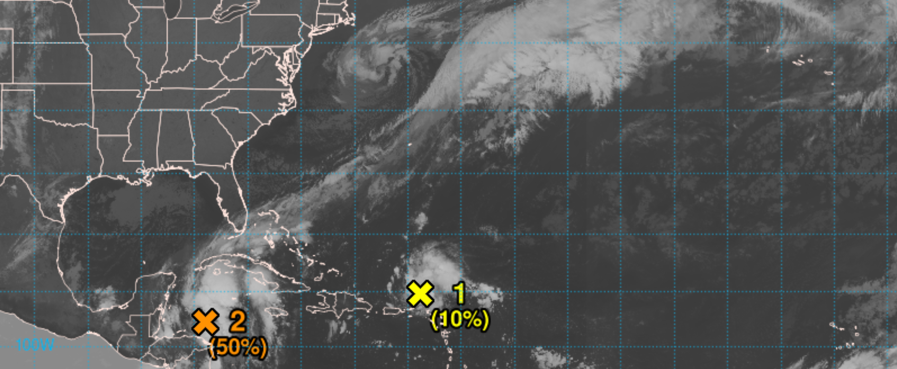
These warnings come as meteorologists have been closely tracking a pair of storm systems over the Atlantic and western Caribbean Sea.
While the National Hurricane Center had previously given the disturbance, dubbed AL94, a medium chance of further development as it passes north of the US Virgin Islands and Puerto Rico on Friday, the agency downgraded that possibility early Friday morning.
The long area of low atmospheric pressure is producing showers and thunderstorms in the area, but if there’s any strengthening it should be slow to occur.
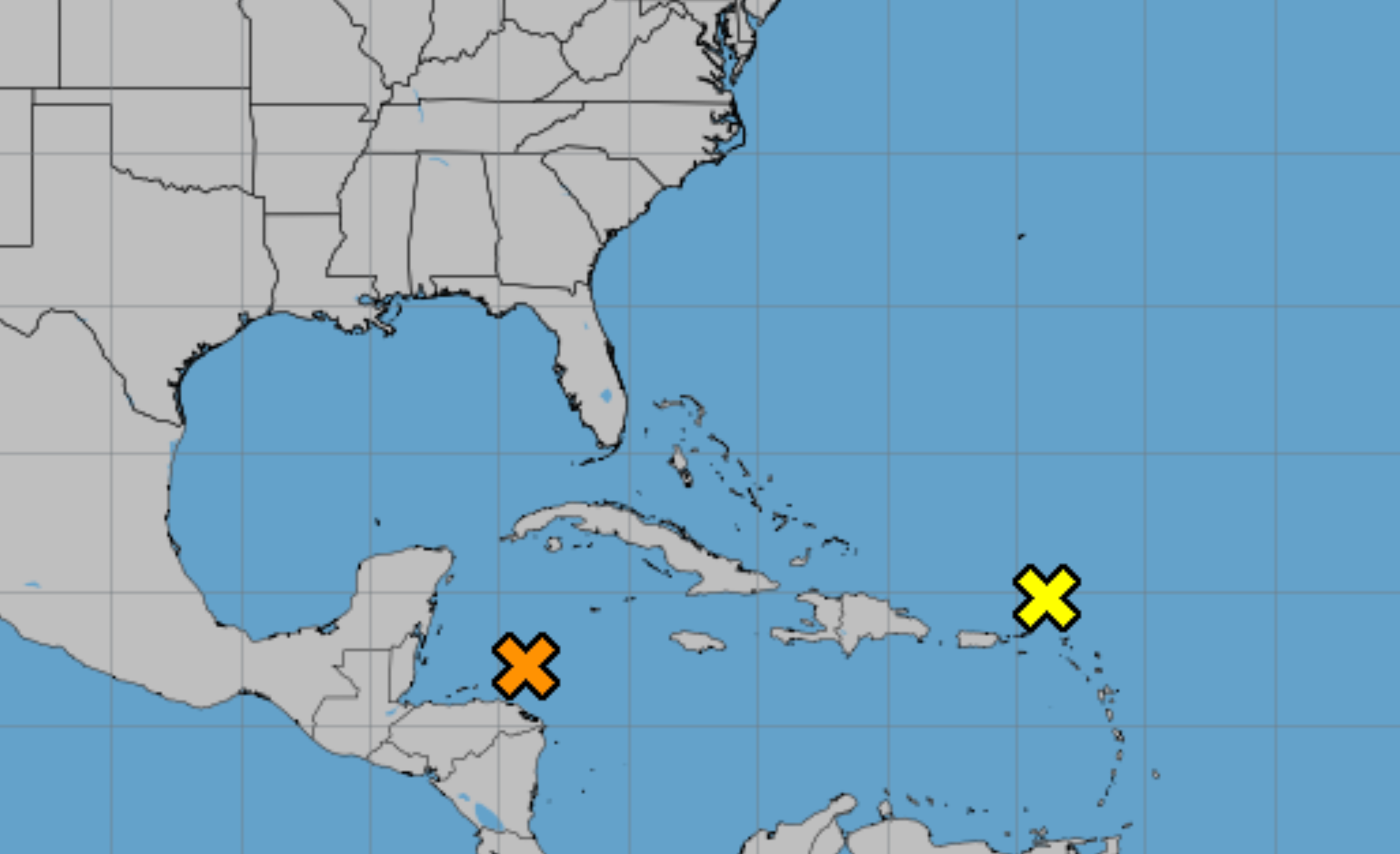
AL94 was moving westward at around 20 mph and is expected to move near Hispaniola and the southeastern Bahamas over the weekend.
“Further development is not expected due to strong upper-level winds by early next week,” the agency said.
Another area of low pressure, AL95, has brought widespread showers and thunderstorms across the northwestern Caribbean Sea.
The system is becoming better defined, forecasters said, as it moves north of eastern Honduras.
“Environmental conditions appear conducive for some additional development over the next day or so, and a short-lived tropical depression or storm could form before the system moves inland over Belize and the Yucatan Peninsula of Mexico on Saturday,” the center wrote.
Heavy rainfall is likely across Central America and southern Mexico through the weekend.
Pressure is caused by gases in the atmosphere, but not all areas have equal air pressure. Those with less pressure are called low-pressure systems. NOAA says these systems suck air into them because “nature wants everything to have equal pressure.” Doing this creates winds and stormy weather.
The Gulf of Mexico remains fairly quiet for now. But, Atlantic Hurricane Season runs through November 30.
Earlier this month, Hurricane Milton slammed into Florida, bringing historic rainfall and flooding that lasted for days. The storm made landfall around Siesta Key on the state’s west coast. The city of Tampa saw major impacts from the Category 3 hurricane and a new assessment of damage reported by WFLA found that 12,560 Pinellas County homes were damaged as of Thursday afternoon.
After Hurricane Helene hit in late September, the total number of homes that sustained damage in Pinellas is over 40,000.
Join our commenting forum
Join thought-provoking conversations, follow other Independent readers and see their replies
Comments