Why Milton's 'reverse surge' sucked water away from flood-fearing Tampa
In the hours before Hurricane Milton hit, forecasters worried it could send as much as 15 feet of water rushing onto the heavily populated shores of Florida’s Tampa Bay
Your support helps us to tell the story
From reproductive rights to climate change to Big Tech, The Independent is on the ground when the story is developing. Whether it's investigating the financials of Elon Musk's pro-Trump PAC or producing our latest documentary, 'The A Word', which shines a light on the American women fighting for reproductive rights, we know how important it is to parse out the facts from the messaging.
At such a critical moment in US history, we need reporters on the ground. Your donation allows us to keep sending journalists to speak to both sides of the story.
The Independent is trusted by Americans across the entire political spectrum. And unlike many other quality news outlets, we choose not to lock Americans out of our reporting and analysis with paywalls. We believe quality journalism should be available to everyone, paid for by those who can afford it.
Your support makes all the difference.In the hours before Hurricane Milton hit, forecasters were worried it could send as much as 15 feet (4.5 meters) of water rushing onto the heavily populated shores of Florida's Tampa Bay.
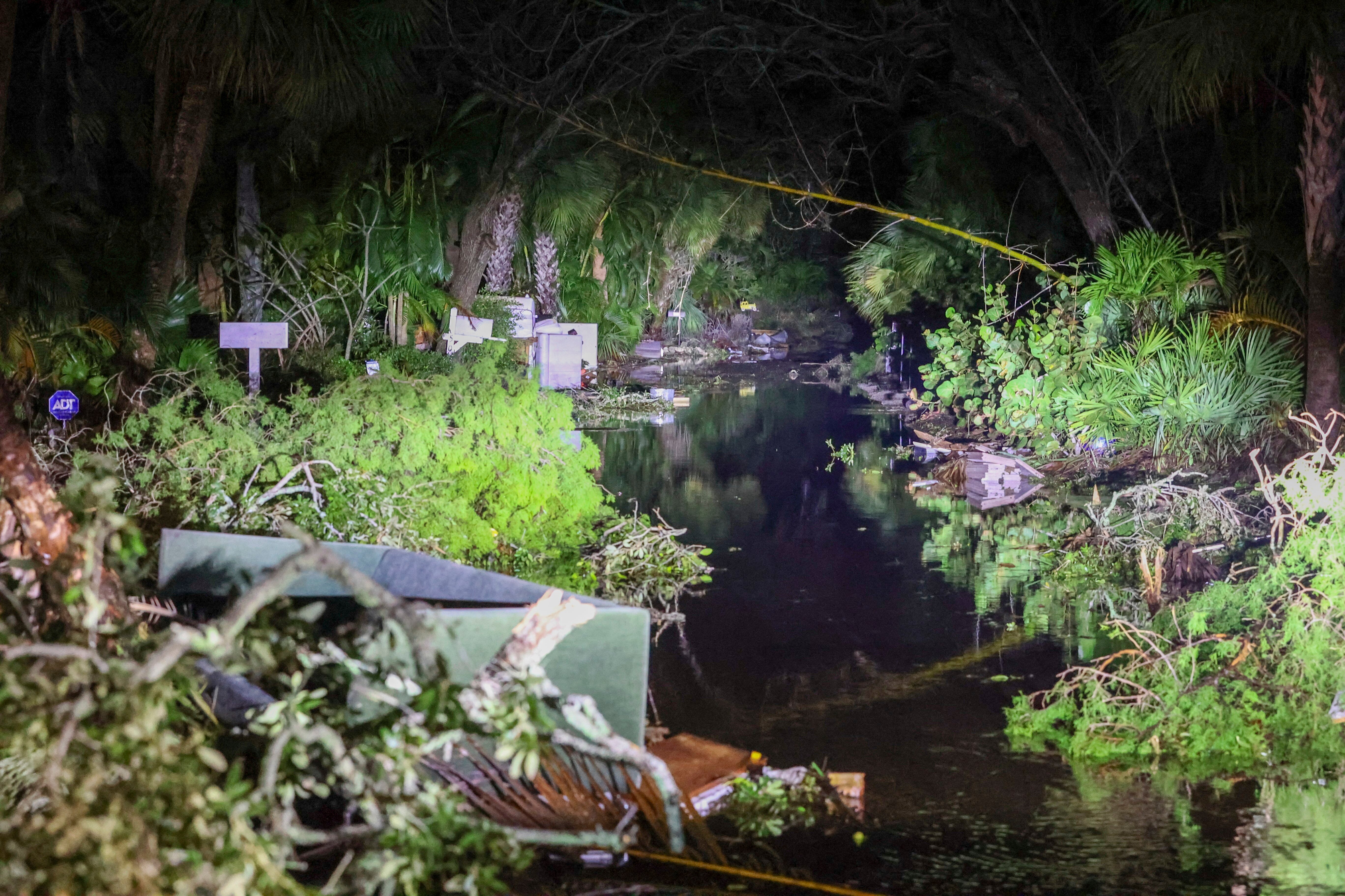
Instead, several feet of water temporarily drained away.
Why? “Reverse storm surge” is a familiar, if sometimes unremarked-upon, function of how hurricane winds move seawater as the storms hit land — in fact, it has happened in Tampa Bay before.
In the Northern Hemisphere, tropical storm winds blow counterclockwise. At landfall, the spinning wind pushes water onshore on one end of the eye and offshore on the other. Picture drawing a circle that crosses a line, and see how the pencil moves toward the line at one point and away at another.
The most pronounced water movement is under the strong winds of the eyewall, explains Brian McNoldy, a University of Miami senior researcher on tropical storms.
Milton's path toward the central part of Florida's west coast was clear for days, raising the possibility that Tampa Bay could bear the brunt of the surge. But it's always tricky to predict exactly where landfall will happen — and when, which can be important because a daily high tide can accentuate a surge.
To be sure, hazardous wind, rain and some degree of surge can happen far from the center. But the exact location of landfall makes a big difference in where a surge peaks, McNoldy said. Same goes for a reverse, or “negative,” surge.
Ultimately, the center of east-northeastward-moving Milton made landfall Wednesday night at Siesta Key, near Sarasota. It's about 70 miles (112 kilometers) south of the city of Tampa.
That meant fierce onshore winds caused a storm surge south of Siesta Key. The National Hurricane Center said Thursday that preliminary data shows water rose 5 to 10 feet (1.5 to 3 meters) above ground between Siesta Key and Fort Myers Beach.
Meanwhile, the water level abruptly dropped about 5 feet at a National Oceanic and Atmosphere Administration gauge near Tampa late Wednesday night.
Hurricane Irma caused a similar effect in 2017. So did Ian in 2022, when people strode out to see what was normally the sea bottom.
In any storm, “that’s an extremely bad idea," McNoldy says. “Because that water is coming back.”
Indeed, water levels returned to normal Thursday morning.
Subscribe to Independent Premium to bookmark this article
Want to bookmark your favourite articles and stories to read or reference later? Start your Independent Premium subscription today.