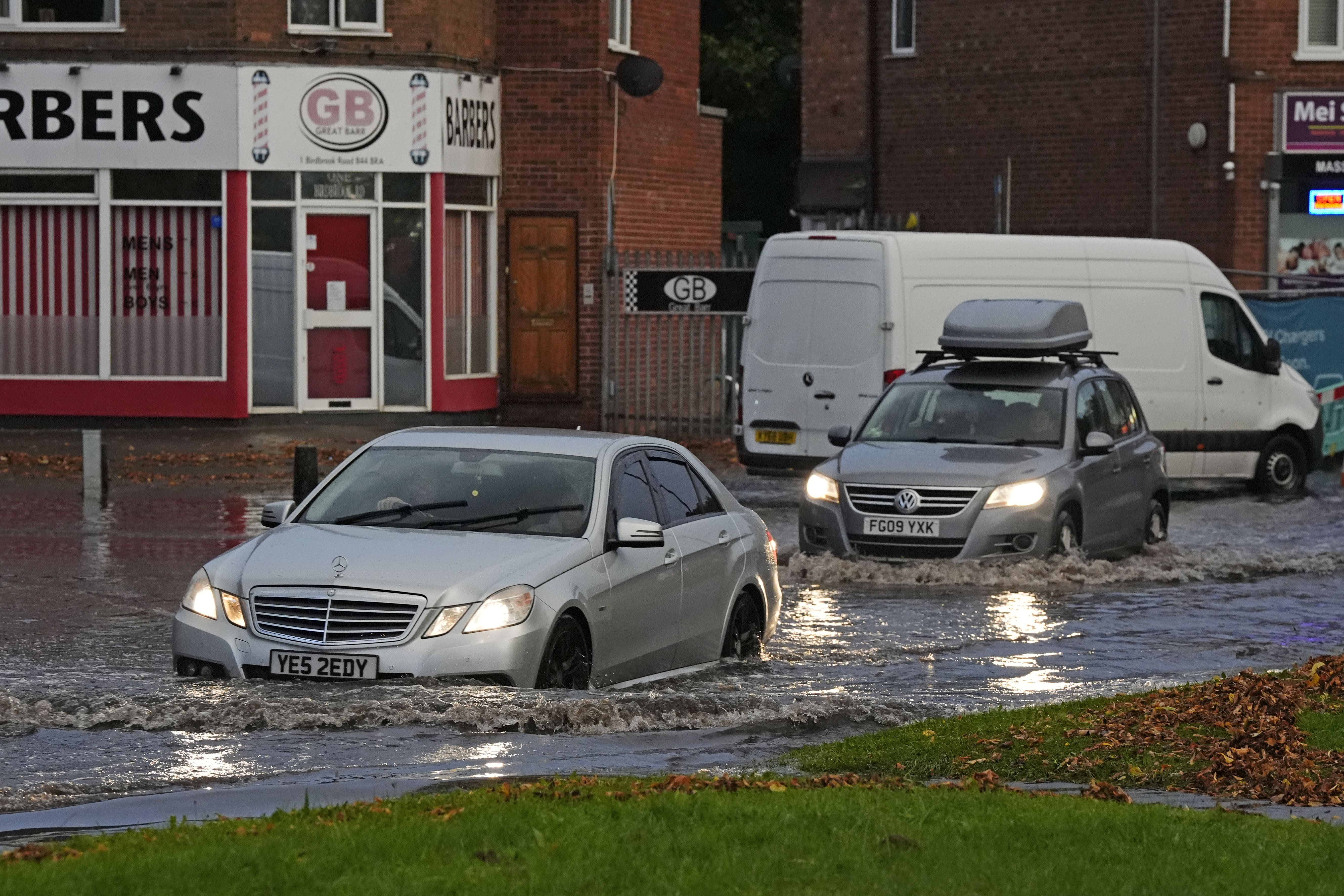
UK weather live: Flooding travel chaos as roads shut and London trains delayed amid Met Office amber alert
Some schools across England have been forced to closed following flooding
Your support helps us to tell the story
My recent work focusing on Latino voters in Arizona has shown me how crucial independent journalism is in giving voice to underrepresented communities.
Your support is what allows us to tell these stories, bringing attention to the issues that are often overlooked. Without your contributions, these voices might not be heard.
Every dollar you give helps us continue to shine a light on these critical issues in the run up to the election and beyond

Eric Garcia
Washington Bureau Chief
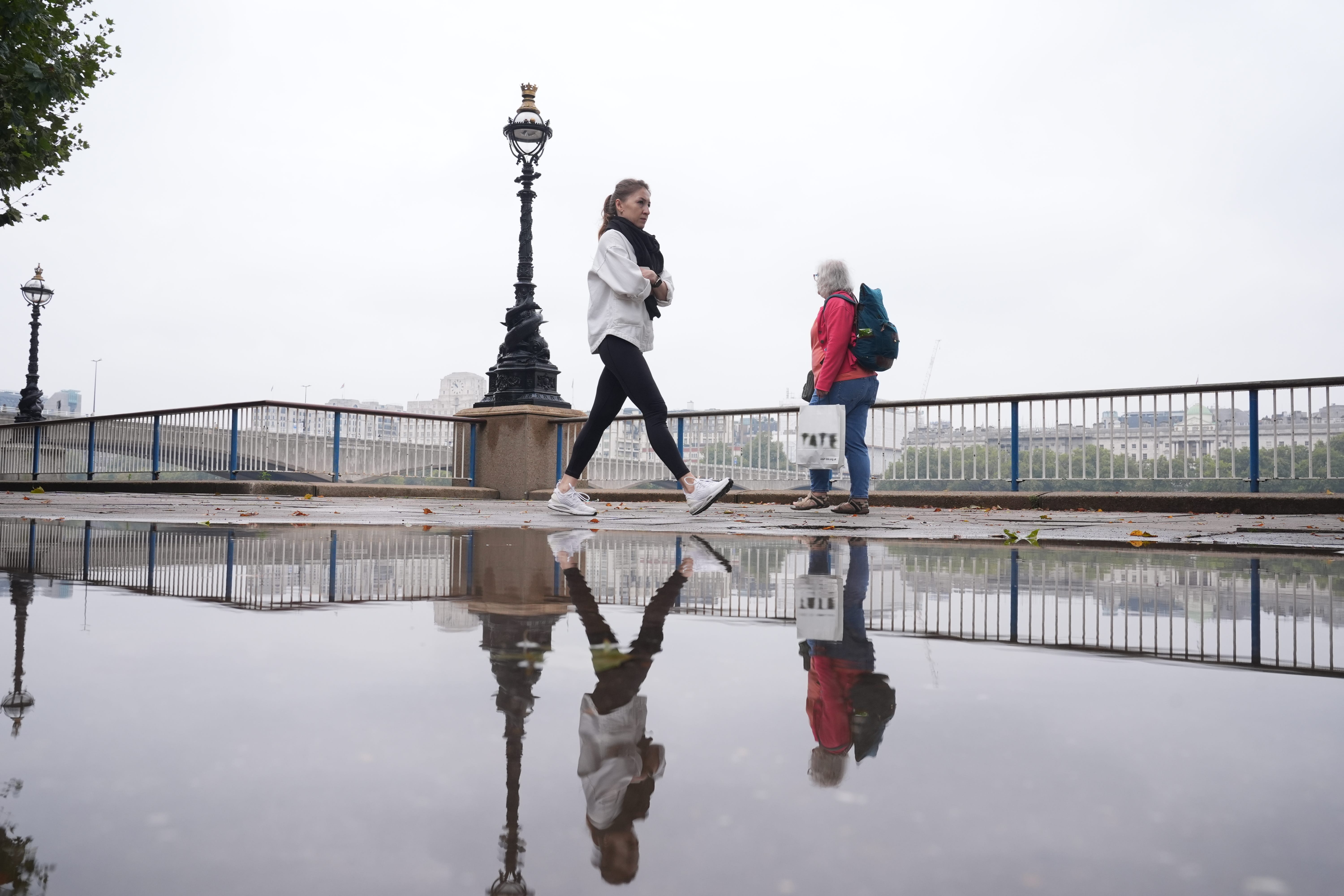
Floods have caused travel chaos across the country with drivers being told to find alternative routes to London after extreme rainfall overnight.
The autumn equinox on Sunday coincided with heavy downpours, as the Met Office warned that “heavy rain is expected to produce some flooding” with an amber and yellow weather warning in place.
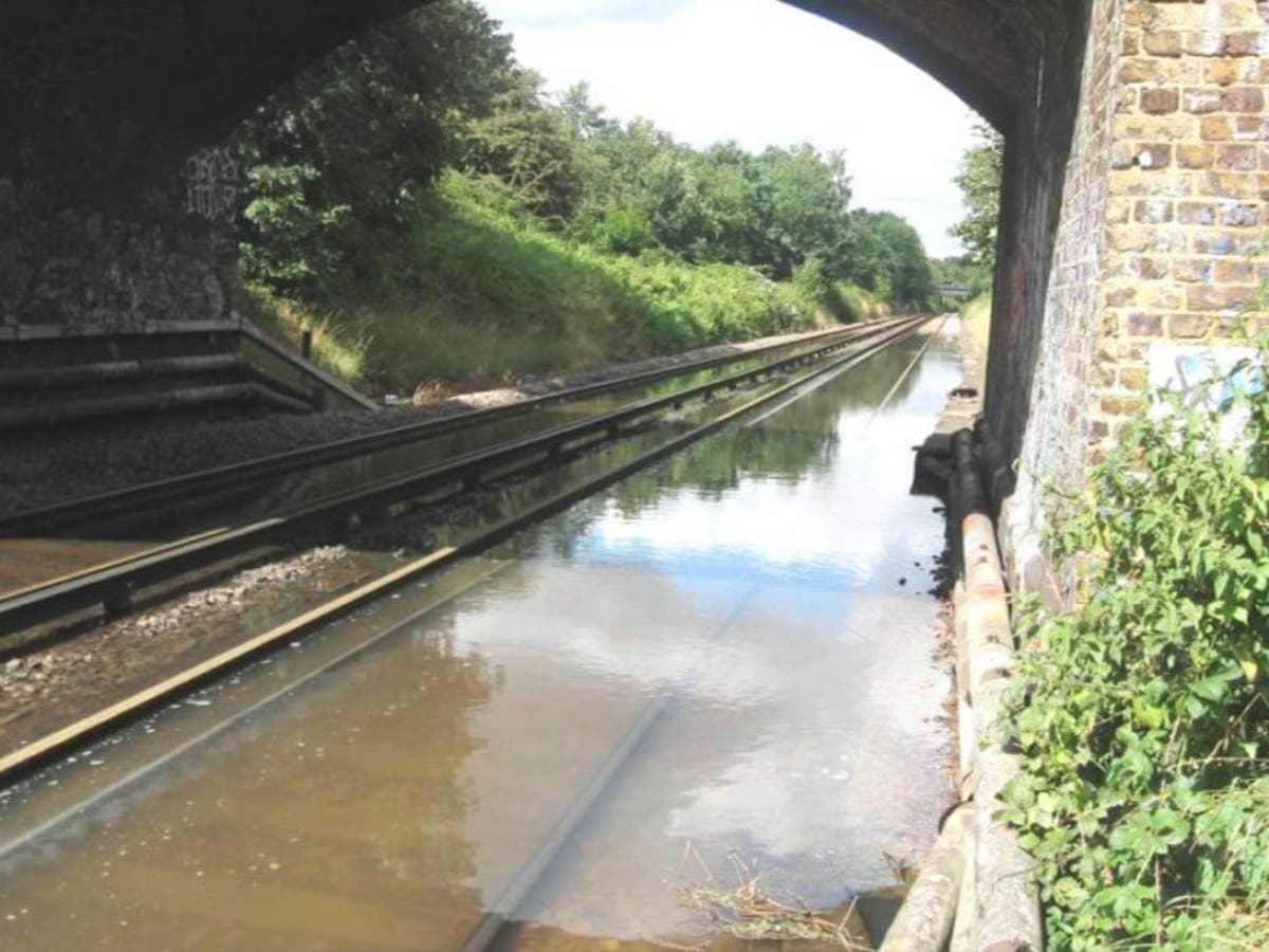
Southern railway lines were flooded earlier today disrupting commuter’s journeys throughout the morning. All lines have now re-opened but there are still delays of up to 40 minutes and some cancellations.
Four Underground lines, including the Overground and Piccadilly lines, are still part-suspended while drivers were asked to find alternative routes into the capital after National Highways said the northbound entry slip road from the M25 at junction 10 was closed due to flooding.
The Met Office has issued a yellow warning for rain from 05:00 BST until 23:59 on Monday across Kent, Surrey and Sussex. A more severe amber warning covers Gloucestershire, London, Northamptonshire, the East of England and Oxfordshire until 21:00.
There are 17 flood warnings in place and 70 flood alerts.
Car left ‘stranded’ overnight in London downpour
The London Fire Brigade had to rescue a stranded car overnight near Croydon.
An image shared by the service shows the vehicle mostly underwater on Manor Road, in Wallington.
They warned drivers that just a foot of water moving 6mph could float a car.
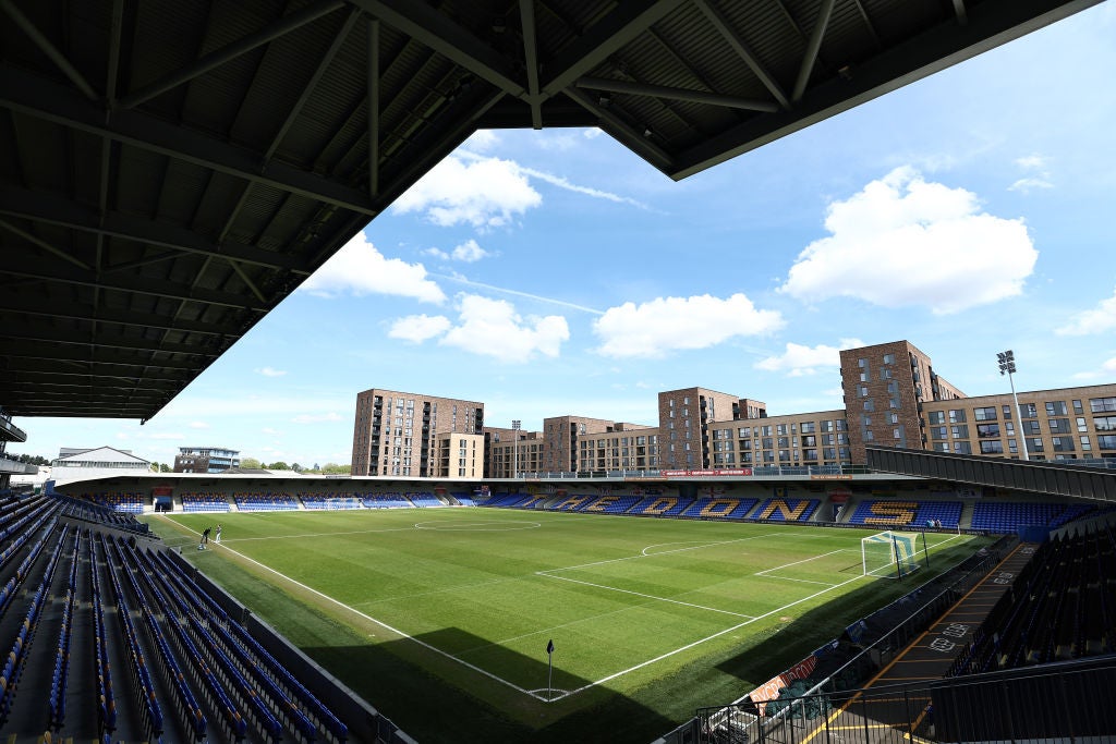
AFC Wimbledon’s Carabao Cup tie against Newcastle postponed
AFC Wimbledon and Newcastle’s Carabao Cup third-round meeting on Tuesday has been called off due to “extensive overnight flooding” at the
The Dons’ stadium in London is now closed with a rescheduled date for the tie yet to be confirmed.
A statement on Wimbledon’s official website read: “We regret to inform supporters that due to extensive overnight flooding of the River Wandle and surrounding areas, including at our Cherry Red Records Stadium, Tuesday night’s Carabao Cup third-round fixture against Newcastle United has been postponed. More information will follow in due course regarding fixture rearrangement. The stadium is closed until further notice.”
The fourth round of the Carabao Cup is due to take place the week commencing October 28.
List of schools forced to close today due to weather
Several schools across the country have been forced to close today due to significant flooding. The flooded schools said pupils had been set to remote learning and urged parents and carers to check their websites for updates. Some school trips have also been cancelled.
Here is a list of the closures which we will be updating throughout the day if information changes.
Gloucestershire:
- Chosen Hill School in Churchdown
- The Milestone School in Gloucester [Monday and Tuesday]
- Tewkesbury CofE Primary
Oxfordshire:
- Frank Wise School, Banbury
- The Warriner School, Bloxham
- Lord Williams’s School, Thame
- St Joseph’s Catholic Primary, Banbury
Bedfordshire:
- Goldington Academy, Putnoe
- Hockliffe Lower School, Leighton Buzzard
- Mark Rutherford School
- St Marys CofE Clophill VA, Clophill
- The Hills Academy,
- Broadmead Lower School, Park Crescent
- Sheerhatch Primary School’s Willington site
- Lincroft Academy, Oakley [only be open to Year 11 and ARC students today]
- Harlington Upper
- Harlington Lower
- Sundon Lower School, Bedfordshire
Where rain could fall in your area as amber warning comes into effect
Met Office meteorologist Jonathan Vautrey said Herefordshire, Gloucestershire and up towards the Wash and the Humber could be hit by the heavy rainfall.
A yellow alert was put in place throughout the day, covering parts of Wales, much of the south of England, the Midlands and into northwest England and Yorkshire.
Met Office meteorologist Jonathan Vautrey added: “First thing on Monday morning then we see an amber weather warning come into force. It stretches between Herefordshire, Gloucestershire and up towards the Wash and the Humber.
“This area in particular, during Monday, we could see over a month’s worth of rain falling, and with the rain we’ve already seen over the last couple of days this certainly has the potential to bring some disruption and flooding in locations and here it is very important we do take care over the course of the day.”

UK weather mapped: Where rain could fall as amber warning comes into effect
The Met Office warned a month’s worth of rainfall could fall in some parts of the UK on Monday
Yellow weather warning extended
The Met Office’s yellow weather warning has been extended to last until 23:59 tonight.
There is still some uncertainty regarding which areas will be affected by the heaviest rain, but at this stage parts of the south Midlands, southern and southwest England look most likely to be greatest hit.
Met Office warn that some areas could see 100mm of rain on Monday
Met Office Chief Meteorologist, Frank Saunders said: “Following on from the heavy rain that some of us have seen on Friday, Saturday and Sunday, the new working week begins with rain across a large swathe of England and Wales.
“The area with the higher likelihood of impactful rain is now covered by an Amber warning, stretching from Gloucester across the Midlands to the Wash and the Humber.
“It’s likely that some parts of this area will be worse affected than others – it all depends on where, and if, the weather system responsible for the heavy rain stalls and pivots.
“However, within this warning period - which encompasses two rush hours – some localities will probably see between 50 and 80 mm of rain, while there’s the possibility that a few could experience in excess of 100mm of rain. Where this happens, this brings the potential for travel disruption and localised flooding.”
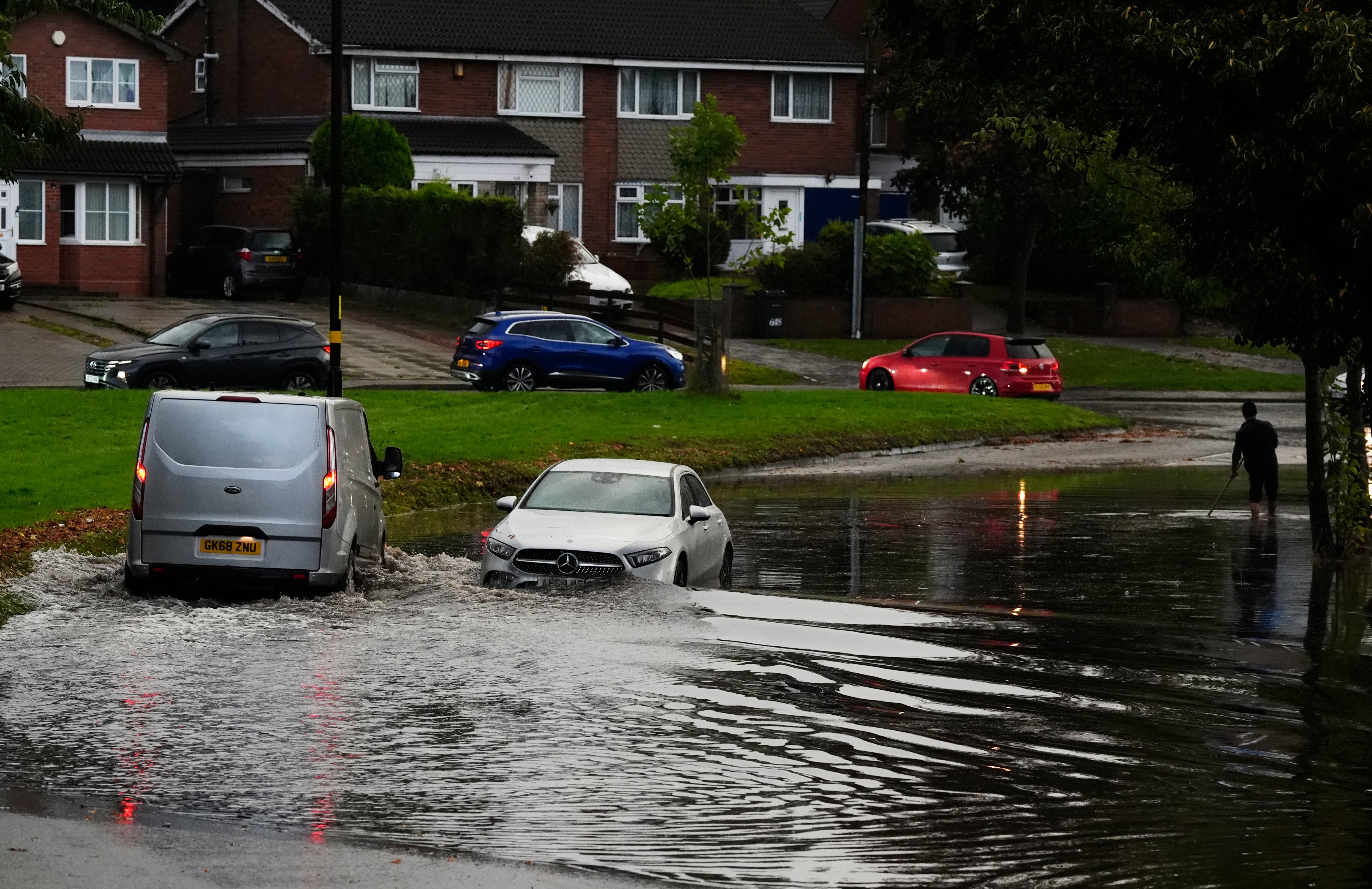
Heavy rain sees road closures and flooding in Bedfordshire
Heavy rainfall overnight has seen areas in Bedfordshire already submerged, with police confirming a number of road closures including Dunstable High Street. Footage shared on social media showed cars battling high water around the Saracen’s Head pub.
Central Bedfordshire Council said flooding had also hit Flitwick, Cranfield and Marston Moretaine.
As of 7.40am, 13 flood warnings – meaning flooding is expected – were issued for England by the Environment Agency.
Areas affected by the flood warnings include Atherstone in Warwickshire, Leighton Buzzard and Luton in Bedfordshire and parts of London including Wimbledon and South Ruislip.
Five day weather forecast shows rain throughout the week
Today:
Heavy rain will linger across parts of England and Wales today. This could lead to localised flooding in some southern areas. Further north it will be drier and largely cloudy, although rain will move into northern Scotland.
Tonight:
Rain in the south will gradually ease tonight and clear to the east during the early hours. Skies will remain cloudy, with rain continuing in northern Scotland through the night.
Tuesday:
Rain in the east clears in the morning. Outbreaks of rain in Scotland will spread to northern England in the afternoon. Largely dry and cloudy elsewhere. Chilly in the north.
Outlook for Wednesday to Friday:
Rain will spread across the UK during Wednesday and Thursday, possibly with strong winds in places. Rain should clear through Friday and it will turn colder in a northerly wind.
Travel chaos on tubes and trains after overnight flooding in London and southeast England
Commuters in London and southeast England face widespread problems at the start of the working week due to overnight flooding.
The UK’s biggest rail franchise, Govia Thameslink Railway (GTR), is warning that severe weather will affect all its operations: Great Northern, Gatwick Express, Southern and Thameslink.
The company says: “Due to the consistent overnight rainfall throughout the GTR network, a number of services are expected to be impacted this morning.”
Read the full article here:
Travel chaos after overnight flooding in London and southeast England
Four Tube lines in the capital are partially closed on Monday morning due to flooding
Road closures across Bedfordshire and Hertfordshire
Police have confirmed a number of road closures across Bedfordshire and Hertfordshire following “substantial flooding” overnight.
Heavy rainfall on Sunday into Monday has seen areas such as Dunstable and Hitchin partially submerged.
Bedfordshire Police said it had closed off part of Dunstable High Street due to “substantial flooding”, with footage shared on social media showing cars battling high water around the Saracen’s Head pub.
Central Bedfordshire Council said flooding had also hit Flitwick, Cranfield and Marston Moretaine.
North Hertfordshire Police have also advised motorists to avoid some parts of Hitchin, including Walsworth Road near the town centre.
Subscribe to Independent Premium to bookmark this article
Want to bookmark your favourite articles and stories to read or reference later? Start your Independent Premium subscription today.
Join our commenting forum
Join thought-provoking conversations, follow other Independent readers and see their replies
Comments