How Cold War spy satellites helped prevent a world war
With the advent of spy satellites came continuous enemy observation and the element of surprise disappeared. Mick O’Hare looks at the lasting impact it’s had on warfare

The weather balloon carrying the microfilm rises into the Arctic air. A Soviet Air Force MiG travelling at Mach 2 swoops in to ensnare it. But, gazing upwards from the ice into the freezing sky, Captain Ferraday squeezes the remote trigger. The film capsule explodes, debris falls to the snow and the two armies facing each other across the frigid waste retreat into the blizzard.
Admittedly this is the denouement to a movie starring the likes of Rock Hudson and Patrick McGoohan, rather than the Red Army facing off with a bunch of western spooks, but it’s probably one of the best endings to a Cold War plot in cinematic history. And more significantly Ice Station Zebra, written by Alistair MacLean, was based on fact.
Hudson, who played US submarine captain Ferraday, had been despatched to the North Pole to retrieve a film ejected from a reconnaissance satellite that had come down in the Arctic. He was racing to beat the Soviets who were also desperate to get hold of it. Back in the 1960s, this stuff was really going on.
Today it’s fair to say that, for better or worse, we are used to being under surveillance, whether from a CCTV in the supermarket or our online shopping habits generating any number of algorithms designed to sell us more. And we appear equally unperturbed knowing that satellites are orbiting our planet recording everything from forest destruction to levels of pollution to, quite obviously, the military installations of foreign powers. Much of what we know about the Russian invasion of Ukraine is from intelligence gleaned from satellites.
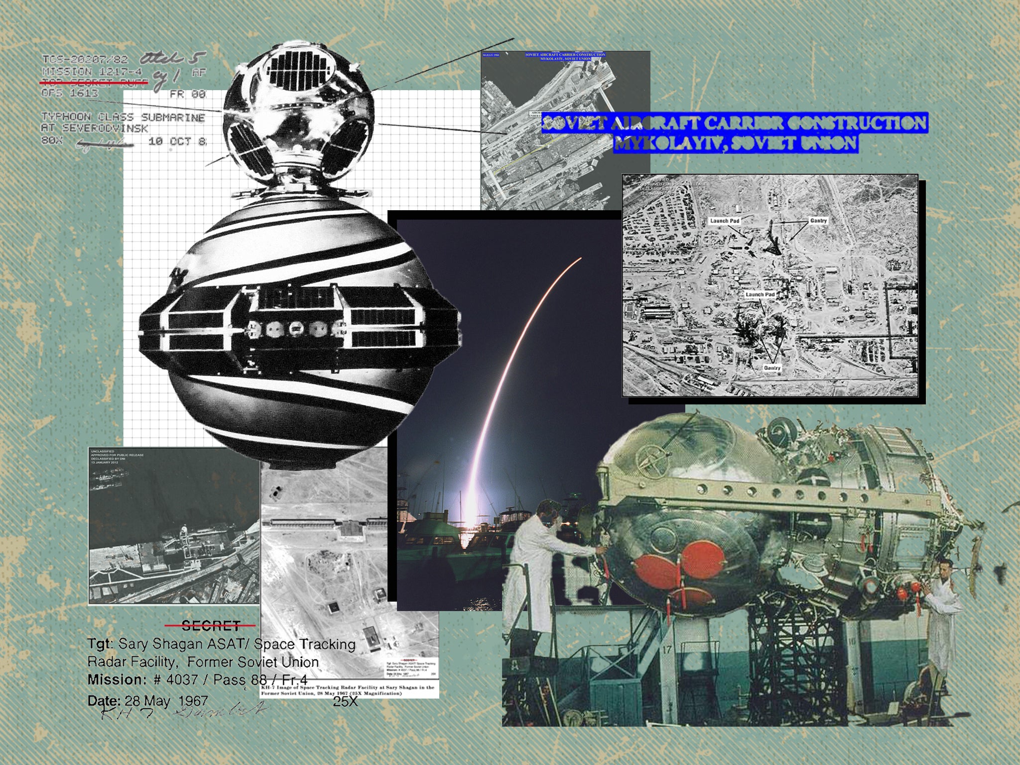
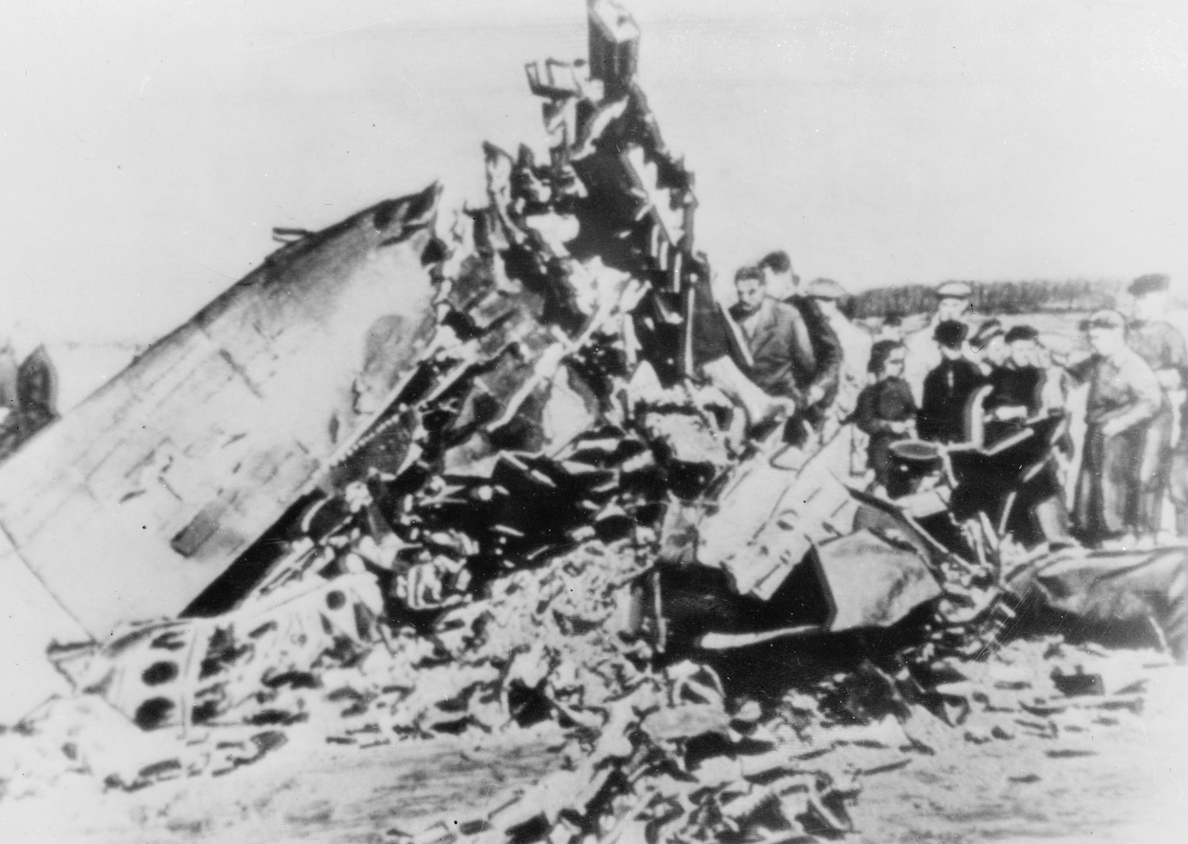
Back in the 1960s, at the height of the superpower Cold War between the United States and the Soviet Union, that was not the case. If you wanted to take a peek at the enemy’s territory you needed to send a high-altitude flight into their airspace, with all the obvious risks involved. The US had been flying such missions since 1956 but when the Lockheed U-2 spyplane of US pilot Gary Powers was shot down over the Ural Mountains in May 1960 the top brass figured more sophisticated means were required to keep a watchful eye on the other side of the iron curtain.
The United States’ Corona photoreconnaissance satellite programme had been given the green light by President Dwight D Eisenhower in 1958. “He decreed it would be a joint venture between the CIA and the US Air Force,” explains James David, a curator in the space history division at the Smithsonian’s National Air and Space Museum in Washington DC. “Eventually, that led to the creation of the National Reconnaissance Office in 1961. But by the time Powers was shot down, no satellites had actually been launched.” Clearly there was an imperative to advance the Corona programme as quickly as possible.
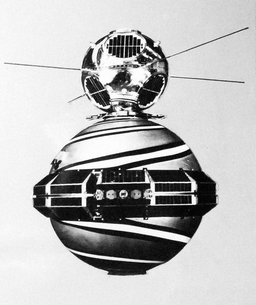
In June 1960 a satellite ostensibly measuring solar radiation was launched into polar orbit, crossing Soviet territory. It was named Solrad. “But it also had a different use,” says David. It was a trial run for Corona. “It was only switched on 34 times before it stopped working but it was searching for radar stations in the USSR and China,” he explains. It was the first military reconnaissance satellite.
By now Corona itself was ready to launch. After numerous unsuccessful attempts, the first satellite was sent into orbit on 10 August 1960. It carried no film but it did have a test capsule on board which was successfully ejected and, after sinking to the bottom of the Pacific, recovered. It was the first man-made object to be returned safely from space.
“Even though it was supposed to be top secret the politicians couldn’t help themselves and the capsule was taken to the White House where Eisenhower held a press conference to show off America’s achievement,” says David. “Eight days later a Corona satellite, this time with film, made eight passes over the Soviet Union. It photographed more in a single pass than the U-2 aircraft had ever covered.” The era of the spy satellite was underway.
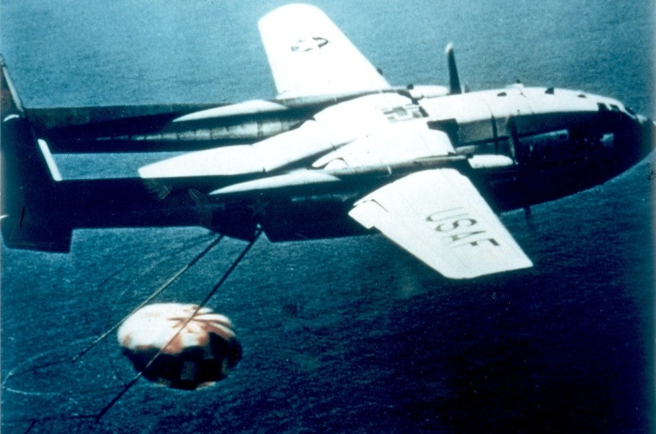
The film capsules were ejected on parachutes to ensure they did not break up when hitting the ground or the ocean but also so that aircraft could scoop them up in mid-descent, just like in Ice Station Zebra. But if things went awry they were designed to float for 24 hours, emitting a signal.
Zenit’s systems were quite sophisticated. The satellites contained a secure radio link that could receive data only when passing over Soviet territory, to avoid interference by foreign agents
Of course, things didn’t always go to plan. Each early satellite carried two capsules, known as the “film buckets”, which were protected during re-entry by a heat shield. At 60,000ft the parachutes opened. Even when the parachutes worked well they could veer markedly off course. Missed capsules often sank immediately. And in 1964 Venezuelan farm workers were surprised to find their sugarcane crop flattened by a large metal container labelled “Secret”. Thereafter the CIA put instructions on the side of the film buckets explaining in different languages what to do if they were found.
Meanwhile, the Soviet Union launched Zenit in 1962. And while the British, French and Chinese would eventually launch satellites of their own, the vast bulk of that early orbital activity was carried out by the two superpowers. The first Soviet reconnaissance satellite was actually a converted Vostok spacecraft of the kind that took Yuri Gagarin on the first human flight into space a year earlier. The first attempt in December 1961 had gone spectacularly wrong and had to be remotely destroyed after launch. But, like the Americans, the Soviets learnt from their mistakes.
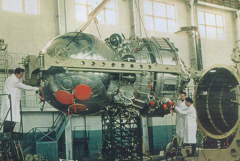
And also like the US, the Soviets pretended Zenit was only used for scientific research and gave it the public name Kosmos. However, Zenit had no film capsules to eject, the entire spacecraft had to be returned to Earth in what the engineers hoped would be a controlled landing in Kazakhstan. More than once all that remained was a pile of burnt, pulped dust. And sometimes not even on the intended landing ground. One Zenit landed in the Volga river metres from startled fishermen.
Flights were short, sometimes no longer than four days, whereas Corona satellites remained aloft until the film was used up. However, Zenit’s systems were quite sophisticated. The satellites contained a secure radio link that could receive data only when passing over Soviet territory, to avoid interference by foreign agents.
The early Corona satellites used a special 70mm film developed by Kodak to allow them to take wide-angle shots. They carried about a mile and a half of film. If that sounds extraordinarily long, by the time film-based satellites were being replaced with digital camera-based reconnaissance, film length had grown to an astonishing 60 miles – or, ironically, about the distance between Alaska and Russia across the Bering Strait – despatched in eight buckets.
To calibrate the satellite cameras and to test their resolution, the US Air Force created a grid of concrete crosses in the Arizona desert. There are 267, the first a mile away from the second, the penultimate one an inch away from the last with diminishing gradations between. “The early Corona satellites could only detect objects of around 40ft from an altitude of about 100 miles,” says David. “And even then couldn’t necessarily define what that object was. By the time film-based satellites were being phased out in the 1970s that resolution had come down to 12 inches, or possibly better. We don’t know because a lot of that data is still classified.”
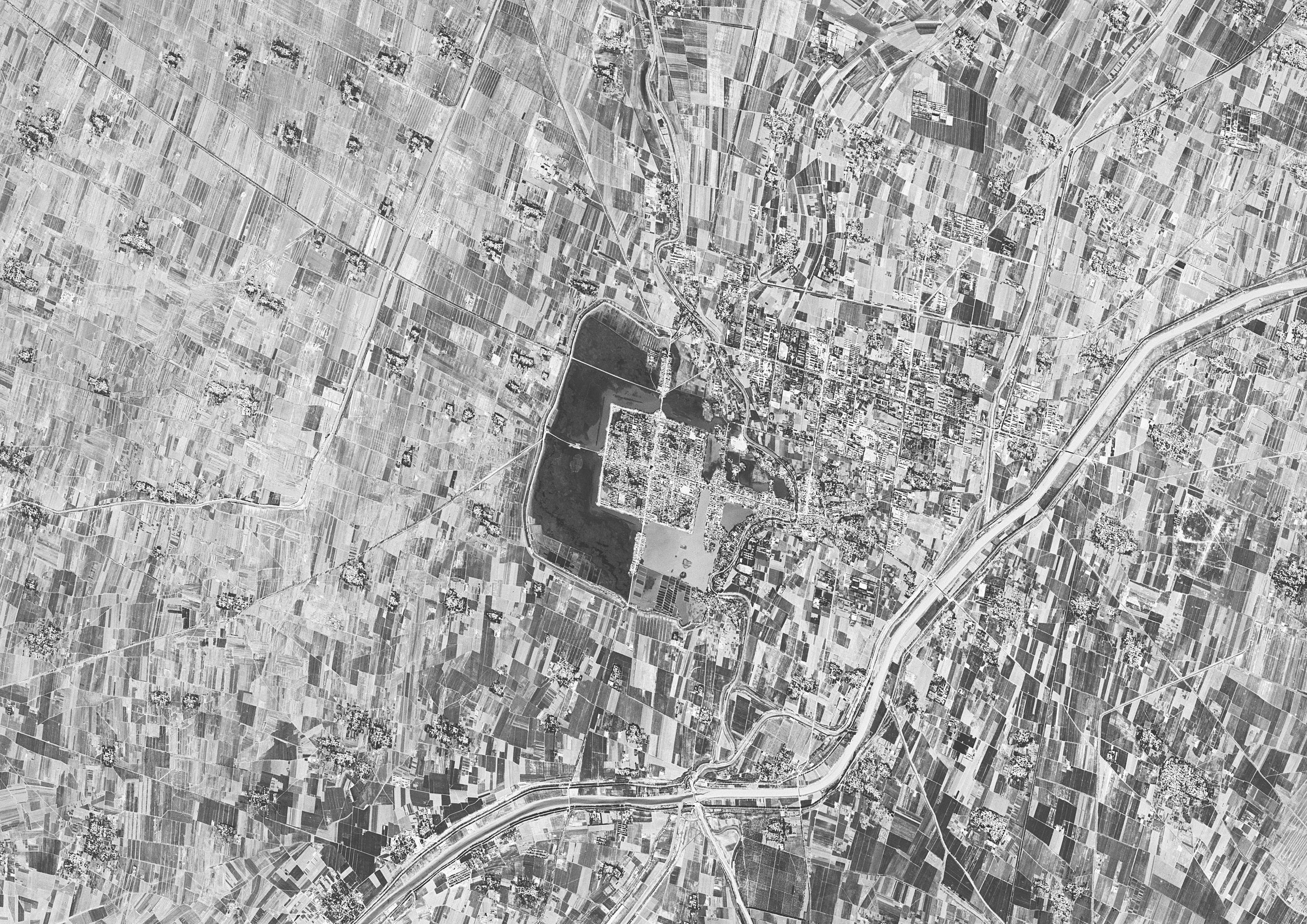
David says that to his frustration the US still keeps much of the information from its spy satellites under wraps. “The world has changed, most of it is irrelevant today,” he says. But despite repeated requests, only small amounts have officially been declassified. In 1995 President Bill Clinton ordered that 860,000 images from the Corona programme between 1960 and 1972 be released for public consumption, the last significant collection of spy satellite photographs to be placed in the public domain.
These early satellites took photographs constantly at regular intervals so a lot of the images have little value. But later versions could be sent to sleep when they were crossing allied nations or the ocean, saving their film for Soviet or, sometimes, Chinese territory.
As useful as Corona proved to be – in more than 120 missions it photographed 750,000,000 sq miles of the planet – lighter and better cameras and film meant the US military was demanding its replacement. “We needed to be able to photograph Brezhnev’s butt, nothing else would do,” said Sidney Drell one of the founders of the NRO.
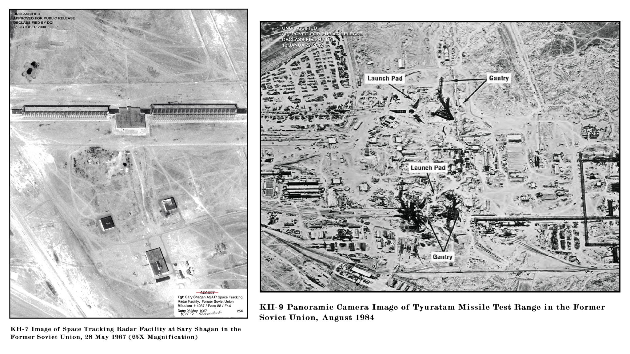
Presumably, no satellite image was ever made of the Soviet premier’s posterior but “the military needed to know where airfields, missile complexes, radar facilities and nuclear reactors were,” says David. “The enduring problem though was that the Soviet Union spans 11 time zones.” The solution was the launch of the Gambit satellites which later operated in tandem with the Hexagon system, the last of the film-based satellites. In a single frame, the latter could cover an area of around 370 by 15 nautical miles in hi-resolution.
Despite official secrecy, examples of both Gambit and Hexagon satellites were released in 2011 to the Air and Space Museum where they went on display for one day only, a full 25 years after their missions ended. Those who had worked on their design and operation said that at last their spouses could see what they had been doing “at the office” for so many years.
Gambit had staying power. The first was launched in 1963 and the last in 1984 with the intention of carrying out very brief missions – an average of only about six days – to provide “specific information on scientific and technical capabilities that threatened the nation.“ Gambit used cameras in stereo initially to build up 3D images of Soviet missile silos.
Later, after it was teamed with Hexagon, Gambit would identify an area of potential interest and Hexagon would then be manoeuvred to photograph the location – most likely a missile silo, airfield or military base – in higher resolution. However, they were also used to determine crop yields and deforestation or pollution in the Eastern bloc, helping to determine the food security of the Soviet Union and the damage being caused to its environment by unfettered industrialisation. “We began to realise we wouldn’t need nukes,” said Drell. “They were doing a good job of poisoning their nation all by themselves.”
Hexagon, which first launched in 1971 from Vandenburg Air Force Base in California, as were nearly all the later surveillance satellites, was a behemoth, the size of a single-decker bus and nicknamed “big bird”. Space.com has reported military historian Dwayne Day describing Hexagon as “bad-ass technology. When it was launched the Soviets were suddenly 10 years behind.” It had rotating cameras rather than a fixed-position lens and as they swept back and forth operators described the process as “mowing the lawn”. The cameras’ designer Phil Pressel says that even now it’s the most complex system the US ever put into orbit “but for obvious reasons, I could never boast about it,” he recalls. “Even in the lab we talked in code and never used words like ‘film’, we always called it ‘material’ just in case somebody was listening.”
Hexagon missions were significantly longer than those of Corona or Gambit but problems with film ejection capsules remained. In 1972, a bucket from one of the early Hexagon flights sank immediately when it smashed into the Pacific after its parachutes were damaged by the aircraft sent to snag them. It contained photographs of Soviet submarine bases the US Navy was desperate to get its hands on. The navy’s Trieste II deep submarine vehicle (DSV) was despatched to retrieve it from three miles down. “At my first attempt to grab it I just pushed it further into the silt,” said the DSV’s captain in his official report. “But we dug down, scooped it up and, along with a ton of sediment and a bucket full of deep-sea critters, got it to the surface.”
We could tell when a missile was launched from complex A, flying to target B at X speed, Y altitude and with Z accuracy. It was an astonishing technical achievement for the time
Mission accomplished, unlike Hexagon’s 20th and final flight which ended in ignominy. On 26 April 1986, only months after the Challenger shuttle disaster and on the same day as the explosion at the Chernobyl nuclear plant in Ukraine, the satellite’s launch vehicle, a Titan 34D rocket booster, broke up seconds after lift-off.
The resulting fireball was an unfortunate end to the era of spying with film. Shortly afterwards the Kennen series of satellites using digital cameras transmitting encrypted images back to earth would replace Hexagon. The US had flirted with a semi-digital system before. The Samos satellites once intended to replace Corona developed their own film in space before scanning the photos and sending the images to Earth via radio telemetry. However running an automated photographic lab in orbit took up space, time, and broke down too often. Kennen was a marked improvement. The clandestine world of ejecting film and scurrying to retrieve it had ended.
Throughout this time the Soviet Union was, of course, also improving its satellite systems. Zenit was replaced by Yantar in 1981. Because Zenit stayed aloft for mere days it had required more than 600 launches. Yantar could orbit for much longer and finally replaced deorbiting with a film-return capsule system. Later it would be adapted to take digital images. And, like Hexagon, the Soviet Union developed a bigger satellite, Orlets, to run in parallel with Yantar. By the end of its operational life, Orlets was carrying 22 film-return canisters.
One possibly apocryphal story from a Russian newspaper of the 1970s has a canister erroneously ejected over the Caribbean and coming down in the sea at the very edge of Cuba’s territorial waters. A rating aboard a US Navy vessel positioned right at the edge of the United States’ maritime boundary with Cuba – an ally of the Soviet Union – was spotted by a Cuban patrol boat. He had a very long pole, reaching into Cuban ocean territory attempting to hook what appeared to be the canister. Rather than falling into American hands, the Cubans chose to shoot it and sink it. “There’s no actual record of any film falling into the hands of the other side,” says David. “But it was a constant fear for both secret services.”
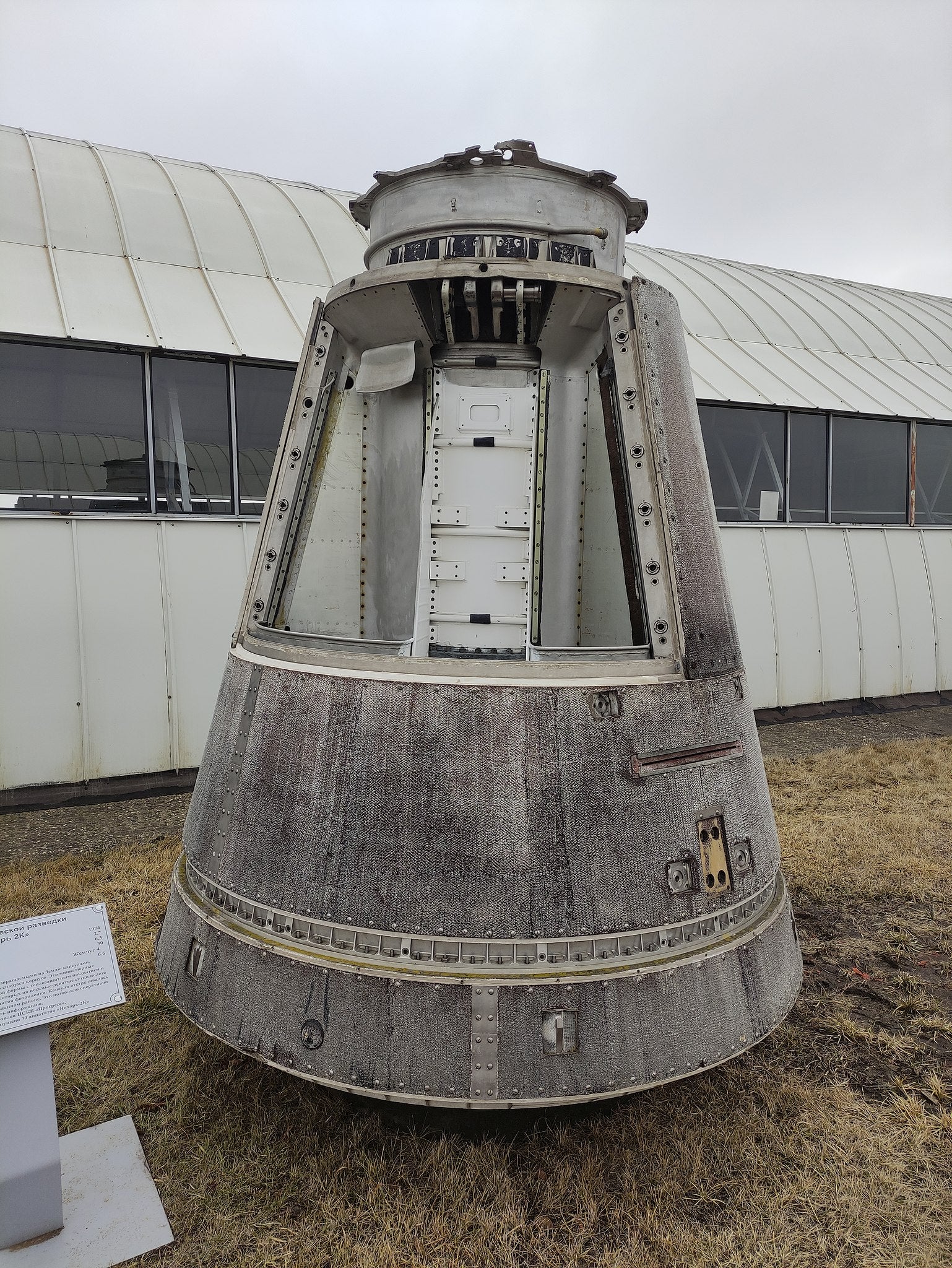
Another Orlets film canister was accidentally released earlier than necessary, close to the Finnish border. The problem was compounded by high winds which blew its parachutes westward. Soviet border guards were alerted by flight controllers that a canister had come down, possibly on the Finnish side of the border. Luckily for them, it hadn’t, it had struck a border post only 25 metres from Finland, smashing through the roof. Fortunately, nobody was at home.
Of course, there was more to satellite surveillance than photography or imaging as it is known by the spooks. Satellites are used to detect enemy missile launches and nuclear weapons tests. They also intercept signals and detect radar. Some use radar themselves to create images of the terrain and structures below, especially useful at night or in cloudy conditions, the bane of ground-based photoreconnaissance operatives.
“Signals intelligence was often as useful as photographic intelligence,” says David. “If you can intercept enemy radar you can locate where their stations are based and develop countermeasures to jam their detection systems. And telemetry intelligence which can intercept the messages being sent from missiles to their ground stations is invaluable. You can learn speed, altitude, course and – best-case scenario – information on its self-destruct systems.
“We know so much about North Korea’s programme from this but even back in the 1960s it was possible to pick up much intelligence on the opposition’s missile programme. We could tell when a missile was launched from complex A, flying to target B at X speed, Y altitude and with Z accuracy. It was an astonishing technical achievement for the time.”
Most reconnaissance satellites were in a polar orbit which provides more coverage of land and less ocean but the US’s Orion system of signals intelligence satellites were placed in geostationary orbit which proved far better for detecting the telemetry of an entire missile flight from launch to impact. The Soviet Oko satellites carried out a similar function.
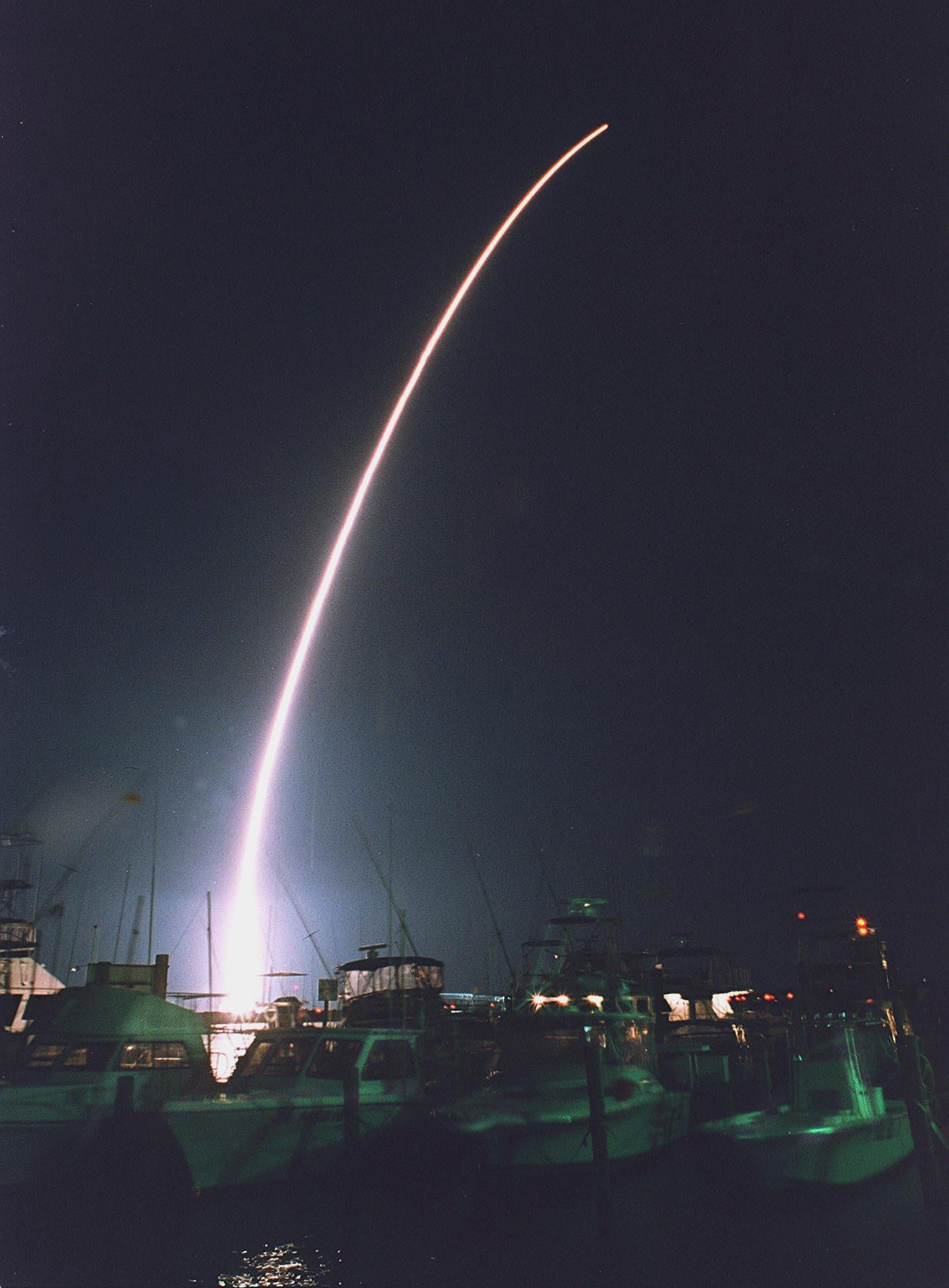
So are reconnaissance satellites only ever used for the bad stuff? No, not anymore. They have been deployed to enforce human rights by observing the populations of migrants from wars such as Kosovo or South Sudan, and have helped direct aid missions during natural disasters. The release of the Corona photographs has also allowed scientists to spot environmental changes and to study ancient archaeological sites from above.
It is argued that reconnaissance satellites, like the nuclear weapons they locate, helped keep the peace throughout the Cold War. Both sides knew what the other was doing and both knew each had the manifest capability to destroy the other. In his 1980 State of the Union address, US President Jimmy Carter stated that “photoreconnaissance satellites are enormously important in stabilising world affairs and make a significant contribution to the security of all nations.”
The counterargument would be that satellite surveillance wouldn’t be necessary in a world without nuclear weapons or armies. But they exist and David is unequivocal about the great achievement of the early satellite programme. “The bottom line is this,” he says emphatically. “When you have satellite reconnaissance your coverage is continuous, broad and without risk – unlike spies on the ground or aircraft which can be intercepted. And the quantity and quality of intelligence is huge. Corona discovered all 25 of the Soviet Union’s Intercontinental Ballistic Missile complexes. Without doubt this was the prime achievement of the early programme. Simultaneously the USSR was learning where all ours were.”
When Hexagon and Gambit went on display, Rob Landis an engineer at the Johnson Space Centre in Houston, Texas, said: “You have to credit Eisenhower. He was of the generation who wanted no more surprises, no more Pearl Harbors. Frankly [the satellite programme] prevented World War Three.”
In 1967 US President Lyndon B Johnson announced: “We’ve spent maybe $40bn on the space programme. And if nothing else had come out of it except space photography it would be worth 10 times the cost. Because tonight we know how many missiles the enemy has, and it turns out our guesses were way off.”
Doubtless Soviet premier Leonid Brezhnev was telling the Politburo in the Kremlin the same thing. Spy satellites, for better or worse and with a few bumps along the way, maintained detente in a period of our history – rather like today – when detente was pretty much all we had to cling to.


Join our commenting forum
Join thought-provoking conversations, follow other Independent readers and see their replies
Comments