Hurricane Rafael makes landfall as a Category 3 storm, bringing life-threatening storm surge to Cuba
AccuWeather reported that the hurricane’s most probable US landfall will be the Louisiana coast
Your support helps us to tell the story
From reproductive rights to climate change to Big Tech, The Independent is on the ground when the story is developing. Whether it's investigating the financials of Elon Musk's pro-Trump PAC or producing our latest documentary, 'The A Word', which shines a light on the American women fighting for reproductive rights, we know how important it is to parse out the facts from the messaging.
At such a critical moment in US history, we need reporters on the ground. Your donation allows us to keep sending journalists to speak to both sides of the story.
The Independent is trusted by Americans across the entire political spectrum. And unlike many other quality news outlets, we choose not to lock Americans out of our reporting and analysis with paywalls. We believe quality journalism should be available to everyone, paid for by those who can afford it.
Your support makes all the difference.A rare November hurricane is expected to make landfall in the southern US this weekend, according to meteorologists.
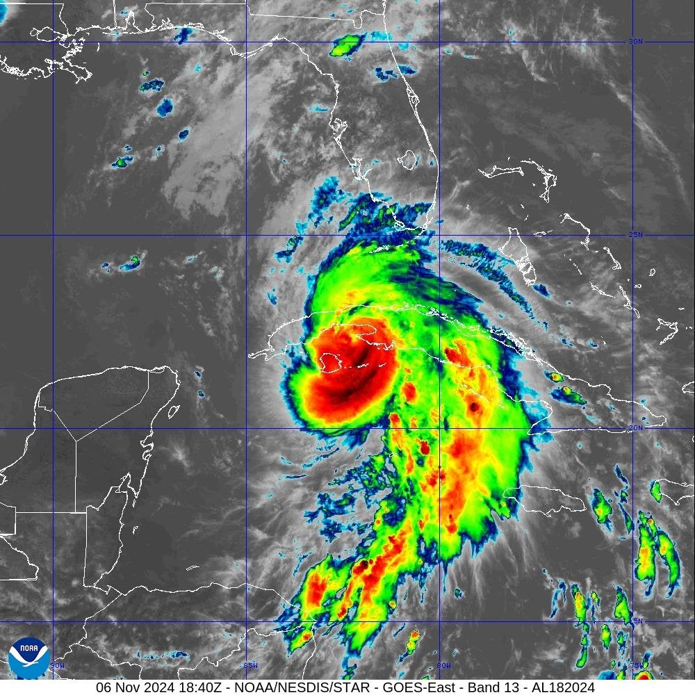
Tropical Storm Rafael intensified into a Category 3 hurricane on Wednesday, making landfall in western Cuba as it approached the Gulf of Mexico, according to the National Oceanic and Atmospheric Administration (NOAA).
The storm is bringing life-threatening storm surge, damaging hurricane-force winds, and flash flooding.
The center said it would likely emerge into the southeastern Gulf of Mexico tonight as a hurricane.
Tropical storm conditions are anticipated in Florida Keys, but it remains too soon to determine impacts to portions of the northern Gulf Coast. Forecasters warned a couple of tornadoes were possible there and in southwestern Florida through Wednesday night.
The lower and middle Florida Keys could also see as many as three inches of rain from Rafael.
Island officials closed schools and government offices in anticipation, the Associated Press reports.

The storm currently has maximum sustained winds of 115mph and is moving northwest at 14mph.
Rafael, the 17th named storm of this above-average storm season, passed by Jamaica where little damage was reported.
The U.S. State Department warned against traveling to Cuba and offered departure flights to non-essential staff. A hurricane warning was in effect for the island’s provinces of Pinar del Rio, Artemisa, La Habana, Mayabeque, Matanzas, and the Isle of Youth.
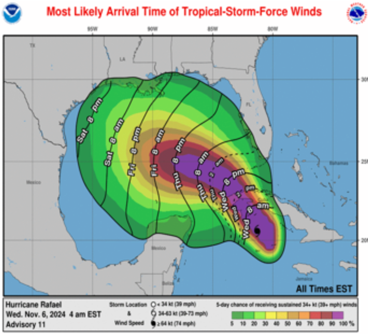
Rafael is expected to remain a Category 1 or 2 storm before it begins to weaken on its approach to the US central Gulf coast this weekend. Current projections show the storm moving to the left of Florida toward Texas.
Despite weakening as it approaches the the US, the storm is expected to be strong enough to create rough seas in the Gulf of Mexico, which will trigger beach erosion and dangerous surf conditions.

Meteorologists expect there to be some coastal flooding, and believe the storm will most likely make US landfall along the Louisiana coast, though the precise location could range from the Florida Panhandle to the Texas coast.
"The good news is that while the Rafael may well enter the Gulf as a hurricane mid-week, there is very little chance of the storm reaching land as a hurricane," Dr. Ryan Truchelut, chief meteorologist with WeatherTiger, told the Fort Myers, Florida, News-Press paper.
There is potential for the remnants of the storm to drop enough rain on southern Appalachia to cause flooding, but thankfully most of that rain is not expected to hit the regions affected by Hurricane Helene, where relief efforts are still underway.
Non-profit Climate Central said Wednesday that climate change had made the unusually warm Caribbean sea surface temperatures fueling Rafael at least 60 times more likely. The group noted that it is the seventh Atlantic hurricane to undergo rapid intensification.

Join our commenting forum
Join thought-provoking conversations, follow other Independent readers and see their replies
Comments