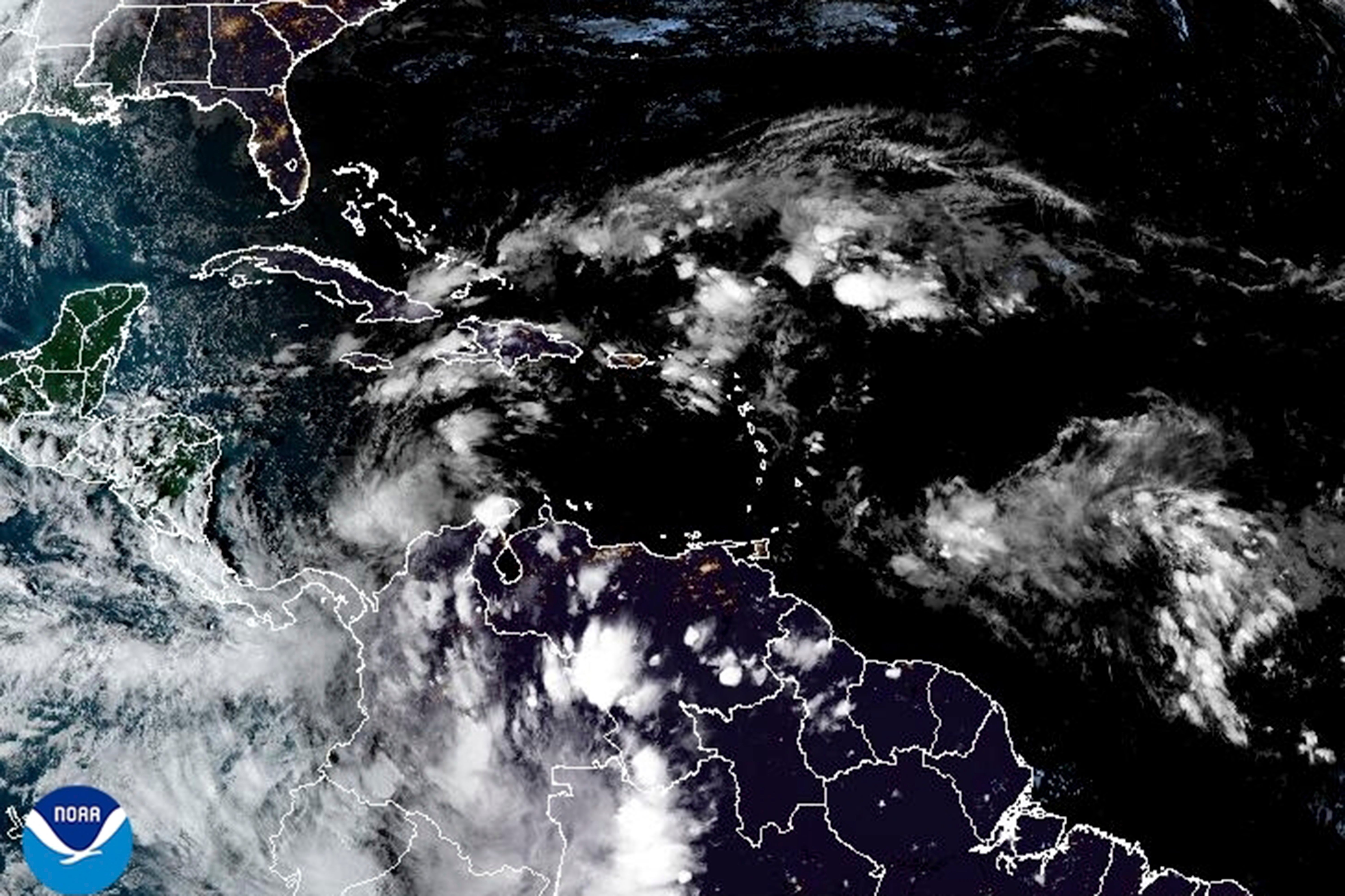
Storm in the Caribbean is on a track to likely hit Cuba as a hurricane
Forecasters say a new tropical storm is expected to form in the Caribbean and will bring heavy rain to Jamaica and the Cayman Islands before strengthening to a hurricane and likely hitting Cuba

Your support helps us to tell the story
From reproductive rights to climate change to Big Tech, The Independent is on the ground when the story is developing. Whether it's investigating the financials of Elon Musk's pro-Trump PAC or producing our latest documentary, 'The A Word', which shines a light on the American women fighting for reproductive rights, we know how important it is to parse out the facts from the messaging.
At such a critical moment in US history, we need reporters on the ground. Your donation allows us to keep sending journalists to speak to both sides of the story.
The Independent is trusted by Americans across the entire political spectrum. And unlike many other quality news outlets, we choose not to lock Americans out of our reporting and analysis with paywalls. We believe quality journalism should be available to everyone, paid for by those who can afford it.
Your support makes all the difference.A new tropical storm was expected to form Monday in the Caribbean and will bring heavy rain to Jamaica and the Cayman Islands before strengthening to a hurricane and likely hitting Cuba, forecasters said.
The storm was expected to be named Rafael. Later in the week it also is expected to bring heavy rainfall to Florida and portions of the U.S. Southeast, according to advisories from the Miami-based U.S. National Hurricane Center.
A tropical storm warning was in effect for Jamaica and a hurricane watch was in effect for the Cayman Islands.
“Potential Tropical Cyclone Eighteen” on Monday morning was located about 220 miles (355 kilometers) south of Kingston, Jamaica. The storm had maximum sustained winds of 35 mph (55 kph) while moving north at 7 mph (11 kph), the center said.
The storm was expected to move near Jamaica by late Monday and be near or over the Cayman Islands late Tuesday into Wednesday. It could be near hurricane strength when it passes near the Cayman Islands.
The most recent forecast shows the storm could pass over western Cuba on Wednesday as a hurricane. People in Cuba and the Florida Keys were among those urged to monitor the storm as it develops.
Heavy rainfall will affect the western Caribbean with totals of 3 to 6 inches (7 to 15 centimeters) and up to 9 inches (23 cm) expected locally in Jamaica and parts of Cuba. Flooding and mudslides are possible.
On the opposite side of the Atlantic Ocean, Tropical Storm Patty was forecast to become a post-tropical cyclone on Monday. The storm was about 490 miles (785 km) east of the Azores, with maximum sustained winds of 40 mph (65 kph). There were no coastal watches or warnings in effect.