Hurricane Nigel expected to ‘rapidly intensify’ and become major storm by Tuesday: Latest tracker
Hurricane Nigel is forecast to ‘rapidly intensify’ to become a Category 3 hurricane
Your support helps us to tell the story
From reproductive rights to climate change to Big Tech, The Independent is on the ground when the story is developing. Whether it's investigating the financials of Elon Musk's pro-Trump PAC or producing our latest documentary, 'The A Word', which shines a light on the American women fighting for reproductive rights, we know how important it is to parse out the facts from the messaging.
At such a critical moment in US history, we need reporters on the ground. Your donation allows us to keep sending journalists to speak to both sides of the story.
The Independent is trusted by Americans across the entire political spectrum. And unlike many other quality news outlets, we choose not to lock Americans out of our reporting and analysis with paywalls. We believe quality journalism should be available to everyone, paid for by those who can afford it.
Your support makes all the difference.Hurricane Nigel has strengthened slightly overnight and is set to intensify further, according to the latest advisory from the National Hurricane Center.
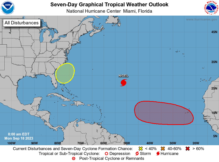
Nigel, the sixth hurricane to form in the Atlantic Ocean this season, developed into a Category 1 storm yesterday and was forecast to “rapidly intensify” to become a Category 3 hurricane.
At the moment, Nigel has sustained winds of 80mph (130kph) but forecasters in the National Weather Service (NWS) and National Hurricane Center expect the storm to have sustained winds of at least 111mph as it grows.
Nigel was located approximately about 875miles (1,410km) east-southeast of Bermuda and was moving northwest at a speed of 12mph (19kph).
The hurricane is not expected to make landfall and no warnings or watches have been issued.
As of now, the National Hurricane Center predicts Nigel will veer off right into the open Atlantic Ocean by Wednesday morning.
Nigel developed shortly after Hurricane Lee landed in Nova Scotia as a post-tropical storm.
Canada’s hurricane center forecasted Lee’s path

Both the US and Canadian hurricane centers issued their final advisories for Lee
The National Hurricane center issued its final advisory this morning at 11am, while Environment Canada issued its final advisory at 4pm.
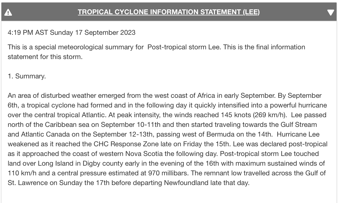
The Timeline of Storm Lee
In its final advisory about the storm, Environment Canada provided a summary of the storm’s path. Here’s the timeline:
6 September: a tropical cyclone formed
7 September: the storm intensified into a hurricane
10-11 September: Lee passed north of the Caribbean sea
12-13 September: the storm began moving towards the Gulf Stream and Atlantic Canada
14 September: the storm passed just west of Bermuda
15 September: Hurricane Lee was downgraded
16 September: Post-tropical storm Lee made landfall in Nova Scotia
Where is Hurricane Nigel?
Hurricane Nigel, the sixth hurricane to form in the Atlantic Ocean this season, is located in the middle of the Atlantic as of Monday morning.
The Category 1 hurricane is approximately 935 miles from Bermuda near the latitude 26.5 North and longitude 50.7 West.
As of now, Hurricane Nigel is not expected to land anywhere as forecasters believe it will turn right and head into the middle of the ocean by Wednesday.
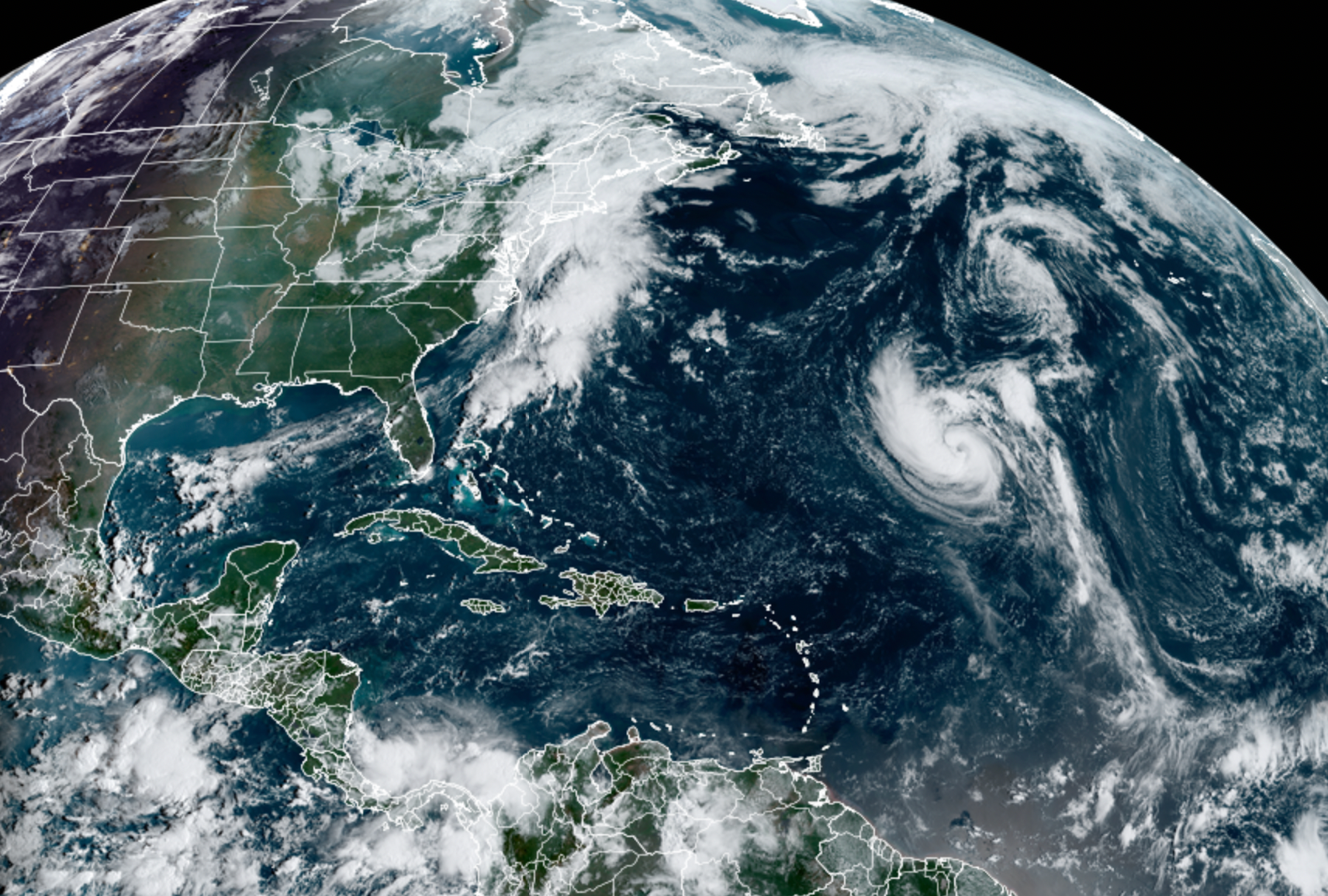
National Hurricane Center expects Hurricane Nigel to ‘rapidly intensify’
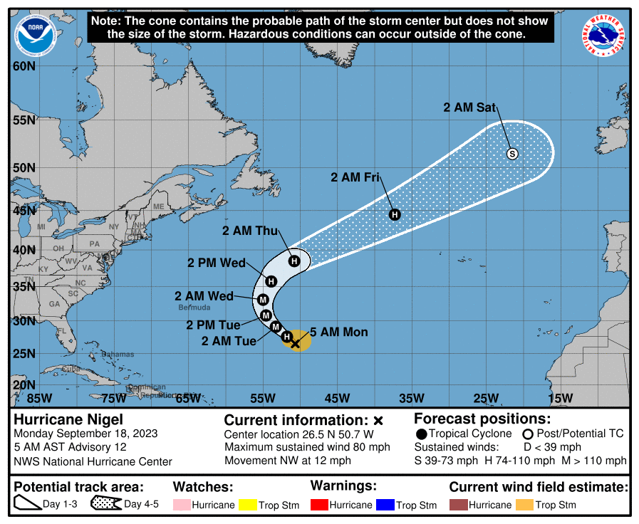
Hurricane Nigel’s expected path
Forecasters in the National Hurricane Center do not predict that Hurricane Nigel will make landfall anywhere.
As of Monday morning, Hurricane Nigel will continue moving northwesterly then veer right on Wednesday morning – heading back into the middle of the Atlantic Ocean.
Why are so many hurricanes ‘rapidly intensifying’
When a hurricane, goes from a Category 1 storm to a Category 3 within two days it is considered “rapidly intensifying” – the same prediction given to Hurricane Nigel.
The National Hurricane Center (NHC) defines rapid intensification where a storm’s maximum sustained winds jump 35 miles per hour (56 kph) in less than 24 hours.
These storms can become extremely dangerous as they approach coastlines because they give residents little time to prepare and evacuate. They are the most costly and a great threat to human life. They are also becoming more common.
In the past 32 years, most Category 3 or higher hurricanes have undergone rapid intensification, according to a 2022 study.
This is due to warmer ocean waters, more moisture in the atmosphere and low vertical wind shear, Philip Klotzbach of Colorado State University told Science News.
Vertical wind shear happens when winds at different heights move at different speeds in different directions. These can assist in a storm’s intensification by pulling heat and moisture across the upper structure of the storm.
But warming ocean temperatures are a major factor in helping boost storms’ size and speed. As the Earth becomes warmer, ocean temperatures rise and contribute to fueling hurricanes.
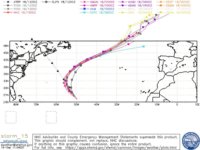
Spaghetti models of Hurricane Nigel
The spaghetti models of Hurricane Nigel show the Category 1 storm making a right and veering off into the Atlantic Ocean as of Wednesday.
What names are left on the Atlantic hurricane season?
So far, 14 names of the 21 allocated for the 2023 Atlantic hurricane season have been used.
Nigel is the latest to be used for the Category 1 storm brewing in the middle of the Atlantic Ocean. There are seven other names to be used for storms until the end of hurricane season at the end of November.
After Nigel, the names that can be used are: Ophelia, Philippe, Rina, Sean, Tammy, Vince and Whitney.
Atlantic hurricane season runs from 1 June until 30 November. Peak hurricane season is typically in mid-September when temperatures in the ocean are at their warmest.

Join our commenting forum
Join thought-provoking conversations, follow other Independent readers and see their replies
Comments