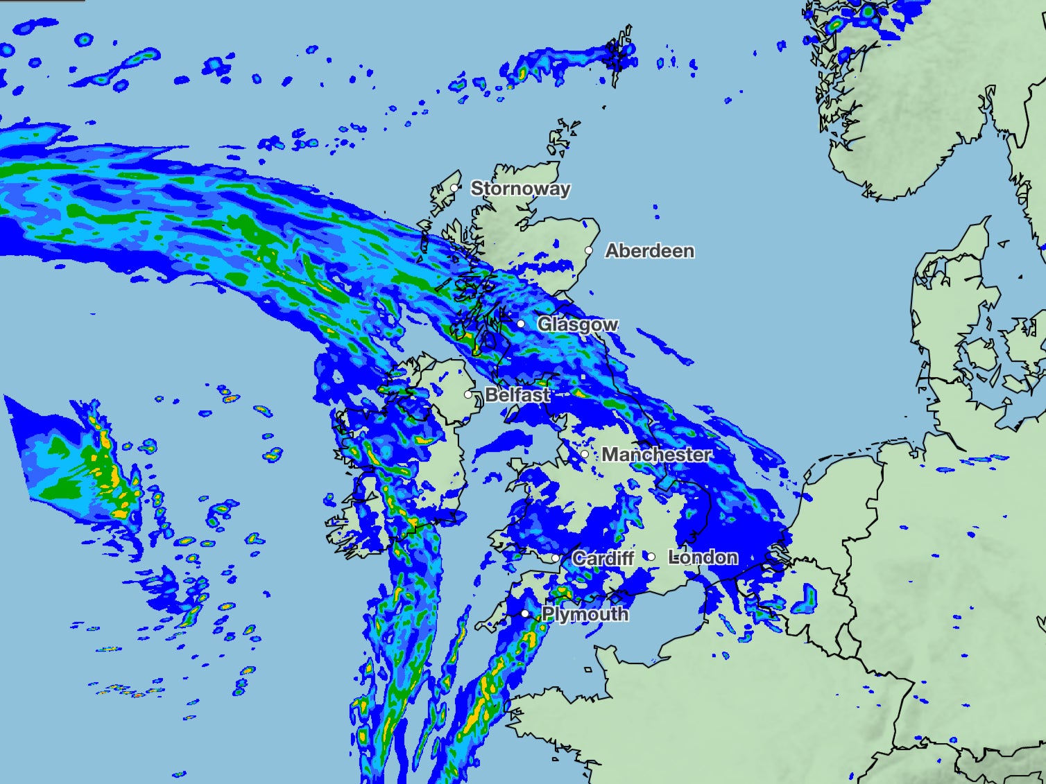
UK weather: Met Office gives update on thunderstorms across Britain as flood alerts persist
UK braces for another round of turbulent weather as 16 areas face flood warnings or alerts
Your support helps us to tell the story
From reproductive rights to climate change to Big Tech, The Independent is on the ground when the story is developing. Whether it's investigating the financials of Elon Musk's pro-Trump PAC or producing our latest documentary, 'The A Word', which shines a light on the American women fighting for reproductive rights, we know how important it is to parse out the facts from the messaging.
At such a critical moment in US history, we need reporters on the ground. Your donation allows us to keep sending journalists to speak to both sides of the story.
The Independent is trusted by Americans across the entire political spectrum. And unlike many other quality news outlets, we choose not to lock Americans out of our reporting and analysis with paywalls. We believe quality journalism should be available to everyone, paid for by those who can afford it.
Your support makes all the difference.The UK is expected to experience mostly cloudy weather on Monday with outbreaks of rain and drizzle as the country prepares for another round of turbulent weather.
Heavy rain is anticipated in the hills of Northern Ireland, southwest Scotland and northwest England, with 15 flood alerts still in effect throughout the country, according to the Met Office. A more serious flood warning is in place for Keswick Campsite in Cumbria.
While central and eastern areas may experience occasional mild weather with some bright spells, overall conditions are predicted to be rainy and grey, with temperatures around 10-12C.
The latest forecast has dashed hopes for more pleasant weather conditions after last week’s cold snap saw snowfall and ice in parts of the country.
The forecast for Tuesday up to Thursday predicts the likelihood of rain or showers for all regions.
The forecast said it will be “windy and wet”, with gales expected on Wednesday, while there could be heavy rain with thunder on Thursday.
The Met’s forecast for Friday said there are likely to be “unsettled” conditions, “with showers for all, these perhaps heavy and thundery at times”.
There is a chance of showers in the north turning wintry over high ground, said the Met’s long range forecast between 24 March and 2 April.
Although there is a lower risk of organised rain with strong winds in the southeast at first, the forecaster said it was anticipated that the weather will remain unsettled throughout the weekend, with colder conditions expected to move in from the north, “possibly bringing an overnight frost risk”.
The east is expected to have the best dry weather.
In the forecast for 3-17 April, the weather is likely to remain unsettled, with periods of strong winds and rain interspersed with shorter drier spells, the Met Office said.

The south may experience the wettest weather, with temperatures expected to be close to average, while those in the north may be rather cold with a risk of wintry conditions.
According to Met Office spokesperson Stephen Dixon, there is still some uncertainty in the forecast due to a change in the jet stream.
He was, however, confident that widespread rain and strong winds will be the “main feature” in the coming days.


Join our commenting forum
Join thought-provoking conversations, follow other Independent readers and see their replies
Comments