UK weather: Rain returns for Britain prompting new flood alerts
Showers are expected to intensify on Thursday
Your support helps us to tell the story
From reproductive rights to climate change to Big Tech, The Independent is on the ground when the story is developing. Whether it's investigating the financials of Elon Musk's pro-Trump PAC or producing our latest documentary, 'The A Word', which shines a light on the American women fighting for reproductive rights, we know how important it is to parse out the facts from the messaging.
At such a critical moment in US history, we need reporters on the ground. Your donation allows us to keep sending journalists to speak to both sides of the story.
The Independent is trusted by Americans across the entire political spectrum. And unlike many other quality news outlets, we choose not to lock Americans out of our reporting and analysis with paywalls. We believe quality journalism should be available to everyone, paid for by those who can afford it.
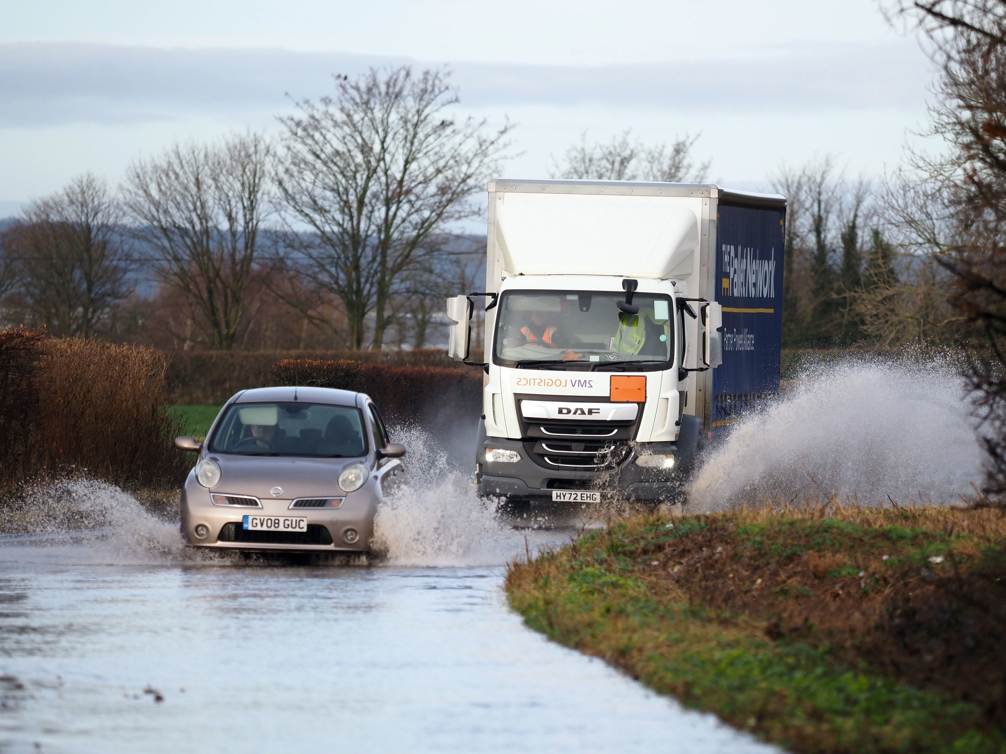
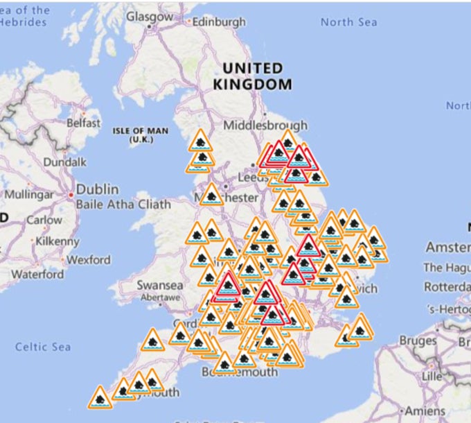
Your support makes all the difference.Large parts of the United Kingdom are experiencing fresh rainfall after a brief respite, with hundreds of flood alerts and warnings already in place.
On Wednesday, milder conditions were expected to persist with clouds covering more regions, bringing some heavy and quite persistent rain through the day, the Met Office forecast showed.
Overnight the temperatures remained in stark contrast between the north and south with Scotland dipping into freezing levels while Southern England saw a warmer night at 10-12 degrees Celsius.
Rain is expected to spread across northern Scotland on Wednesday with some hilly areas seeing snowfall and some bright spells in eastern England.
Met Office meteorologist Annie Shuttleworth said the weather will be “very mild” on Wednesday, but “it will be quite wet”.
“We’re gonna see heavy bursts of rain pushing in from the south and west. There will be some heavy bursts, particularly on Wednesday evening and through much of Thursday, when we have quite a large frontal system that will sweep across the country, bringing some heavy and quite persistent rain through the day,” she said.
The next couple of days are expected to remain gloomy, withrainfall intensifying on Thursday, the forecaster said.
The Environment Agency has warned residents in flood warning zones to avoid walking, cycling or driving through flood water with hundreds of flood alerts in place.
The showers return after a brief respite following flooding and travel disruptions last week when up to 10cm of snowfall was recorded, with many areas already on saturated ground.
The Met Office said that while there are no weather warnings in place for rain as of yet, the saturated ground “increases the sensitivity for rain events”.
Met Office forecaster Andrea Bishop said: “It does look a wet week, with Thursday looking the wettest day.
“With regards to Thursday’s rain, the rain will push northeastwards across most of the country, with many places seeing 20mm or so over the course of a day or two.
Later on Friday, “drier and brighter” conditions are expected with just a few showers in England and Wales. As the weekend approaches, milder conditions will take over the UK with the next couple of weeks remaining mild, the Met Office said.
The Nor’easter storm that is dumping snow and rain in the United States is going to be travelling across the Atlantic, impacting the UK by the end of the week.
“As this storm comes closer across the Atlantic, it will be dredging up this mild air, and we’re going to continue to see that mild air boot out that colder air out the way,” Ms Shuttleworth said.
Join our commenting forum
Join thought-provoking conversations, follow other Independent readers and see their replies
Comments