UK weather: Met Office issues warning for fog as travel faces disruption
Weather could cause ‘difficult driving conditions’, forecaster says
The Met Office has issued a weather warning for fog that could lead to travel disruption on Thursday morning.
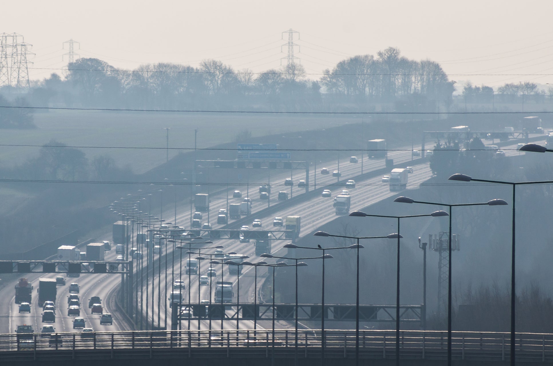
Areas across central and southern England, as well as southern Wales, were told journeys could take longer than usual due to the bad weather. Flights could end up delays and even cancelled from the fog.
Its yellow advisory notice came into effect at 4am and runs until 11am. Fog can cause difficult driving conditions and slower journey times with delays to bus and train services are possible, the Met Office said.
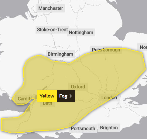
“Not everywhere will experience fog, but where fog patches do develop, they are likely to become dense in some places with visibility less than 100 metres, and perhaps less than 50 metres in a few spots,” the Met Office said.
“The fog will slowly thin towards late morning but may persist into the afternoon in some areas.”


The warning spanned across the country from the East to West Midlands, dropping south to cover parts of London, Devon, Wiltshire and Somerset. Cardiff was also affected in the fog warning in Wales.
Areas of the UK also faced a fog warning and the same warnings of disruption to travel on Tuesday morning this week.
The Met Office said Thursday will mostly be dry across England and Wales with some sunny spells. Some patches of fog and low cloud may persist, making it feel cold, it said.
Outbreaks of rain and drizzle are expected to move eastwards across Northern Ireland, Scotland and the far north of England.
On Friday, fog patches are expected to lift in the south, leading to sunny spells and a few showers.
The Met Office forecast for the weekend includes showers - most frequent near eastern coasts - and cloudy weather. It says it will likely feel cold due to a “brisk easterly breeze”.
MET OFFICE OUTLOOK
Today:
Some mist or dense fog patches may linger during the morning, mainly in western parts. Elsewhere generally dry and bright with some sunny spells but feeling chilly. Cloudier towards the coast where isolated showers are possible. Maximum temperature 9 °C.
Tonight:
Dry inland overnight with clear spells and falling temperatures, allowing mist, fog or frost patches to form. Cloudy with showers along Channel coasts. Minimum temperature 1 °C.


Friday:
Frosty start for some, but this along with any mist or fog patches gradually clearing. Cloudier and colder conditions with an easterly breeze developing later, along with a few showers. Maximum temperature 8 °C.
Outlook for Saturday to Monday:
Cold and cloudy start Saturday with a few showers. Staying cloudy and turning colder Sunday and Monday with strengthening easterly winds and scattered showers, perhaps wintry over the highest hills.
Join our commenting forum
Join thought-provoking conversations, follow other Independent readers and see their replies
Comments