Heavy rain to follow UK’s cold blast as flooding and disruption expected in days ahead
Your support helps us to tell the story
From reproductive rights to climate change to Big Tech, The Independent is on the ground when the story is developing. Whether it's investigating the financials of Elon Musk's pro-Trump PAC or producing our latest documentary, 'The A Word', which shines a light on the American women fighting for reproductive rights, we know how important it is to parse out the facts from the messaging.
At such a critical moment in US history, we need reporters on the ground. Your donation allows us to keep sending journalists to speak to both sides of the story.
The Independent is trusted by Americans across the entire political spectrum. And unlike many other quality news outlets, we choose not to lock Americans out of our reporting and analysis with paywalls. We believe quality journalism should be available to everyone, paid for by those who can afford it.
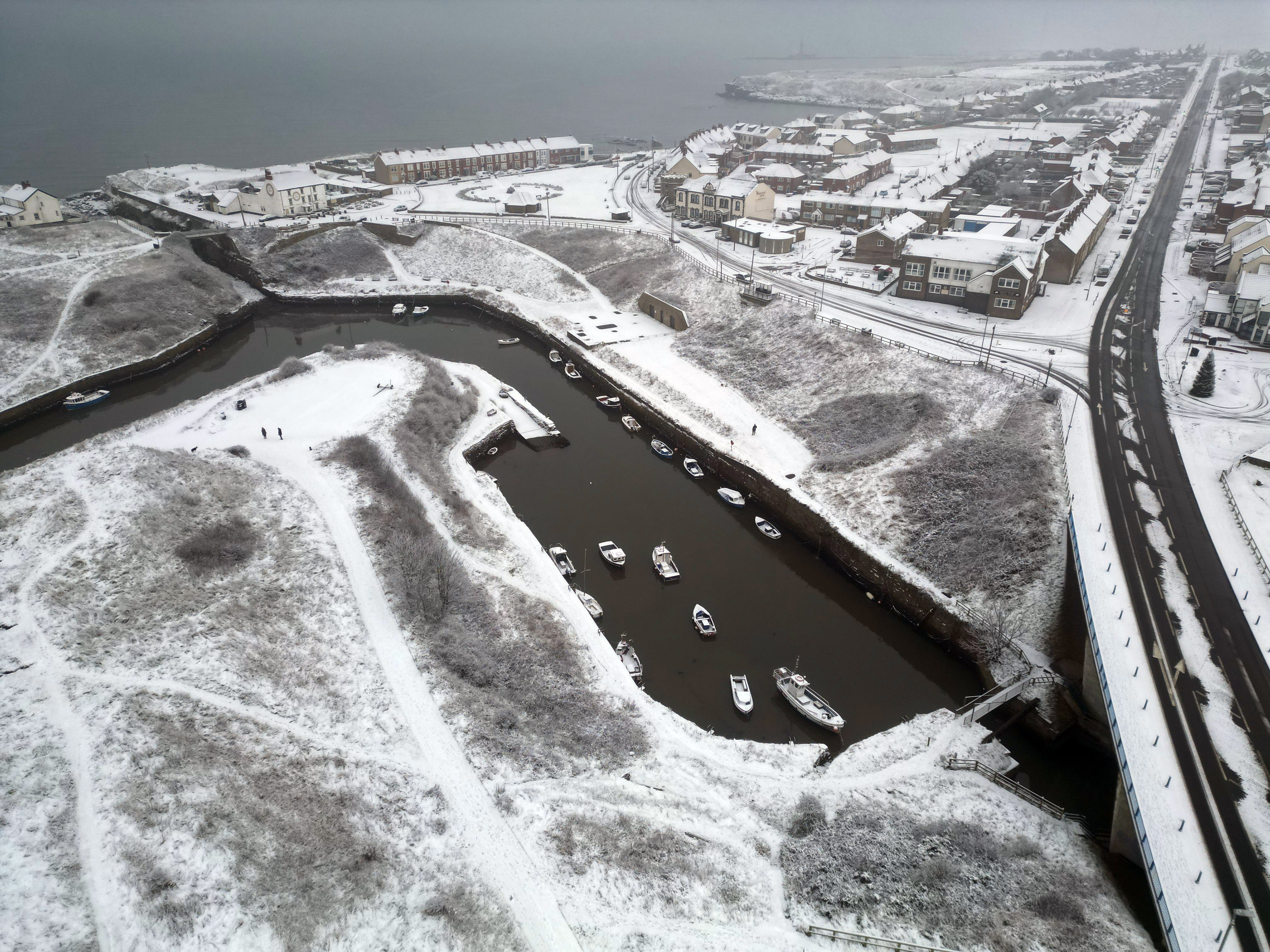
Your support makes all the difference.Travel chaos is expected to continue while over 1,000 homes have been left without power, as the UK continues to be hit by icy weather conditions.
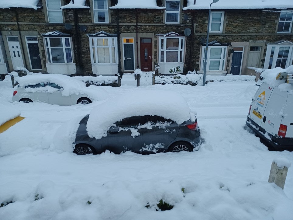
After a weekend that saw heavy snowfall coat the north-west, Brits can expect a slight thawing in temperature as the weather turns gradually to rain with brighter spells expected in the coming days.
In their three to five day weather forecast, the Met Office warns of “frost and fog” with wet and windy conditions arriving from the southwest later this week.
However, the impact from the weekend’s cold snap continues to have an impact with dozens of drivers abandoning their vehicles in Cumbria, and two men dying after being frozen to death.
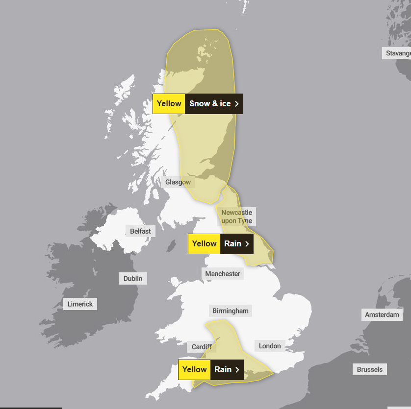
The UK Health and Security Agency has issued five amber cold health alerts for the East Midlands, West Midlands, North West, North East, Yorkshire and the Humber until 5 December.
Follow all the latest weather updates with our live blog
The agency warned that “cold weather impacts are likely to be felt across the whole health service for an extended period of time”.
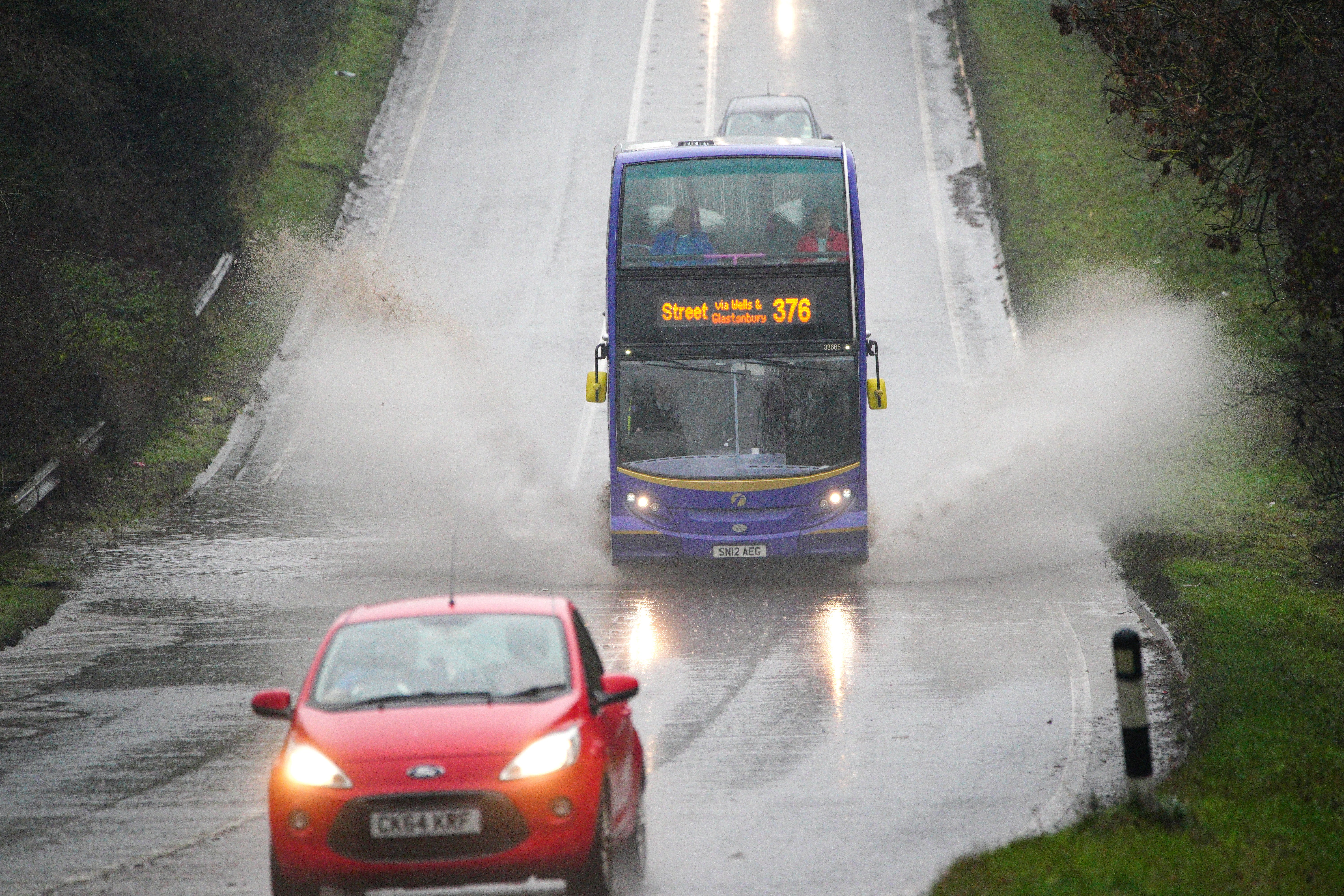
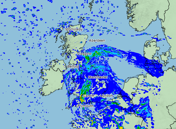
It comes as warnings continue to be enforced across the UK, with the Met Office expanding today’s yellow rain weather warning to cover North East England, Yorkshire and the Humber. Areas affected include Newcastle, Middlesbrough and York with the warning in place until 9am on Tuesday.
Up to 50mm to 70mm of rain is expected to fall in some east-facing hills, while the weather, mixed with some snow, will become “persistent” in areas today and overnight into tomorrow.
A yellow weather warning for snow and ice remains in place in north-eastern Scotland, covering Aberdeen, Edinburgh and Inverness, with ScotRail urging passengers to check for travel advice.
In their latest update for Scotland, the Met Office warned that ongoing wintry showers, snow on hills and icy patches on untreated roads could result in disruption to traffic and some injuries from slips and falls.
A Met Office spokesperson said a rain warning was also being considered for north-east England for Monday night into Tuesday morning.
Over the weekend, sub-zero temperatures led to the deaths of two men who were believed to be homeless, with one discovered in a shop doorway in Manchester and the other freezing to death inside a car.
RAC Breakdown spokesperson Simon Williams said northern parts of the country could be facing an “ice rink Monday as snow refreezes overnight”.
He added: “We’re expecting some very treacherous icy conditions in northern parts, so those who have to drive should exercise great caution”.
A crash on the M4 near Bristol Aiport at 5am this morning has already caused queues across the Severn Bridge while police were called to the M60 near Manchester after a collision closed two lanes.
Flood warnings are currently in place for parts of Somerset and Devon until 6pm, as rising water levels in the River Yarty, River Yeo and Shreen Water are expected to cause floodings.
This latest warning forms part of 22 that have been issued across England, while a futher 95 alerts cover areas where flooding is possible.
Meanwhile, 40 schools remain closed in Cumbria after heavy snowfall over the weekend caused widespread disruption, while over 1,000 homes remain without power.
Electricity North West have listed 18 areas that are currently without electricity, with the majority of those in Cumbria, while some customers are not due to have power restored until 5pm.
Met Office spokesman Grahame Madge said the risk of snow was now lessening and would “more or less be confined to Scottish mountains” by the end of the week.
He said “Temperatures are rising from below average now to above average. Overnight (on Monday), in parts of the north, frost remains still a risk. Tomorrow could see frost from Scotland down into central southern England.
“In general, conditions will be more wet and windy.”
In their long-range weather forecast, which is predicted until 17 December, the Met Office says: “A transition to milder, wetter and windier conditions is likely to have spread to most of the country by Friday.
“By this time the main chance of any snow becomes more restricted to high ground in the north. However, the change in conditions may take until the weekend to reach the far northeast with wintry showers remaining possible here.
“ Thereafter, a continuation of generally unsettled conditions is most likely through mid-December with spells of heavy rain and strong winds for most areas at times.
“Temperatures are most likely to be around average though with some milder spells, more especially in the south. Colder interludes remain possible but likely shorter-lived than the current period and probably more restricted to the north.”
Join our commenting forum
Join thought-provoking conversations, follow other Independent readers and see their replies
Comments