Met Office issue yellow weather warning as flash flooding wreaks havoc across England
Heavy rain is expected to hit the north-east on Thursday
Your support helps us to tell the story
From reproductive rights to climate change to Big Tech, The Independent is on the ground when the story is developing. Whether it's investigating the financials of Elon Musk's pro-Trump PAC or producing our latest documentary, 'The A Word', which shines a light on the American women fighting for reproductive rights, we know how important it is to parse out the facts from the messaging.
At such a critical moment in US history, we need reporters on the ground. Your donation allows us to keep sending journalists to speak to both sides of the story.
The Independent is trusted by Americans across the entire political spectrum. And unlike many other quality news outlets, we choose not to lock Americans out of our reporting and analysis with paywalls. We believe quality journalism should be available to everyone, paid for by those who can afford it.
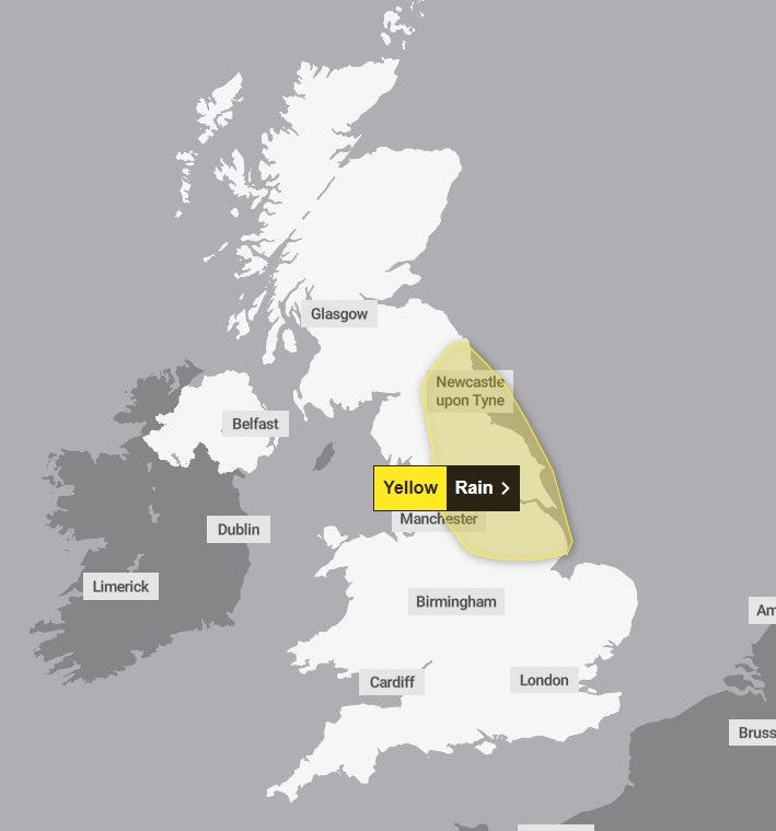
Your support makes all the difference.The Met Office has issued a yellow weather warning for Thursday as heavy rain is set to hit the UK, just days after flash flooding wreaked havoc.
Parts of north-east England are expected to see further disruption to transport routes and homes, just days after a month’s rainfall fell on Monday, reaching 100mm in some areas.
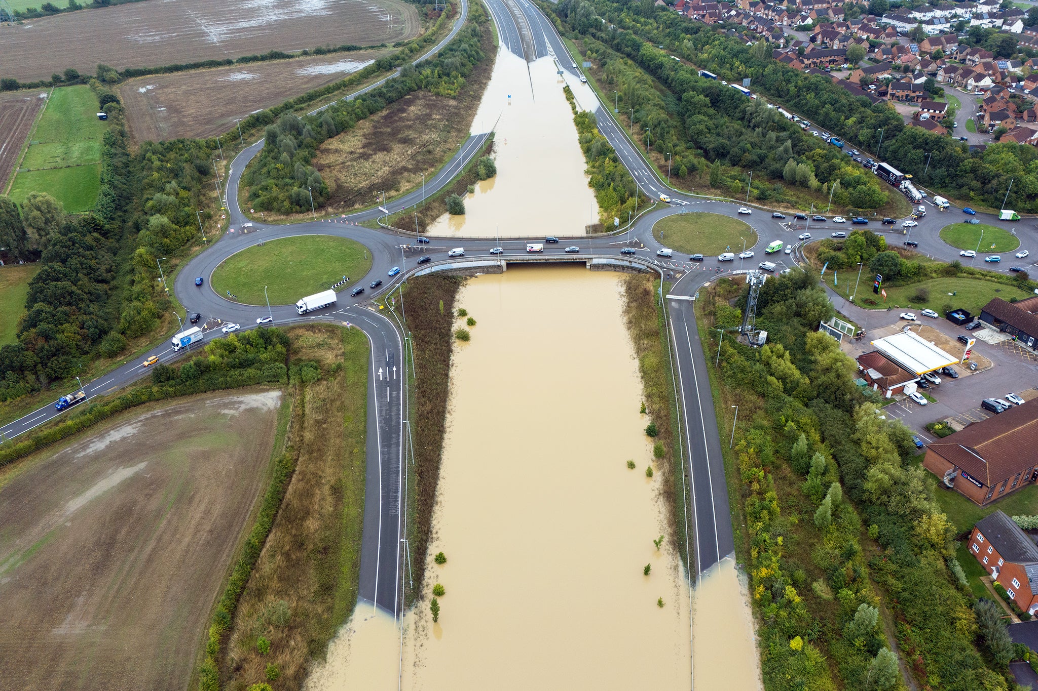
Counties that were among those most severely affected included Bedfordshire, Buckinghamshire, and Northamptonshire, with cars seen floating along the A421 after the rain caused extreme flooding.

Commuters travelling to London also faced transport chaos, with delays ongoing throughout the morning from Euston station and rail services running at reduced speeds.
Northwestern Railway said its Marston Vale line, which operates services between Bedford and Bletchley, would be suspended until September 30, while Chiltern Railways said trains between Banbury and Bicester North were running at reduced speed on all lines.
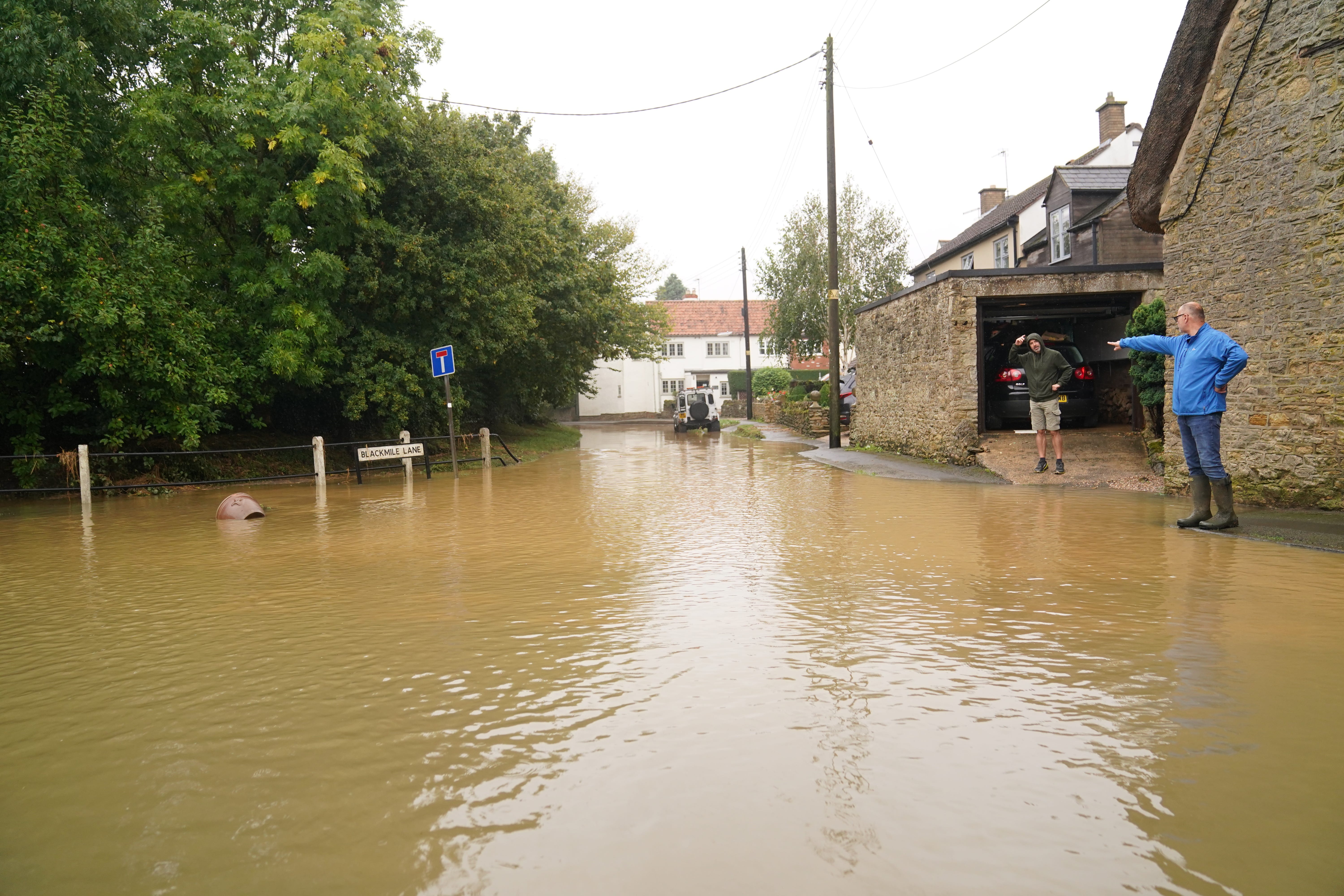
The Environment Agency currently has 26 flood warnings in place across the Midlands and the south-east with a further 67 flood alerts.
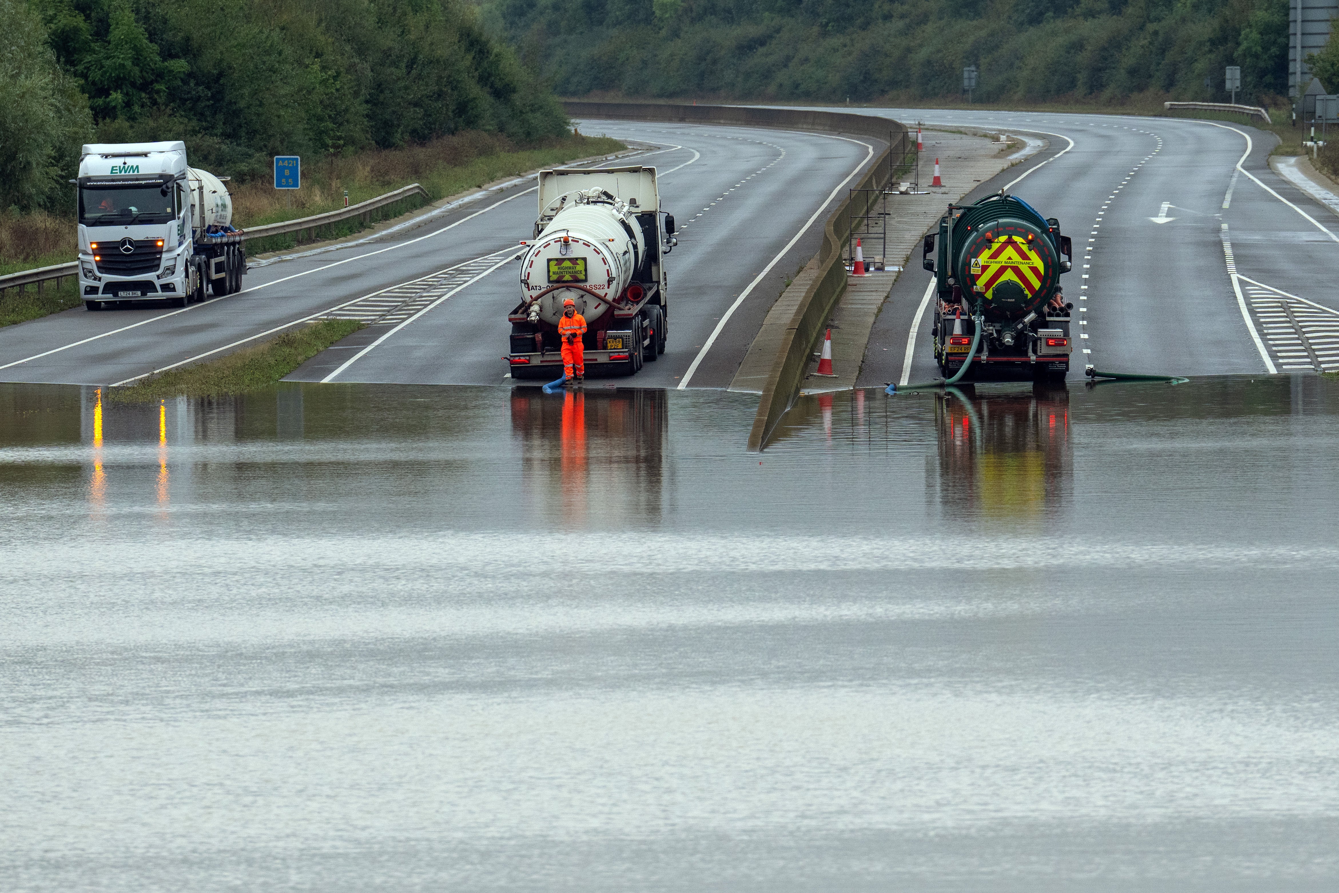
National Highways said it expected the A421 in Bedfordshire to remain closed throughout Tuesday in both directions between the A6 Bedford and M1 J13 near Marston Moretaine because of severe flooding, and that it “cannot provide a timeline for the road to reopen”.
The northbound A5 between the A421 in Bletchley and Great Holm at Milton Keynes was closed by rising water levels on Tuesday morning after one lane had been opened overnight.
Oli Claydon, spokesman for the Met Office, said that while Tuesday was much drier, there will be some showers on Wednesday morning in southern England but the rest of the day will be “largely fine”, he added.
An area of low pressure will move in on Thursday and stall over north-east England, which is where the yellow weather warning has been issued.
Between 20 and 30mm of rain could be seen widely, 50 to 70mm could fall in some locations and it is possible the Pennines and North York Moors could have between 80-100mm of rain.
But the area covered by the warning is different to those areas worst affected by the recent flooding, Mr Claydon said.
Temperatures are then expected to drop to below average on Friday across the UK.
Met Office Deputy Chief Meteorologist Brent Walker said: “After the rain through much of this week, things will be turning decidedly cooler into the weekend, with frost likely for much of the UK overnight on Friday and a more autumnal feel to daytime temperatures.
“A north-westerly flow of air is developing, bringing cooler air from the north over the UK and dropping temperatures into the weekend and possibly below freezing overnight for some. Some isolated showers are possible through the weekend, though it will largely be drier for many, with some sunny spells.
“There’s potential for further wet and windy weather late on Sunday and into the start of next week, though there is much detail to be determined on the exact conditions so stay up to date with the latest forecast.”
Join our commenting forum
Join thought-provoking conversations, follow other Independent readers and see their replies
Comments