UK weather: Met Office issues yellow warning for eight hours of thunderstorms after warm spell
The September warm spell is set to break in the south of the country
Your support helps us to tell the story
From reproductive rights to climate change to Big Tech, The Independent is on the ground when the story is developing. Whether it's investigating the financials of Elon Musk's pro-Trump PAC or producing our latest documentary, 'The A Word', which shines a light on the American women fighting for reproductive rights, we know how important it is to parse out the facts from the messaging.
At such a critical moment in US history, we need reporters on the ground. Your donation allows us to keep sending journalists to speak to both sides of the story.
The Independent is trusted by Americans across the entire political spectrum. And unlike many other quality news outlets, we choose not to lock Americans out of our reporting and analysis with paywalls. We believe quality journalism should be available to everyone, paid for by those who can afford it.
Your support makes all the difference.The Met Office has issued a yellow weather warning for thunderstorms covering a large area of southern England and Wales.
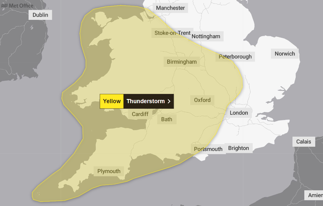
The weather warning will last from 12pm until 8pm on Friday, before another takes its place from 1am until 11.59pm on Saturday.
Travel disruption is possible on both days, as heavy rain may potentially lead to road closures and some communities becoming cut off. The forecaster also warns of a chance of delays and cancellations to train and bus services.
Thundery showers will be present early on Friday before “developing more widely” within the warning area, the Met Office added.
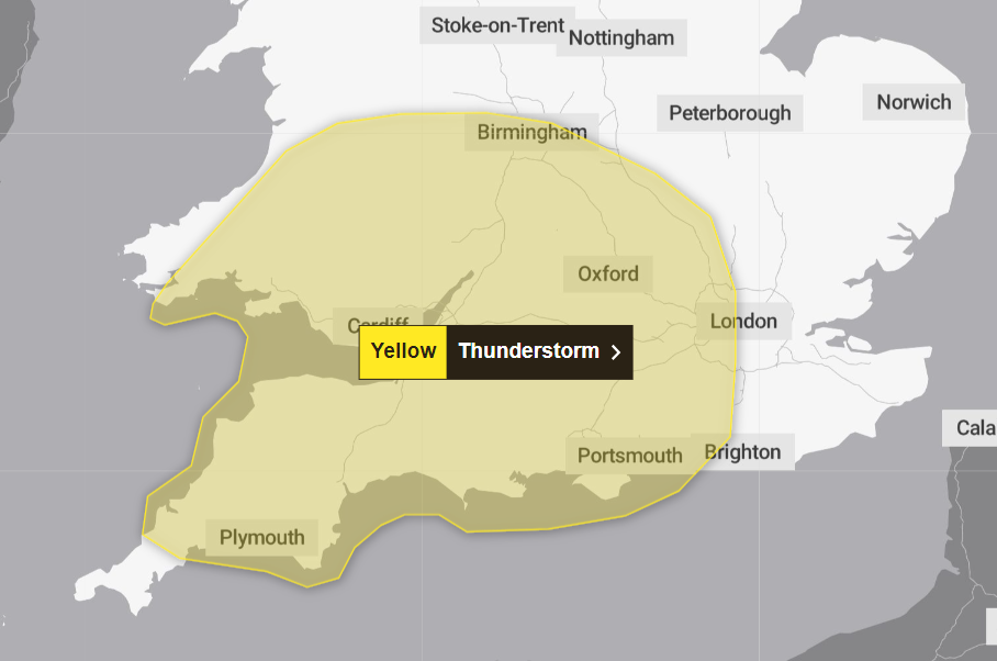
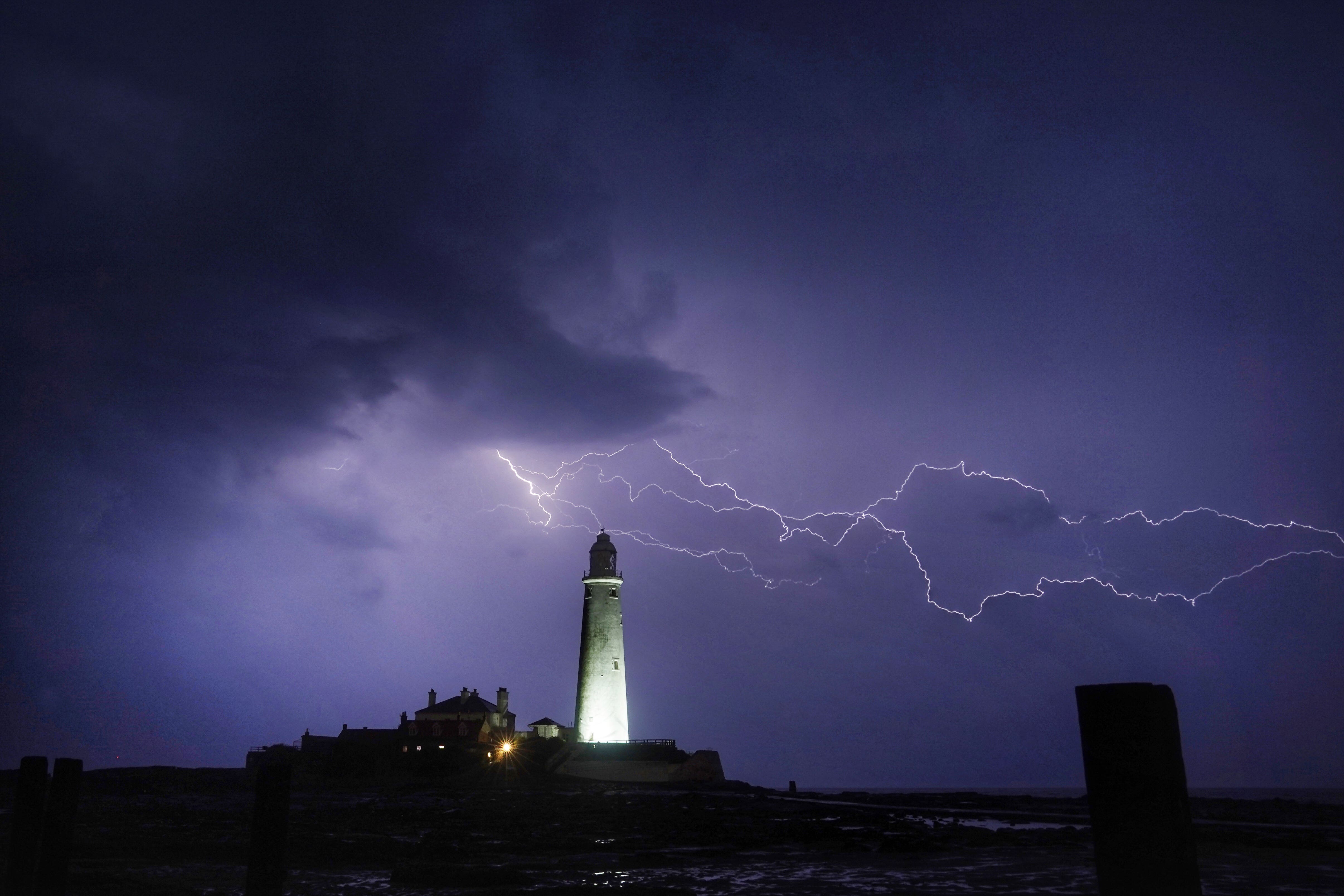
Frequent lightning, strong winds, large hail and heavy rain are all expected to lash across the area, which stretches from central London down to Cornwall, also covering the Midlands and south Wales.
Around a third of a month’s rain could fall in just one hour, with up to 25mm possible in the worst affected areas, before the showers ease up into Friday evening.
Saturday’s weather warning covers the entirety of Wales, the South West, and large areas of the Midlands.
Weather charts on the Met Office website show pockets of rain entering the UK from the South East and passing through the country to the west coast.
The forecaster said: “Scattered showers and thunderstorms are likely to develop and spread northwest-wards at times later on Friday night and through Saturday.”
Some areas could see 50 to 70mm of rainfall in just a few hours - on the lower end of the average rainfall for the whole of September.
Hail and frequent lightning are possible in the “most intense storms”, which are likely to be on Saturday afternoon and evening in parts of southern England, the Midlands, and eastern Wales.
The Met Office said there is a “slight chance that power cuts could occur and other services to some homes and businesses could be lost”.
It added homes and businesses are at risk of flooding, with a small chance of danger to life as a result of fast and deep floodwater.
The Environment Agency also issued one flood warning and 21 flood alerts across England.
The flood warning - which means flooding is expected and residents should act immediately - was issued for the North Sea coast at Hornsea, in east Yorkshire.
Flood alerts were issued in Devon, Cornwall, Norfolk, and around the Thames Estuary.
Join our commenting forum
Join thought-provoking conversations, follow other Independent readers and see their replies
Comments