UK Weather: Warnings in place as heatwave makes way for thunderstorms and flash flooding
The Met Office has warned of lightning, hail, gusty winds and heavy rain which could cause flash flooding and disruption to traffic
Your support helps us to tell the story
From reproductive rights to climate change to Big Tech, The Independent is on the ground when the story is developing. Whether it's investigating the financials of Elon Musk's pro-Trump PAC or producing our latest documentary, 'The A Word', which shines a light on the American women fighting for reproductive rights, we know how important it is to parse out the facts from the messaging.
At such a critical moment in US history, we need reporters on the ground. Your donation allows us to keep sending journalists to speak to both sides of the story.
The Independent is trusted by Americans across the entire political spectrum. And unlike many other quality news outlets, we choose not to lock Americans out of our reporting and analysis with paywalls. We believe quality journalism should be available to everyone, paid for by those who can afford it.
Your support makes all the difference.Parts of the UK have been hit by torrential downpours and lightning as the country’s heatwave made way for stormy conditions.
A yellow thunderstorm warning is in place across the south of England and Wales until 10pm Saturday, while another will come into place across the southeast from 9am until midnight Sunday.
The Met Office has warned of lightning, hail, gusty winds and heavy rain which could cause flash flooding and disruption to traffic.
The recent heatwave, which saw an extreme heat warning issued across parts of the UK as record-breaking temperatures were recorded, faded on Friday as warm conditions were replaced by thunderstorms and torrential downpour in parts of the country,
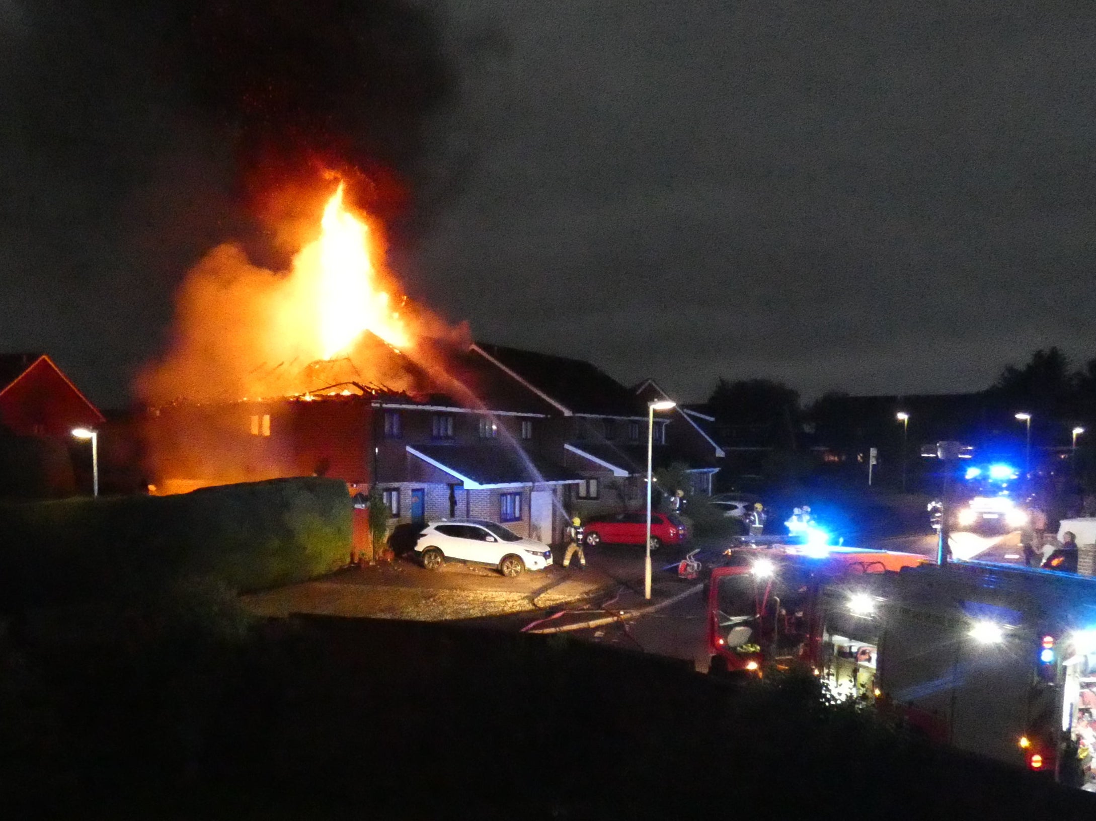
Lightning struck two semi-detached houses on Saturday morning, causing severe damage. A 70-year-old woman escaped unharmed.
Hampshire Fire and Rescue Service were called to the scene in Mercia Avenue, Andover, shortly after 4.30am. They had to contend with both roofs collapsing as flames spread through the properties, and fire crews were still damping down the homes on Saturday afternoon.
There could be up to 35mm of rain falling within an hour, bringing the risk of flooding, the Met Office warned.
It said that there is the potential for up to 80-100mm of rain to build up in some locations over the course of the day. The average rainfall in July in the UK is around 63 millimetres, or 10 days of rain.
The heavy rain has arrived just as the school summer holidays began, with holidaymakers heading to the south coast in for a wetter holiday than expected.
Met Office principal operational meteorologist Frank Saunders said: “This more unsettled weather brings a risk of torrential downpours and flooding in some places.”
Forecasters said the unsettled weather looks set to continue early next week, with more persistent rain expected for much of the UK.
It comes just after a record-breaking heatwave hit the UK last week, with Northern Ireland recording hottest-ever temperatures three times in seven days.
Northern parts of the country will remain warm and dry with some clouds on Saturday and the stormy weather is expected to travel further up towards the midlands as the weekend goes on.
Earlier this month flash floods battered London as a month’s worth of rainfall fell in a single day.
Kew, in southwest London, experienced 47.8mm of rain, most of it in just one hour. The area’s average monthly rainfall in July is 44.5mm.
Join our commenting forum
Join thought-provoking conversations, follow other Independent readers and see their replies
Comments