UK officially set for heatwave this week as temperatures to top 30C, Met Office says
Your support helps us to tell the story
From reproductive rights to climate change to Big Tech, The Independent is on the ground when the story is developing. Whether it's investigating the financials of Elon Musk's pro-Trump PAC or producing our latest documentary, 'The A Word', which shines a light on the American women fighting for reproductive rights, we know how important it is to parse out the facts from the messaging.
At such a critical moment in US history, we need reporters on the ground. Your donation allows us to keep sending journalists to speak to both sides of the story.
The Independent is trusted by Americans across the entire political spectrum. And unlike many other quality news outlets, we choose not to lock Americans out of our reporting and analysis with paywalls. We believe quality journalism should be available to everyone, paid for by those who can afford it.
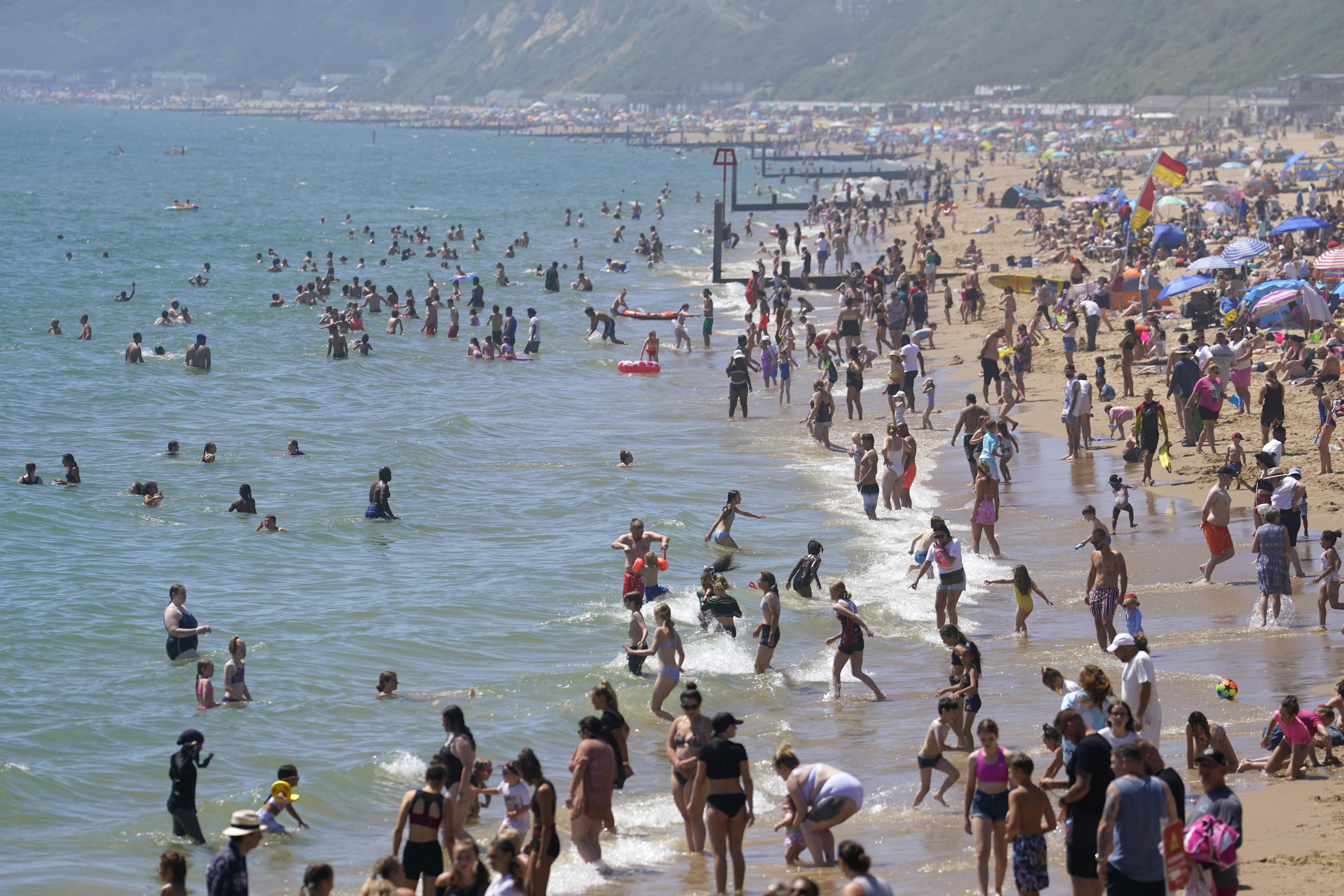
Your support makes all the difference.A heatwave is headed to the UK this week, the Met Office has said, with temperatures likely to exceed 30°C.
The September heat is expected to peak on Wednesday and Thursday with 32°C possible in parts of the southeast, the forecaster explained.
It comes after a washout August that saw miserable conditions for many across the country.
This week could also potentially see the highest temperatures of summer 2023, beating the 32.2C record that was recorded on 10 and 25 June.
The warmer weather is being linked to a jet stream, which has brought largely unsettled weather conditions to the UK. High pressure conditions are building across the country over the week, as the jet stream shifts northwards.
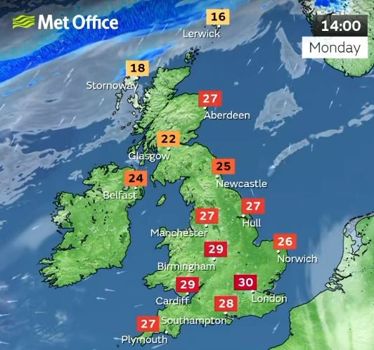
After a misty Monday morning, early low cloud and fog will clear to give way to plenty of warm and hot sunshine with the highest temperatures being recorded in the south of the UK – including London, with a high of 28C.
There will be a good amount of sunshine to be had on Tuesday morning for a vast majority of the country, with showers in some parts of northern England.

Met Office Deputy Chief Meteorologist Mark Sidaway said: “High pressure is situated to the southeast of the UK, which is bringing more settled conditions with temperatures on the rise through the first half of this week.
“While the highest temperatures are expected in the south, heatwave conditions are likely across much of England and Wales especially, with parts of Scotland and Northern Ireland also likely to see some unseasonably high temperatures.”
“An active tropical cyclone season in the North Atlantic is helping to amplify the pattern across the North Atlantic, and has pushed the jet stream well to the north of the UK, allowing some very warm air to be drawn north,” Mr Sidway continued. “It’s a marked contrast to the much of meteorological summer, when the UK was on the northern side of the jet stream with cooler air and more unsettled weather.”

MET OFFICE OUTLOOK
Monday:
Cloudy with patchy rain in the far north. Otherwise a fine day with early low cloud and fog clearing to leave plenty of very warm or hot sunshine.
Monday night:
Cloudy with light rain in the far north. Otherwise a dry, mild night with some mist and fog patches developing. A chance of the odd shower affecting the far southwest.
Tuesday:
Any mist and fog clearing to leave another fine and dry day. Remaining cloudier in the far north with the odd spot of rain. Feeling very warm to hot.
Outlook for Wednesday to Friday:
Mostly dry with very warm or hot sunshine. However, patches of low cloud and fog overnight. Some drizzle in the far north, and showers possible later, mainly in the west.


Join our commenting forum
Join thought-provoking conversations, follow other Independent readers and see their replies
Comments