UK weather: Temperatures soar to 21C after days of floods, thunderstorms and downpours
Warm and dry conditions likely to continue for most areas on Sunday, Met Office says
Your support helps us to tell the story
From reproductive rights to climate change to Big Tech, The Independent is on the ground when the story is developing. Whether it's investigating the financials of Elon Musk's pro-Trump PAC or producing our latest documentary, 'The A Word', which shines a light on the American women fighting for reproductive rights, we know how important it is to parse out the facts from the messaging.
At such a critical moment in US history, we need reporters on the ground. Your donation allows us to keep sending journalists to speak to both sides of the story.
The Independent is trusted by Americans across the entire political spectrum. And unlike many other quality news outlets, we choose not to lock Americans out of our reporting and analysis with paywalls. We believe quality journalism should be available to everyone, paid for by those who can afford it.
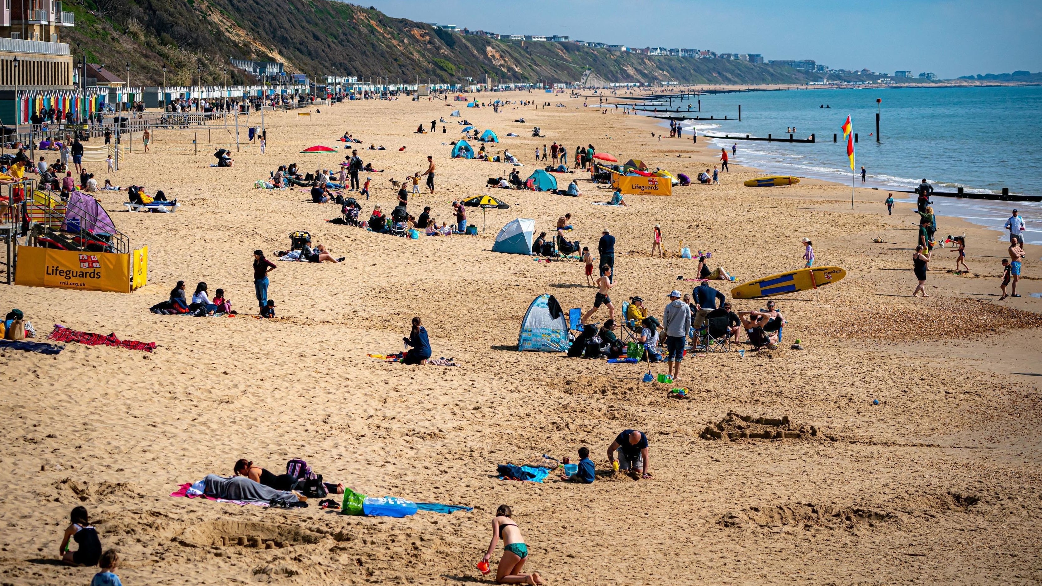
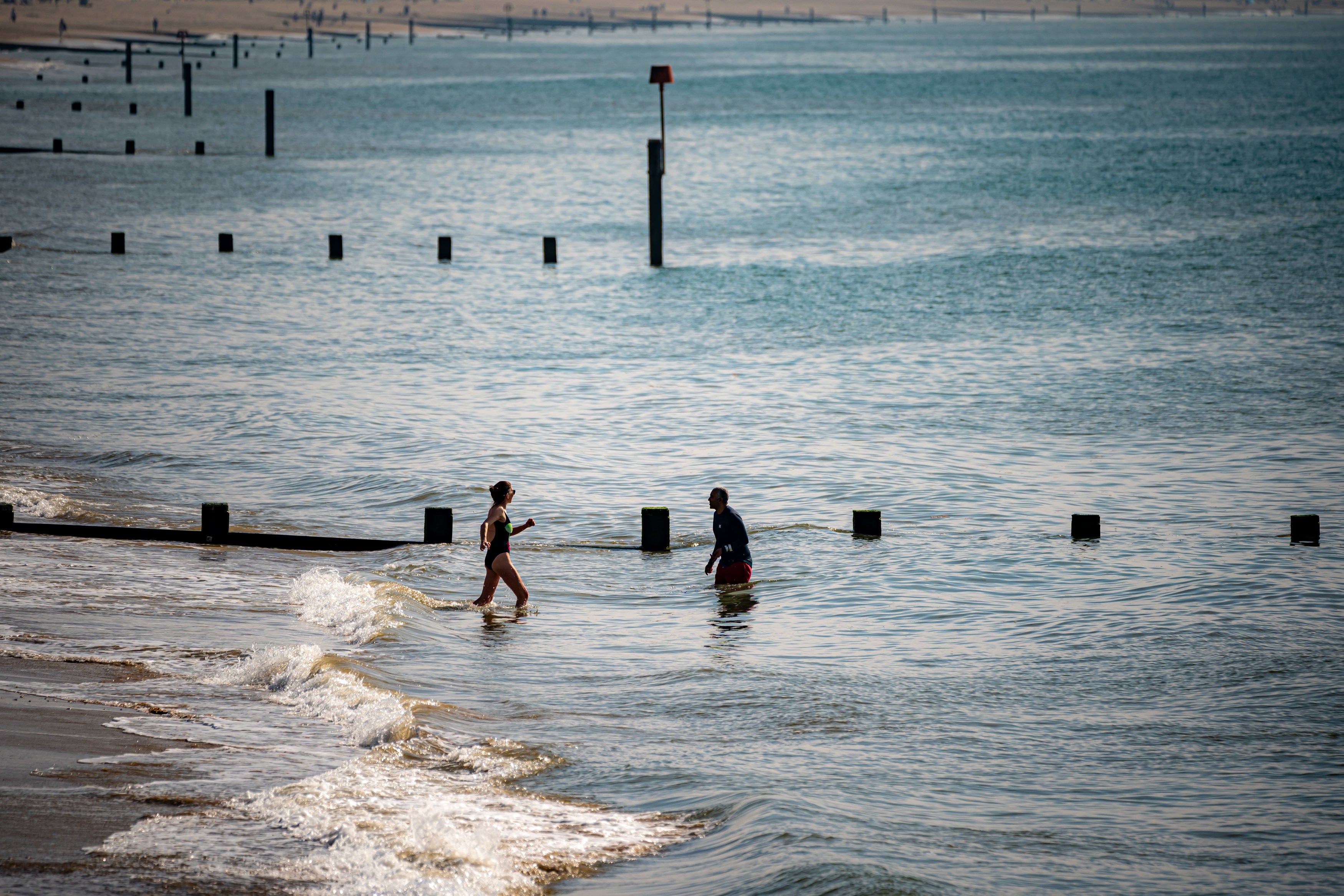
Your support makes all the difference.Britons are set to bask in 21C highs on Saturday in one of the hottest days of the year so far.
It follows a week dominated by thunderstorms, heavy rain and spells of hail, with flash flooding resulting in a major incident being declared in Somerset.
And though the forecast promises a cloudy start to Saturday for many, things are expected to brighten up throughout the morning, especially across the western flank of the UK.
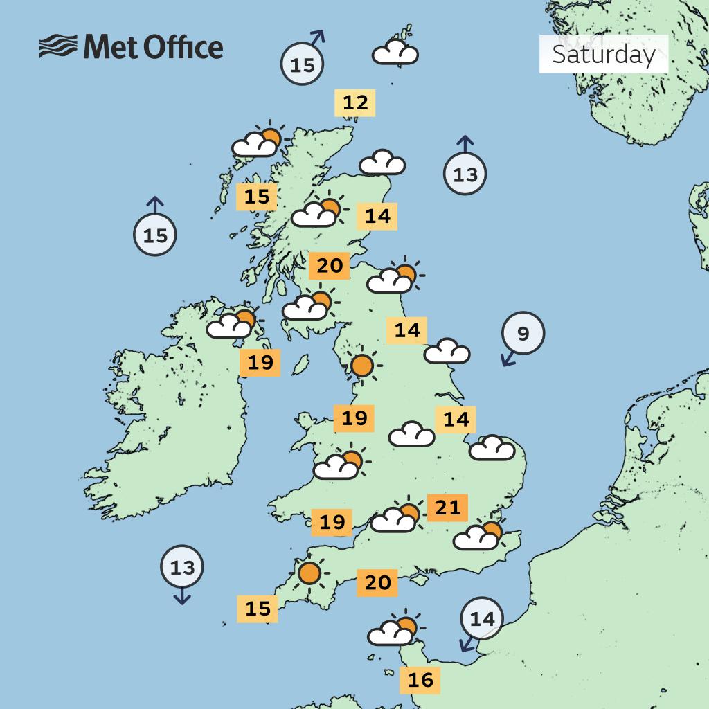
The highest temperatures, meanwhile, will likely be in the southeast, with the Met Office pointing to highs of 21C in Bournemouth on Saturday afternoon. The hottest day so far this year was 21.2C in April.
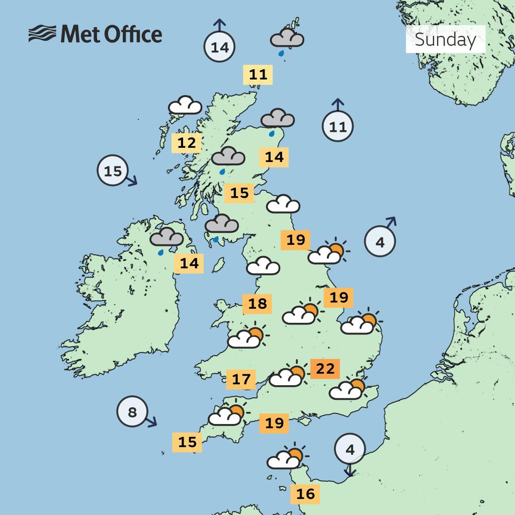
The warm and dry conditions are likely to persist for most areas on Sunday, though there could be some downpours in western parts as well as Scotland and Northern Ireland.


Met Office meteorologist Aidan McGivern said: “It’s been an energetic week of weather with heavy showers and in some places a thunderstorm.
“But it all calms down a little at least for a day or two heading in this weekend as an area of high pressure starts to topple in from the North West and by Saturday morning virtually everyone is fine and settled.”
Mr McGivern said plenty of low cloud was expected across the UK first thing tomorrow, which would be thickest along the North Sea coast, which could also see some patchy drizzle.
As a result, temperatures could be “held back” in cities such as Norwich and Hull to only 14C – while southern England looks destined for highs of 21C.
On Sunday, Scotland and Northern Ireland will wake to rain, which will then push into western England through the morning.
But a slow-moving weather front will bring some wet weather at the start of next week into southern and eastern areas and hold back temperatures again.
Scattered clouds and showers for all, turning thundery in the North East, is likely on Monday
However, after that for much of next week more settled weather is expected, while also turning slightly cooler.
Met Office five-day outlook
Friday night
Outbreaks of mainly light rain and drizzle clearing from the far southwest but remaining cloudy across the south and east. Clear spells elsewhere with a few fog patches, particularly Northern Ireland.
Saturday:
Low cloud becoming confined to North Sea coasts. Plenty of sunshine for most parts and feeling warm in light winds.
Outlook for Sunday to Tuesday:
Largely dry away from a rain band which moving steadily across the UK whilst decaying, although a chance of widespread showers on Monday. Temperatures around to a little below average.
Join our commenting forum
Join thought-provoking conversations, follow other Independent readers and see their replies
Comments