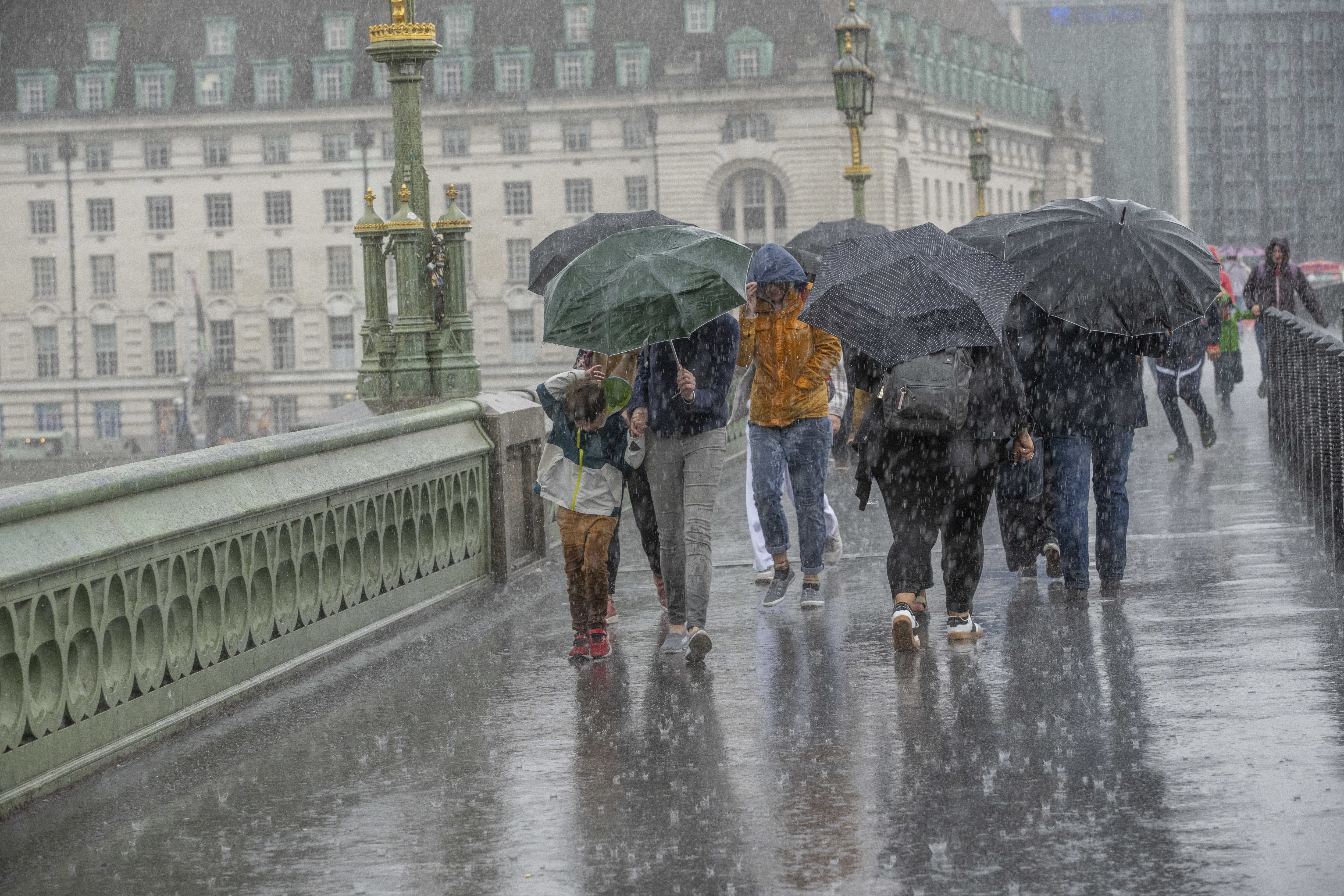
UK faces flash flooding, lightning storms and scorching heat in turbulent weekend of weather
Flash flooding, large hail, stormy days and hot, humid nights are all possible over the weekend as the UK’s tropical-style weather continues
Your support helps us to tell the story
From reproductive rights to climate change to Big Tech, The Independent is on the ground when the story is developing. Whether it's investigating the financials of Elon Musk's pro-Trump PAC or producing our latest documentary, 'The A Word', which shines a light on the American women fighting for reproductive rights, we know how important it is to parse out the facts from the messaging.
At such a critical moment in US history, we need reporters on the ground. Your donation allows us to keep sending journalists to speak to both sides of the story.
The Independent is trusted by Americans across the entire political spectrum. And unlike many other quality news outlets, we choose not to lock Americans out of our reporting and analysis with paywalls. We believe quality journalism should be available to everyone, paid for by those who can afford it.
Your support makes all the difference.The UK will continue to enjoy the warm weather over the weekend, but in some areas it will be punctuated with wet and stormy downpours.
Met Office spokesperson Grahame Madge told The Independent that the storm impact in some areas could be “significant”, with “flash flooding, large hail, frequent lightning and even squally winds”.
The Met Office said there could be between 50mm and 100mm of rain on Thursday during the storms, which amounts to around one month’s worth of rainfall.
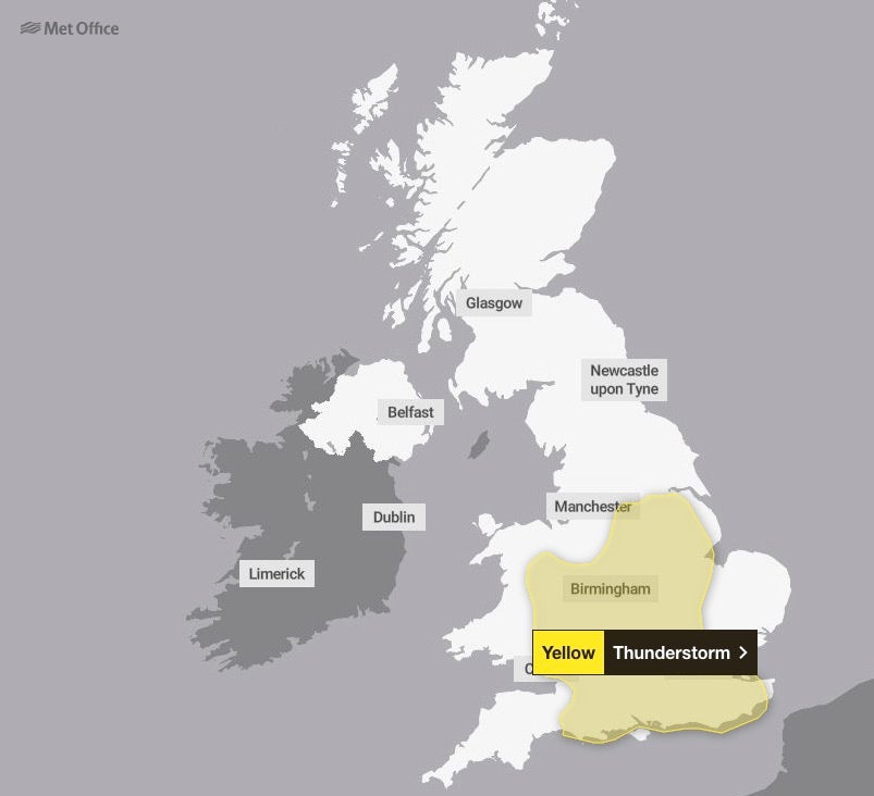
But some areas within the weather warning zone “won’t witness any impacts” and may “enjoy potentially fine conditions”, Mr Madge said.
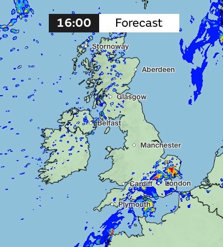
All parts of the UK can expect to see rain at some point over the weekend as thunderstorms sweep across the nation, possibly starting in northern areas later on Thursday.
It will be “hot and humid” for the rest of the day for those in south England, particularly in the south east, with temperatures touching on 27C into the evening and some more “unpleasant sleeping conditions” overnight.
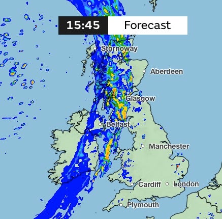
Friday will be warm and dry for most of the south and east, while a torrent of rain sweeps across Scotland and strikes northwest England and parts of the midlands into the evening.
Temperatures will peak at 28C in London and the southeast, while the southwest peaks at 20C, the northwest at 23C, and Scotland at 18C.
Saturday and Sunday will see temperatures drop to highs of between 18C and 23C across the UK.
“The heat and humidity of the last few days will give way to fresher conditions from tomorrow and into Saturday,” Mr Madge said.
“Over the weekend there will be some fine conditions – interspersed with spells of rain for some – but temperatures will be a few degrees lower than the last few days.”
Those who find themselves in a thunderstorm have been advised to not use mobile phones, umbrellas, or to stand under trees if their area is struck by storm.
On Thursday night the UK can expect “thundery showers” which will ease through the evening, while many across the UK remain in dry spells, the Met Office website reads.
It will be a “warm, muggy” night in the south, it says.
Friday will see “cloud and rain edging into the northwest” while it will be “mostly dry elsewhere with sunny spells” and a “few heavy showers in the east”.
Parts of Scotland may face more than 30mm of rainfall on Friday, Met Office weather maps show, with the south and southeast facing the same fate on Saturday.
Another heavy front of rain is then expected to strike from the northwest side of the UK in the early hours of Monday.
Join our commenting forum
Join thought-provoking conversations, follow other Independent readers and see their replies
Comments