UK weather: Heavy rain and flood warnings as downpours to lash England and Wales for 20 hours
Met Office weather warnings for rain have been issued for areas across England and Wales
Your support helps us to tell the story
From reproductive rights to climate change to Big Tech, The Independent is on the ground when the story is developing. Whether it's investigating the financials of Elon Musk's pro-Trump PAC or producing our latest documentary, 'The A Word', which shines a light on the American women fighting for reproductive rights, we know how important it is to parse out the facts from the messaging.
At such a critical moment in US history, we need reporters on the ground. Your donation allows us to keep sending journalists to speak to both sides of the story.
The Independent is trusted by Americans across the entire political spectrum. And unlike many other quality news outlets, we choose not to lock Americans out of our reporting and analysis with paywalls. We believe quality journalism should be available to everyone, paid for by those who can afford it.
Your support makes all the difference.England and Wales are set to be lashed by persistent heavy rain, with three days of warnings issued by the Met Office.
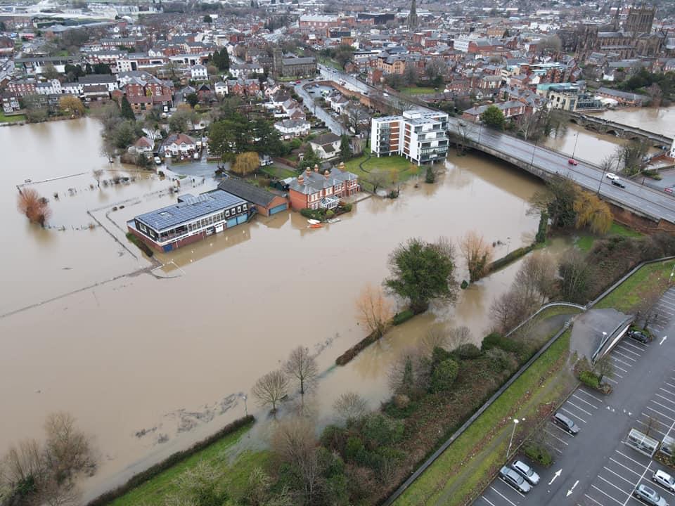
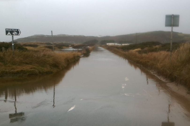
Scores of flood warnings and alerts are already in place for large parts of the country, with more downpours on the way this week.
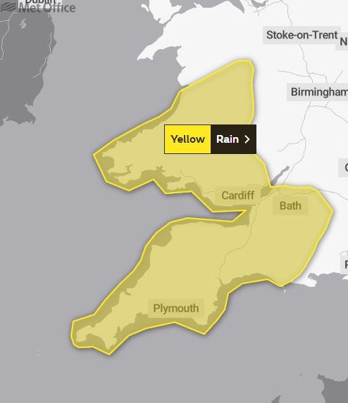
Yellow weather warnings are already in place for north west England and parts of Wales and Scotland until 8pm on Monday.
And now further warning covering south west England AND southern Wales has been announced, from 9pm on Wednesday through to 5pm on Thursday.
The Environmental Agency also still has 28 flood warnings and 96 alerts for much of the UK, with groundwater flooding expected in areas soaked by recent wet weather. The saturated ground means that even areas that avoid the worst of Tuesday’s deluge could be at risk of flooding.


The Met Office has warned of disruption in affected areas, including potential flooding of homes and businesses, transport delays nd possible power cuts.
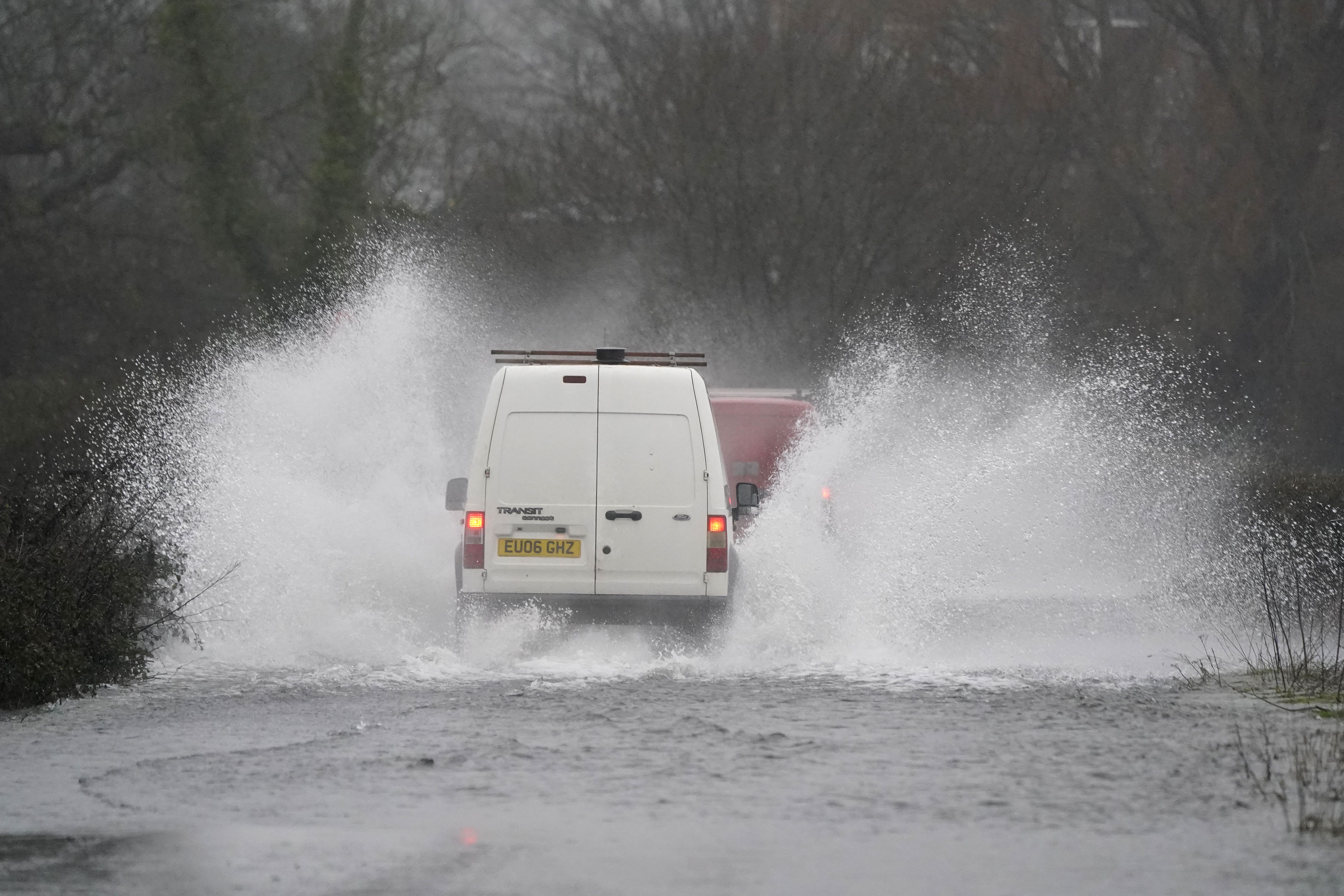
The heavy rain is already causing disruption to travel on roads across Greater Manchester with delays reported on the M60 and M61 motorways. Fire crews were filmed wading through flood water in Levenshulme, south Manchester as cars were submerged underneath a railway bridge, with the road cordoned off for safety.
Network Rail is also responding to flooding on parts of the railway in South and West Wales, with teams diverting flood water from two stations. Lines have reopened between Ferryside, in Camarthenshire, and Llanharan, in the Rhondda.
Mid and West Wales Fire and Rescue Service issued a warning to people visiting beauty spots near water, as well as to “time your walks to make the most of the daylight.”
South Wales Fire and Rescue Service urged people to avoid outdoor water-based activities such as paddle-boarding and open water swimming.
A spokesperson said: “The risks of entering open water include strong currents and cold-water shock, as the temperature can be much colder than anticipated, especially in fast-flowing sections.”
Clustered warnings are in place for groundwater flooding in Dorset and parts of Hampshire, as well as areas surrounding the river Tone and river Wye.
Flood alerts are in place for parts of Surrey and Oxfordshire due to high water levels on the River Thames, and disruption to rail services is expected in Wiltshire.
Barriers have been deployed in Ironbridge, Shropshire and along the banks of the river Severn in Shrewsbury.
Natural Resources Wales, in its 5 day flood risk assessment, issued 20 flood alerts across the same areas covered by the Met Office warnings.
The forecast said: “Local river and surface water flooding impacts are probable across Wales on Tuesday and river flooding impacts may continue into Wednesday.
“Land, roads and some properties may flood and there may be travel disruption.”
And north of the border, the Scottish Environment Protection Agency (Sepa) has issued five flood alerts across south-west Scotland, covering Argyll and Bute, Ayrshire and Arran, Central Scotland, Dumfries and Galloway, and West Central Scotland.
Network Rail Scotland said on Twitter: “We have extra staff, water pumps and other vital kit on standby.”
Meteorologist Alex Deakin described Tuesday as “a rather dull and damp affair” with gusty winds but warned of further rain on the way.
Temperatures will be milder than Monday and are expected to reach 13C in Cardiff and Belfast, 12Cin London, and 11C in Edinburgh.
“The rain will be spreading its way through eastern England and then through Scotland,” he added. “That band of rain should sweep across England and Wales, leaving clearer skies for a time but also plenty of showers coming in.”
MET OFFICE OUTLOOK
Tuesday evening
Bands of rain clearing eastwards followed by clear spells. Blustery showers affecting western areas, especially the northwest where some will be heavy. Windy for most with coastal gales in the west and severe gales across the far north of Scotland.
Wednesday:
Sunny spells and blustery showers, some heavy and thundery in the west, and merging into longer spells of rain for a time. Windy, with coastal gales.
Outlook for Thursday to Saturday:
Remaining unsettled with further spells of rain and strong winds. Mostly mild, but turning somewhat colder on Saturday.
Join our commenting forum
Join thought-provoking conversations, follow other Independent readers and see their replies
Comments