Met Office expects ‘quite intense hot spell’ with temperatures set to soar again over weekend
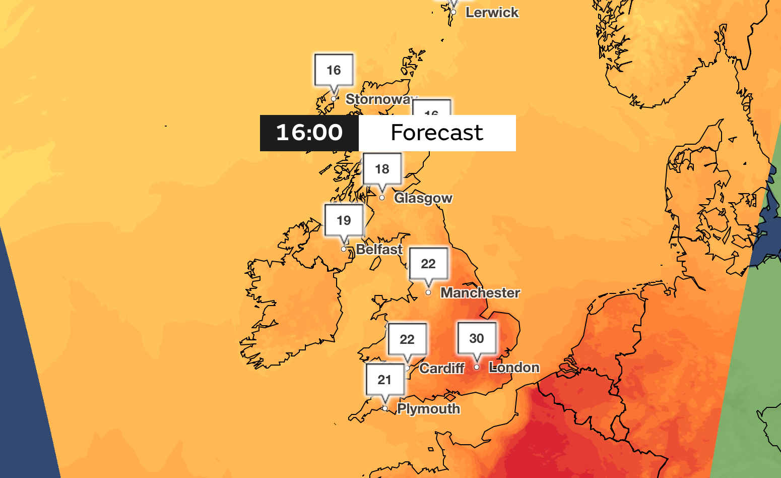
London will see highs of 30C with Sunday and Monday set to be the warmest days, according to the Met Office
Your support helps us to tell the story
From reproductive rights to climate change to Big Tech, The Independent is on the ground when the story is developing. Whether it's investigating the financials of Elon Musk's pro-Trump PAC or producing our latest documentary, 'The A Word', which shines a light on the American women fighting for reproductive rights, we know how important it is to parse out the facts from the messaging.
At such a critical moment in US history, we need reporters on the ground. Your donation allows us to keep sending journalists to speak to both sides of the story.
The Independent is trusted by Americans across the entire political spectrum. And unlike many other quality news outlets, we choose not to lock Americans out of our reporting and analysis with paywalls. We believe quality journalism should be available to everyone, paid for by those who can afford it.
Your support makes all the difference.Britain is braced for temperatures in some areas to once again soar as high as 30C over the weekend and into next week.
Warm air will move up from Europe on Saturday and through Sunday and Monday before temperatures dip again on Tuesday to average levels for this time of year, the Met Office said.
England and Wales are expected to see temperatures hit the high twenties and low thirties, with high teens and low twenties forecast for Scotland and Northern Ireland.
Sunday and Monday are expected to be the warmest days, with highs of 30C in London, 25C in Manchester, 22C in Glasgow and 21C in Belfast.

Met Office chief meteorologist Dan Suri, said: “Tropical Storm Debby in North America is helping to strengthen the jet stream, and is causing it to meander over the Atlantic. This will allow hot air to move into the UK later this weekend, and early next week.
“Temperatures are likely to reach the low 30C in places, notably in the South and South East. Further north and west within this warm air, outbreaks of heavy showers or thunderstorms are possible. As well as the hot daytime temperatures, a very warm night is also expected on Sunday night into Monday.”
Much of the country will be cloudy and humid on Saturday morning, with the north seeing brighter spells and light showers. The clouds will clear up throughout the day with warmer air moving in on Saturday evening.
Met Office spokeswoman Nicky Maxey added: “The hot spell is short-lived but quite intense. Temperatures are due to peak on Monday and rapidly return to average on Tuesday and Wednesday.”
By Tuesday, the hot air mass will likely become displaced by fresher conditions. The weather then will become unsettled once again, with occasional Atlantic frontal systems or showers moving through at times.
However, the weather will also feel fairly pleasant in between these systems, according to the Met Office.
Join our commenting forum
Join thought-provoking conversations, follow other Independent readers and see their replies
Comments