UK to see warmer temperatures next week as London forecast to be hotter than Barcelona
Forecasters say high pressure should bring warmer weather across the UK next week
Your support helps us to tell the story
From reproductive rights to climate change to Big Tech, The Independent is on the ground when the story is developing. Whether it's investigating the financials of Elon Musk's pro-Trump PAC or producing our latest documentary, 'The A Word', which shines a light on the American women fighting for reproductive rights, we know how important it is to parse out the facts from the messaging.
At such a critical moment in US history, we need reporters on the ground. Your donation allows us to keep sending journalists to speak to both sides of the story.
The Independent is trusted by Americans across the entire political spectrum. And unlike many other quality news outlets, we choose not to lock Americans out of our reporting and analysis with paywalls. We believe quality journalism should be available to everyone, paid for by those who can afford it.
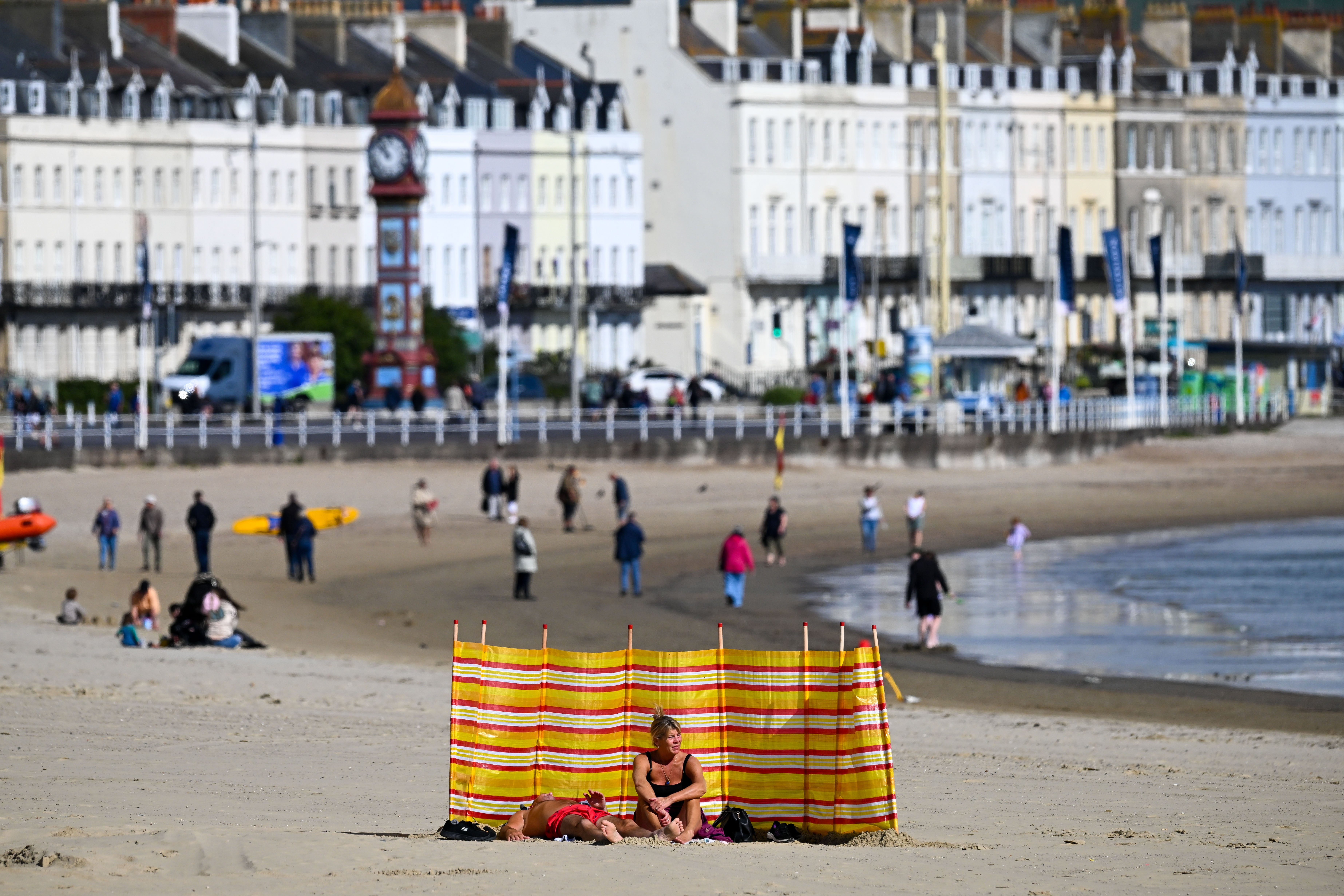
Your support makes all the difference.As the Arctic blast that saw temperatures plunge below zero fades, the UK is expected to get a late burst of summer weather next week before Autumn takes hold.
After -2.7C was recorded in Topcliffe, North Yorkshire on Friday and the earliest sighting of frost since 2019 reported in south Wales, many were led to believe that summer was officially over.
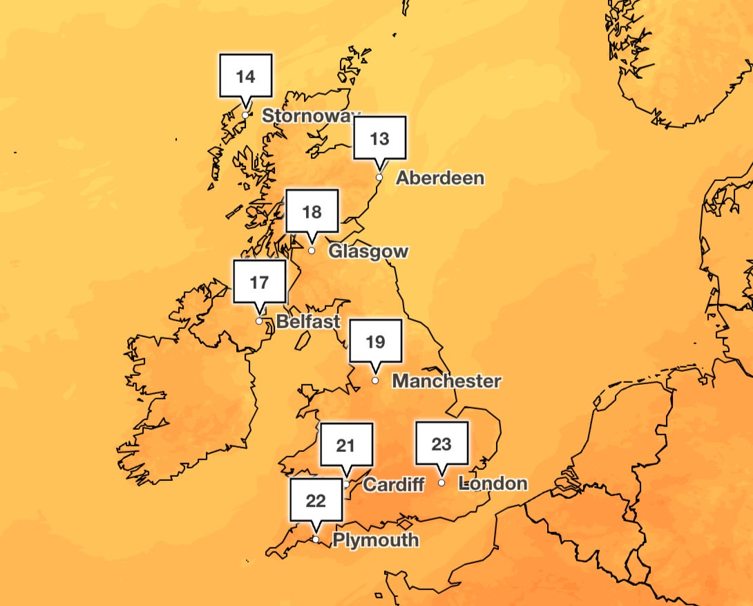
But as the ice thawed under a ridge of high pressure, next week looks to be dry and warmer for many across the UK with London set to see highs of 26C by Thursday, far higher than Barcelona’s 22C.
David Oliver, deputy chief meteorologist at the Met Office said: “In the wake of the front on Sunday, high pressure then builds, bringing fine and dry conditions to most parts of the UK for much of next week.
“If any rain develops it is expected to be confined to the extreme northwest of Scotland on Monday and Tuesday. There is a risk of some fog patches overnight and temperatures continue to increase, with many places a little above average by mid-week.”
Belfast, Edinburgh, and Cardiff are all predicted to reach highs of 20C on Tuesday next week.
The second half of next week is also expected to be “fine and dry” and most parts of the UK will see “spells of sunshine”, according to the Met Office’s long range weather forecast.
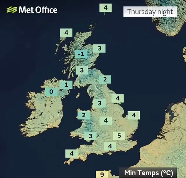
Many regions will experience daytime temperatures that are above average, but forecasters have warned that some cool nights with mist or fog patches are possible.
The long-range forecast adds: “Fairly strong winds could affect the south at times. As we go through the weekend and into the following week, there will be little change from this in the north, but southern areas become more likely to see showers at times, with perhaps some heavy or thundery ones. By late September there is a chance that more unsettled conditions may begin to develop more widely.”
“Typical Autumn weather will probably affect the UK with a mix of weather types during late September and early October. Periods of wet, unsettled weather will likely be broken up by some spells of more settled, drier weather. Overall, the wettest conditions will probably be in the west with the east drier. Temperatures are most likely to be close to or slightly above average.”
Join our commenting forum
Join thought-provoking conversations, follow other Independent readers and see their replies
Comments