Mapped: Where Storm Ciarán will hit UK as new weather warnings issued
Hundreds of schools have closed, flights and trains have been cancelled and roofs have been ripped of homes
Your support helps us to tell the story
From reproductive rights to climate change to Big Tech, The Independent is on the ground when the story is developing. Whether it's investigating the financials of Elon Musk's pro-Trump PAC or producing our latest documentary, 'The A Word', which shines a light on the American women fighting for reproductive rights, we know how important it is to parse out the facts from the messaging.
At such a critical moment in US history, we need reporters on the ground. Your donation allows us to keep sending journalists to speak to both sides of the story.
The Independent is trusted by Americans across the entire political spectrum. And unlike many other quality news outlets, we choose not to lock Americans out of our reporting and analysis with paywalls. We believe quality journalism should be available to everyone, paid for by those who can afford it.
Your support makes all the difference.Storm Ciarán is bringing heavy rain and gusts of wind to the UK with large parts of the country under yellow, amber, and red “danger to life” warnings.
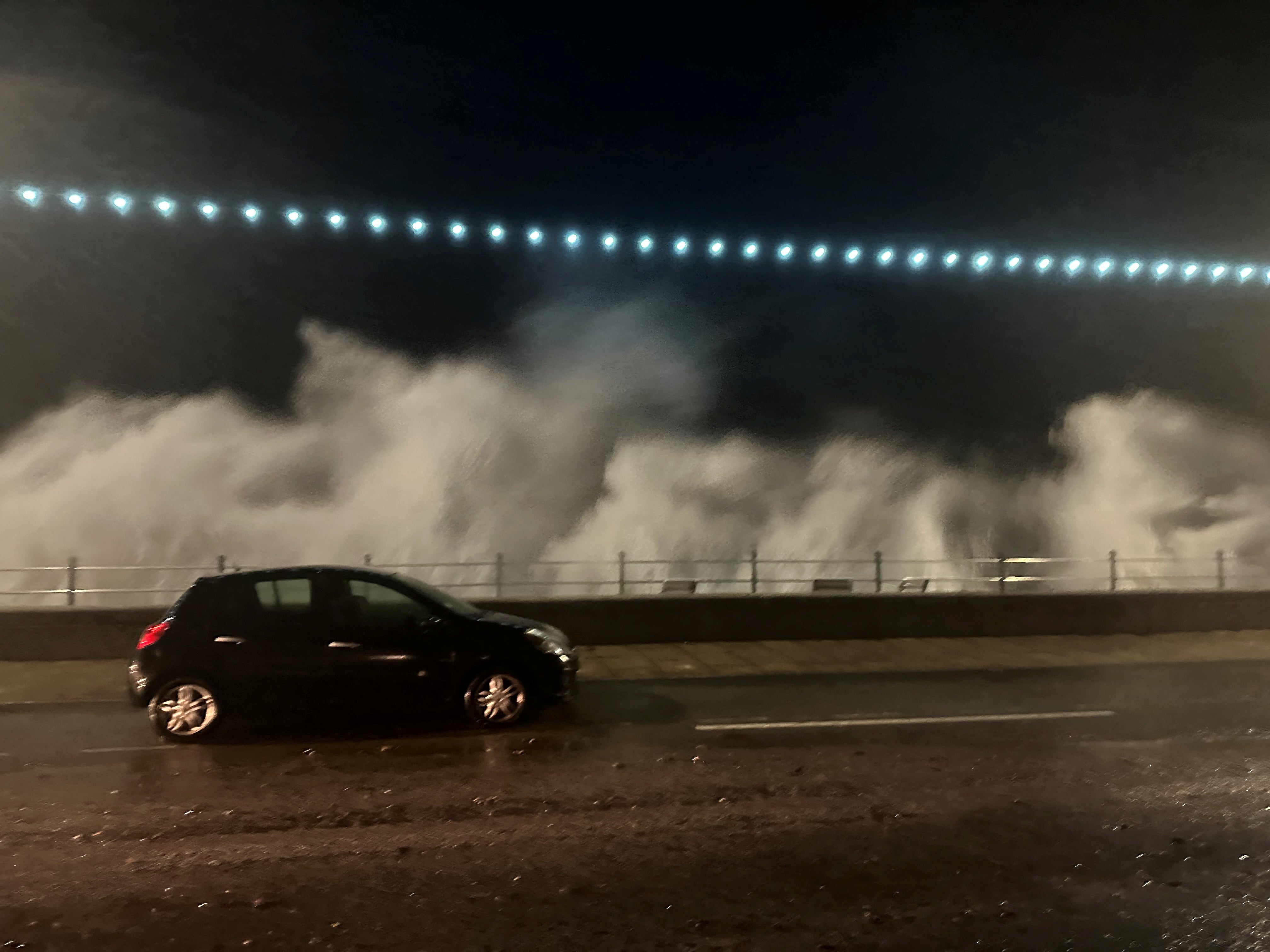
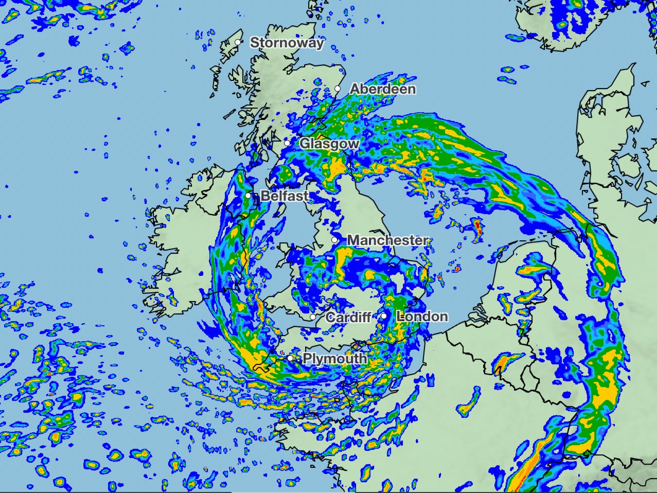
The storm has been battering the British Isles and the Channel Islands, with strong winds and heavy rain forcing hundreds of schools to close and trains and flights to be cancelled.
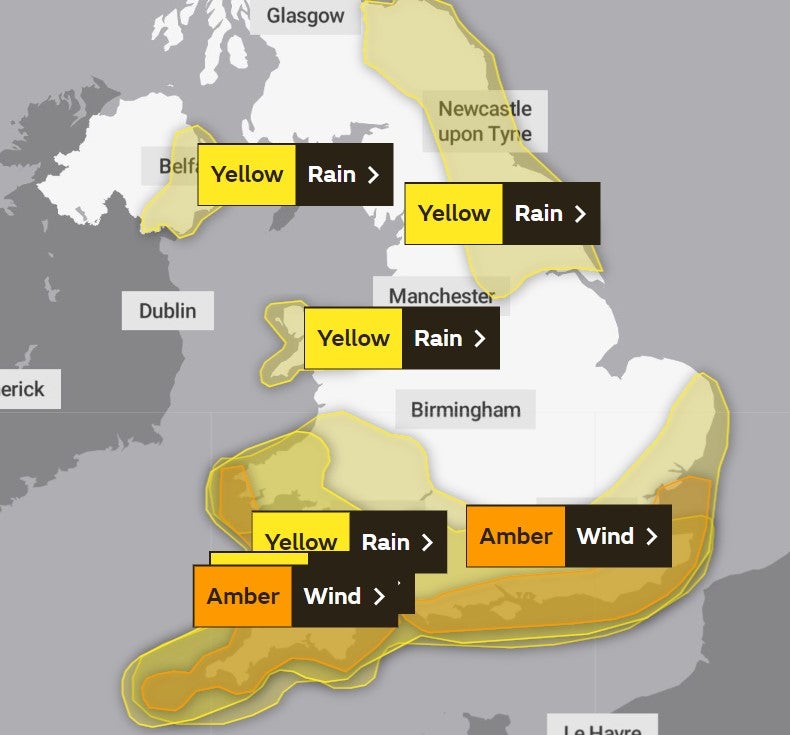
The Met Office updated its amber warning for the south east on Thursday, showing wind speeds of up to 90mph across Sussex and Kent.
Meanwhile, more than 8,500 homes in Cornwall are without power, according to its council, and one woman’s home in Jersey had its roof ripped off.
There are both amber and yellow warnings for wind in place from Wednesday night until the end of Thursday and will affect large swathes of England and Wales.
A yellow warning for rain has also been issued for northeast England and southeast Scotland from Thursday morning until early Friday.
A red wind warning, the highest level, was issued by Jersey Met for Wednesday evening into Thursday, meaning residents are being warned to avoid being outside due to predicted gusts of almost 100mph.


It comes after roads were closed in Northern Ireland due to heavy flooding following torrential rain, which saw a city canal burst its banks in Newry, Co Down on Monday. Widespread travel disruption was alsoreported as Bangor rail line and Translink announced closures and delays.
People in England are also being urged by the Environment Agency to prepare for “possible significant flooding” until Friday.
There are at least 24 flood warnings – where flooding is expected – and 113 flood alerts- where flooding is possible. Scotland has eight flood warnings and one flood alert, while Wales has been issued one flood warning and 14 flood alerts.
Kate Marks, flood duty manager at the Environment Agency advised people to “stay away from swollen rivers” as she urged people “not to drive through flood water as just 30cm of flowing water is enough to move your car”.
There are currently eight weather warnings in place across the UK which span the next three days.
This map shows the areas under weather warnings:

Areas impacted by amber weather warning for wind:
Train operators have warned travellers to expect disruption with Southern Railway, ThamesLink and Gatwick Express urging commuters to work from home.
London Heathrow airport, the busiest in the UK, has imposed restrictions on the “flow rate” of arriving aircraft due to the strong winds expected to arrive with Storm Ciarán.
Hundreds of schools have also been forced to close their doors to pupils and staff on Thursday as storms batter the south of the UK.
Met Office deputy chief meteorologist Chris Almond said: “Winds associated with Storm Ciaran are likely to gust to 80mph along the south coast of England, with a small risk of somewhere exposed seeing 90mph, and winds could even gust up to 50 or 60mph further inland.
“This deep, low-pressure system will also bring heavy rain to much of the UK, but the heaviest rain is expected in southern and western areas, with 20 to 25mm quite widely across the region but up to 40 to 60mm potentially over higher ground.
“Heavy and persistent rain will fall onto the already saturated ground, bringing a risk of further impacts such as flooding in areas that are already struggling to clean up from the heavy rainfall we have seen over the last week or so.”
The third named storm of this year’s season comes after areas across Scotland and north-east England were battered with the worst of Storm Babet, which caused serious damage and several deaths when it hit last week.

Join our commenting forum
Join thought-provoking conversations, follow other Independent readers and see their replies
Comments