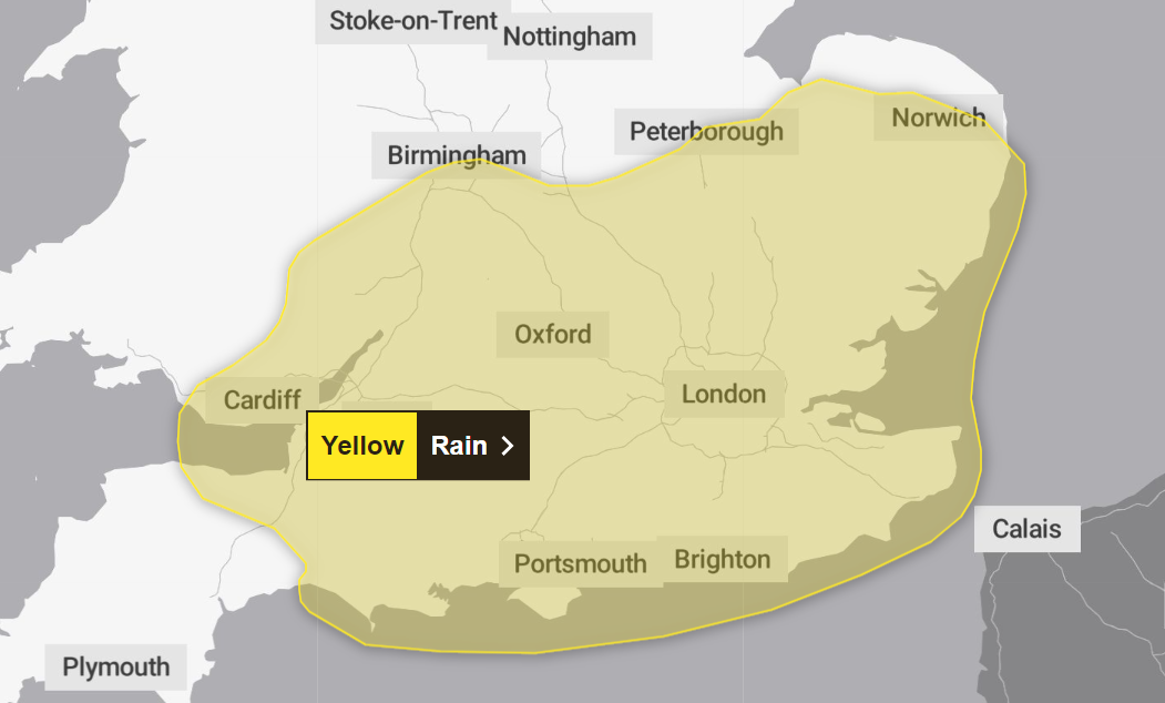
Met Office issues yellow weather warning for rain with flooding and power cuts possible
Up to half a month’s worth of rain could fall in just one hour, the Met Office says
Your support helps us to tell the story
From reproductive rights to climate change to Big Tech, The Independent is on the ground when the story is developing. Whether it's investigating the financials of Elon Musk's pro-Trump PAC or producing our latest documentary, 'The A Word', which shines a light on the American women fighting for reproductive rights, we know how important it is to parse out the facts from the messaging.
At such a critical moment in US history, we need reporters on the ground. Your donation allows us to keep sending journalists to speak to both sides of the story.
The Independent is trusted by Americans across the entire political spectrum. And unlike many other quality news outlets, we choose not to lock Americans out of our reporting and analysis with paywalls. We believe quality journalism should be available to everyone, paid for by those who can afford it.
Your support makes all the difference.The Met Office has issued a yellow weather warning with up to half a month’s worth of rain in just one hour which could cause possible flooding and travel disruption.
The warning will be in place from 9pm on Wednesday (4 September) until 9am on Thursday (5 September).
It covers the entire south and east of England, parts of southeastern Wales, the south Midlands and most of East Anglia.
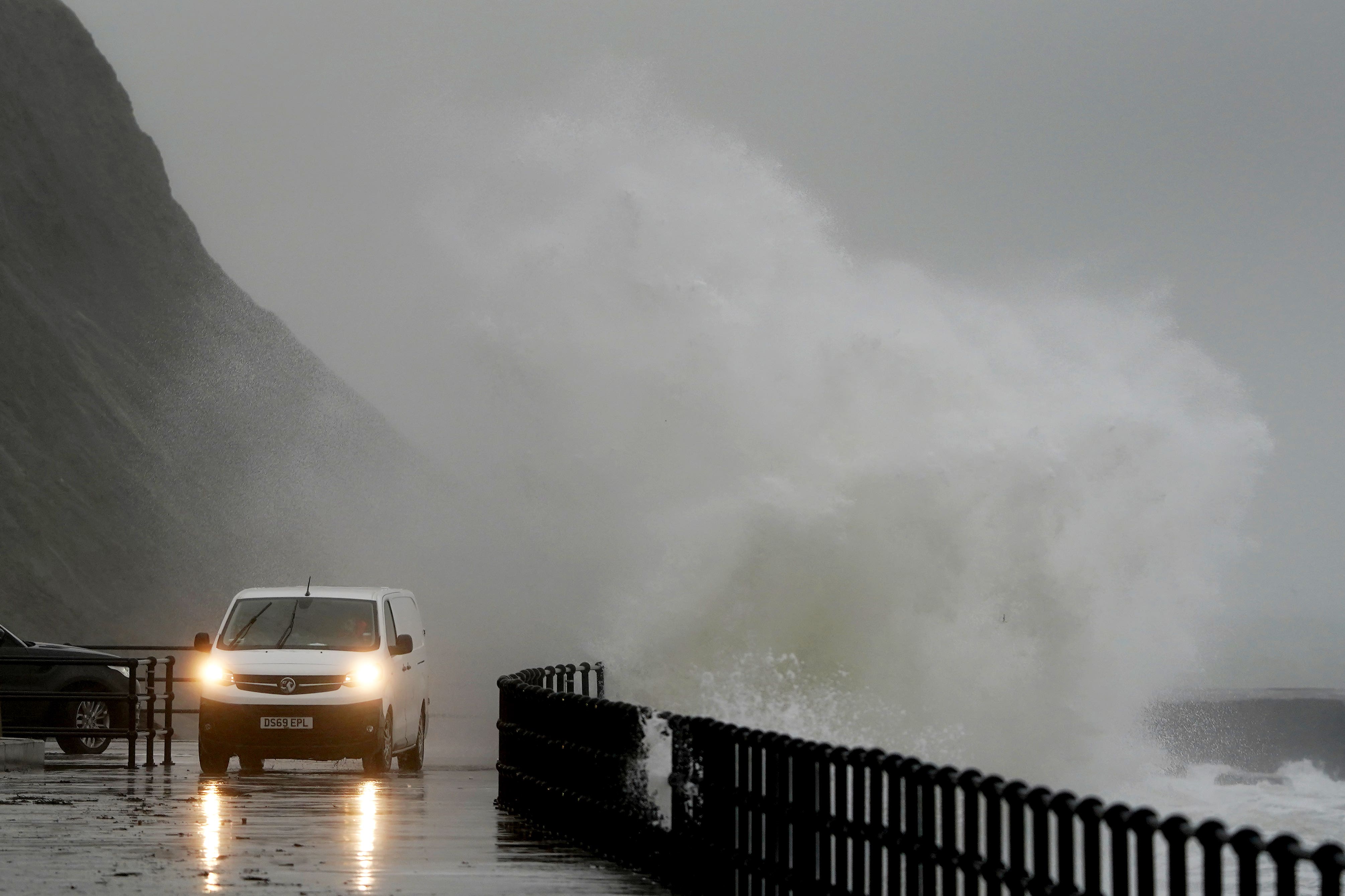
The Met Office said “heavy showers” and “thundery” weather are possible overnight from Wednesday into Thursday, with intense rain potentially causing major travel disruption due to sudden flooding and lightning strikes.
“Spray and sudden flooding could lead to difficult driving conditions and some road closures. Where flooding or lightning strikes occur, there is a chance of delays and some cancellations to train and bus services,” the forecaster said.
Rainfall of 20mm to 40mm in just one or two hours is possible in areas with the heaviest downpours. The UK typically sees in the region of 80mm of rain throughout September.
“Whilst there is some uncertainty, and not all areas will be affected, scattered heavy showers on Wednesday evening may merge into longer spells of heavy, showery rain in places through Wednesday night into Thursday morning,” the Met Office added.
“Where heavy downpours occur, perhaps thundery in places, accumulations of 20mm to 40mm are possible in an hour or two, with the small chance of isolated accumulations over 50mm, potentially impacting the Thursday morning commute in some areas.”
There is a “slight chance” that power cuts will occur and “other services to some homes and businesses could be lost”.
A danger to life warning was also issued due to the possibility of quick flooding.
“There is a small chance that homes and businesses could be flooded quickly, with damage to some buildings from floodwater, lightning strikes, hail or strong winds. There is a small chance of fast flowing or deep flood water causing danger to life,” it added.
As the UK sees a wet start to September, six flood alerts have remained in place from the Environment Agency since Monday.
Flooding is possible on River Blythe in Warwickshire; River Cole; River Rea; River Stour and Smestow Brook in the Black Country and South Staffordshire; Upper Tame; and Upper Tame at Sandwell Valley.
The Environment Agency said this morning: “Surface water flooding impacts are possible but not expected overnight Wednesday into Thursday in the East and South East of England, including London.
“Local inland flooding impacts are possible in parts of England on Thursday and Friday. Properties may flood and there may be travel disruption.”
Join our commenting forum
Join thought-provoking conversations, follow other Independent readers and see their replies
Comments