UK weather: Torrential rain warnings issued by Met Office with flood alerts across the country
Colder weather expected later in the month as unsettled conditions continue
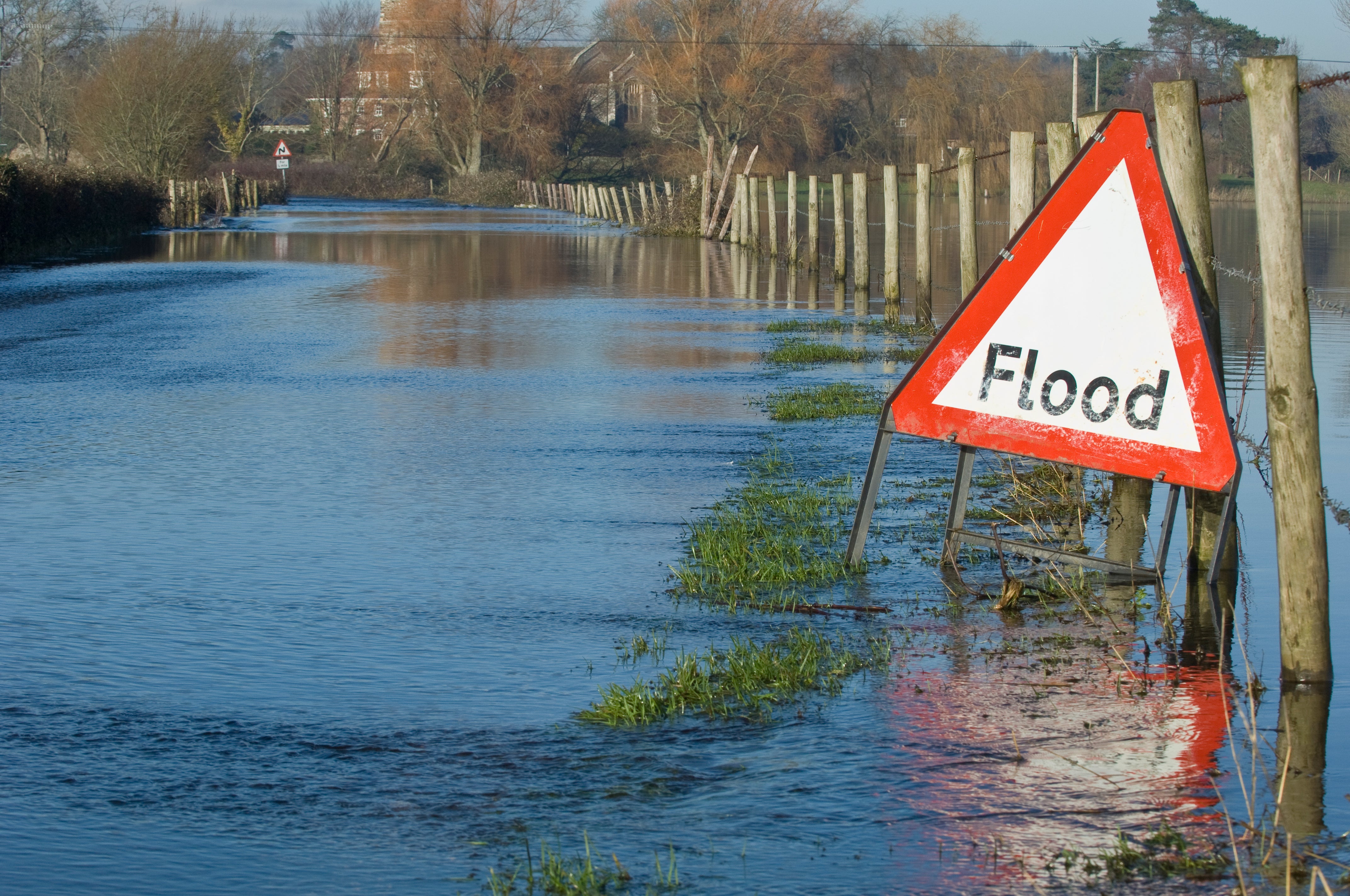
Torrential rain is set to hit the UK on Tuesday, the Met Office has warned, with flood alerts across large parts of the country.
Gusts of up to 35mph and milder-than-average temperatures are the result of a low pressure polar vortex to the west, causing a widespread band of rain to land on Tuesday.
But despite reports of an ‘Arctic blast’, current forecasts are predicting colder weather towards the end of the month to be more in line with seasonal averages.
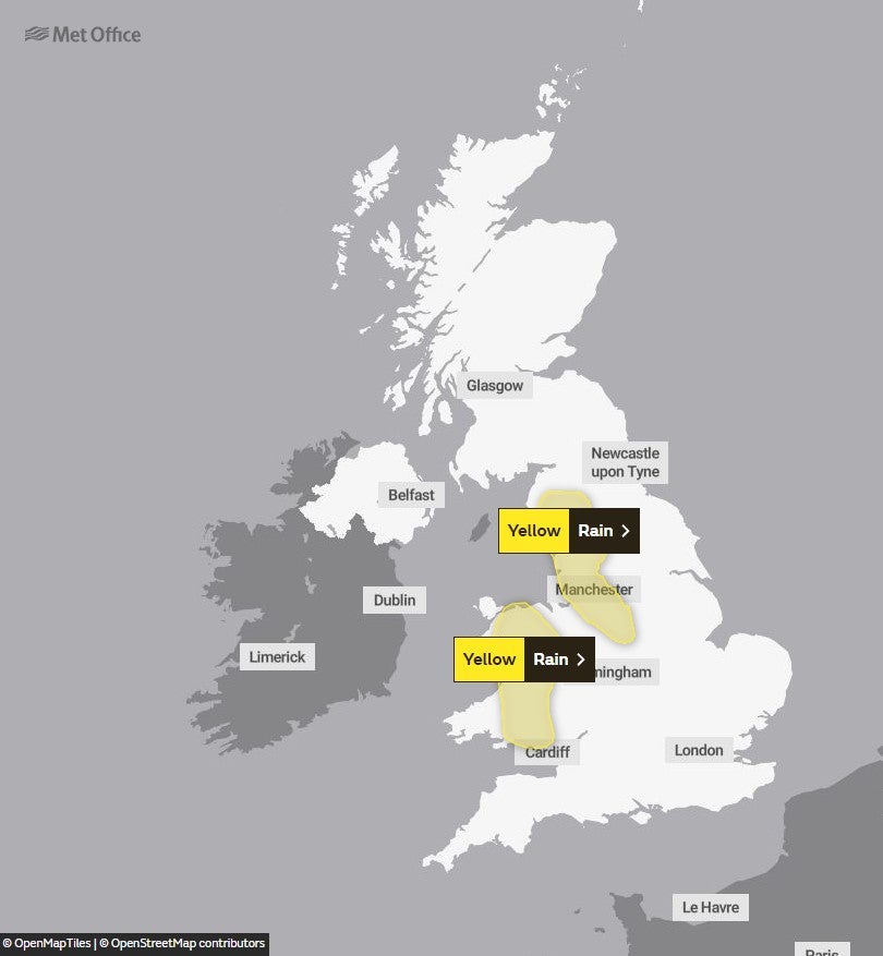
Weather warnings are due to come into effect at 6am on Tuesday, for the west of England and much of Wales, with threats of flooding and disruption expected.
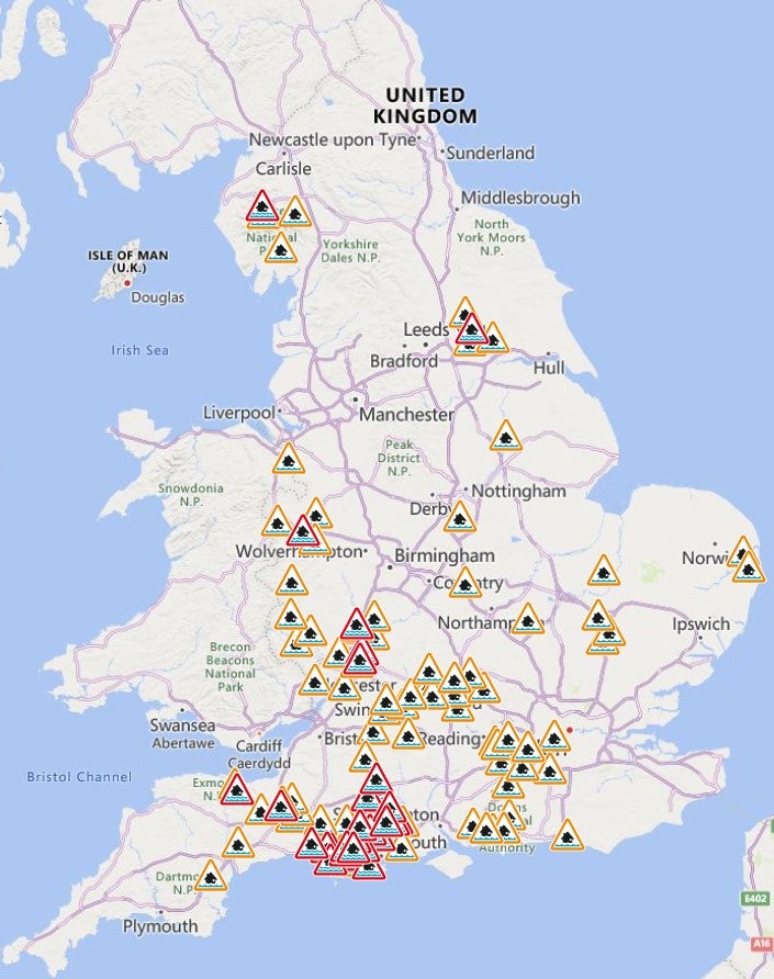
The Environment Agency has also issued 28 flood warnings for England, expecting “imminent” threats and there are a further 80 alerts for “possible” flooding across England.


People are urged to take appropriate action to protect property and life in the event of flooding.
Official Environment Agency guidance recommends people “move important items upstairs or to a safe place in your property...turn off gas, electricity and water supplies if it’s safe to do so” and “[use] property protection products such as flood barriers.”
The Met Office forecast has said: “Outbreaks of rain will spread across England and Wales during Tuesday. This will be heaviest and most persistent across parts of northwest England, particularly over higher ground.
“Rainfall totals of 60-80 mm could accumulate over parts of Cumbria”
Meteorologists have said January’s weather will be generally “unsettled” as a result of wider global conditions.
Rebekah Sherwin, deputy chief meteorologist from the Met Office, said: “The temperature drop in North America before the end of 2022 was the underlying cause of our wet and windy weather in the run-up to New Year.
“The conditions across the Atlantic served to strengthen the jet stream and help send low pressure systems and weather fronts towards the UK, resulting in the recent unsettled conditions.”
“Those incredibly low temperatures have now passed in North America and there will not be any direct impacts from that period of weather on the UK in terms of any potential snowfall events.”


MET OFFICE OUTLOOK
Monday
A mixture of sunny spells and showers, some of the showers heavy with the chance of hail and thunder, although drier in the south and east later. Strong westerly winds making it feel cold.
Monday night:
Showers fading apart from far north, then clear spells and a touch of frost in places, before increasing cloud and wind heralds rain spreading east into western and central parts.
Tuesday:
Windy and mostly cloudy with spells of rain, heaviest in the west. Some snow for the Scottish mountains during the morning. Becoming mild away from the far north.
Outlook for Wednesday to Friday:
Bright or sunny spells Wednesday with heavy showers and strong winds. Rain on Thursday clearing to blustery and heavy showers, mainly north, some sunny spells. Temperatures around normal.
Join our commenting forum
Join thought-provoking conversations, follow other Independent readers and see their replies
Comments