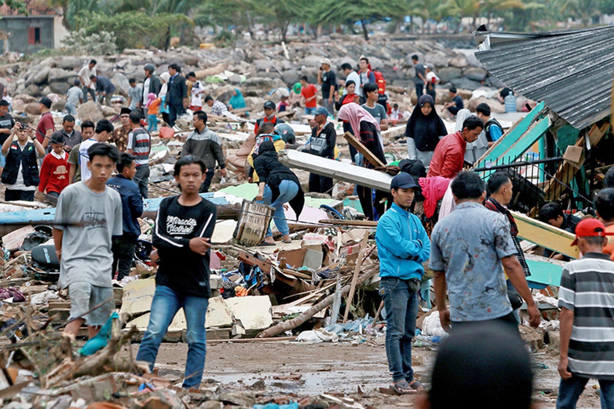
How did the deadly Indonesia tsunami creep past early warning systems?
The region has seen a concentration on earthquake detection to the detriment of tsunamis caused by landslides and volcanos

Your support helps us to tell the story
From reproductive rights to climate change to Big Tech, The Independent is on the ground when the story is developing. Whether it's investigating the financials of Elon Musk's pro-Trump PAC or producing our latest documentary, 'The A Word', which shines a light on the American women fighting for reproductive rights, we know how important it is to parse out the facts from the messaging.
At such a critical moment in US history, we need reporters on the ground. Your donation allows us to keep sending journalists to speak to both sides of the story.
The Independent is trusted by Americans across the entire political spectrum. And unlike many other quality news outlets, we choose not to lock Americans out of our reporting and analysis with paywalls. We believe quality journalism should be available to everyone, paid for by those who can afford it.
Your support makes all the difference.Just three months after the tsunami in Palu on the Indonesian island of Sulawesi, Indonesia has been hit by another tsunami, this time hitting the coastal areas on both sides of the Sunda Strait in Java and Sumatra. Hundreds have died and many more are missing and injured. The 14th anniversary of the 2004 Boxing Day tsunamis is only two days away, and we are left wondering what lessons may have been learned. Was there a warning system in place? Did it work? What should happen next?
This tsunami appears to have been generated by an eruption of Anak Krakatau, the “child” of Krakatau (sometimes known as Krakatoa), which sits in the Sunda Strait. Reports suggest that a nighttime eruption led to a section of the side or flank collapsing into the sea and triggering underwater landslides.
A landslide that starts on the flank of a volcano can produce a tsunami provided that the slide eventually enters the sea and continues as an underwater slide. Other landslides can simply start underneath the sea surface and move downslope. In both cases tsunamis are produced.
Earthquakes are the usual suspects for the cause of tsunamis in this part of the world. However, there were no recorded earthquakes in the region over the last few days, so the eruption of Anak Krakatau seems the most likely source.
As long as the eruption continues, there is a continued possibility of additional slope instability, underwater landslides and further tsunamis. These processes represent a real and continued threat to coastal communities living around the Sunda Strait.
The area is no stranger to tsunamis. One of the biggest to impact the area followed the eruption of Krakatoa in 1883 which killed 36,000 people. It is from the ashes of this volcano that Anak Krakatau has been building over the last 125 years. This is not unusual given the geography of the area – in the well-known Pacific “Ring of Fire”. It is an area characterised by low-lying coasts and key tourist beaches. It is heavily populated at this time of year and, therefore, the tsunami impact is all the more devastating.
Unfortunately, it simply isn’t possible to predict exactly when a tsunami may strike a coastal area. The position of the volcano in the Sunda Strait is very close to coastal villages and towns in Java and Sumatra so it is a huge challenge to provide prior warning in sufficient time ahead of waves approaching the coastline. In addition, there is no tsunami warning system linked to volcanic and landslide activity. The existing tsunami warning system is solely linked to events caused by earthquakes.
The Indonesian authorities and BMKG, an agency responsible for meteorology, climate and geophysics, have been unfairly criticised for this latest disaster.
Local tide gauges in the Sunda Strait did record the tsunami. However, it is very difficult to give any advance notice of a tsunami caused by underwater landslides. There may have been 30-40 minutes between the onset of the tsunami and its arrival at the coast, but it takes time for the gauges to register, and an element of chance in how quickly the recordings are seen and acted upon.
There has been a concentration on earthquake detection in this region to the detriment of underwater landslide and volcanic-induced events. What is clear is that a concerted effort must be made to try and provide a warning system that spans all the potential causes. This, combined with a good education programme, would empower communities to be aware of the risks. That must be the way forward.
We must also remember not to use the term "natural" disaster to describe these events. They are natural hazards. We cannot prevent them, but they only become a disaster due to the combination of their scale and the relative preparedness of coastal communities. The affected nation states and governments must ensure they have at their disposal the required interventions and expertise needed to overcome their unfortunate geographical location.
Dr Sue Dawson is a reader in physical geography at the University of Dundee
Join our commenting forum
Join thought-provoking conversations, follow other Independent readers and see their replies
Comments