Your support helps us to tell the story
From reproductive rights to climate change to Big Tech, The Independent is on the ground when the story is developing. Whether it's investigating the financials of Elon Musk's pro-Trump PAC or producing our latest documentary, 'The A Word', which shines a light on the American women fighting for reproductive rights, we know how important it is to parse out the facts from the messaging.
At such a critical moment in US history, we need reporters on the ground. Your donation allows us to keep sending journalists to speak to both sides of the story.
The Independent is trusted by Americans across the entire political spectrum. And unlike many other quality news outlets, we choose not to lock Americans out of our reporting and analysis with paywalls. We believe quality journalism should be available to everyone, paid for by those who can afford it.
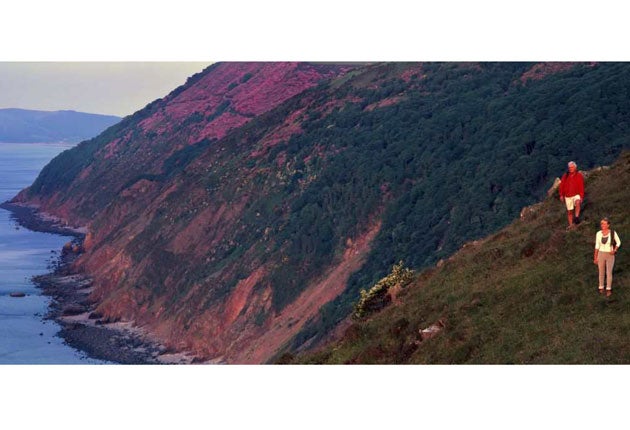
Your support makes all the difference.This year promises to be a good one for walkers. The Marine Bill, introduced to the Commons in December, gave the green light to the ambitious plan to map a coastal access corridor around the whole of England, allowing preparatory work on the 2,700-mile scheme to begin in 2009. But while hikers wait, many new paths and initiatives are opening up.
The revival of the long-distance path is a re-emerging trend, after several walking groups felt it had come under pressure from the demand for shorter walking breaks. According to the Long Distance Walkers Association, the number of long-distance trails is increasing; its routes are up from 150 in the early 1970s to close to 900.
Three of the long-distance paths scheduled for opening in 2009 catch the eye. For the first time, hikers will be able to walk entirely round the shoreline of Kielder Water, after the route is completed in March ( www.visitnortheastengland.com / www.walkingmicrosite/home).
In Wales, Wat's Dyke Path ( www.watsdykeway.org) is a 60-mile route that links Llanymyench (Powys-Shropshire border) to Basingwerk Abbey (River Dee Estuary, Flintshire). It follows a fifth-century earthwork that predates the better-known Offa's Dyke by several centuries.
And the London Outer Orbital Path (Loop), "the M25 for walkers", is being copied by other towns and cities, such as the 28-mile Stevenage Outer Orbital Path, Stoop ( www.nhrg.org.uk).
This year will also see the expansion of the Walkers Are Welcome project ( www.walkersarewelcome.org.uk), in which towns encourage hikers by providing waymarked paths with clear routes leading into and out of towns; widely available walking leaflets; and walking festivals. Twelve towns have signed up, with another 13 looking to join in 2009, including Great Malvern.
Meanwhile, the National Trust ( www.nationaltrust.org.uk /walks) has just added four more walks to its website, which now boasts more than 130 routes, including a seven-mile walk around Malham Tarn in the Yorkshire Dales.
Tourism authorities in Somerset have launched a range of car-free itineraries that enable visitors to travel by bus, bicycle, train – including steam trains – and on foot (www.visitsomer set.co.uk). There are seven itineraries, ranging from routes that explore the county's legends and associations with King Arthur, its coastline, fossil hunting by the seaside, and the hinterland of the Somerset Levels. The routes are outlined in detail, providing bus numbers, links to timetables and suggestions for places to hire bicycles, as well as costs, and websites of attractions along the way.
A series of 15 short walks, Walks on Wheels, has been launched for people with limited mobility, power scooters or who are pushing a buggy, and who wish to explore the Cotswolds. The walks, which make clear where paths can be problematic, can be downloaded from the Cotswolds' Area of Outstanding Natural Beauty site ( www.cotswoldsaonb.com).
The National Forest is to launch a revised and updated walks pack ( www.nationalforest.org/visit/walks). And a new pack of rail trails has been published by Kent & East Sussex Railway. Six walks, based round the steam railway's rural branch line, take in Bodiam Castle and Great Dixter House and Gardens. The trails can be ordered free ( www.kesr.org.uk).
Walks from train stations are proving popular, and Felixstowe tourist information centre has just issued a new walking guide to exploring Suffolk's estuarine and coastal scenery, including the rivers Deben and Orwell and the coastal nature reserve at Landguard Point. A leaflet can be ordered from the centre (01394 276770).
And if you plan to hike up Ben Nevis this year, you'll notice a change in the scenery. The John Muir Trust, which owns the mountain, has removed 120 "unsightly" cairns from the summit as part of a clean-up to preserve the mountain's sense of wilderness.
Walks competition
The Whole of Britain, however remote, is covered by Ordnance Survey Explorer maps, which are specially designed for outdoors activities. For your chance to win OS Explorer maps to cover all Britain's national parks enter online at: www.outdoorsshowextra.co.uk/comp1

Join our commenting forum
Join thought-provoking conversations, follow other Independent readers and see their replies
Comments