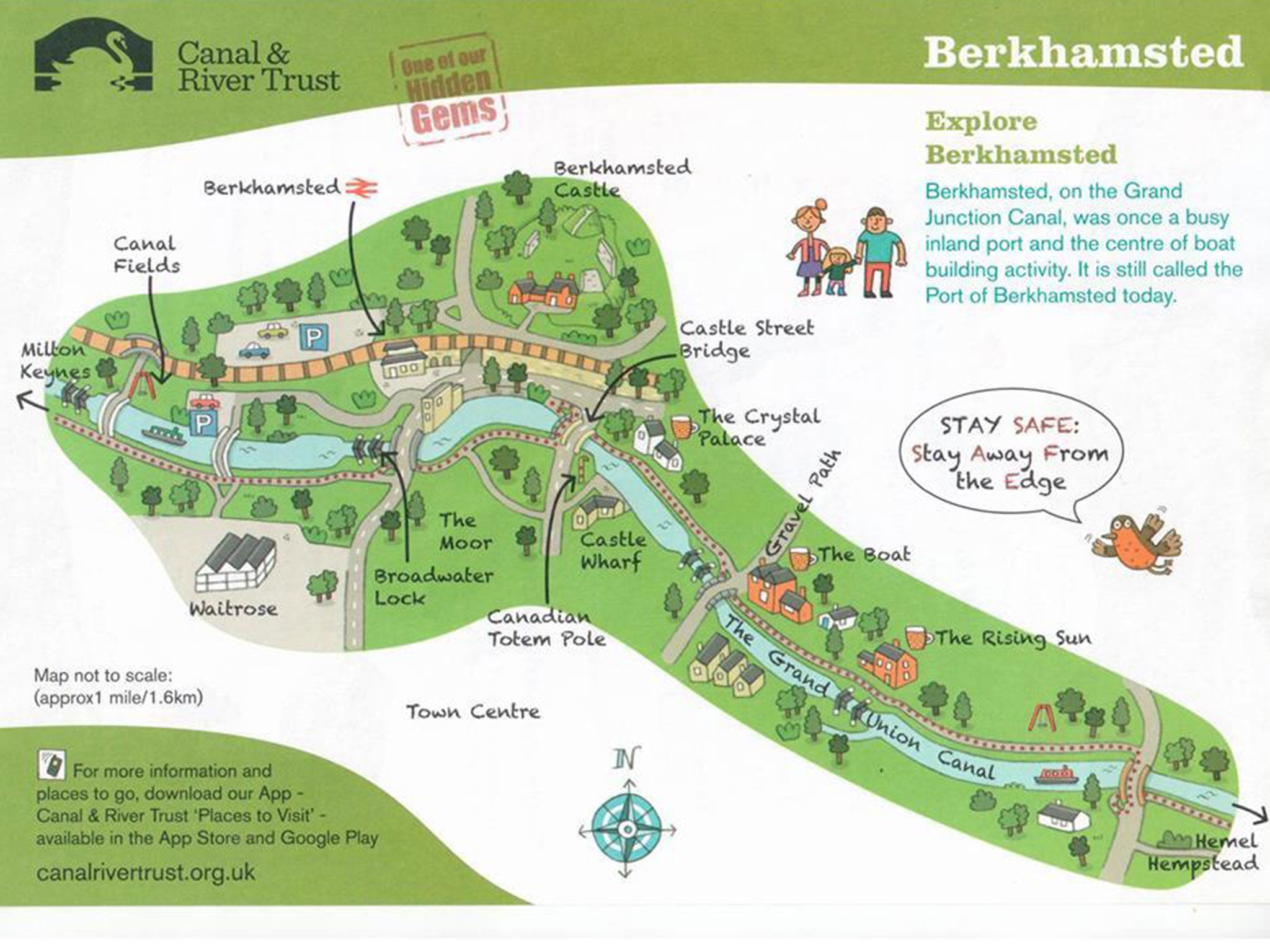
Penis-shaped map of Berkhamsted goes viral and accidentally boosts family-friendly Canal and River Trust's campaign
"Obviously we’re not going to be setting out to make any maps we produce in future to look phallic," the charity behind the map said

Your support helps us to tell the story
From reproductive rights to climate change to Big Tech, The Independent is on the ground when the story is developing. Whether it's investigating the financials of Elon Musk's pro-Trump PAC or producing our latest documentary, 'The A Word', which shines a light on the American women fighting for reproductive rights, we know how important it is to parse out the facts from the messaging.
At such a critical moment in US history, we need reporters on the ground. Your donation allows us to keep sending journalists to speak to both sides of the story.
The Independent is trusted by Americans across the entire political spectrum. And unlike many other quality news outlets, we choose not to lock Americans out of our reporting and analysis with paywalls. We believe quality journalism should be available to everyone, paid for by those who can afford it.
Your support makes all the difference.What should have been a perfectly innocent map of an historic town in Hertfordshire has caused a fair few giggles across social media, after a Facebook user pointed out the diagram resembled an enormous phallus.
The friendly-looking cartoon style map was commissioned as part of the '100 Places to Visit' campaign by the Canal and River Trust, which looks after the waterways of England and Wales.
Depicting the area of the town which runs alongside The Grand Union Canal, the map features Berkahmsted Castle, a Canadian Totem Pole and a number of waterfront pubs.
But the town's arrangement meant the map was drawn in the shape of male genitalia - as pointed out by Facebook fans of the Haresfoot Brewery which features on the diagram.
While the owners of the Brewery praised the map as a “great graphic”, a Facebook user quipped: “It looks like a willy tee hee!!”
Responding to the unexpectedly successful map campaign, a spokesman from the Canal River Trust told The Independent: “It’s been overwhelming positive, everyone has seen it as a bit of fun. If people see the map and want to find out a bit more canals and Berkhamsted, or pay them a visit then that’s great."
Explaining why the map resembled a penis, the spokesman added: “It’s a bit in the nature of canals, they are long, straight things, and when you draw a map it tends to be that sort of shape.
“The reaction has been a bit of fun, but obviously we’re not going to be setting out to make any maps we produce in future to look phallic," he added.
Join our commenting forum
Join thought-provoking conversations, follow other Independent readers and see their replies
Comments