Game of Thrones' Westeros remade in Google Maps by Reddit user
Map features roads and realistic topographical features
The opening credits to Game of Thrones might be stunning and grand. But they’re also a little antiquated.
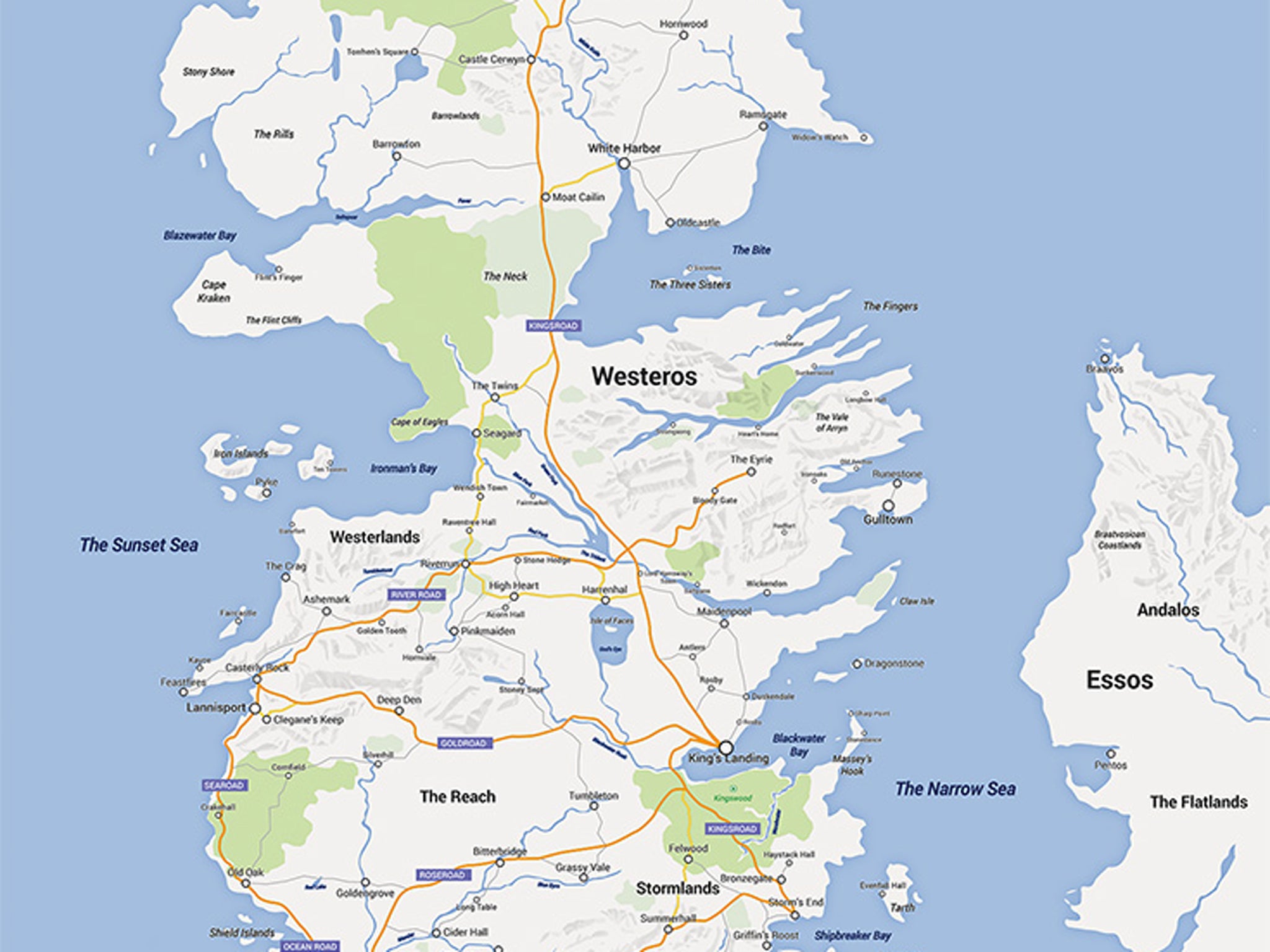
In response, one Redditor has re-drawn the entire map of the fictional Westeros continent in Game of Thrones in the style of Google Maps.
The drawing features the all-important roads — you can follow the Starks’ journey from Winterfell to King’s Landing — as well as realistic topographical features and depictions of the sea.
A high-quality version of the map was available on Etsy, but seems to have been taken down. It’s not clear whether that was because demand was so high or for another reason.
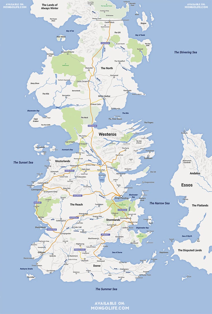
Redditor Selvag uploaded the map to Reddit, saying that he had made 99 per cent of it in Adobe’s Illustrator drawing program and then touched it up in Photoshop. Selvag appears to be a graphic designer and has other items for sale on his Etsy store.
Join our commenting forum
Join thought-provoking conversations, follow other Independent readers and see their replies
Comments
Bookmark popover
Removed from bookmarks