Vast lakes of water under surface of Mars could sustain life, scientists say
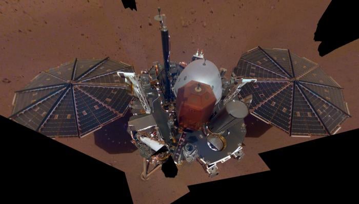
Researchers analysing data from Nasa’s InSight lander noticed that tiny cracks and pores in rocks in the middle of the Martian crust
Your support helps us to tell the story
From reproductive rights to climate change to Big Tech, The Independent is on the ground when the story is developing. Whether it's investigating the financials of Elon Musk's pro-Trump PAC or producing our latest documentary, 'The A Word', which shines a light on the American women fighting for reproductive rights, we know how important it is to parse out the facts from the messaging.
At such a critical moment in US history, we need reporters on the ground. Your donation allows us to keep sending journalists to speak to both sides of the story.
The Independent is trusted by Americans across the entire political spectrum. And unlike many other quality news outlets, we choose not to lock Americans out of our reporting and analysis with paywalls. We believe quality journalism should be available to everyone, paid for by those who can afford it.
Your support makes all the difference.Groundbreaking new evidence points to the likely presence of vast lakes of liquid water under the Martian surface that could potentially sustain life on the planet, scientists say.
The evidence is presented in a study published in the journal PNAS on Monday. It indicates that there’s enough water in underground reservoirs on Mars to create oceans on the Red Planet’s surface.
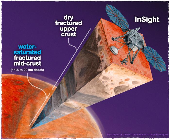
Researchers analysing data from Nasa’s InSight lander noticed that tiny cracks and pores in rocks in the middle of the Martian crust, 11 to 20km below the surface, could store liquid water.
The finding may help researchers understand the climate history of Mars and determine the potential areas of the planet to look for alien life.
Scientists say the volume of the underground water could cover the entire planet to a depth of 1-2km.
This water may not be available as an energy source for a future Mars colony, however, since drilling about a kilometre deep to extract water is impossible even on Earth with the technology currently available.
But researchers say the underground reservoirs could be a promising place to look for life on Mars if they can be accessed.
“It’s certainly true on Earth – deep, deep mines host life, the bottom of the ocean hosts life. We haven’t found any evidence for life on Mars, but at least we have identified a place that should, in principle, be able to sustain life,” Michael Manga, a co-author of the study from UC Berkeley, said.
In the new study, researchers used InSight lander data to simulate the physics of rocks on Mars similar to the way models are used on Earth to map underground aquifers and oil fields.
They found that the seismic data gathered from Insight is best explained by a deep layer of fractured igneous rocks that are saturated with liquid water.
“Establishing that there is a big reservoir of liquid water provides some window into what the climate was like or could be like,” Dr Manga said.
“And water is necessary for life as we know it. I don’t see why [the underground reservoir] is not a habitable environment.”
A growing body of research suggests that fossil river channels, deltas and lake deposits, as well as eroded rocks found on Mars are signs that liquid water once flowed on the planet’s surface.
This wet period on Mars ended over three billion years ago when the planet lost its atmosphere and it remains a mystery what happened to all the water that likely once existed.
The latest study indicates that this water may not have entirely escaped into space and could have filtered down into the Martian crust.
Join our commenting forum
Join thought-provoking conversations, follow other Independent readers and see their replies
Comments