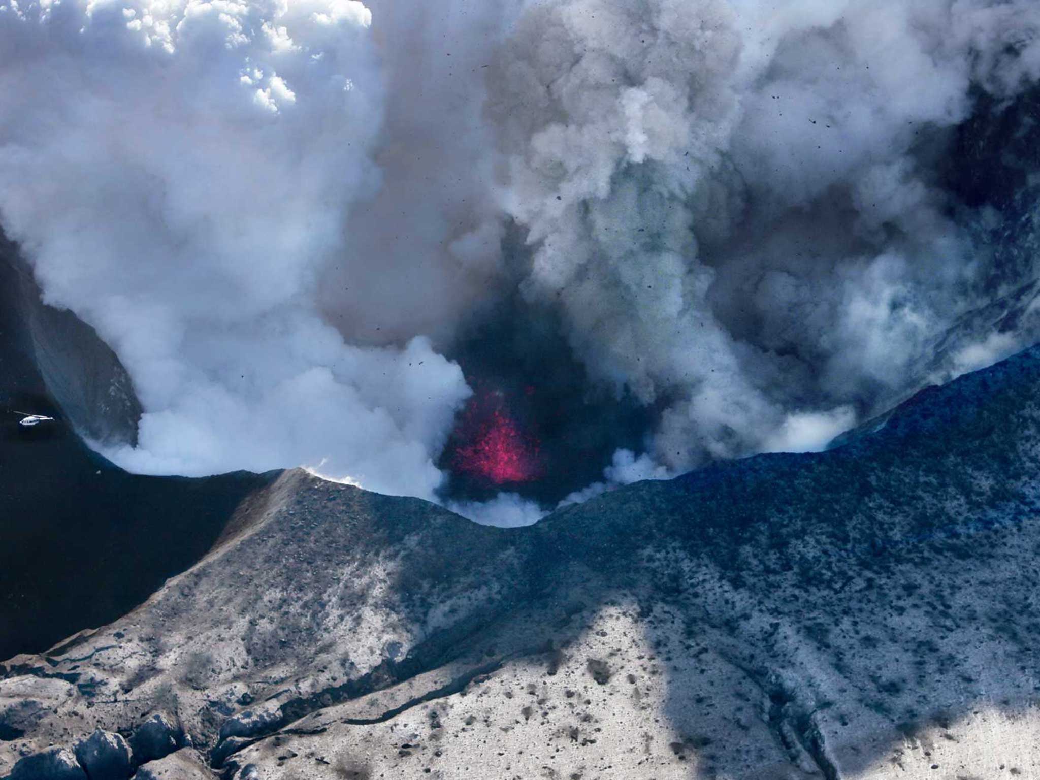
Iceland volcano: Area near Bardarbunga evacuated

Your support helps us to tell the story
From reproductive rights to climate change to Big Tech, The Independent is on the ground when the story is developing. Whether it's investigating the financials of Elon Musk's pro-Trump PAC or producing our latest documentary, 'The A Word', which shines a light on the American women fighting for reproductive rights, we know how important it is to parse out the facts from the messaging.
At such a critical moment in US history, we need reporters on the ground. Your donation allows us to keep sending journalists to speak to both sides of the story.
The Independent is trusted by Americans across the entire political spectrum. And unlike many other quality news outlets, we choose not to lock Americans out of our reporting and analysis with paywalls. We believe quality journalism should be available to everyone, paid for by those who can afford it.
Your support makes all the difference.Iceland is to evacuate an area north of the Bardarbunga volcano.
The country's civil protection agency said the possibility of an eruption "cannot be ruled out".
The move came after authorities warned airlines about increased seismic activity at Iceland's largest volcanic system. Ash from the eruption of Iceland's Eyjafjallajokull volcano in 2010 shut down much of Europe's airspace for six days.
“This decision is a safety measure,” the agency said on its website late on Tuesday. “It cannot be ruled out that the seismic activity in Bardarbunga could lead to a volcanic eruption.”
All roads leading into the mostly uninhabited area were closed earlier in the week. Park rangers who live there during the summer and tourists are now being evacuated.
Authorities say the area north of the glacier risks being hit by floods as an eruption in the volcano, which is under the ice cap of the Vatnajokull glacier in southeast Iceland, would melt vast amounts of ice.
Einar Einarsson, a meteorologist at Iceland's Met Office, said earthquakes were happening practically every minute and seismic activity was constant.
“The fact that it is constant in motion and depth is probably good news,” he said. “It doesn't seem to vary a lot - it is concentrated in one area under the glacier.”
The Icelandic Met Office on Monday raised its risk level to the aviation industry for an eruption to orange, which is the fourth level on a five-grade scale, after confirming magma movements less than 10 km (6 miles) from the surface.
The Vatnajokull National Park is more than 300 km from the capital Reykjavik and covers 14 percent of Iceland.
The 2010 eruption at Eyjafjallajokull, a little over 100 km from the capital, affected more than 10 million air travellers and cost $1.7 billion.
Reuters
Join our commenting forum
Join thought-provoking conversations, follow other Independent readers and see their replies
Comments