Mapped: Iceland earthquake locations revealed as volcano eruption alert issued
Series of earthquakes have hit tourist hotspots prompting the closure of Blue Lagoon geothermic baths
Your support helps us to tell the story
From reproductive rights to climate change to Big Tech, The Independent is on the ground when the story is developing. Whether it's investigating the financials of Elon Musk's pro-Trump PAC or producing our latest documentary, 'The A Word', which shines a light on the American women fighting for reproductive rights, we know how important it is to parse out the facts from the messaging.
At such a critical moment in US history, we need reporters on the ground. Your donation allows us to keep sending journalists to speak to both sides of the story.
The Independent is trusted by Americans across the entire political spectrum. And unlike many other quality news outlets, we choose not to lock Americans out of our reporting and analysis with paywalls. We believe quality journalism should be available to everyone, paid for by those who can afford it.
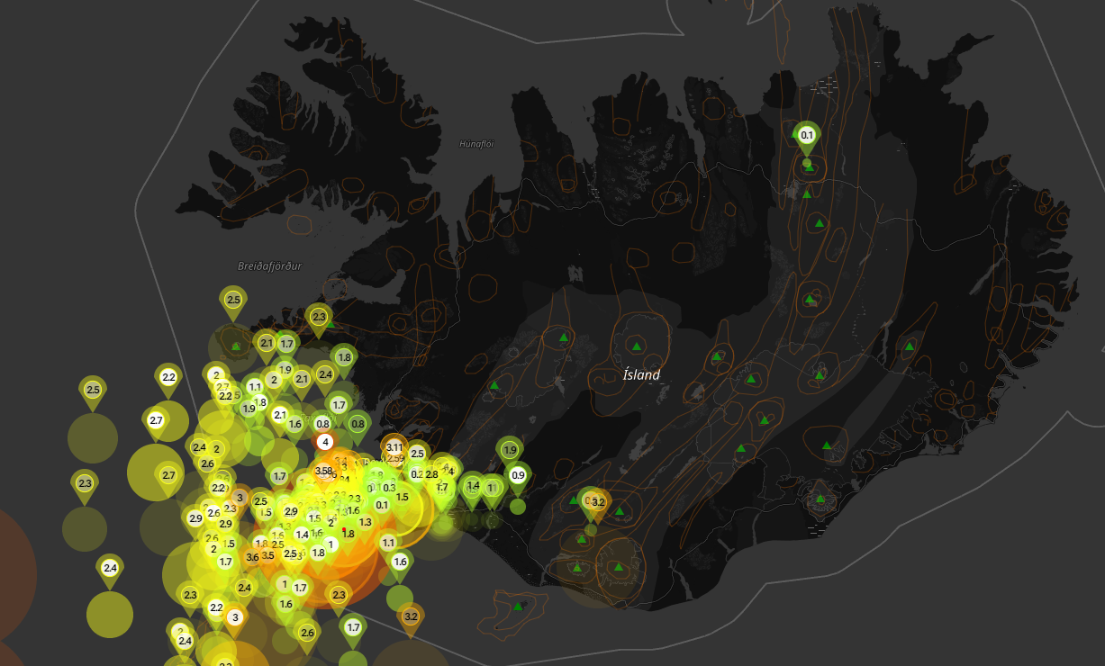
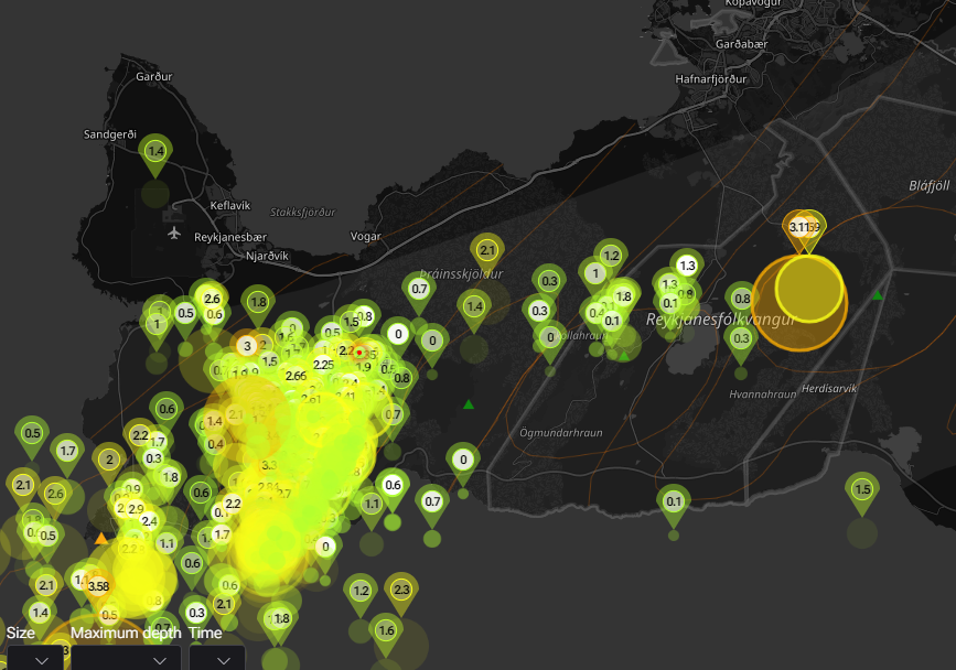
Your support makes all the difference.Iceland is experiencing a seismic swarm as 2800 earthquakes have hit the country in just 48 hours prompting fears of a volcanic eruption.
Most tremours have been felt in the Reykjanes peninsula in the southwest of the country where small earthquakes have been felt every day for more than two weeks due to a build-up of volcanic magma three miles underground.
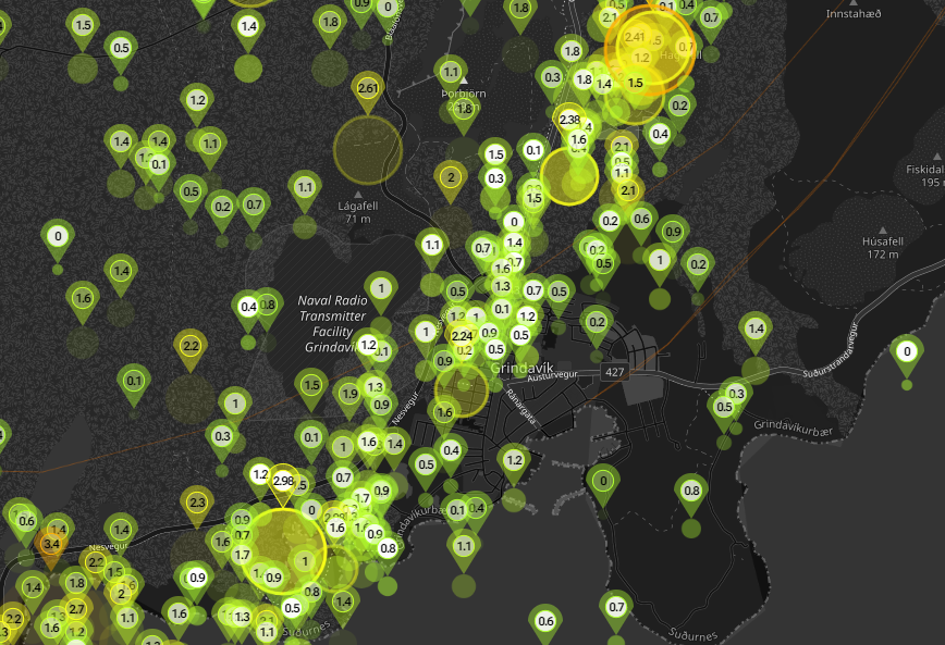
Thousands have been told to evacuate the town of Grindavik as a precautionary measure as a magma tunnel stretches below the surface.
The UK foreign office has updated its travel advice, warning that a volcanic eruption is increasingly likely.
Its official warning reads: “Earthquakes and indications of volcanic activity have increased above normal levels on the Reykjanes peninsula, southwest of Reykjavik.

“The Icelandic authorities continue to monitor the area closely, particularly the area northwest of Mt Thorbjörn near the Svartsengi power plant and the Blue Lagoon. On 10 November, a Civil Protection Alert was declared after an intense swarm of earthquakes.
“The town of Grindavík was evacuated as a precaution. Some roads have been closed and visitors are advised to stay away from the area.

“Keflavik International Airport is operating as normal. While there is no current eruption, it is increasingly possible that one could occur.
“You should monitor local media for updates and follow the authorities’ advice on travel to the area.”

But it stopped short of advising against travel to the country, where flights from the UK are still running.
Airlines and holiday companies are operating trips as normal, which means passengers have no automatic right to cancel their plans.
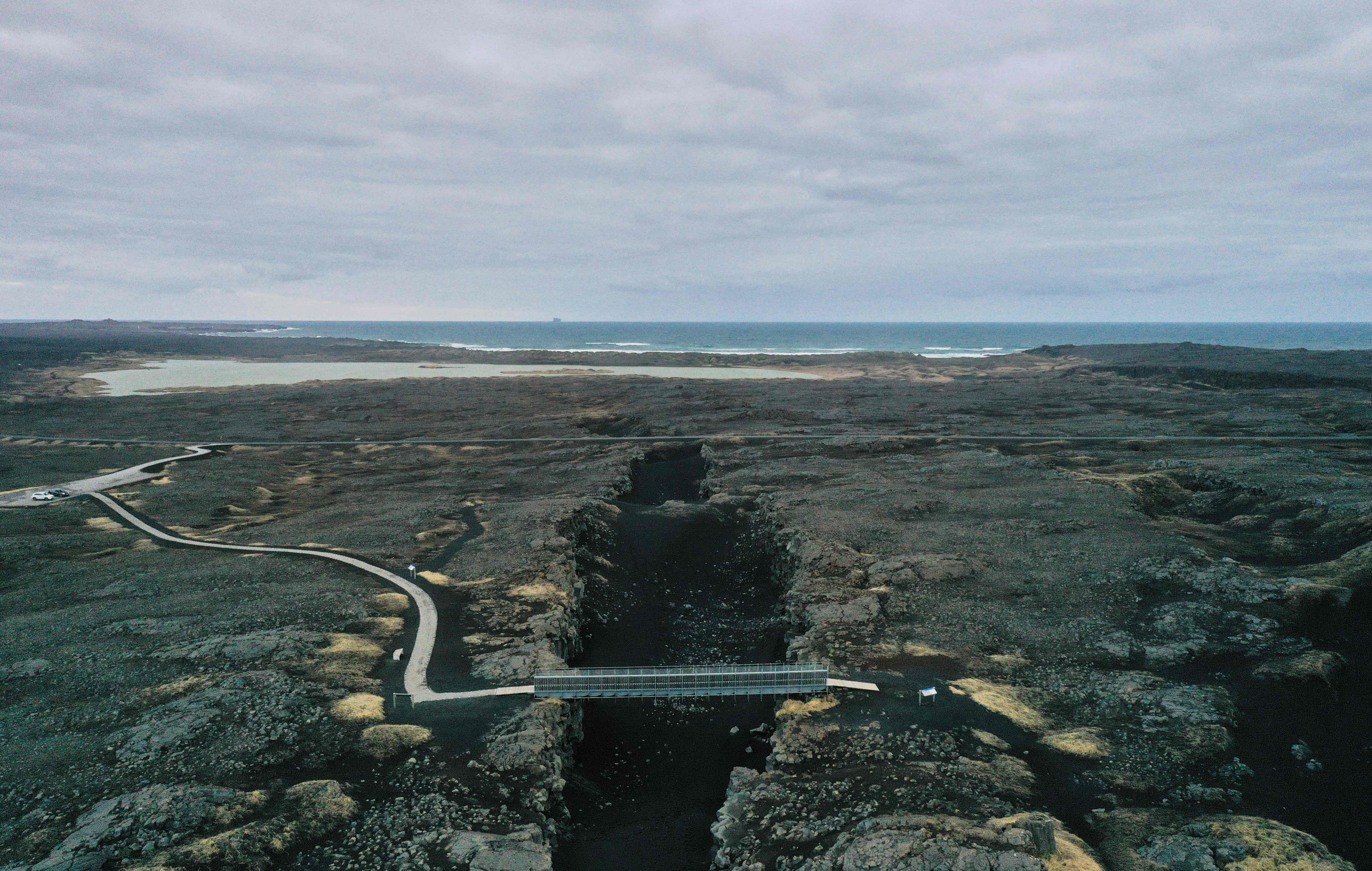
Iceland is highly susceptible to natural disasters as it lies on the Mid-Atlantic Ridge – a divergent plate boundary where the North American Plate and the Eurasian Plate are moving away from each other, leading to volcanic eruptions and earthquakes.

Experts are still unclear on the size of the growing volcanic threat.
Dr Evgenia Ilyinskaya, an associate professor at the school of earth and environment at the University of Leeds, shared on X, formerly Twitter: “Still much uncertainty about what the scientific data are telling us about the magma intrusion under #Grindavik but the general consensus is that the intrusion is larger than has been seen in recent eruptions.”

Join our commenting forum
Join thought-provoking conversations, follow other Independent readers and see their replies
Comments