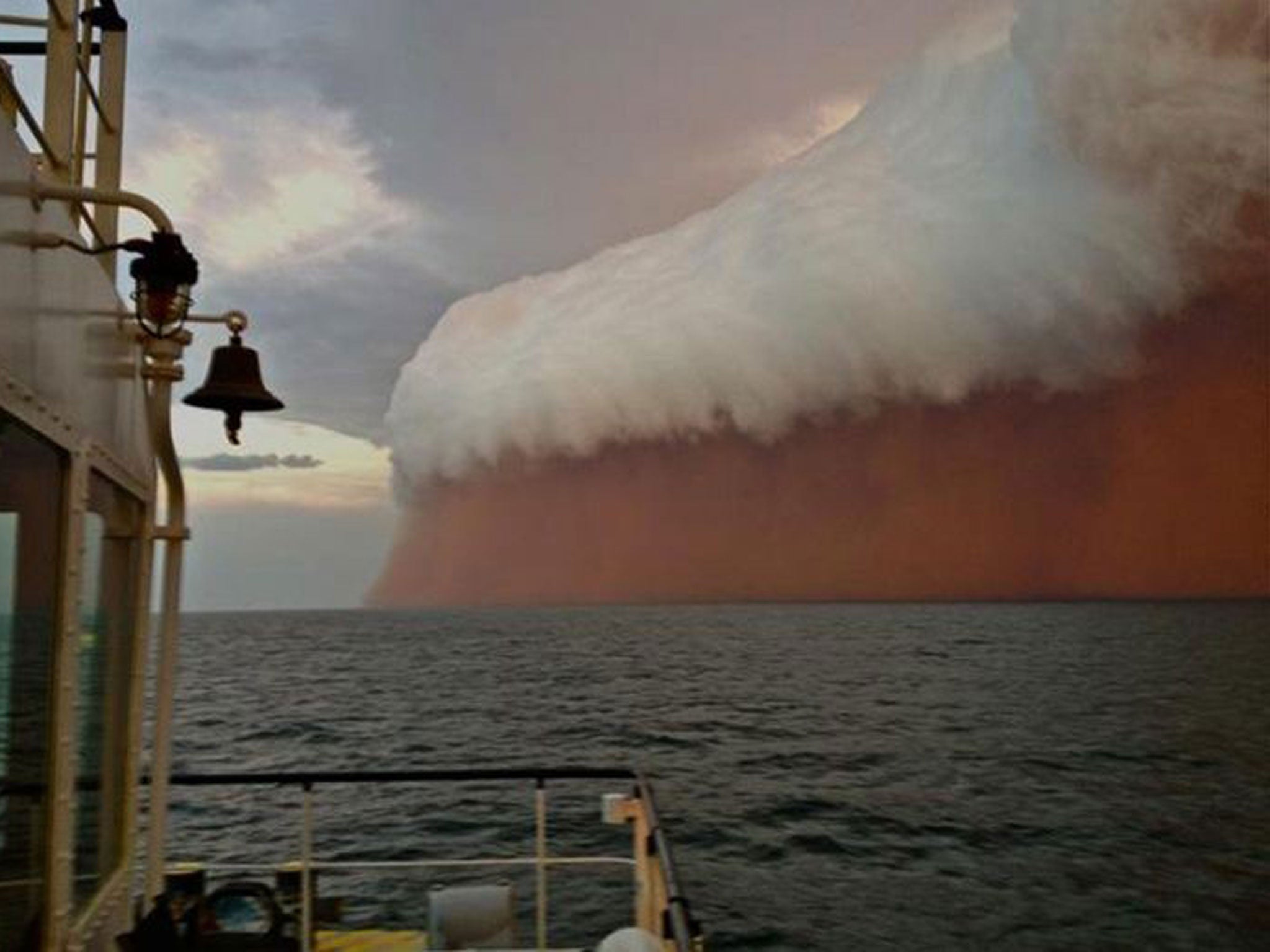
Sand ahoy, captain! Vast dust storm hits Western Australia ahead of cyclone
Images posted by Perth Weather Live showed a towering red dust storm over the ocean ahead of the cyclone

Your support helps us to tell the story
From reproductive rights to climate change to Big Tech, The Independent is on the ground when the story is developing. Whether it's investigating the financials of Elon Musk's pro-Trump PAC or producing our latest documentary, 'The A Word', which shines a light on the American women fighting for reproductive rights, we know how important it is to parse out the facts from the messaging.
At such a critical moment in US history, we need reporters on the ground. Your donation allows us to keep sending journalists to speak to both sides of the story.
The Independent is trusted by Americans across the entire political spectrum. And unlike many other quality news outlets, we choose not to lock Americans out of our reporting and analysis with paywalls. We believe quality journalism should be available to everyone, paid for by those who can afford it.
Your support makes all the difference.With wildfires burning across southeastern Australian, and the northwest of the country bracing for Tropical Cyclone Narelle, the Aussies probably have enough to deal with without a monster red dust storm.
Remarkable images of just such a wall of dust have emerged showing an enormous wall of sand bearing down on ships 25 nautical miles from the coast of Australia.
Images posted by Perth Weather Live showed a towering red dust storm over the ocean ahead of the tropical cyclone.
Tugboat worker Brett Martin was working west of False Island when the storm passed over.
"We were steaming along in the boat just before sunset and the storm was casually building in the distance, then it got faster and faster and it went from glass to about 40 knots in two minutes," he told the West Australian newspaper.
"It was like a big dust storm under a thunderhead, there was a lot of lightning but not a lot of rain."
The storm hit northwest Australia and headed out into the India ocean at sunset on Wednesday evening.
The bright red colour in the storm is unrelated to the massive bush fires in Australia this week.
Red dust and iron ore which covers the Pilbara region is believed to have given the storm its vivid colour.
A dust storm of this magnitude is known as a "haboob", deriving from the Arabic word habb, meaning “wind” or "blow".
They form when air is pushed down and forward by the front of a traveling thunderstorm cell, it drags with it dust and debris.
Winds of 60 mph can stir up dust and sand and create a blowing wall as high as 10,000 feet.
Join our commenting forum
Join thought-provoking conversations, follow other Independent readers and see their replies
0Comments