Super Typhoon Vongfong: This is what it looks like from space
'I’ve seen many from here, but none like this,' astronaut said
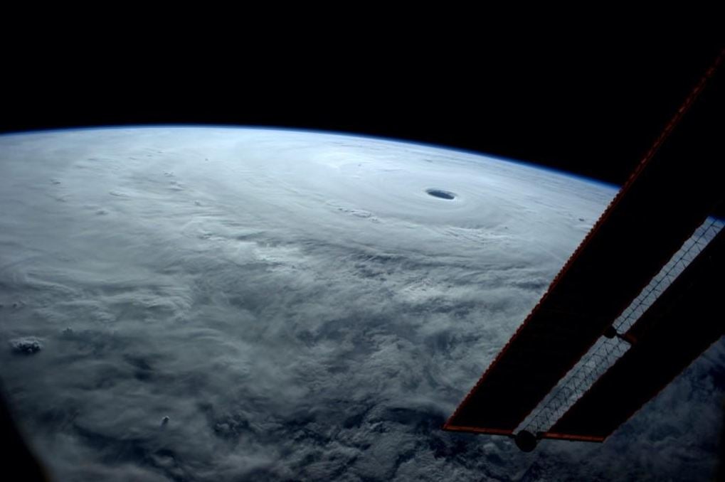
A storm is brewing over the western Pacific Ocean equivalent to a Category 5 hurricane, and from space it looks pretty formidable.
Nasa astronaut Reid Wiseman posted a photo of it taken from the International Space Station, seeing the cyclone blanketing the Earth as far as the eye can see.
"I’ve seen many from here, but none like this," he wrote of the storm on Twitter, which is the biggest of the year.
It is in fact slowly winding down, but could still cause considerable damage when it hits Japan's southern island Okinawa over the weekend.

The typhoon follows in the path of Phanfone, which killed nine people earlier in the week, and is the strongest storm since Hurricane Haiyan, which devastated the Philippines last year.
"There is no question that (Vongfong) is an extremely large, extremely powerful typhoon," Japan's Meteorological Agency told Reuters.
"It's the strongest storm we've had this year, definitely, although it has lost some strength from its peak."
Join our commenting forum
Join thought-provoking conversations, follow other Independent readers and see their replies
Comments