Huge 7.3 earthquake strikes the Philippines
Quake measured at a depth of 617 km, according to the US Geological Survey

Your support helps us to tell the story
From reproductive rights to climate change to Big Tech, The Independent is on the ground when the story is developing. Whether it's investigating the financials of Elon Musk's pro-Trump PAC or producing our latest documentary, 'The A Word', which shines a light on the American women fighting for reproductive rights, we know how important it is to parse out the facts from the messaging.
At such a critical moment in US history, we need reporters on the ground. Your donation allows us to keep sending journalists to speak to both sides of the story.
The Independent is trusted by Americans across the entire political spectrum. And unlike many other quality news outlets, we choose not to lock Americans out of our reporting and analysis with paywalls. We believe quality journalism should be available to everyone, paid for by those who can afford it.
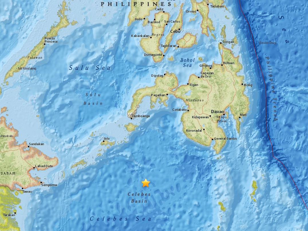
Your support makes all the difference.A major undersea earthquake with a magnitude of 7.3 struck southeast of the Philippines on Tuesday, the US Geological Survey (USGS) said.
The quake was measured at a depth of 617 km (380 miles), the USGS said.
It struck in the Celebes Sea and comes five days after a smaller, 4.7-magnitude tremor in the same area, according to the USGS.
Journalist Barnaby Lo said he felt "no significant tremor" on the island of Jolo, which lies north-east of the epicentre.
The US Tsunami Warning Centre has issued no warning, advisory, watch or threat after the quake.
Philippine seismologists said the earthquake was far too deep to cause any damage and casualties or generate a tsunami.
Renato Solidum of the Philippine Institute of Volcanology and Seismology told AP that the quake, which was set off by movement of oceanic plates 625 kilometers (387 miles) under the seabed, was slightly felt in southern General Santos city.
Solidum said the undersea quake was centered 223 kilometers (138 miles) southeast of Sulu province and aftershocks were possible.
The Philippine archipelago lies in the Pacific “Ring of Fire,” where earthquakes and volcanic activities are common. A magnitude 7.7 quake killed nearly 2,000 people on the northern island of Luzon in 1990.
Reuters/AP
Join our commenting forum
Join thought-provoking conversations, follow other Independent readers and see their replies
Comments