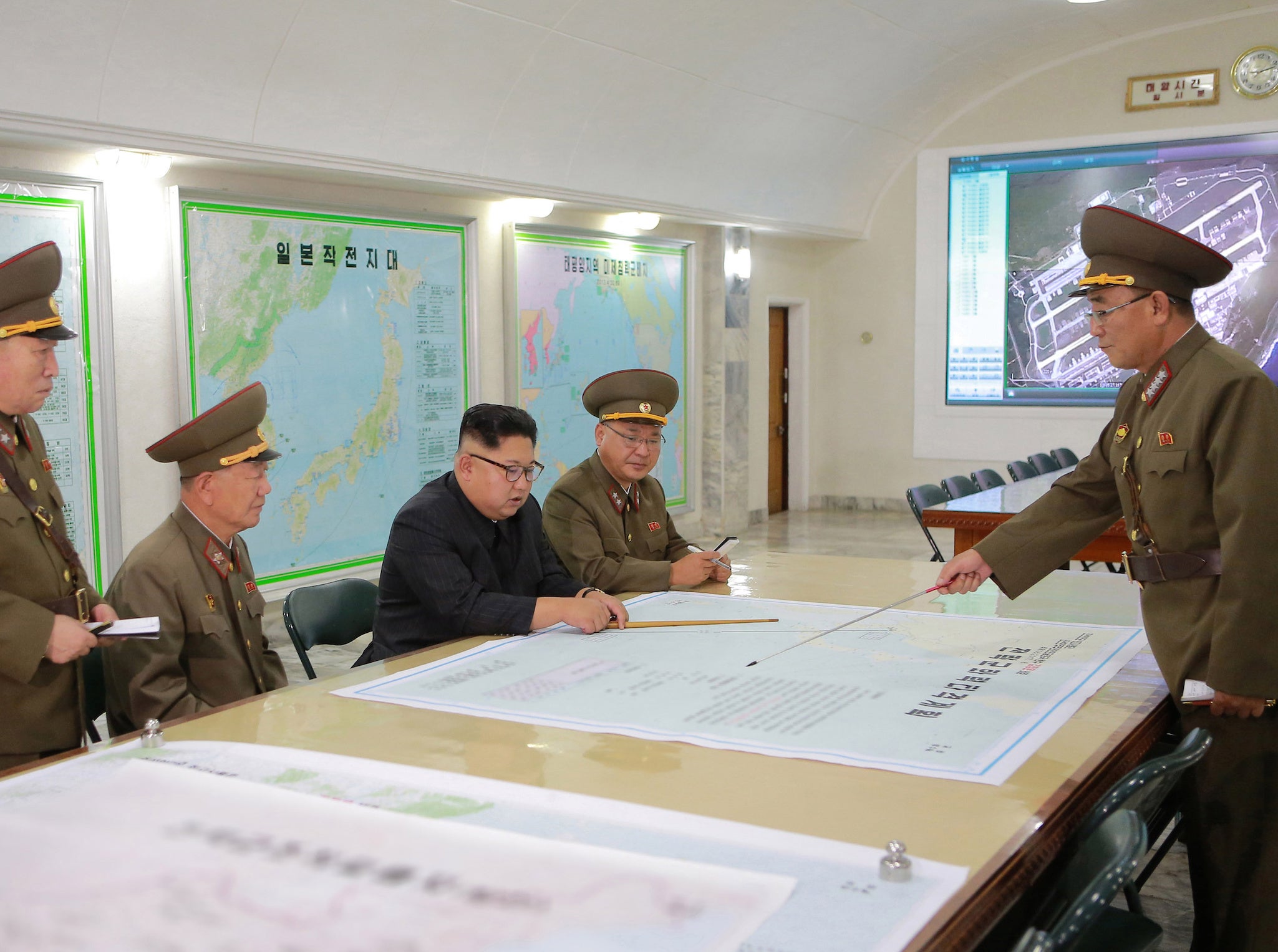
North Korea nuclear crisis: Kim Jong-un 'using old Google Earth photos to pinpoint targets'
Propaganda images released by regime appear to show leader studying maps from at least six years ago

Your support helps us to tell the story
From reproductive rights to climate change to Big Tech, The Independent is on the ground when the story is developing. Whether it's investigating the financials of Elon Musk's pro-Trump PAC or producing our latest documentary, 'The A Word', which shines a light on the American women fighting for reproductive rights, we know how important it is to parse out the facts from the messaging.
At such a critical moment in US history, we need reporters on the ground. Your donation allows us to keep sending journalists to speak to both sides of the story.
The Independent is trusted by Americans across the entire political spectrum. And unlike many other quality news outlets, we choose not to lock Americans out of our reporting and analysis with paywalls. We believe quality journalism should be available to everyone, paid for by those who can afford it.
Your support makes all the difference.Kim Jong-un has reportedly been studying dated Google Earth photos as he continues to develop his nuclear programme.
The North Korean leader is understood to have hosted a massive celebration to congratulate his nuclear scientists and technicians who steered the country's sixth and largest nuclear test a week ago.
But new propaganda photos released by the regime appear to show him studying maps of the Anderson Air Base in Guam that were taken at least six years ago, amid claims he does not have the technology to precisely pinpoint targets.
Nick Henson at Stanford University's Center for International Security and Cooperation, told Voice of America the evidence suggests that North Korea has no satellites of its own and therefore has to use publicly available images.
It comes as tensions continue to escalate between the country and the US.
The United Nations Security Council unanimously passed its toughest-ever sanctions package against North Korea on Monday.
The council imposed a US-drafted ban on the country’s textile exports as well as capping imports of crude oil – but was forced to water down an initial tougher bill which called for a total oil ban for the state.
In response, North Korea's envoy to the UN warned “forthcoming measures” will “make the US suffer the greatest pain” it has ever experienced.
Pyongyang's ambassador, Han Tae Song, made the vitriolic comments at the UN-sponsored Conference on Disarmament in Geneva.
He said: “The Washington regime fired up for political, economic, and military confrontation, [is] obsessed with the wild game of reversing the DPRK's development of nuclear force which has already reached the completion phase”.
Additional reporting by agencies
Join our commenting forum
Join thought-provoking conversations, follow other Independent readers and see their replies
Comments