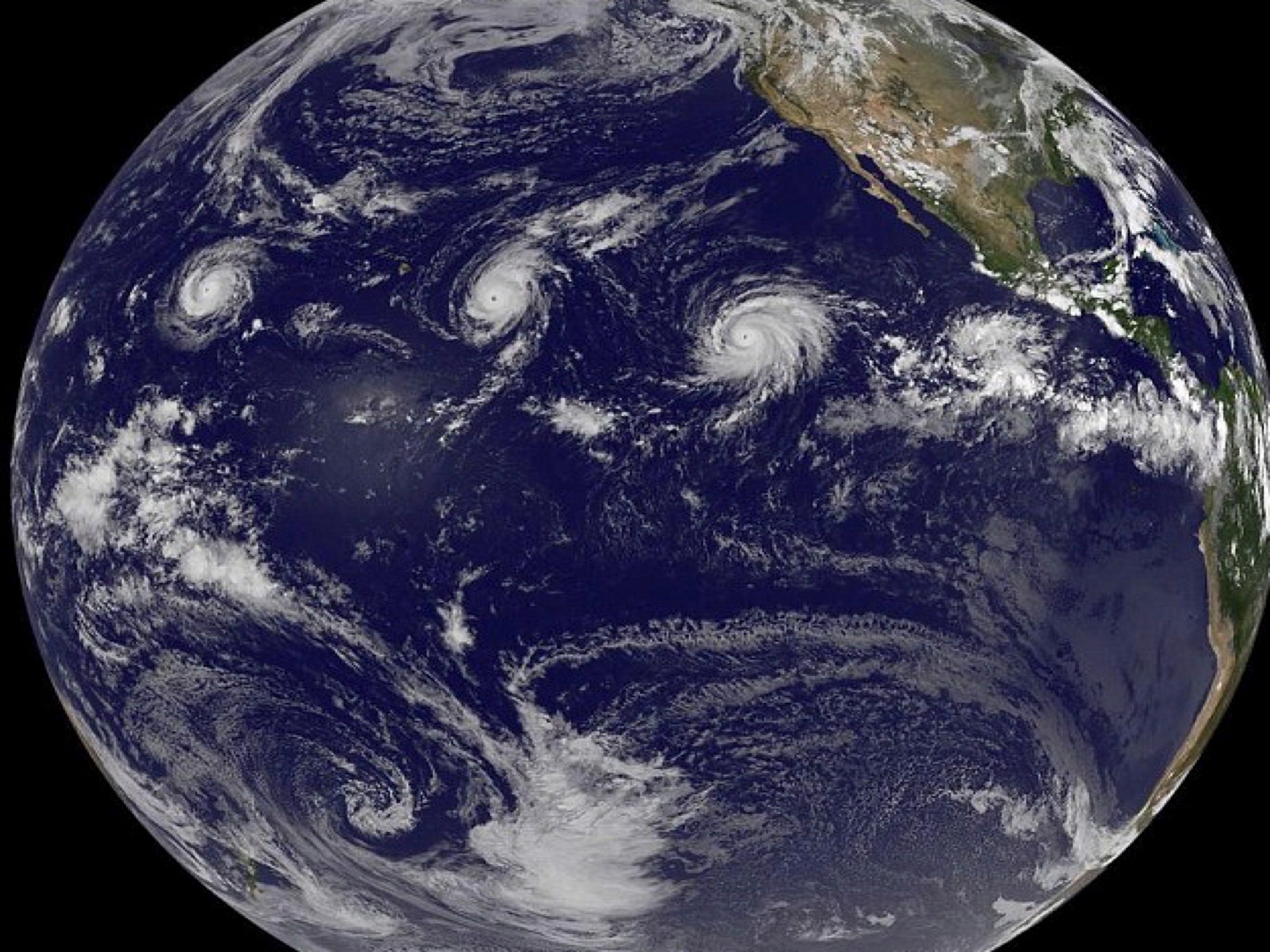
Three major hurricanes pictured over Pacific for first time
Hurricanes Ignacio, Kilo and Jimena were filmed NASA over the weekend

Your support helps us to tell the story
From reproductive rights to climate change to Big Tech, The Independent is on the ground when the story is developing. Whether it's investigating the financials of Elon Musk's pro-Trump PAC or producing our latest documentary, 'The A Word', which shines a light on the American women fighting for reproductive rights, we know how important it is to parse out the facts from the messaging.
At such a critical moment in US history, we need reporters on the ground. Your donation allows us to keep sending journalists to speak to both sides of the story.
The Independent is trusted by Americans across the entire political spectrum. And unlike many other quality news outlets, we choose not to lock Americans out of our reporting and analysis with paywalls. We believe quality journalism should be available to everyone, paid for by those who can afford it.
Your support makes all the difference.They look like swirls, spirals, missives in the firmament.
But the images captured by NASA reveal three major hurricanes simultaneously making their way across the Pacific Ocean for the first time in history.
Hurricanes Ignacio, Kilo and Jimena – each of them Category 4 - were pictured together by NASA and astronauts from the International Space Station over the weekend, stretching their way from across the Pacific from Mexico to Hawaii.
It is the first time three storms classed as Category 3 or higher have been pictured together at the same time, Nasa officials said.
For a time at the weekend, all of the storms reached Category 4, before Ignacio, which was sitting close to Hawaii, weakened back to Category 2.
Meanwhile, a fourth hurricane churned and whirled far out in the Atlantic. The Los Angeles Times said this made it the most powerful hurricane season since 1994, according to Colorado State University hurricane expert Phil Klotzbach.
Late August and early September are the typical peak of the US hurricane season, though none of these storms is forecast to strike the land. Hawaii on Monday dodged a swipe from Hurricane Ignacio, which by then had substantially weakened to a Category 2.
It is expected to continue to pass to the north east of the throughout Wednesday, the National Weather Service said.
Forecasters said the storm should become a Category 1 hurricane by Tuesday and weaken into a tropical storm by midweek as it encounters southwesterly winds. Hurricane warnings are in effect for the waters around Hawaii, but none for land areas.
The other two hurricanes in the Pacific, Kilo and Jimena, are still massive Category 4 storms with winds of at least 130 mph, but they are not forecast to hit land.
Even though the storms are forecast to miss Hawaii, officials have had to gear up emergency measures as a precaution. Stores have reported an increase in purchases of emergency supplies, declarations of warning have been issued by state leaders and emergency management officials and hundreds of volunteers have been put at the ready by groups such as the Red Cross.
“This hurricane season seems to be busier than normal,” said Krislyn Yano, communications manager for the state chapter of the Red Cross.
“We don’t want residents to get fatigued by the close calls then think we’re invincible. We are always trying to be prepared, and we’re only half way through the season. Everyone should always be ready.”
Join our commenting forum
Join thought-provoking conversations, follow other Independent readers and see their replies
Comments