‘Exposed, inexperienced’ Tampa in the eye of the hurricane for first time in more than a century
The gentle, shallow slope of the coastline near Tampa makes the city especially vulnerable to significant and dangerous storm surges as Hurricane Milton bears down
Your support helps us to tell the story
From reproductive rights to climate change to Big Tech, The Independent is on the ground when the story is developing. Whether it's investigating the financials of Elon Musk's pro-Trump PAC or producing our latest documentary, 'The A Word', which shines a light on the American women fighting for reproductive rights, we know how important it is to parse out the facts from the messaging.
At such a critical moment in US history, we need reporters on the ground. Your donation allows us to keep sending journalists to speak to both sides of the story.
The Independent is trusted by Americans across the entire political spectrum. And unlike many other quality news outlets, we choose not to lock Americans out of our reporting and analysis with paywalls. We believe quality journalism should be available to everyone, paid for by those who can afford it.
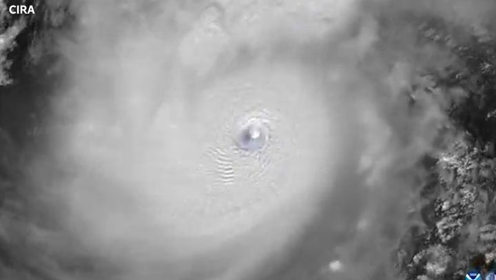
Your support makes all the difference.Hurricane Milton, the monster Category 5 storm raging in the Gulf of Mexico will bring its fury to western Florida and threaten a city that has typically escaped widespread damage from hurricanes.
Despite its location, Tampa has been lucky to avoid the worst of the hurricanes that slam into the Sunshine State each year. The last time the eye of a large storm passed through Tampa was more than 100 years ago.
Unlike in 1921, Tampa is now home to more than 3 million people, and the climate crisis is in full swing, creating the conditions for more storms and worse flooding. Hurricane Milton’s projected path is currently right through the city.
As Hurricane Milton churns toward Tampa, experts worry that its storm surge and related flooding will cause widespread damage to the city and its outlying lands.
The National Hurricane Center predicts storm surges in Tampa Bay and the surrounding waters of between 8 and 12 feet (2.5m to 3m) above the typical tide conditions. That massive surge will be paired with between four and 6 inches (10 to 15 cm) of expected rainfall.
Hurricane Helene — which made landfall approximately 150 miles away from Tampa last week — still managed to create surges of around 5 to 8 feet in Tampa Bay and cause drowning deaths in the city.
Philip Klotzbach, a hurricane researcher at Colorado State University, told the Associated Press that “it could have been a lot worse” if Helene had “made landfall just a little farther to the south and east.”
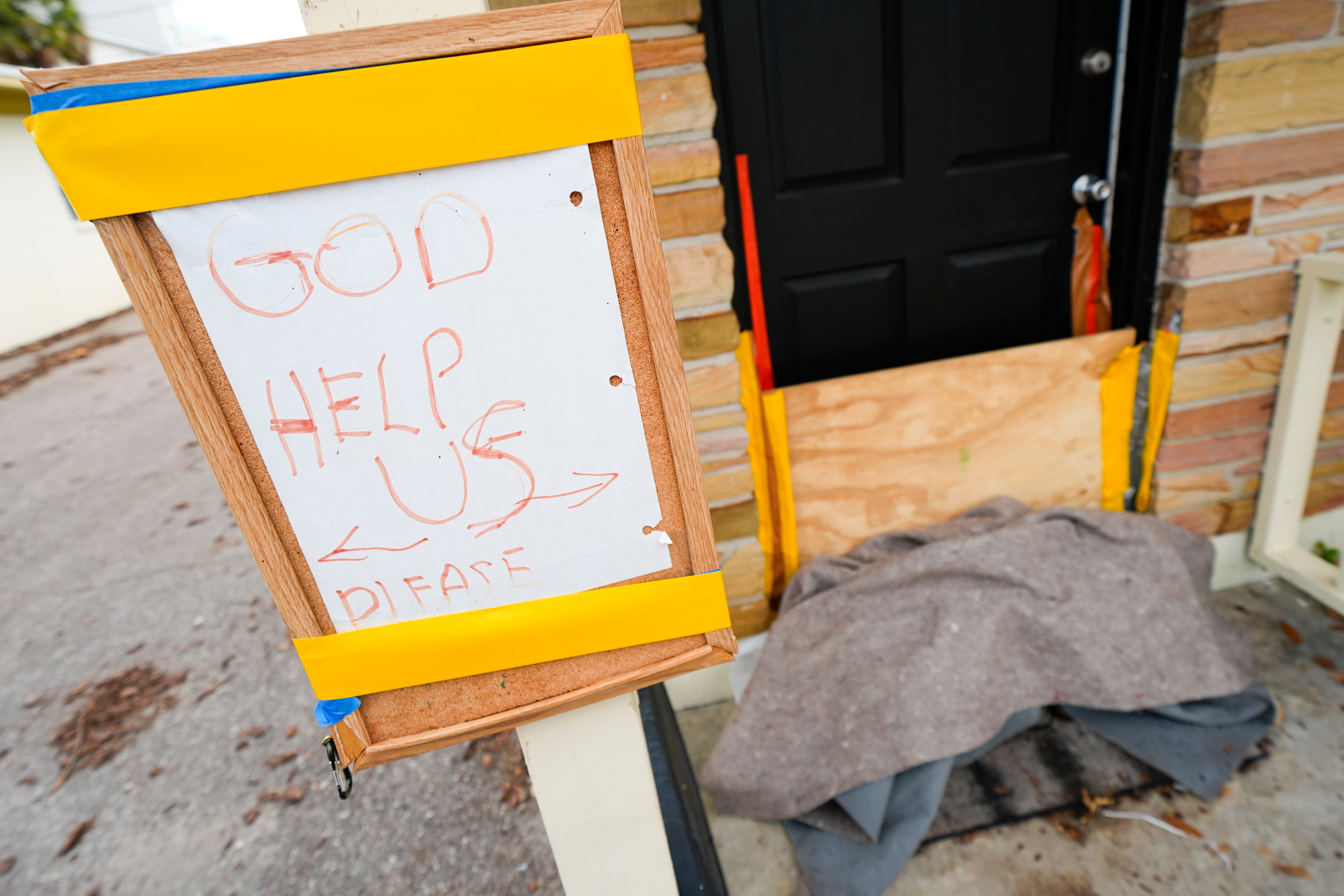
Tampa Mayor Jane Castor has already declared a state of emergency in Tampa ahead of Milton’s expected arrival late Wednesday. Evacuation orders were given on Wednesday for residents in six counties surrounding Tampa Bay representing approximately four million people.
Evacuation is a critical step to preventing deaths; while Tampa’s location has protected it from direct hurricane hits, its topography has made it vulnerable to surges that can cause deadly flooding in coastal communities.
The coastline of the Gulf of Mexico in that region slopes gently away from the land until it reaches a drop-off. The higher ocean floor retains the water dumped by hurricanes, which then displaces the ocean water onto the shore, causing the “surge.”
In 2015, a report from Karen Clark and Co — a disaster modeling firm — found that Tampa Bay was the most vulnerable place in the US for storm surge flooding damage.
The report also found that the city could suffer $175bn in damages during a particularly bad period of storm surge flooding.
As ocean temperatures rise due to human-caused climate change, the warm water acts as fuel for hurricanes, increasing their strength until they either dissipate over cool waters or break over land.
While the climate crisis isn’t necessarily creating more storms, it is creating the conditions that allow storms not only to form but to become very powerful, very quickly.
Hurricane Milton gained 75mph (120kph) of intensity over the course of a single day. The storm is now a Category 5 storm, with 180-plus mph winds and gusts of over 200mph.
If left unchecked and unaddressed, the climate crisis will continue to worsen and the world will be left to try to adjust to the sometimes lethal and disastrous effects.
Despite that risk, Tampa is still a very popular place to live; the city is the fifth-largest growing US metro area according to US Census data.
The more hurricanes that churn up over the Atlantic Ocean, the more likely it is that one will make landfall in Tampa.
MIT meteorology professor Kerry Emanuel told the AP that a major hurricane hitting Tampa was a “black swan,” worst-case scenario event, and its possibility has worried experts for years.
“It’s a huge population. It’s very exposed, very inexperienced, and that’s a losing proposition,” Emanuel told the AP. “I always thought Tampa would be the city to worry about most.”
Join our commenting forum
Join thought-provoking conversations, follow other Independent readers and see their replies
Comments