Your support helps us to tell the story
This election is still a dead heat, according to most polls. In a fight with such wafer-thin margins, we need reporters on the ground talking to the people Trump and Harris are courting. Your support allows us to keep sending journalists to the story.
The Independent is trusted by 27 million Americans from across the entire political spectrum every month. Unlike many other quality news outlets, we choose not to lock you out of our reporting and analysis with paywalls. But quality journalism must still be paid for.
Help us keep bring these critical stories to light. Your support makes all the difference.
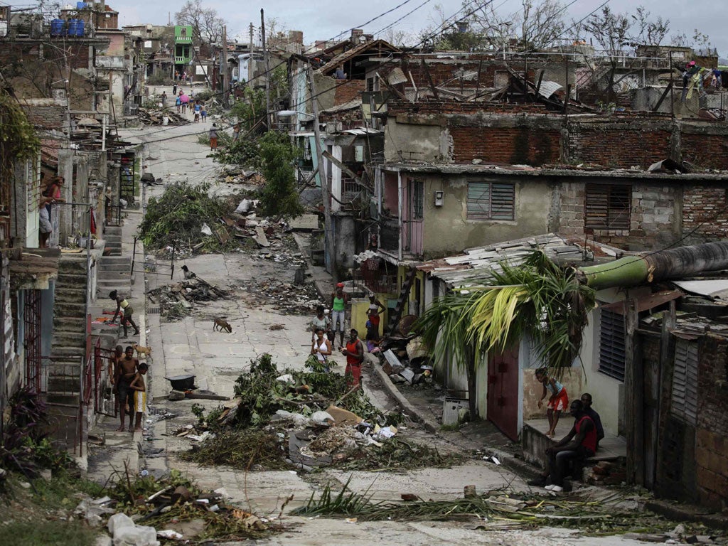
This is how the city of Santiago de Cuba looked yesterday after a pummelling from Hurricane Sandy. At least 41 people were killed as the storm system swept through the Caribbean; 11 of them in Cuba and most of those were in this 498-year-old city. There was no power or water supplies for its half a million inhabitants, but, at first light, truck convoys rolled into the city bringing equipment and utility workers from the rest of the country to help restore services.
Sandy is now headed towards the north-east coast of the United States, where weather forecasters fear it will combine with an early winter depression and so form a "super-storm". This would bring severe rains, winds and perhaps even snow to a wide swathe of the US. The present projected track predicts landfall late on Monday or early Tuesday, somewhere between North Carolina and southern New England.
Sandy is continuing to grow, and by early next week it could be packing tropical-force winds extending 450 miles from its centre. Storm warnings are in effect north from Florida, and New York is considering suspending public transport for fear of accidents once the storm hits.
Subscribe to Independent Premium to bookmark this article
Want to bookmark your favourite articles and stories to read or reference later? Start your Independent Premium subscription today.
Join our commenting forum
Join thought-provoking conversations, follow other Independent readers and see their replies
Comments