Family members post desperate Facebook messages as hundreds remain missing from Helene
Helene one of the deadliest storms in US history, with at least 160 fatalities
Your support helps us to tell the story
From reproductive rights to climate change to Big Tech, The Independent is on the ground when the story is developing. Whether it's investigating the financials of Elon Musk's pro-Trump PAC or producing our latest documentary, 'The A Word', which shines a light on the American women fighting for reproductive rights, we know how important it is to parse out the facts from the messaging.
At such a critical moment in US history, we need reporters on the ground. Your donation allows us to keep sending journalists to speak to both sides of the story.
The Independent is trusted by Americans across the entire political spectrum. And unlike many other quality news outlets, we choose not to lock Americans out of our reporting and analysis with paywalls. We believe quality journalism should be available to everyone, paid for by those who can afford it.
Your support makes all the difference.Hundreds of people are still presumed missing across six states following the devastating impacts from Hurricane Helene.
Helene is now one of the deadliest storms in US history, with 160 deaths reported late Tuesday. The majority of fatalities were in North Carolina.
“The current data that we have, is that it looks like there could be as many as 600 lost lives,” Homeland Security Advisor Liz Sherwood-Randall said Monday. “But, we don’t have any confirmation of that. We know there are 600 who are either lost or unaccounted for.”
Sherwood-Randall cautioned that the numbers “vary widely” and there’s “a lot of reporting that doesn’t add up about the numbers.”
She added: “And so, while we may see the numbers go up as we get to more locations that have not yet been fully developed in terms of disaster, immediate emergency response operations, we may see more people who unfortunately perished. But we may also not see the numbers skyrocket as people have predicted they might.”
Governors in the impacted states did not provide an update to that figure on Tuesday.
North Carolina Governor Roy Cooper and Director of Emergency Management William Ray said that they’d work with the state’s information and referral service to determine the number of missing.
“We know that there will be more fatalities,” Cooper said.
South Carolina Governor Henry McMaster announced that the number of confirmed deaths from the storm in his state rose to 36 on Tuesday afternoon.
“This has really hit our region hard,” he said.

A Facebook group with more than 477,000 members included posts from people looking for family members. Some also provided updates saying their loved ones had been found.
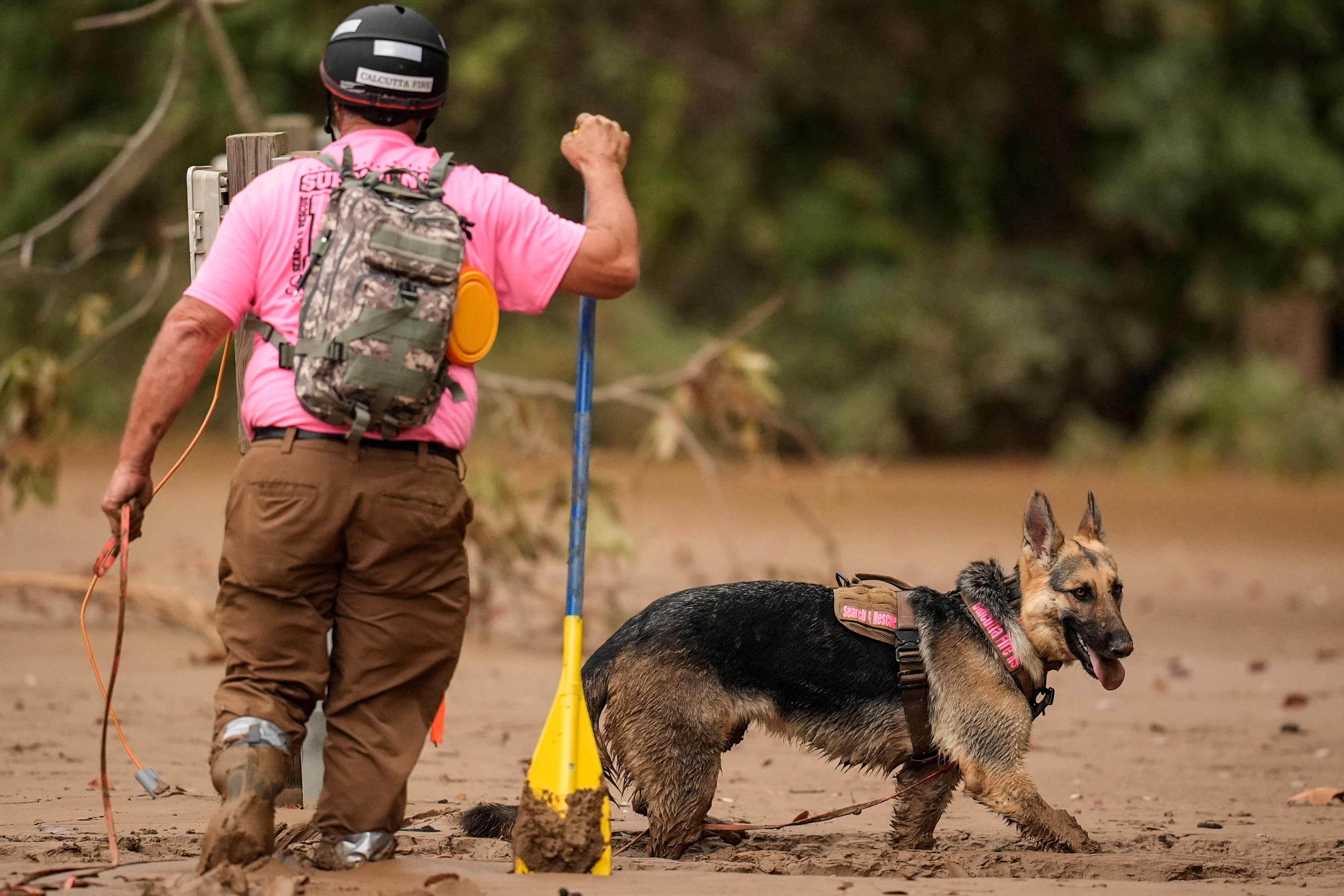
Search and rescue efforts continued in western North Carolina with 92 teams working on the ground. Helicopters provided air support while rescuers trudged through deep mud with dogs.
Images taken in the Wautaga County town of Boone over the weekend revealed the extent of the damage, with collapsed houses and whole areas underwater.
On Tuesday, Watauga County Director of Emergency Management Will Holt said there was one team left in the area. “Now we’re really starting to get into isolated pockets and finding where people are,” he said.
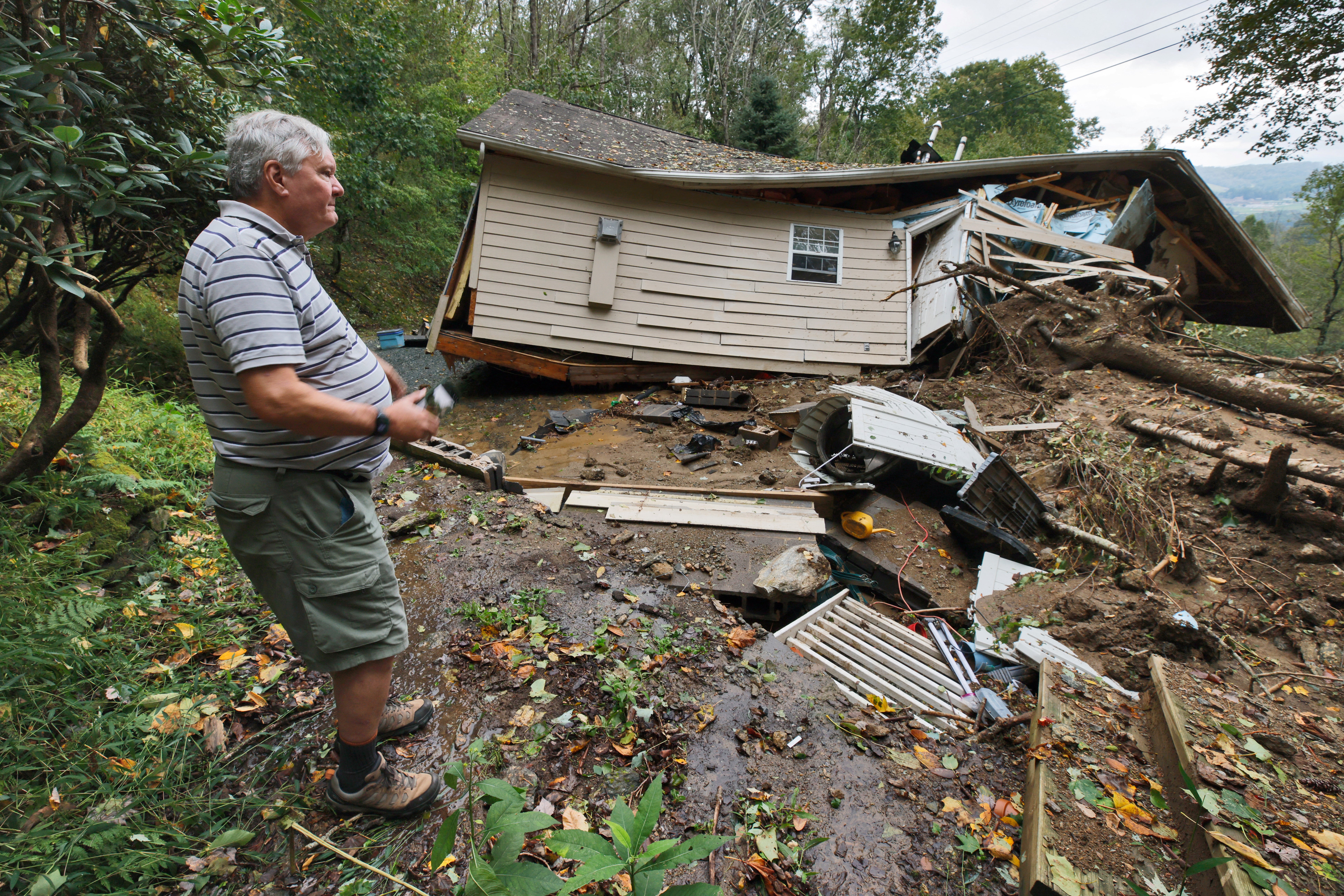
The Watauga County Sheriff’s Office told The Watauga Democrat on Monday that there had been two deaths related to the storm. In hard-hit Buncombe County, 40 deaths were reported.
Thousands of federal personnel have been deployed to respond to Helene, and President Joe Biden will travel to Raleigh, North Carolina on Wednesday. The president had waited to travel there until it was determined his presence would not to disrupt rescue efforts, according to officials.
Hurricane Helene hit Florida’s Big Bend region last Thursday as a Category 4 hurricane.
The National Hurricane Center said Tropical Storm Kirk had strengthened into a hurricane on Thursday. The storm is expected to become a major hurricane in the coming days.
Join our commenting forum
Join thought-provoking conversations, follow other Independent readers and see their replies
Comments