Mapped: Charting Hurricane Helene’s deadly path as it slams Georgia after making landfall in Florida
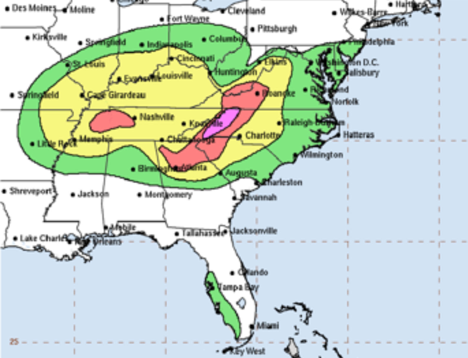
Helene charting a path north from the Gulf coast towards Tennessee through the Appalachian Mountains on Friday before cutting into Kentucky
Your support helps us to tell the story
From reproductive rights to climate change to Big Tech, The Independent is on the ground when the story is developing. Whether it's investigating the financials of Elon Musk's pro-Trump PAC or producing our latest documentary, 'The A Word', which shines a light on the American women fighting for reproductive rights, we know how important it is to parse out the facts from the messaging.
At such a critical moment in US history, we need reporters on the ground. Your donation allows us to keep sending journalists to speak to both sides of the story.
The Independent is trusted by Americans across the entire political spectrum. And unlike many other quality news outlets, we choose not to lock Americans out of our reporting and analysis with paywalls. We believe quality journalism should be available to everyone, paid for by those who can afford it.
Your support makes all the difference.At least 41 people are dead after Hurricane Helene crashed into Florida as a Category 4 storm, pounding the state’s west coast with “unsurvivable” conditions, before tracking a destructive path north through Georgia and the Carolinas on Friday.
The storm is tracking north over the Tennessee Valley Friday night and through the weekend, threatening dangerous flash flooding.
Helene has since been downgraded to a tropical depression but remained “life-threatening”, according to forecasters, causing a flash flood emergency in metro Atlanta and putting Kentucky’s Appalachia region on high alert for heavy rains and landslides.
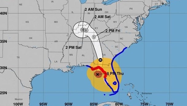
Sustained winds had dropped to around 35mph with higher gusts on Friday after Helene had slammed into the Gulf coast with 140mph winds, and 15ft storm surge, late on Thursday night.
As the sun came up in Florida, the damage was widespread and catastrophic. Storm surge has left some homes underwater to the roofline, and boats in marinas were smashed together like bath toys. Downed trees, powerlines and other debris were making navigating roadways treacherous for emergency responders.
Around 4 million people were without power from Florida up the east coast to Virgina.
Among the fatalities were a driver who was killed when a sign fell onto their car in Tampa. Five other deaths were reported in Florida’s Pinellas County. Some 11 people died in Georgia, including two in Wheeler County who were killed after their trailer crashed on a highway. Another person was an emergency responder.
At least six people died in South Carolina, including two people who died when tree fells on houses Friday morning in Anderson. In North Carolina, a person was killed by a falling tree in the city of Charlotte.
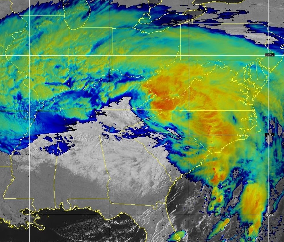
Helene continued to bring historic and catastrophic flooding to the Appalachians and large parts of the Southeast on Friday afternoon as the storm hovered about 125miles south of Louisville, Kentucky.
Some places in the Carolinas and Tennessee have seen a half of foot of rain since Tuesday.
Helene is the fourth hurricane to make landfall in the US this year.
Join our commenting forum
Join thought-provoking conversations, follow other Independent readers and see their replies
Comments