A storm is brewing in the Atlantic...and it has Florida and the Caribbean in its sights
The storm is currently in the Atlantic Ocean, but forecasters say it could have a major impact on Florida
Your support helps us to tell the story
From reproductive rights to climate change to Big Tech, The Independent is on the ground when the story is developing. Whether it's investigating the financials of Elon Musk's pro-Trump PAC or producing our latest documentary, 'The A Word', which shines a light on the American women fighting for reproductive rights, we know how important it is to parse out the facts from the messaging.
At such a critical moment in US history, we need reporters on the ground. Your donation allows us to keep sending journalists to speak to both sides of the story.
The Independent is trusted by Americans across the entire political spectrum. And unlike many other quality news outlets, we choose not to lock Americans out of our reporting and analysis with paywalls. We believe quality journalism should be available to everyone, paid for by those who can afford it.
Your support makes all the difference.A tropical wave is forming a few hundred miles from the Caribbean, and forecasts say it has the United States in its sights.
The disturbance will interact with another, approaching tropical wave this week, and determine whether the wave strikes Florida and the Carolinas, swerves south toward the Gulf of Mexico, or recurves into the Atlantic Ocean, according to the National Oceanic and Atmospheric Administration.
The wave, which is moving west at about 18 mph, is currently predicted to cross into much of the Caribbean including Puerto Rico, Hispaniola, and Cuba.
Weather analysts give a 60 percent chance that the disturbance strengthens into a tropical hurricane over the next week. Its direction may change over the next few days as it gets held down by high winds and dry air.
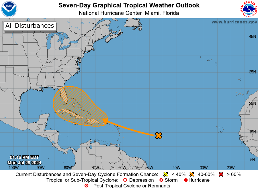
If it strengthens to a hurricane, it will be named Debby, becoming the fourth named storm in the Atlantic this year.
“Toward the end of this week, the wave will move into an area with fairly low shear and ample moisture, and that could allow some organization and strengthening,” AccuWeather’s lead hurricane expert Alex DaSilva said.
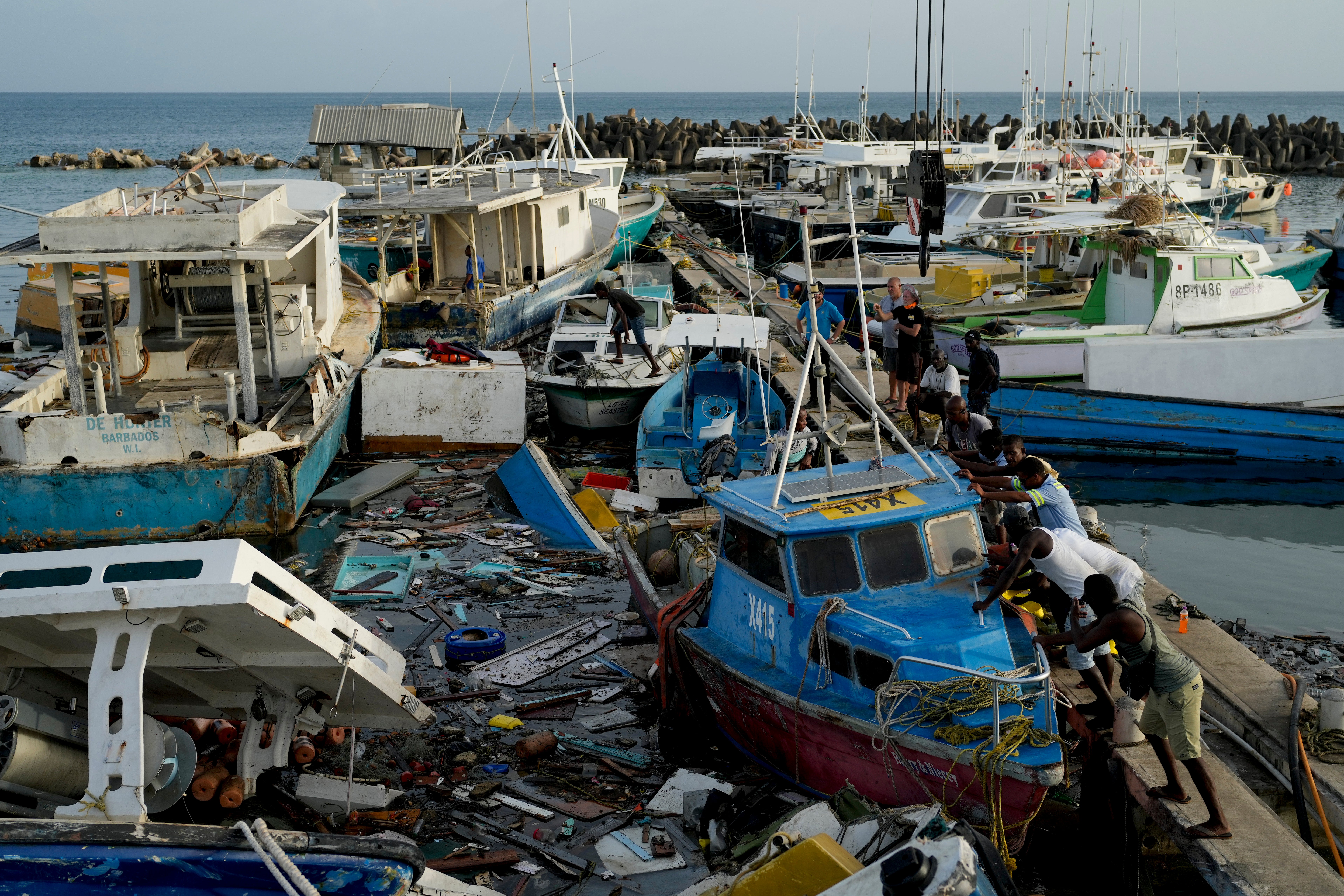
Earlier this month, Hurricane Beryl pummeled Eastern Texas, killing 36 people and leaving 2.7 million without power, with the city of Houston severely impacted. Beryl was the earliest Category 5 hurricane in the Atlantic Ocean on record.
Weather experts are predicting greater numbers of hurricanes this year as the effects of the climate crisis intensify around the world. Water temperatures have continued to break records this year, which scientists believe can cause hurricanes to more rapidly intensify into major storms.
“The fear is that as we enter the heart of the tropical season—from late August to early October—the sea-surface temperature may continue to eclipse last year’s record-breaking season. The warmer the oceans are, the more favorable the environment will be for tropical development and rapid intensification,” DaSilva said.
Peak hurricane season in the Atlantic usually runs from June to November, with a peak in September. The National Weather Service has a hurricane preparation guide for people living in areas at risk of hurricanes and other weather disturbances.
Join our commenting forum
Join thought-provoking conversations, follow other Independent readers and see their replies
Comments