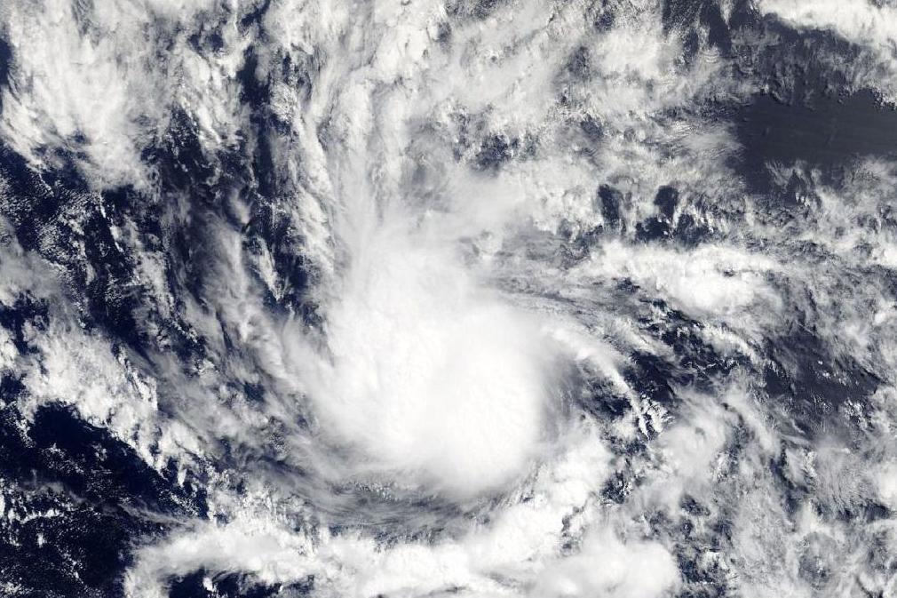
Hurricane Beryl: Surprise as US hit by first hurricane of year 40 days earlier than expected
Storm expected to weaken substantially before reaching the Caribbean, where it may cause downpours and strong winds

Your support helps us to tell the story
From reproductive rights to climate change to Big Tech, The Independent is on the ground when the story is developing. Whether it's investigating the financials of Elon Musk's pro-Trump PAC or producing our latest documentary, 'The A Word', which shines a light on the American women fighting for reproductive rights, we know how important it is to parse out the facts from the messaging.
At such a critical moment in US history, we need reporters on the ground. Your donation allows us to keep sending journalists to speak to both sides of the story.
The Independent is trusted by Americans across the entire political spectrum. And unlike many other quality news outlets, we choose not to lock Americans out of our reporting and analysis with paywalls. We believe quality journalism should be available to everyone, paid for by those who can afford it.
Your support makes all the difference.To everyone's surprise, the tiny tropical depression that formed far out in the eastern Atlantic Ocean on Thursday became Hurricane Beryl in just 18 hours.
Not only is that rate of strengthening impressive by itself, its formation is also 40 days ahead of the average date of a season's first hurricane.
While hurricane-strength, Beryl is a very small storm. Tropical-storm-force winds extend an average of just 30 miles from the centre. Beryl is about 1,140 miles east of the Lesser Antilles with 75-mph peak sustained winds. It is forecast to continue tracking towards the west-northwest, reaching the islands that were ravaged by Hurricane Maria last September by Monday.
Thankfully, Beryl will be nothing like Maria. While it could strengthen some in the very short term, it is forecast to weaken substantially before reaching the Lesser Antilles early on Monday. It will not be a destructive storm, but some downpours and strong winds cannot be ruled out over the islands.
Forecast models have a difficult time projecting small storms such as Beryl. They tend to strengthen and weaken quickly, and their movement can be erratic. By around next Tuesday, however, they project the storm's remnants over or near Hispaniola, where it could produce some heavy rainfall. Beyond that, it may dissipate entirely.
In addition to its miniature size and rapid rate of intensification, Beryl is also notable for gaining hurricane strength so far east in the Atlantic so early in the season. Beryl is the easternmost pre-August hurricane to develop on record for storms with an African pedigree. Usually, environmental conditions in the deep tropics are too unwelcoming to systems coming off Africa this early on.
Beryl is the first July hurricane to form in the Atlantic since Bertha in 2014.
Elsewhere in the tropical Atlantic, the only other area of interest in the coming days is off the southeast US coast. Some models are hinting at the tropical development of a high-altitude disturbance as it spins off the coast on Sunday and Monday. The National Hurricane Center says it has an 80 per cent chance of becoming a tropical depression or storm over the next five days. It could be something to watch in the Carolinas for the middle of next week.
The Washington Post
Join our commenting forum
Join thought-provoking conversations, follow other Independent readers and see their replies
Comments