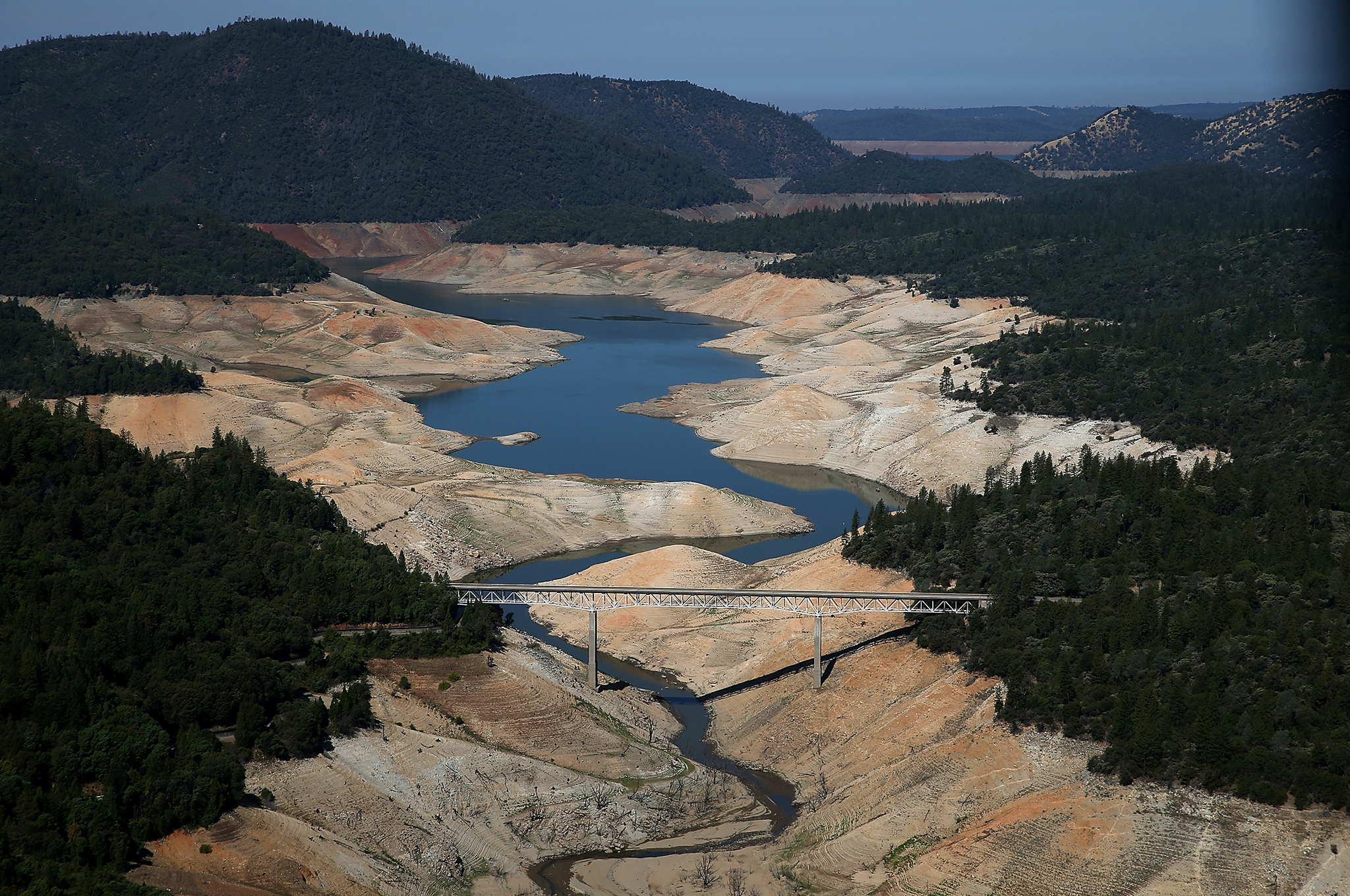
Californian drought is so severe it's 'causing the ground to move'
Scientists says 63 trillion gallons of water has been lost on west coast of the United States
Your support helps us to tell the story
From reproductive rights to climate change to Big Tech, The Independent is on the ground when the story is developing. Whether it's investigating the financials of Elon Musk's pro-Trump PAC or producing our latest documentary, 'The A Word', which shines a light on the American women fighting for reproductive rights, we know how important it is to parse out the facts from the messaging.
At such a critical moment in US history, we need reporters on the ground. Your donation allows us to keep sending journalists to speak to both sides of the story.
The Independent is trusted by Americans across the entire political spectrum. And unlike many other quality news outlets, we choose not to lock Americans out of our reporting and analysis with paywalls. We believe quality journalism should be available to everyone, paid for by those who can afford it.
Your support makes all the difference.Vanishing water is causing the ground to rise in the western United States, according to a new study.
Scientists estimate that 63 trillion gallons of water has been lost in the west over the past 18 months.
The surface of the Earth is much more springy than you might think. When you put something very heavy on it, there’s a good chance the ground will sink at least a little bit. And in the same way, when you remove something very heavy, the ground will lift.
As it turns out, 63 trillion gallons of water is pretty heavy.
That is how much water scientists at Scripps Institution of Oceanography at UC San Diego estimate has gone missing from the western US over the past 18 months. That incredible water deficit weighs nearly 240 billion tons, and as it evaporated, the ground began to shift.
A network of GPS devices, the Plate Boundary Observatory, is laid out in the western US, used to study shifting tectonic plates. As small earthquakes happen, the distance that the ground shifts can be measured with the same technology that gets you from here to there in your car.
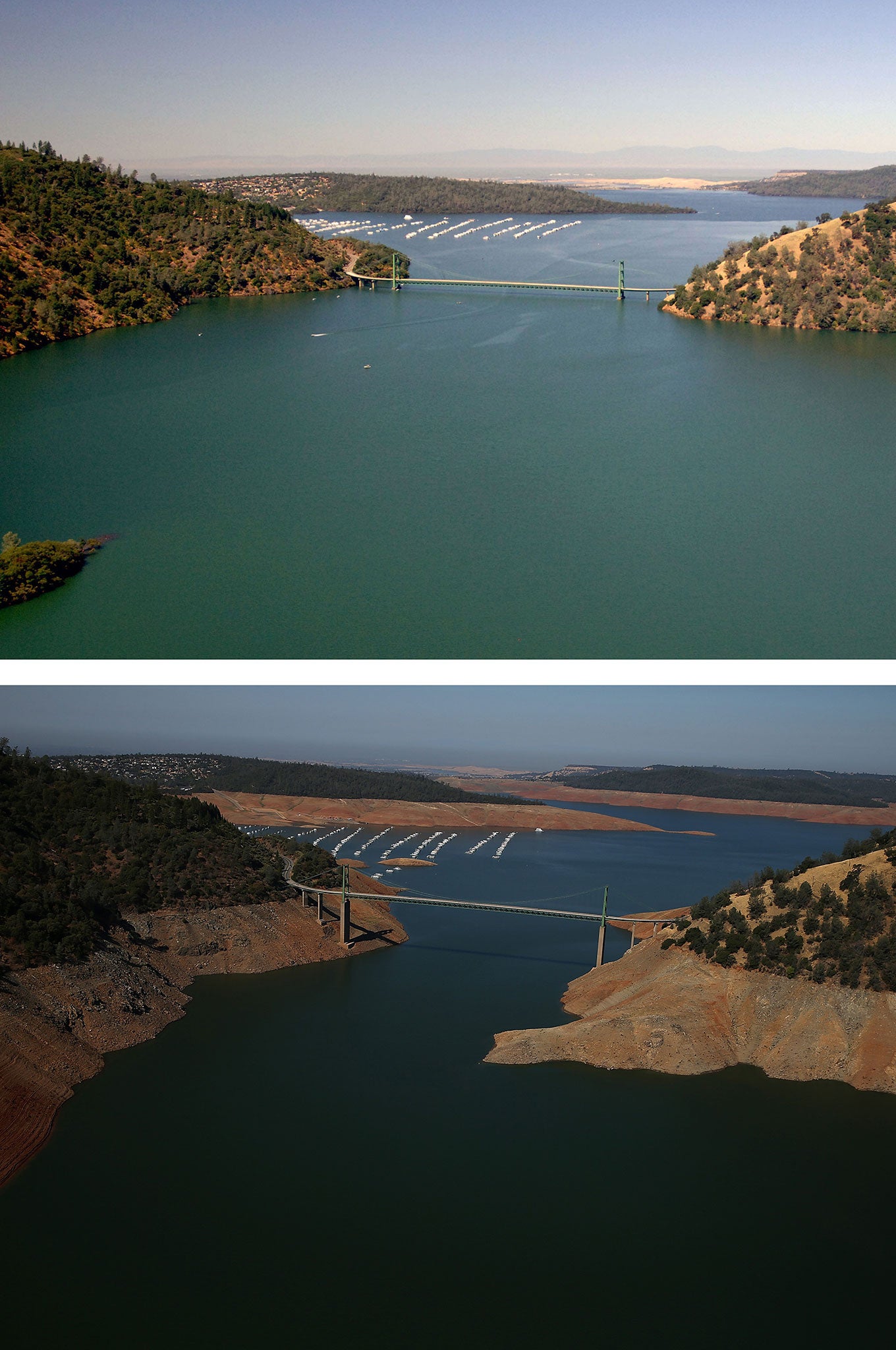
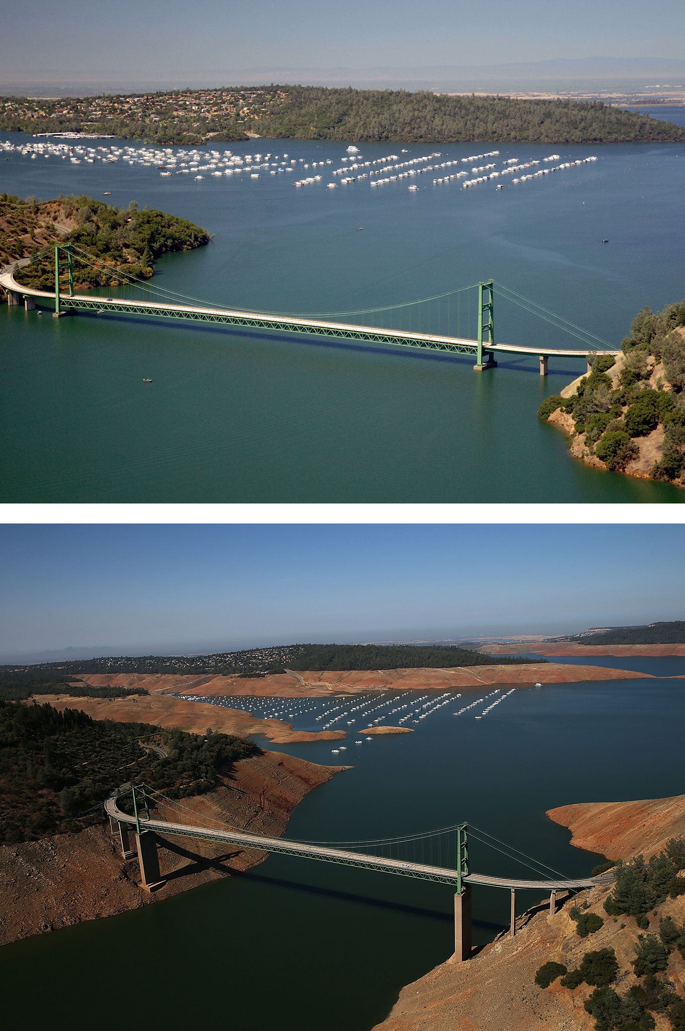
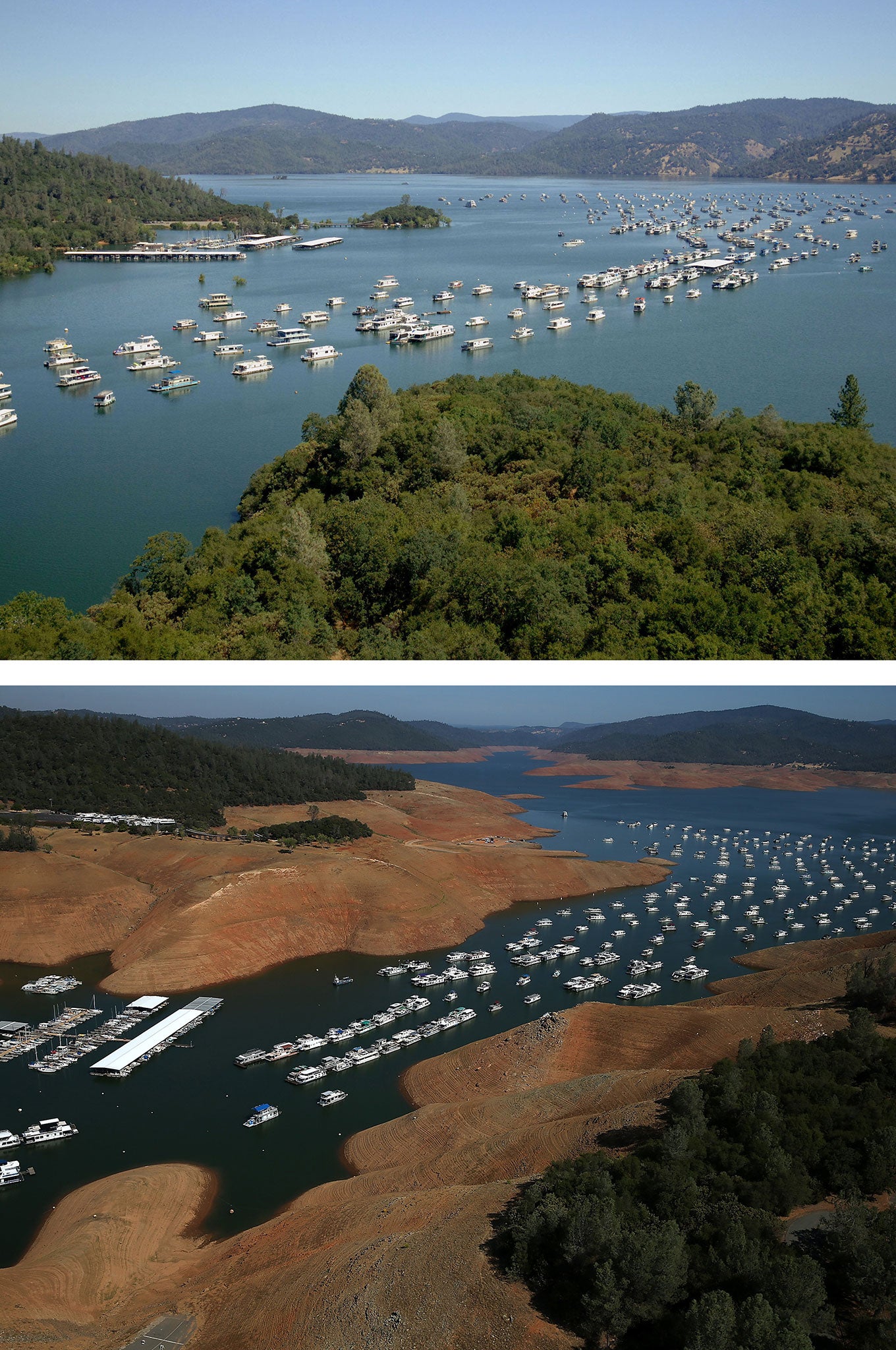
Below is a sequence of images of Lake Oroville in California, which show high water levels pictured in July 2011 and images taken this month of significantly lower levels caused by the drought
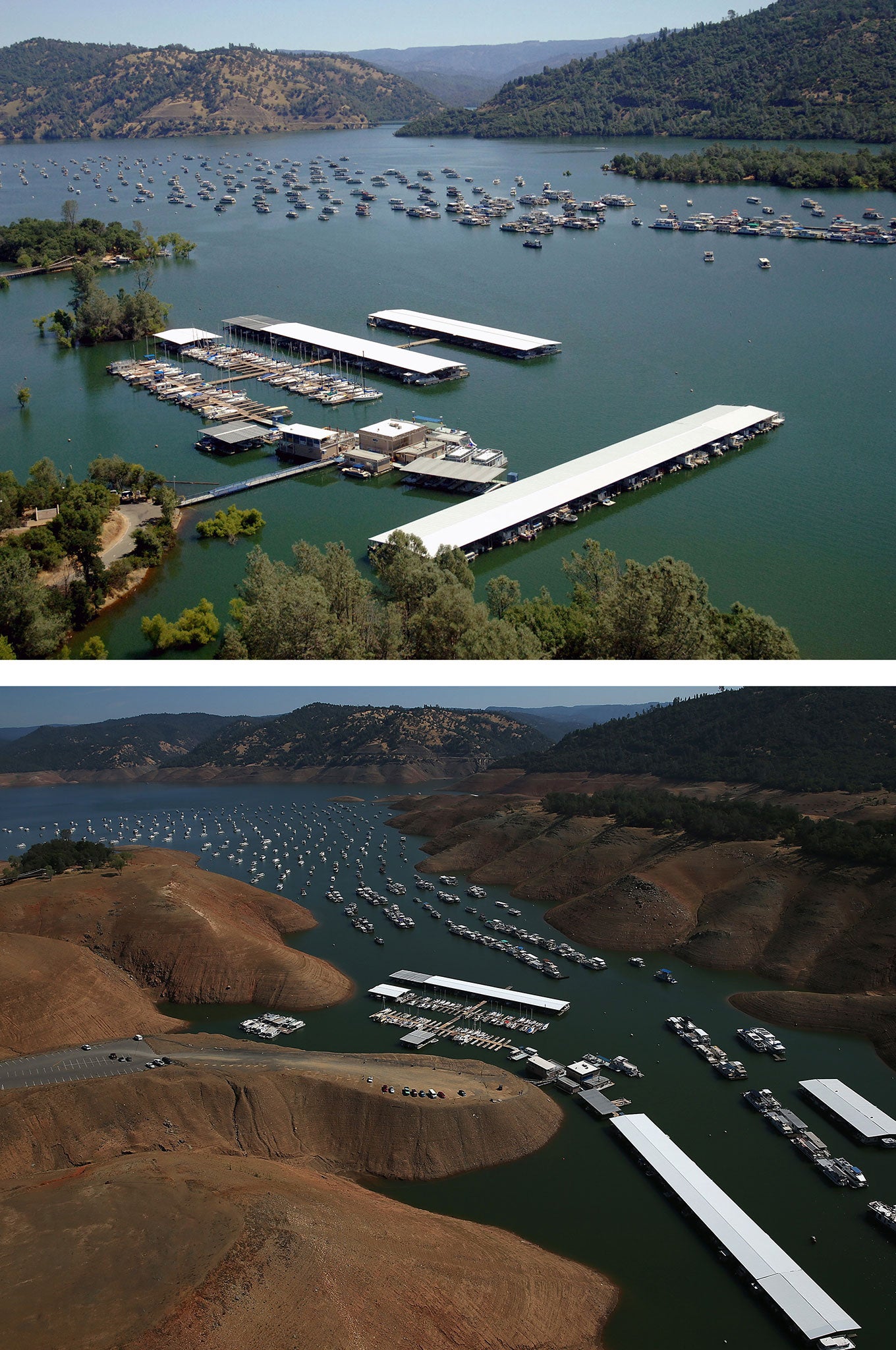
While scouring the GPS data, researchers noticed that the ground was slowly rising beneath their feet, coinciding with the drought. Taking a closer look, they found that across the western US, the ground has risen an average of 0.15 in since 2013. The effect is much more pronounced in the mountains of California, where the uplift was as high as half an inch.
Using these measurements, scientists were able to put a number on the vast amount of water that the West has lost. Scripps scientist Dan Cayan is hopeful these results can prove to be helpful in monitoring water shortages across the globe. “These results demonstrate that this technique can be used to study changes in fresh water stocks in other regions around the world, if they have a network of GPS sensors,” Cayan said in a press release.
Drought conditions have spread across over 70 per cent of the western U.S. as of Thursday. But no state is feeling the drought as bad as California, where over half of the state was in an exceptional drought, the U.S. Drought Monitor’s worst drought classification.
© Washington Post
Subscribe to Independent Premium to bookmark this article
Want to bookmark your favourite articles and stories to read or reference later? Start your Independent Premium subscription today.
Join our commenting forum
Join thought-provoking conversations, follow other Independent readers and see their replies
Comments