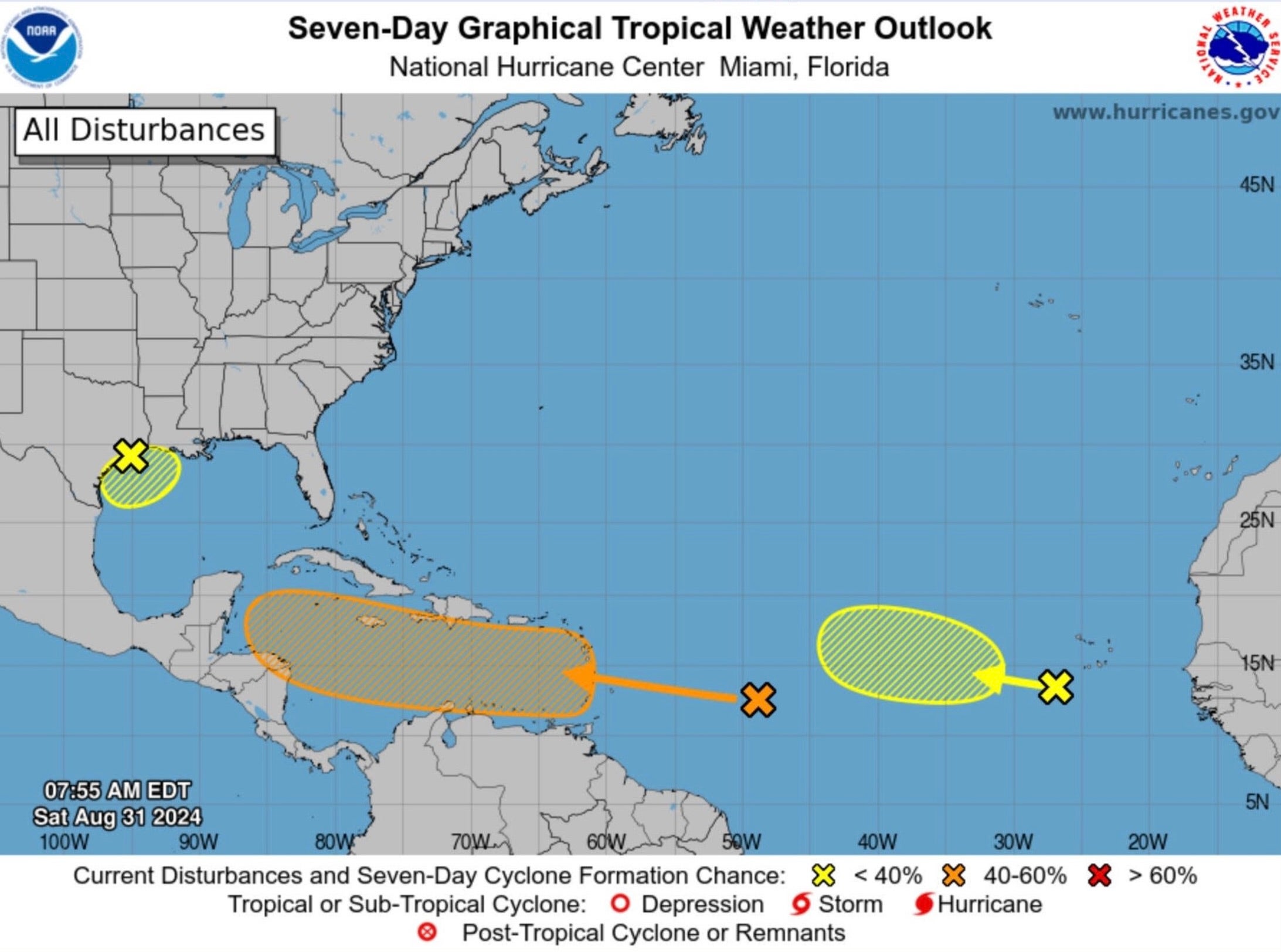
Three storms are brewing in the ocean with potential to impact US
The waves are most likely to hit Florida and Texas

Your support helps us to tell the story
From reproductive rights to climate change to Big Tech, The Independent is on the ground when the story is developing. Whether it's investigating the financials of Elon Musk's pro-Trump PAC or producing our latest documentary, 'The A Word', which shines a light on the American women fighting for reproductive rights, we know how important it is to parse out the facts from the messaging.
At such a critical moment in US history, we need reporters on the ground. Your donation allows us to keep sending journalists to speak to both sides of the story.
The Independent is trusted by Americans across the entire political spectrum. And unlike many other quality news outlets, we choose not to lock Americans out of our reporting and analysis with paywalls. We believe quality journalism should be available to everyone, paid for by those who can afford it.
Your support makes all the difference.Three tropical waves are developing with the potential to impact the US, the National Hurricane Center (NHC) has said.
The waves are in the Caribbean Sea, Atlantic Ocean, and Gulf of Mexico. They are most likely to hit Florida and Texas if they develop into a storm. At least two of the waves have a chance of turning into a tropical depression, the NHC said.
One tropical wave, located off the coast of Texas, is not expected to develop into a tropical depression, storm, or hurricane, the NHC has announced. But it’s likely to bring heavy rainfall and flash flooding to parts of the state’s coastline throughout this week.
The wave has about a 10 percent chance of developing further.
A second wave situated near the Lesser Antilles islands in the Caribbean Sea has continued to produce showers and thunderstorms. It has a 40 percent chance of developing further. That percentage has not changed for the last couple of days.

According to the NHC, the system is likely to head west across the Caribbean Sea through Tuesday, bringing with it strong winds and heavy rain. No additional development is likely to take place until then. Yet, officials say it’s possible for that to change as the system moves into the central and western parts of the Caribbean Sea.
It could become a tropical depression during the second week of September.
Meanwhile, a third wave centered off the western coast of Africa has the highest chance of developing into a storm. On Monday morning, the NHC upped the odds of that happening to 40 percent. The wave is currently producing showers and thunderstorms.
“Environmental conditions are forecast to gradually become more favorable for development, and a tropical depression could form in a few days while the disturbance moves slowly west-northwestward or northwestward over the eastern tropical Atlantic Ocean,” the agency said.
Join our commenting forum
Join thought-provoking conversations, follow other Independent readers and see their replies
Comments