Boko Haram attack: Before and after satellite images show shocking scale of destruction in north east Nigeria
At least 150 people were killed in attacks by the insurgent group last week
Your support helps us to tell the story
From reproductive rights to climate change to Big Tech, The Independent is on the ground when the story is developing. Whether it's investigating the financials of Elon Musk's pro-Trump PAC or producing our latest documentary, 'The A Word', which shines a light on the American women fighting for reproductive rights, we know how important it is to parse out the facts from the messaging.
At such a critical moment in US history, we need reporters on the ground. Your donation allows us to keep sending journalists to speak to both sides of the story.
The Independent is trusted by Americans across the entire political spectrum. And unlike many other quality news outlets, we choose not to lock Americans out of our reporting and analysis with paywalls. We believe quality journalism should be available to everyone, paid for by those who can afford it.
Your support makes all the difference.Satellite images have revealed the shocking scale of destruction wreaked by Boko Haram militants during attacks last week, when scores of civilians were murdered.
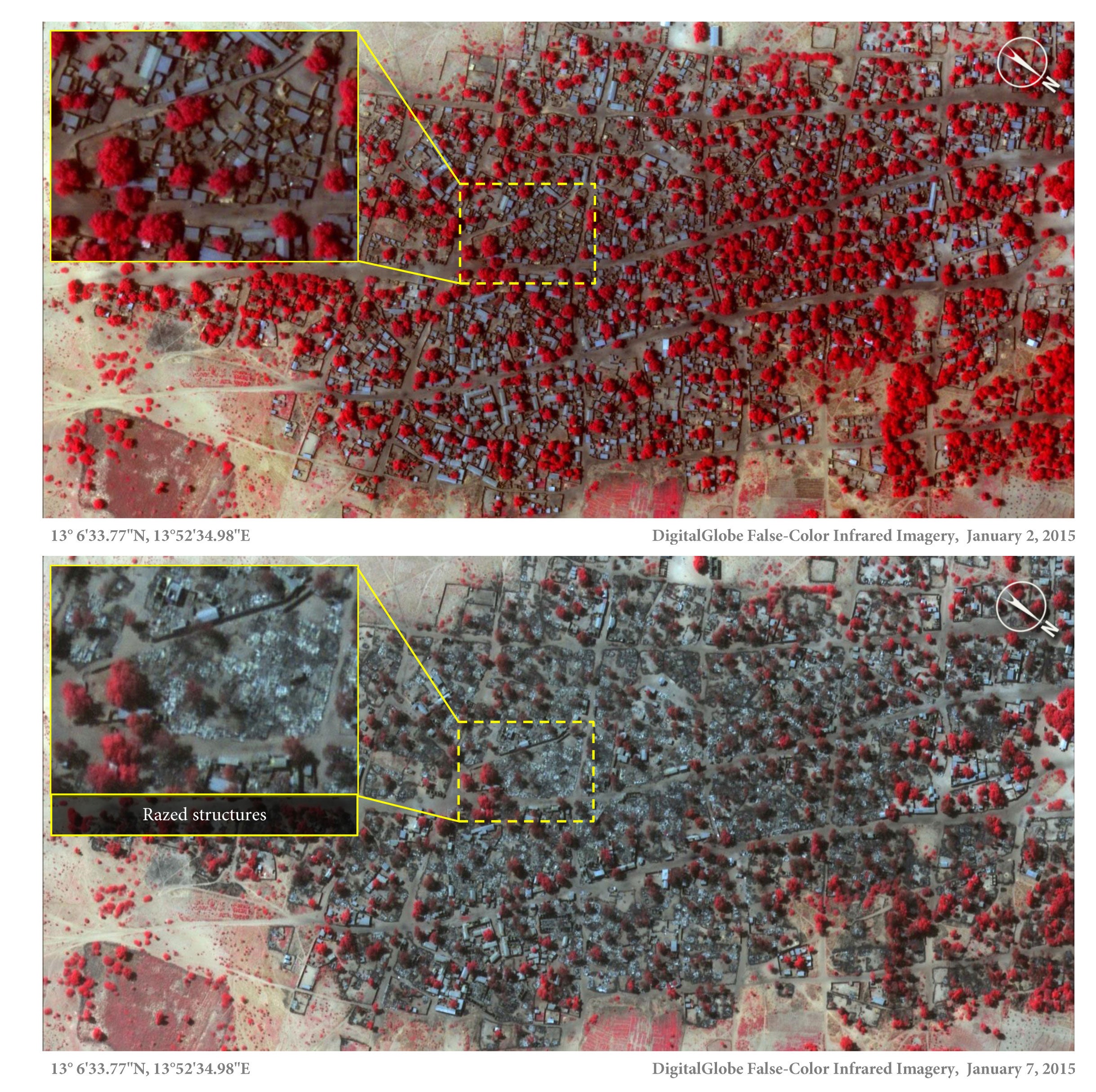
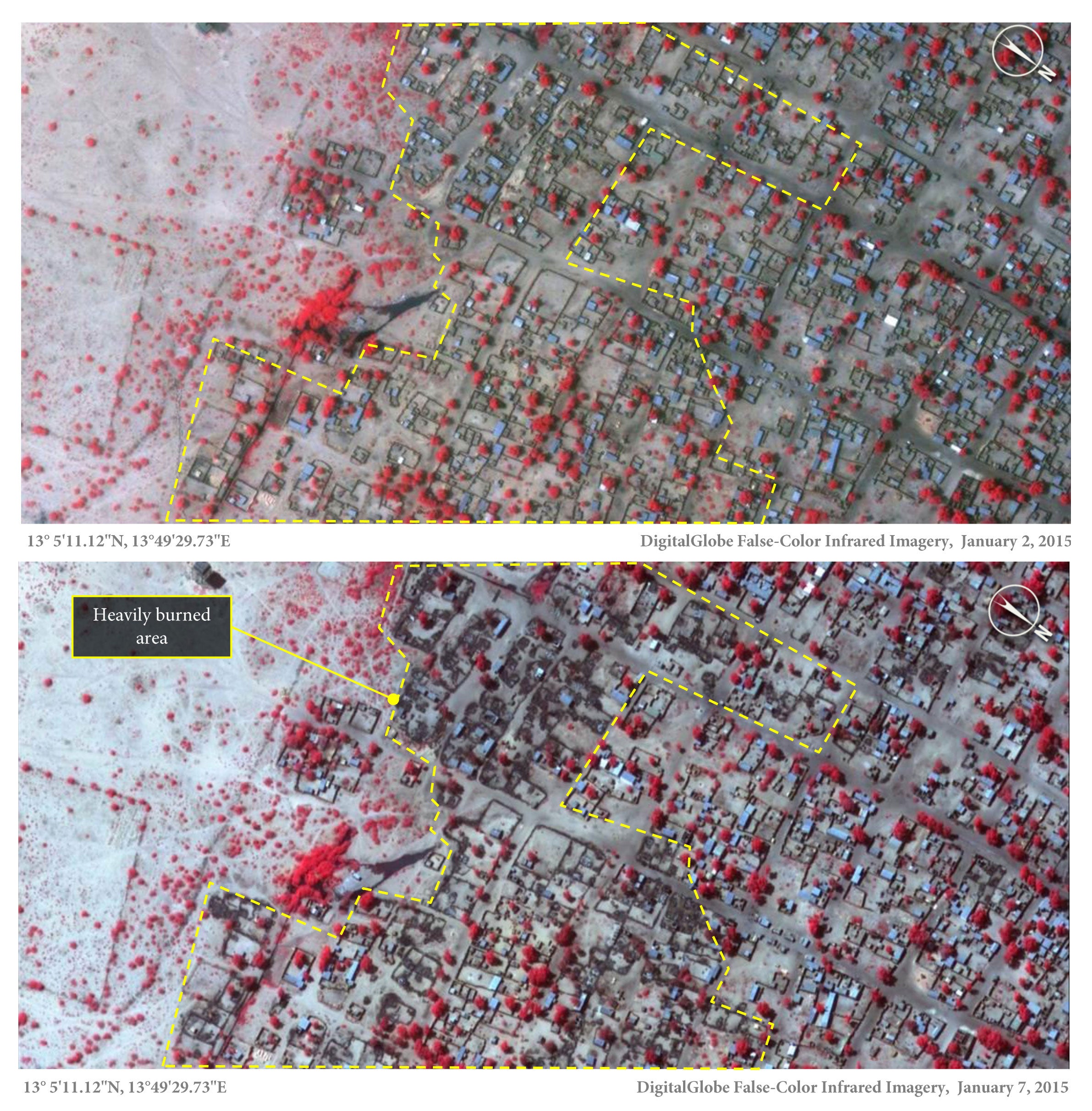
Before and after satellite images taken on 2 and 7 January show how the neighbouring towns of Baga and Doron Baga (also known as Doro Gowon) were razed to the ground.
Human rights charity Amnesty International has reported that over 3,700 structures were damaged or completely destroyed during this period, and other nearby towns and villages were also attacked.
The number of lives claimed in the massacres in Baga and Doron Baga remains unclear. Initial reports suggested that 2,000 people were killed, but the Nigerian Government has since reduced the figure to 150.
Daniel Eyre, Nigeria researcher for Amnesty International, said: “These detailed images show devastation of catastrophic proportions in two towns, one of which was almost wiped off the map in the space of four days.
“Of all Boko Haram assaults analysed by Amnesty International, this is the largest and most destructive yet. It represents a deliberate attack on civilians whose homes, clinics and schools are now burnt out ruins.”

The marginalised part of the country is semi-arid desert that turns to lush forest around Lake Chad and is home to traders, subsistence farmers, herdsmen and fishermen.
As Baga is isolated and Boko Haram militants are in control of the area, it is difficult to verify the facts surrounding the tragedy, he explained.


While Nigeria’s Director of Defence Information stated that the number of people killed in Baga - including Boko Haram fighters - did not exceed 150, the images and eye witness accounts suggest that the final death toll is likely to be much higher, he argued.
“Residents have not been able to return to bury the dead, let alone count their number. But through these satellite images combined with graphic testimonies a picture of what is likely to be Boko Haram’s deadliest attack ever is becoming clearer,” said Mr Eyre.

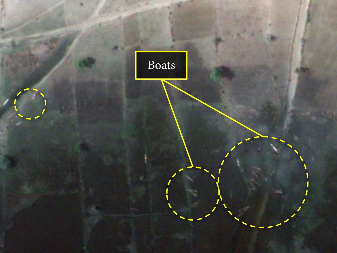
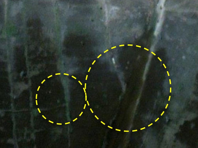
Fires destroyed or damaged over 3,100 structures in Doro Baga. Eyewitnesses told Amnesty International that desperate residents fled the town by boat across Lake Chad.
The harrowing testimonies are backed by the satellite images, which show how the wooden fishing boats which dotted the shoreline on 2 January had disappeared by 7 January.
And in Baga, a densely populated town less than two square kilometres in size, approximately 620 structures were damaged or completely ravaged by fire.
A man in his fifties told Amnesty that he fled the attack in Baga, and hid in the bush where he was discovered by Boko Haram fighters and detained for four days.
“They killed so many people. I saw maybe around 100 killed at that time in Baga. I ran to the bush. As we were running, they were shooting and killing.”
Others who fled describe seeing many more corpses in the bush. “I don’t know how many but there were bodies everywhere we looked,” one woman told Amnesty.
Médecins sans Frontières reported yesterday that 5,000 survivors of the attack on Baga are currently staying in a camp in Maiduguri. Meanwhile, the UN refugee agency (UNHRC) reported last week that some 7,300 Nigerian refugees had arrived in western Chad.
The attacks in north east Nigeria demonstrate how Boko Haram’s ferocity has strengthened over the past 12 months, following a 6 year campaign of insurgency. The latest wave of attacks have further destabilised Africa's most populous nation as it prepares for elections.
Additional reporting by AP

Join our commenting forum
Join thought-provoking conversations, follow other Independent readers and see their replies
Comments